
The Lower Junction City site was constructed to enhance both terrestrial and aquatic habitat quality. In-river work was done to increase habitat complexity through construction of slow water refuge habitats, reconnection of the floodplain with the river, and placement of in-river geomorphic and habitat features (e.g., construction of islands and wood structures). On-shore included revegetation of riverine and upland areas with native vegetation.
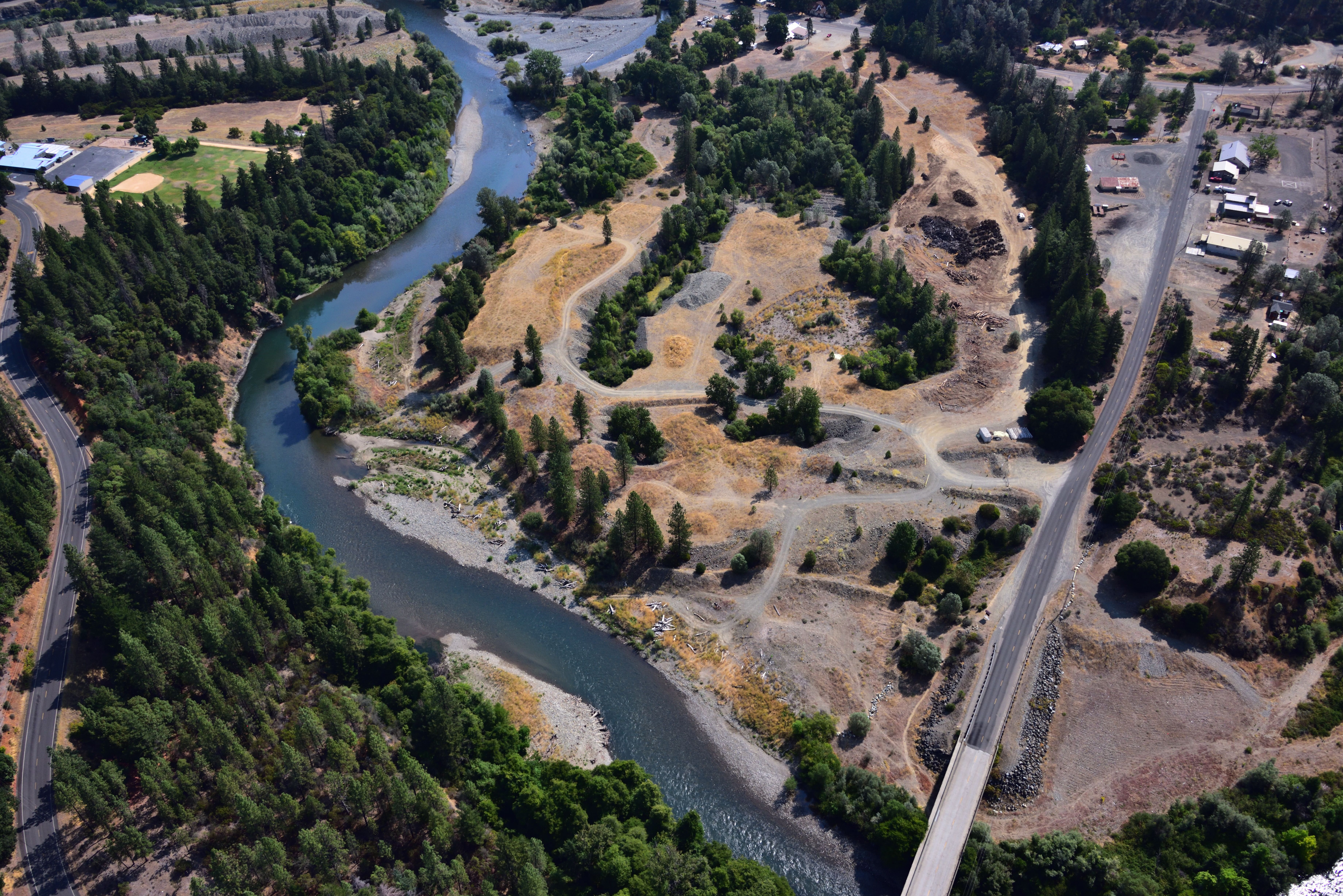
Lower Junction in 2016, two years after construction. Photo by Kenneth DeCamp, purchased by Trinity River Restoration Program, Bureau of Reclamation.
Further Information:
- Draft Environmental Assessment/Initial Study (EA/IS)
- Final EA/IS with signed Finding of No Significant Impact (FONSI)
- Map of site design excerpted from EA/IS (pdf)
- Changes to Federal Emergency Management Agency (FEMA) Base Flood Elevations (BFE) based on as-built conditions. There was no rise in BFE at insurable structures.
- Notification from Trinity County on changes for properties (pdf)
- Exhibit A: Completed project with approximate parcel boundaries (pdf)
- Exhibit B: Forecast changes to FEMA Base Flood Elevation at a flow modeling cross sections between River Miles 79.35 and 81.08 (pdf)
- Exhibit C: FEMA Flood Hazard Zone boundary changes (pdf)
- Search TRRP online library for “Lower Junction City”