Contributing Authors: Michael Dixon (TRRP), Kiana Abel (TRRP)
The Trinity River Restoration Program was established to address the impacts of the construction and operation of the Trinity River Division of the Central Valley Project on wildlife below Lewiston Dam. Although a significant portion of our direct investment continues to be on completing mainstem restoration, we have expanded our focus to provide both financial and in-kind support to partners who are working to restore fish access and habitat quality in key tributaries throughout the basin.
This year, 2026, the TRRP are involved in design and/or implementation to support projects happening in several places throughout the watershed. Below is a list of those that are projected to be completed or implemented this year.
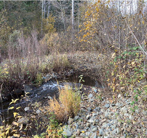
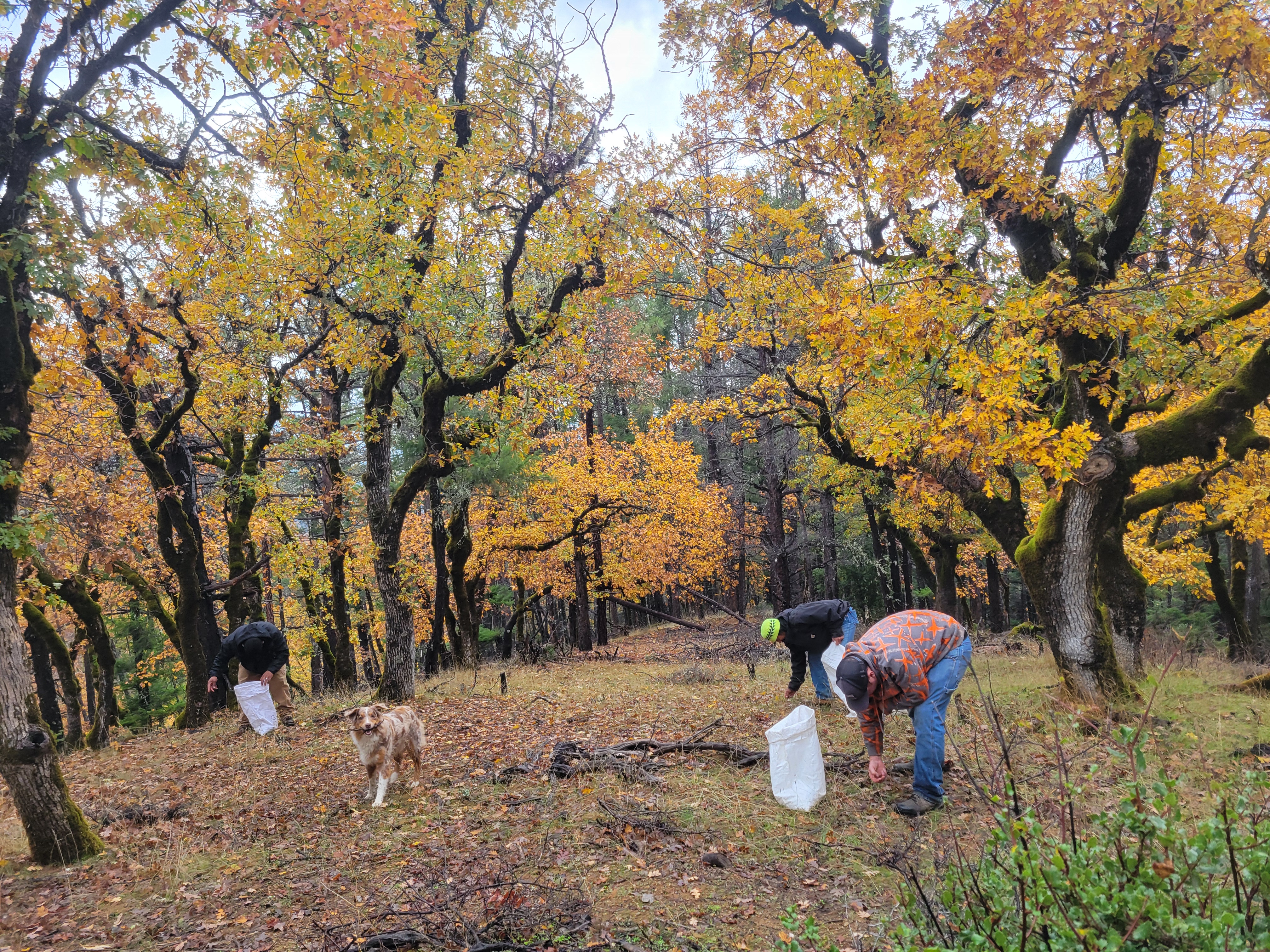
Weaver Creek Habitat Restoration – The Yurok Tribe, Nor Rel Muk Wintu Tribe
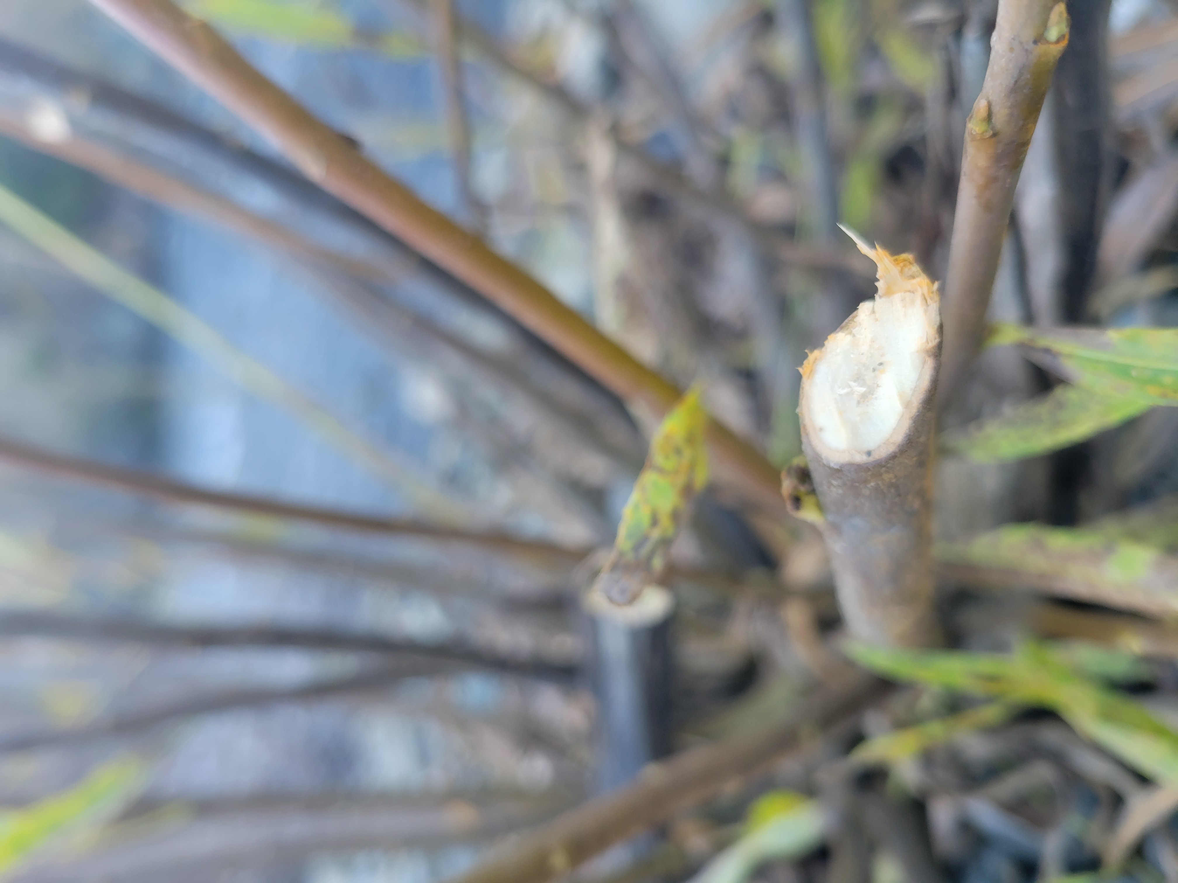
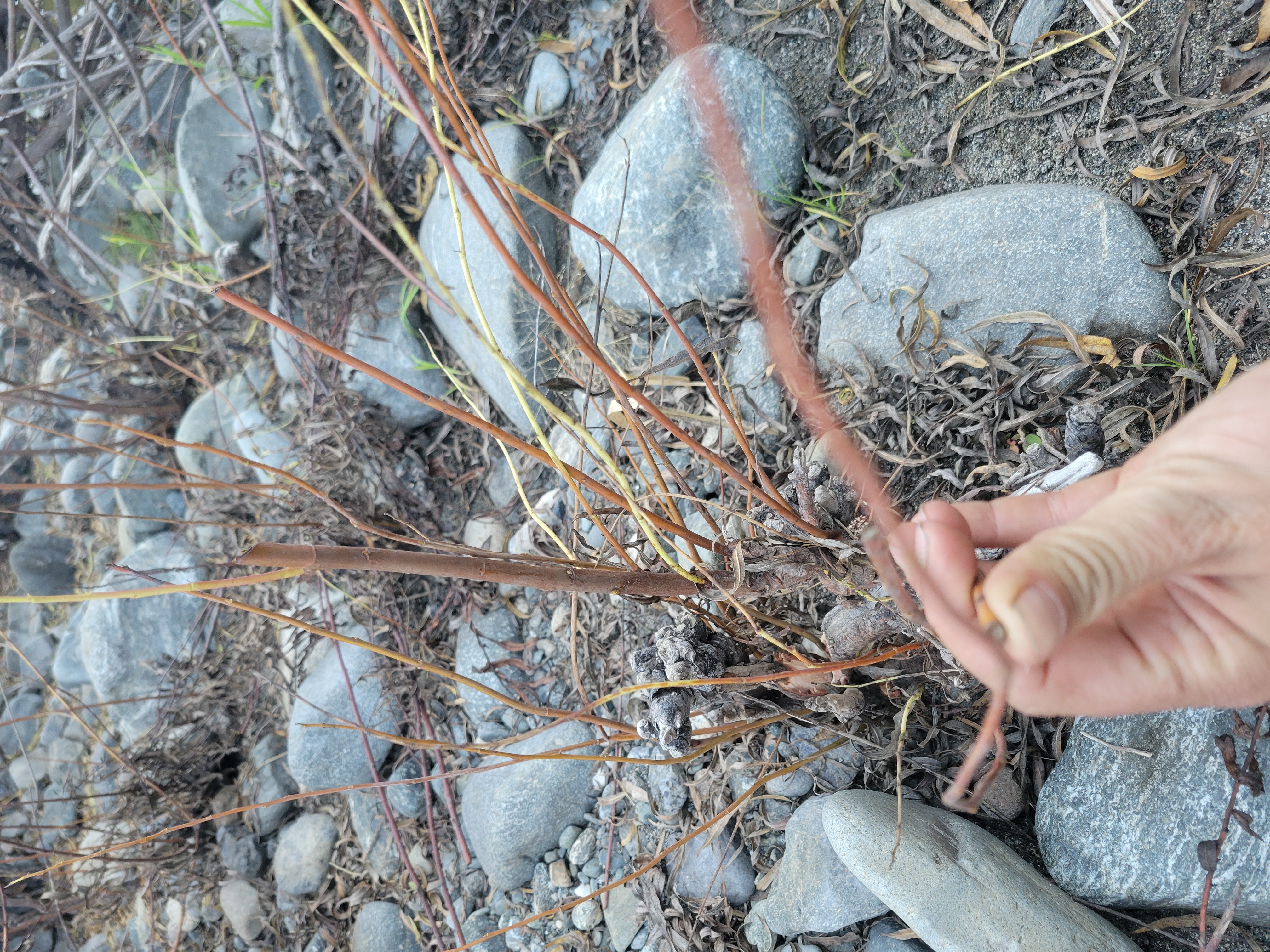
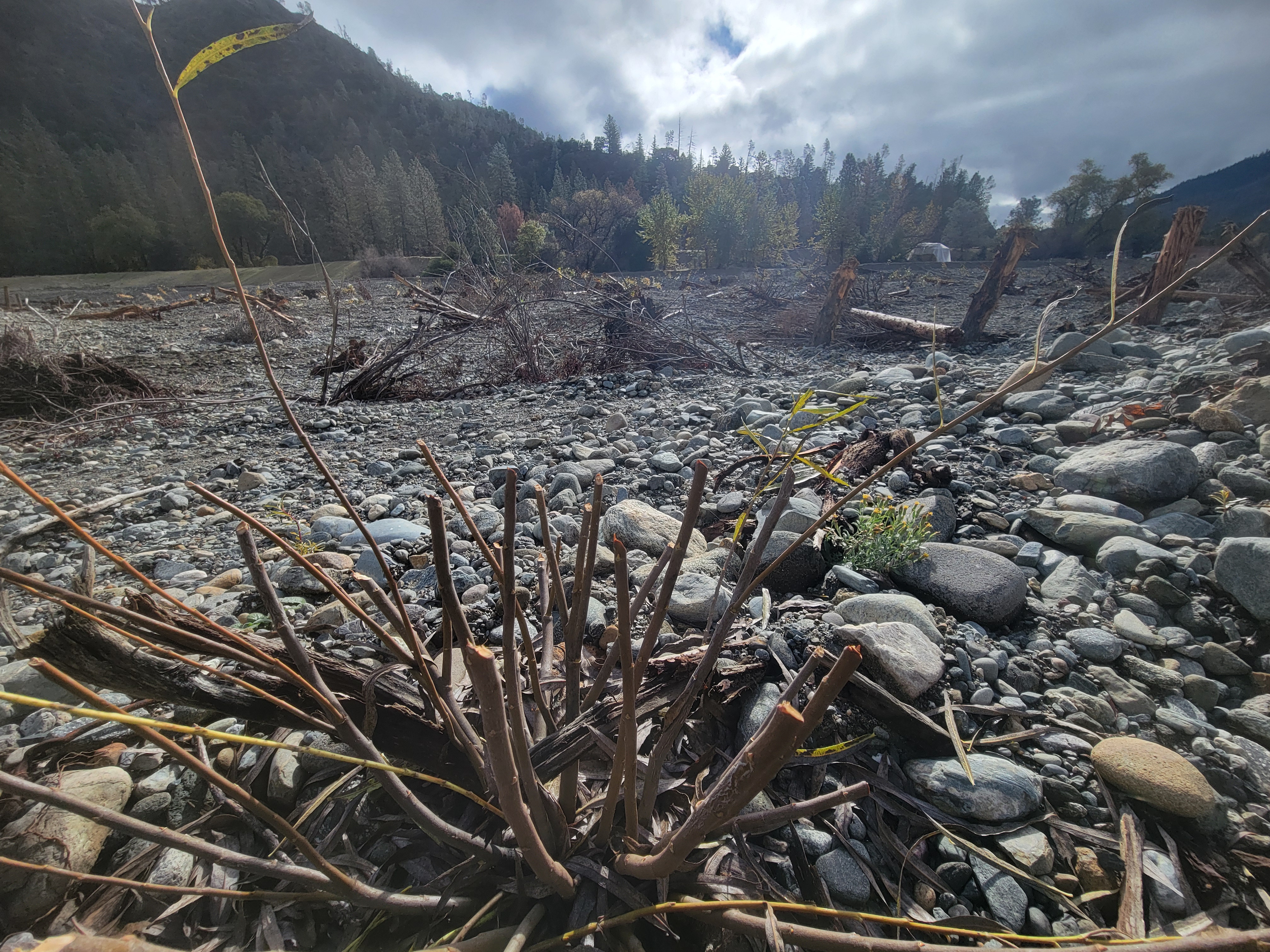
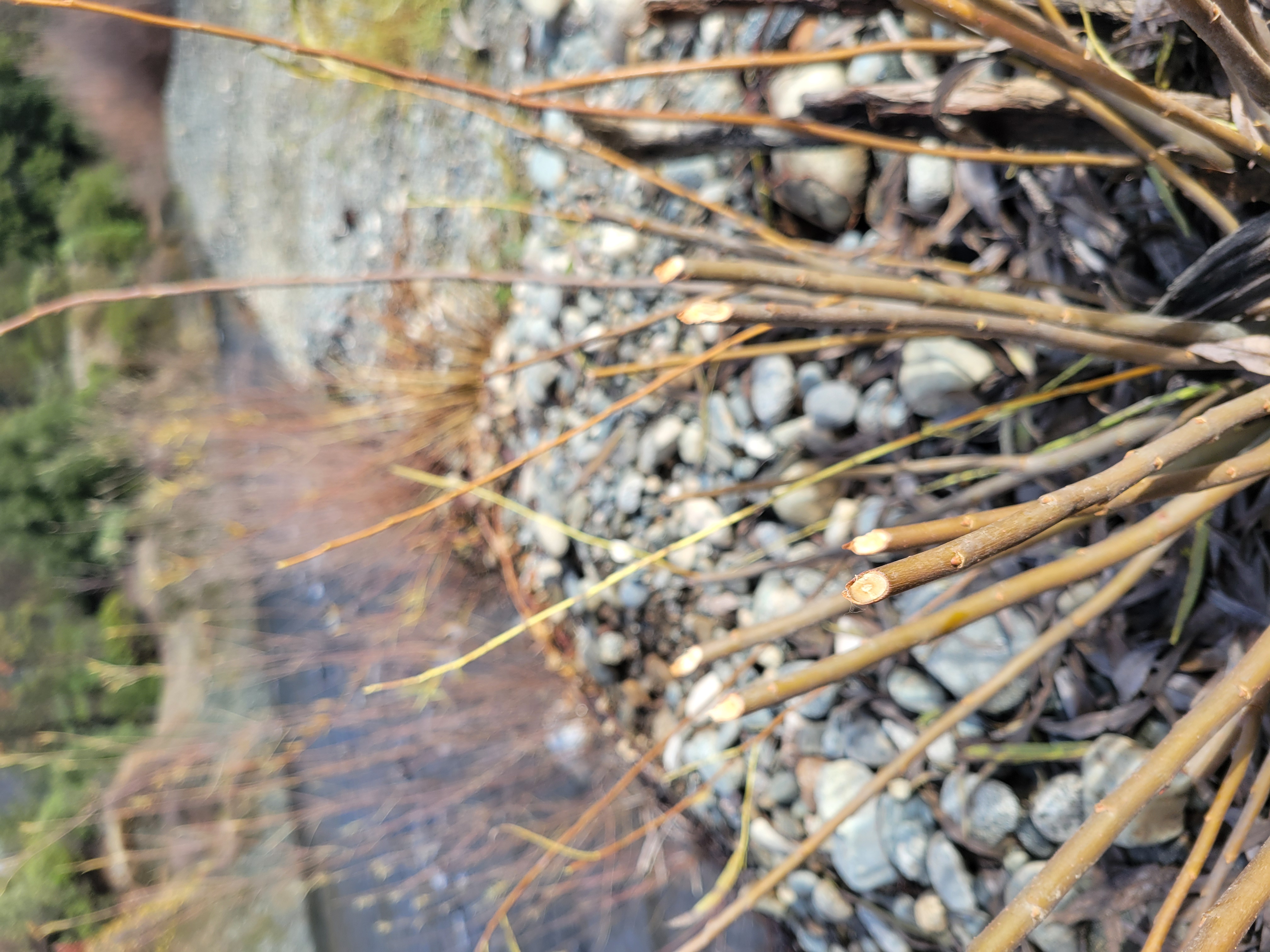
The Yurok Tribe Construction Corporation have begun rehabilitation along Weaver Creek, a tributary to the Trinity River. The project will control the spread of invasive plant species, establish habitat connectivity during summertime baseflow conditions, and support populations of threatened Coho Salmon through enhanced floodplain an instream habitat conditions. The Yurok Tribe is collaborating with the Nor Rel Muk Wintu Tribe, federal land managers, the Weaverville Sanitary District, and adjacent landowners. The project site is closed until completion for the safety of the public. Completion is projected by October 15. Matching funds for construction were provided by the Bureau of Reclamation WaterSMART Grant and the California Department of Fish and Wildlife’s Cannabis Restoration Grant Program. The initial design was funded by the TRRP Watershed Grant Program and the US Fish and Wildlife Klamath Basin Grant Program.
Deadwood Creek Sediment Reduction Project –Northwest California Resource Conservation & Development Council (5Cs)
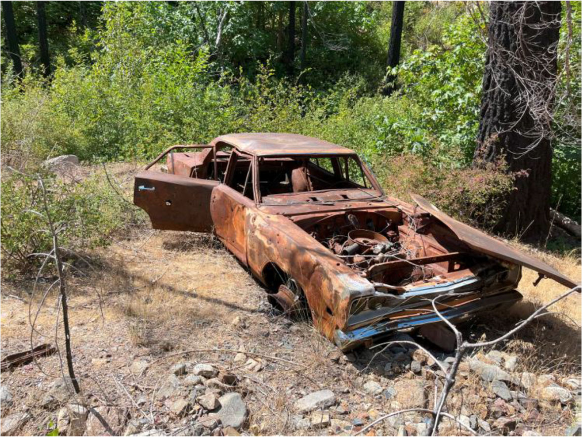
This project is nearing completion and intends to improve sediment delivery in Deadwood Creek, the first major Trinity River tributary below Lewiston Dam. The project will remove legacy mine tailings from Mill Gulch, decommission Thorne Gulch Road, install and enhance 12 rolling or critical dips, remove abandoned vehicles and debris from stream channels and floodplains and build stream enhancement features in Thorne Gulch. The Deadwood Creek project was the first watershed rehabilitation project to use the Trinity River Watershed Environmental Assessment in the project planning process.
Douglas City Community Services District Feasibility Study for Fish Habitat Improvement in Trinity River Tributaries – Watershed Research and Training Center
This project is nearing completion and intends to assess the economic feasibility of creating and maintaining a community services district (CSD) that could provide a stable water supply to residents in rural Douglas City. The development of a CSD could leave water instream for improved habitat connectivity for steelhead, SONCC coho salmon, and Chinook salmon in Browns and Reading Creeks both tributaries to the Trinity River. Project would help determine if a CSD is an economically viable option to achieve environmental and community benefits under an increasingly dry climate.
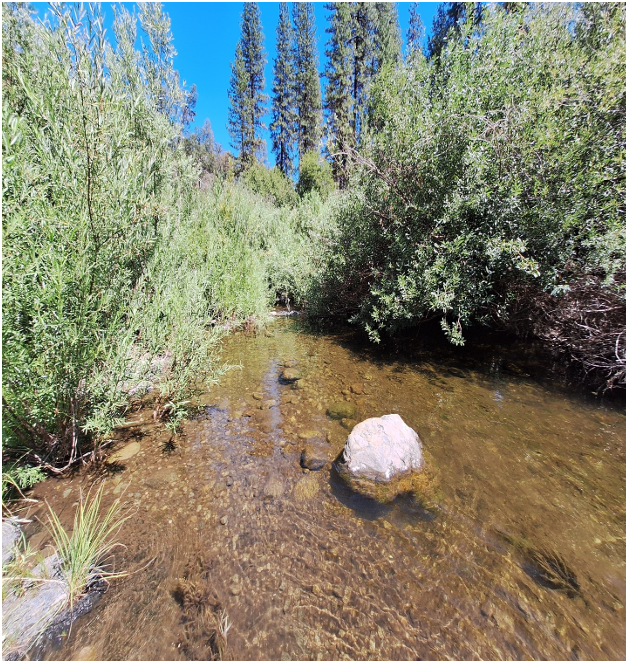
Upper Hayfork Creek Assessment and Planning Project – The Watershed Research and Training Center
Funds were awarded in 2024 to assess over 17 stream miles and 700 floodplain acres within the upper Hayfork Creek watershed, a major tributary to the South Fork Trinity River. Once complete, the assessment will identify restoration opportunities to improve salmonid habitat quality and quantity. The assessment is nearing completion of the Restoration Assessment and Planning document which prioritizes a list of restoration projects and includes a restoration design to advance toward implementation.
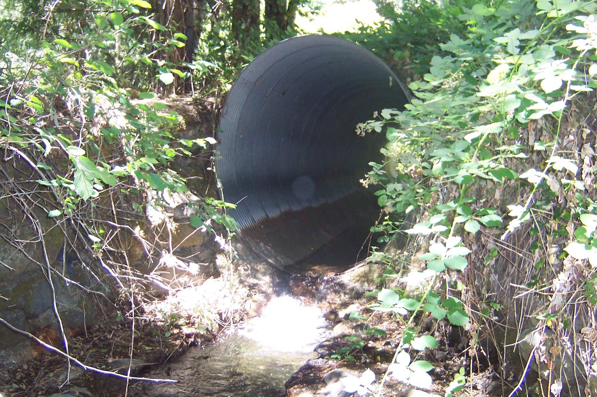
East Branch East Weaver Creek Migration Barrier Removal – Northwest California Resource Conservation & Development Council (5Cs)
This project will replace an aging culvert that has become a fish passage barrier on the East Branch of East Weaver Creek. The new infrastructure placement will open nearly 2 miles of habitat for anadromous species of the Trinity watershed and is slated for implementation summer of 2026.
Indian Creek Fish Passage Barrier Removal Feasibility Project – The Yurok Tribe
The Yurok Tribe was granted funding to evaluate conditions, produce a project feasibility study and design that will mitigate barriers to anadromous fish passage throughout a reach of Indian Creek, a tributary to the Trinity River. The evaluation will assess the removal of a significant barrier to fish passage and reopen 7.5 miles of stream and 85 acres of habitat suitable for SONCC coho salmon, among other aquatic species. The study and design are expected to be complete this year.
Limiting Factors Analysis of Chinook Salmon – Cramer Fish Sciences
Over the past year Cramer Fish Sciences and technical advisors from the Program have worked in collaboration to conduct a Limiting Factors Analysis with the objective of understanding why an increase in the number of Chinook salmon smolts produced in the Trinity River watershed has not resulted in a corresponding increase in the number of returning adult salmon. The collaboration intends to wrap up this fall with a presentation to the Trinity Management Council along with a technical report, user guide, life cycle model and a graphical user interface.
Salt Creek Floodplain Restoration – The Watershed Research and Training Center
This project aims to improve 2,000 feet of heavily degraded salmonid habitat along Salt Creek, a South Fork Trinity River tributary, by reconnecting the creek to its historic floodplain using engineered and process-based restoration techniques. The WRTC recently received additional funding from the Wildlife Conservation Board and the habitat improvement project will move forward once permitting allows, in either the summer 2026 or 2027.
As Public Affairs Specialist for the Trinity River Restoration Program, Kiana manages external communications, media relations, and stakeholder outreach. She acts as a liaison between program initiatives and the public, transforming technical findings into compelling narratives that promote understanding of restoration initiatives on the Trinity River. Kiana holds a Batchelor’s in Art History, has spent most of her career in marketing and is focused at the TRRP on bridging the gap between public awareness and resource restoration and management.
By: Kiana Abel. Edited by James Lee, Implementation Branch Chief (TRRP)
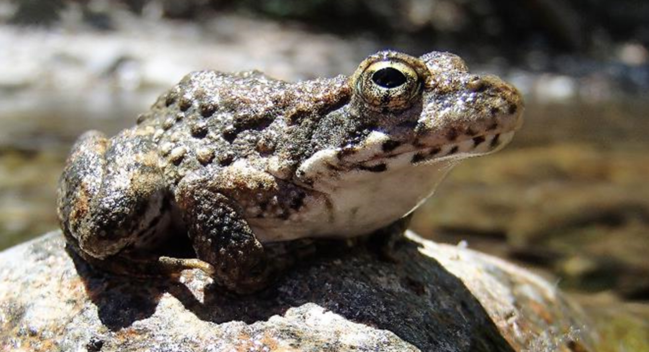
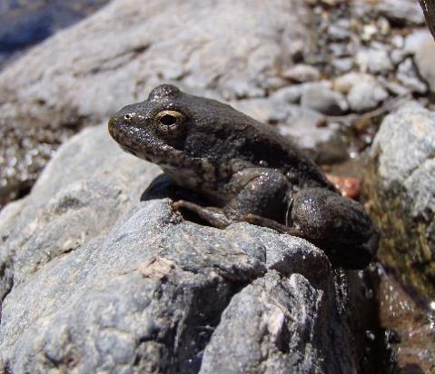
Foothill yellow-legged frog. [Applied River Sciences/Don Ashton]
Meet the foothill yellow-legged frog (Rana boylii), a local “river specialist” who has evolved to survive in the wild waters of Trinity County. While most frogs rely on still ponds and perform loud, midnight croaks, foothill yellow-legged frog has developed a suite of specialized adaptations that make them the perfect frog inhabitant for the fast-moving snow-melt dependent rivers and streams of the Trinity Watershed.
The foothill yellow-legged frog’s life cycle is tightly bound to flowing water. Interestingly, this species is noted as one of the only stream breeding species from the Ranid family. Because the entirety of this unique amphibian life cycle is tied to living in flowing waters their population health tells us exactly how matched (or how mismatched) our flow management strategies are working for them.
FAST FACTS
Scientific Name:Rana boylii
Size: 1.5 to 3.2 inches (Females are larger than males)
Key ID: Lemon-yellow under-legs, granular textured skin, no dark eye mask
Status: Robust in Trinity County but listed as Threatened/Endangered in four other California regions.
Life Span: Reach sexual maturity in 1-2 years and can live up to 10 years in the Trinity River Watershed.
Photo: Foothill yellow-legged frog. [Applied River Sciences/Don Ashton]
Visual Identification: Built for the Riverbed
To the untrained eye, foothill yellow-legged frog may look just like a river rock. The species has evolved incredible camouflage, featuring mottled gray, olive, and brown skin with a rough, sand-like texture. In certain areas of the Trinity River where the geology consists of reddish-brown stone, these frogs even develop brick-red spotting to blend seamlessly with their surroundings.
If you spot one, look for two distinct features:
The Yellow Flash: If they leap, you will catch a flash of bright lemon-yellow washed across the undersides of their hind legs and lower belly.
Streamlined Silhouette: Their “dorsolateral folds” (the parallel ridges running down a frog’s back) are flat and indistinct, giving them a hydrodynamic shape that reduces drag in fast currents.
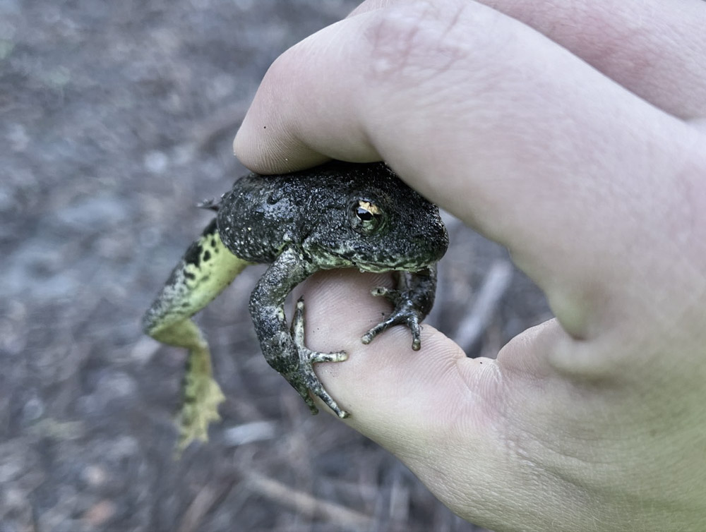
Photo: Foothill yellow-legged frog represented with enhanced yellow coloration due to the photographer’s hazard gear. [Hoopa Valley Tribe/V. Yates]
Life History: A Cycle Tied to Rushing Water
Foothill yellow-legged frog maximum life span can exceed 10 years; however, in the wild few individuals are likely reach their potential maximum age. The foothill yellow-legged frog is typically diurnal (active during the day) but have been observed foraging and active at night.
Winter Months – Hibernation
Unlike some land-dwelling frogs that burrow into forest soil, foothill yellow-legged frog stays tied to their watery homes during their months of hibernation. To survive freezing temperatures and heavy winter storms, they seek shelter in two main areas: underwater crevices and near-shore crevices, root cavities, and other refugia, often moving up tributaries to avoid scouring winter flows in the main channel.
As water temperatures drop, the frog’s metabolism slows. During hibernation they do not need to eat but do need exposure to well-oxygenated waters. By choosing rocky crevices exposed to flowing water, they can absorb dissolved oxygen from moving river water directly through their skin.
Spring Snow Melt Recession (April or May) – Adults Emerge
Snowmelt slows & water temperatures hit ~11°C (52°F)
As soon as winter storms calm, and air temperatures start to rise, the snow melt recession begins. The spring-snowmelt recession is a period of flow management based on historic flow data dating back to 1911 on the Trinity River. Although, pre-dam, the magnitude and duration of the snow-melt recession was highly dependent on annual weather patterns, the existence of a snow-melt recession happened somewhat predictably. As air temperatures rise, rivers, like the Trinity, typically see a peak flow and then gradual recession or decline in river and stream flows. This predictable flow reduction plays a vital role in riverine ecosystems, acting as a key environmental cue for the reproductive timing of aquatic species like foothill yellow-legged frogs.
Once the waters warm to about 11°C (52°F) in April or May, the adults emerge from their rocky winter bunkers to immediately begin their underwater breeding season. Known as the “Goldilocks window”, their breeding cycle relies on these precise temperature triggers. Males will typically emerge before females in hopes of finding the perfect mating spot.
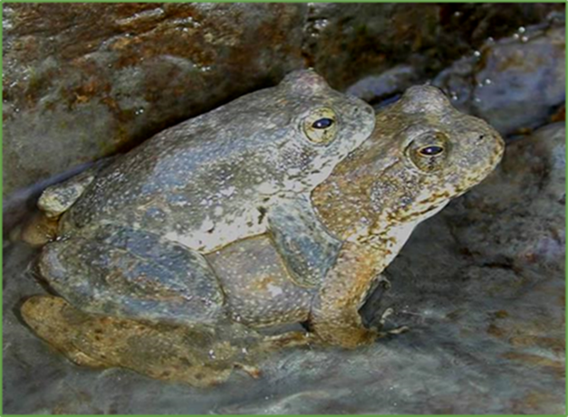
Lekking
Breeding pair post lek. [Applied River Sciences/Don Ashton]
Males establish calling sites and gather to attract females based on their ability to choose the perfect site for breeding and egg deposit. This style of breeding is referred to the lek-style mating system. Males typically call underwater for their future mate, the female assesses the location and if satisfied they simultaneously deposit eggs and fertilize underwater.
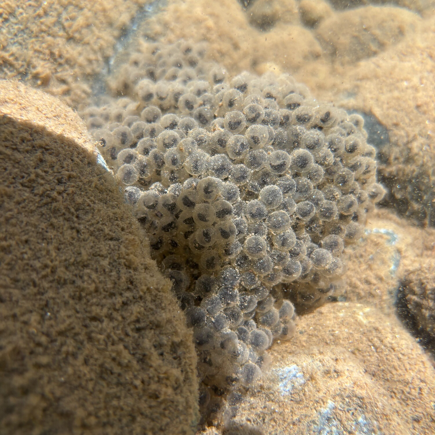
Oviposition/Eggs
An egg mass spotted in May near the Lorenz Boat Launch in Douglas City by TRRP Scientists. [TRRP/Eric Peterson]
Successful breeding sites are typically sunny, shallow areas where a single, fist-sized egg mass containing up to 2,500 eggs are glued to the downstream side of a river cobble. The positioning creates a natural hydraulic shield, protecting the delicate, grape-like clusters from being swept away by the current.
Egg mass viability depends on clean, well oxygenated streams that are shallow, yet connected to a stable source of flow. If flows change in either direction precipitously the viability of the egg mass can be negatively affected.
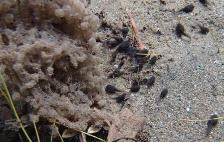
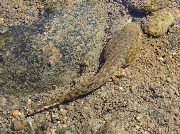
Metamorphosis (3-4 Mo)
Once hatched, the small black tadpoles stick close to their egg sacs for a week or two as the develop strength, mobility and camouflage coloration. Then they are able to dispurse and use specialized mouthparts like tiny suction cups to cling to rocks and scrape off microscopic algae eating the periphyton, detritus, and other sessile aquatic food found within. While they eat and grow, they hide in the gaps between gravel to escape predators.
Newly hatched tadpoles stick close to the egg sac at first. [TRRP]
A late stage tadpole with well developed hindlimbs is camouflaged with the river bottom. [TRRP]
Subadult to Adult
Once metamorphosis is complete (typically occurring July to October), newly emerged juveniles frequently migrate from the hatching site to seek out cooler tributary streams. Adults, meanwhile, largely return to resident microhabitats on tributaries or shaded river sections after the spring breeding season.
Both juveniles and adults are active predators hunting a variety of aquatic and terrestrial invertebrates along the waters edge. They are typically observed hunting during the day for flies, moths, mosquitoes, hornets, aunts, beetles, grasshoppers, water striders and snails. During the hottest periods of the summer, they are known to decrease their daytime activity and seek cooler, shadier microhabitats.
How They Differ from Other Native Amphibians
Remember how we mentioned that the foothill yellow-legged frog possess unique adaptations to stream life that sets it apart from other native amphibians in the watershed, such as the western toad or the high-elevation cascades frog? Here are a few:
Submerged Singing: Sound waves travel poorly through the air next to a roaring river, but they travel beautifully through water. Because air-transmitted calls would be drowned out by crashing rapids, male foothill yellow-legged frog sing most effectively while submerged, making low-pitched rasping sounds underwater to defend territories and attract mates.
The Bottom-Dive: While a tree frog will jump into thick brush when startled, the Foothill yellow-legged frog dives straight into the fastest moving water, wedging its flat body under heavy river stones to anchor itself safely away from predators.
Frogs and Toads of the Trinity River Watershed Comparison
Species
Primary Habitat
Secret Vocal Tricks
Predator Defense
Foothill yellow-legged frog (Rana boylii)
Lotic systems; stays near shallow, sunny, gravel/rocky flowing streams and main river channels.
Underwater low grunts; tiny vocal sacs produce low, faint, raspy clicking notes designed to carry underwater beneath loud river currents. [Listen Here]
Pebble camouflage; blends flawlessly into river cobblestones and leaps directly into fast currents to hide under rocks.
Sierran chorus / tree frog (Pseudacris sierra)
Terrestrial generalist; found in wet meadows, grasslands, and woodlands, moving to ephemeral pools to breed.
The Hollywood “Ribbit”; possesses an incredibly large throat pouch that amplifies a loud, two-note advertisement call. [Listen here]
Rapid escape & color shifting; changes its dorsal color between green and brown to match substrate microhabitats before making massive, erratic leaps.
Cascades frog (Rana cascadae)
Lentic montane habitats; high-elevation wet mountain meadows, snowmelt pools, bogs, and quiet lake margins.
Faint clucking; issues very quiet, low-pitched grating clucks or chuckles that can rarely be heard from a distance. [Listen Here]
Mud burrowing; quickly dives into deep sub-aquatic silt, heavy vegetation, or thick woody debris to hide.
Western toad (Anaxyrus boreas)
Terrestrial burrower; lives in upland fields, damp forests, and brush, utilizing shallow pond margins only for communal breeding.
Vocal-sacless chirping; lacks a formal vocal sac entirely. Emits a high-pitched, bird-like “release chirp” when accidentally grabbed by a rival male. [Listen Here]
Bufotoxin secretion; swells up its body to appear too large to swallow while exuding a foul, toxic milky cardiotoxin from parotoid glands.
Non-native American bullfrog (Lithobates catesbeianus)
This invasive frog prefers slow-moving sloughs, warm reservoirs, deep ponds, and highly modified backwaters.
Resonant “Jug-o-rum”; bellows a deep, bass-heavy foghorn call that can travel over half a mile across open wetlands. [Listen Here]
Piercing distress screams; opens its mouth wide to emit an unexpected, high-frequency “baby-like” scream to startle predators into dropping it. [Listen Here]
A Tale of Two Rivers: Mainstem vs. South Fork
Because this species is so specialized, human modifications to rivers have caused severe disruptions. Today, scientists observe ecological disparity within our own watershed.
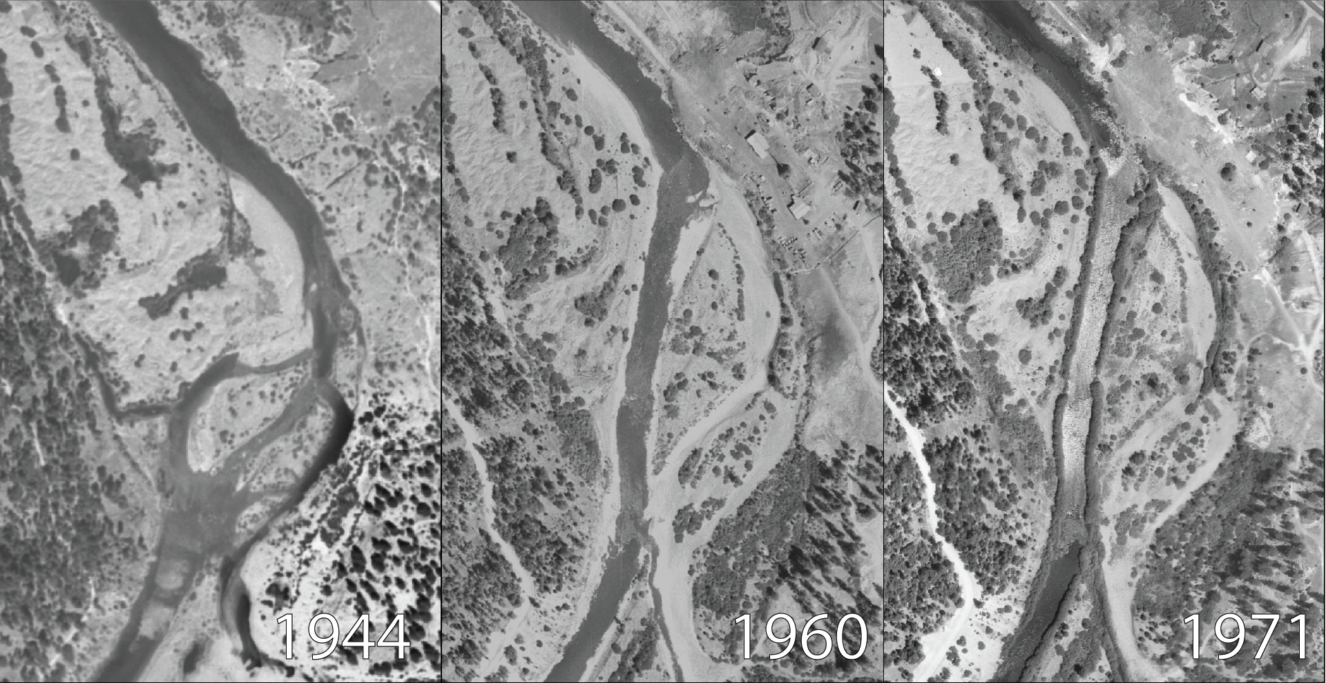
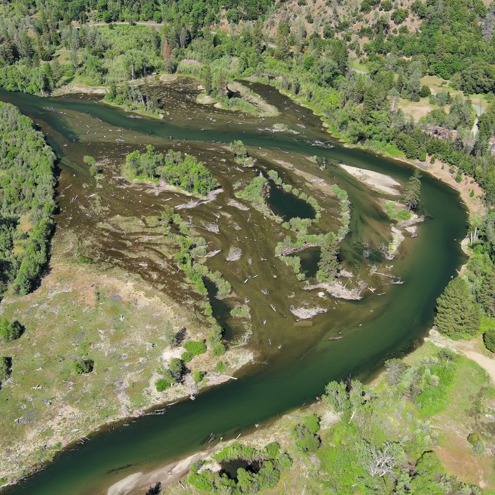
On the free-flowing South Fork of the Trinity River, natural seasonal flow patterns remain intact. Here, frog populations are dense and successful. However, on the Mainstem Trinity River, dam operations at Lewiston and Trinity Dams alter natural water cycles, causing a ten-fold reduction in egg mass densities.
Aerial imagery of the Sawmill Rehabilitation site showing changes in channel morphology pre (1944) and post-dam (1960 and 1971). The lack of variable flows during the post-dam period provided stability for riparian vegetation encroachment. The growth of willows along the rivers edge reduced its use of riparian areas that are vitally important habitat for amphibian and other aquatic animals like juvenile salmonids.
Dams threaten frog survival in three main ways:
Channel Morphology: Steady annual flow releases give riparian vegetation a leg-up on other riparian inhabitants leading to riparian encroachment and a loss of low-flow habitat for frog species.
Stranding (Desiccation): Rapid drops in dam releases can leave egg masses high and dry on exposed gravel bars, causing them to dehydrate and die within hours.
Thermal Stunting: Water released from the bottom of deep reservoirs is often unnaturally cold. This low temperature stunts tadpole growth and narrows the crucial seasonal window they need to successfully complete metamorphosis.
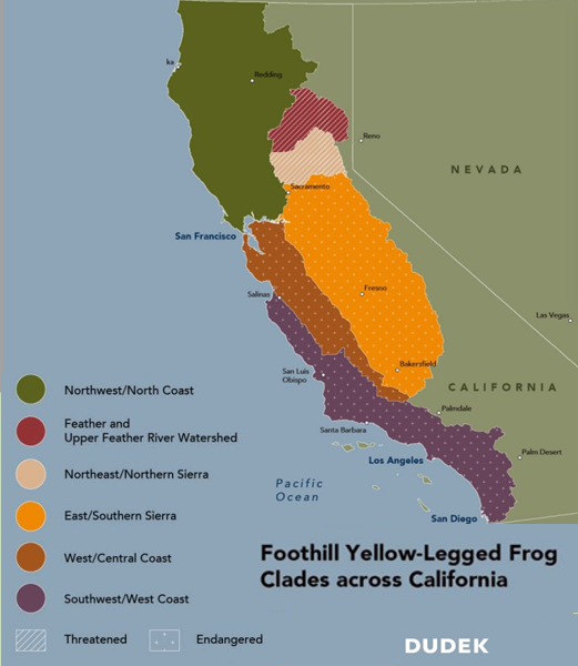
Local Status and Conservation Actions
Map Credit: FYLF clades by Dudek (based on FWS map).
In 2023, the federal government officially listed four of California’s five distinct population segments of this frog as threatened or endangered. Our local Northwest/North Coast population segment remains more robust than their southern counterparts and are not yet listed as threatened or endangered.
However, local stressors are mounting. Illicit cannabis cultivation runoff, off-highway vehicles trampling river bars, intense wildfires increasing sedimentation, invasive predatory bullfrogs, reduced snow-pack and, unnatural summer flow patterns all threaten Trinity County’s populations.
To combat these threats, the Program aims to assist in habitat enhancement for these important riparian specialists in two ways. First, is within channel rehabilitation projects, our technical working group actively designs channel restoration projects that expand riparian areas where the species can thrive. In the past 3 years, the Program has completed two channel rehabilitation projects [Oregon Gulch and Upper Conner Creek Rehabilitation Projects] each with the intent of lowering floodplain surfaces that can provide habitat for juvenile salmonids along with special species like the foothill yellow-legged frog.
Photo: Aerial image of the Oregon Gulch Restoration area in May 2026. [Yurok Tribe/Aaron Martin]
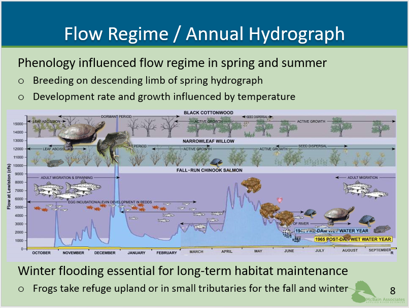
Additionally, on an annual basis, the Program’s Flow Workgroup models the foothill yellow-legged frog response to proposed hydrograph designs and work to adjust dam release schedules that are beneficial for the frog’s life cycle. Foothill yellow-legged frog Assessment Model (FYFAM) is an individual-based ecological simulation tool developed at Cal Poly Humboldt to evaluate how flow and temperature regimes affect the breeding success of the foothill yellow-legged frog. TRRP scientists use this model because it is hypothesized that what is beneficial for Trinity River frog species is also beneficial for juvenile salmonids.
Slide from Science Symposium presentation, “Frogs and Turtles Informing Flow Management and River Restoration”. [Applied River Sciences/Don Ashton]
Winter floods are also essential for long-term habitat maintenance for aquatic species. While floods build habitat for adult salmonids, they also scour and build important habitat for Trinity River frogs and turtles. From 2004-2023, ROD releases were first directly influencing beneficial temperature regimes for both juvenile salmon and foothill yellow-legged frogs from April through June. And second, not releasing scouring floods during the wintertime. With the Program’s implementation of Winter Variable Flows, the river has recovered a portion of its ability to build habitat in the winter as well as improving the temperature regime for cold-blooded species by reallocating water releases from the spring hydrograph into the wintertime. These changes in flow management hope to better match the needs of aquatic species, like frogs, turtles and salmon in the Trinity River.
Be a Citizen Scientist
You can help observe foothill yellow-legged frogs! During May and June, if you spot their distinct, grape-like egg masses along river bars, do not touch them. Instead, take a photo and note the date and your GPS coordinates. Submit your data to the Trinity River Restoration Program (TRRP) via email (info@trrp.net) to help biologists map and monitor breeding success.
Don Ashton, Senior Aquatic Herpetologist/Ecologist – McBain Associates/Applied River Sciences presents, “Frogs and Turtles informing flow management and river restoration.” Available: https://www.youtube.com/watch?v=pWzGrUOUK_0&t=649s
Artificial intelligence was used to formulate information for this article. Some nuances or inaccuracies may have been missed in the editing process. We are happy to consider changes or updates to the article; please send those suggestions to info@trrp.net.
Kiana Abel, Public Affairs Specialist
As Public Affairs Specialist for the Trinity River Restoration Program, Kiana manages external communications, media relations, and stakeholder outreach. She acts as a liaison between program initiatives and the public, transforming technical findings into compelling narratives that promote understanding of restoration initiatives on the Trinity River. Kiana holds a Batchelor’s in Art History, has spent most of her career in marketing and is focused at the TRRP on bridging the gap between public awareness and resource restoration and management.
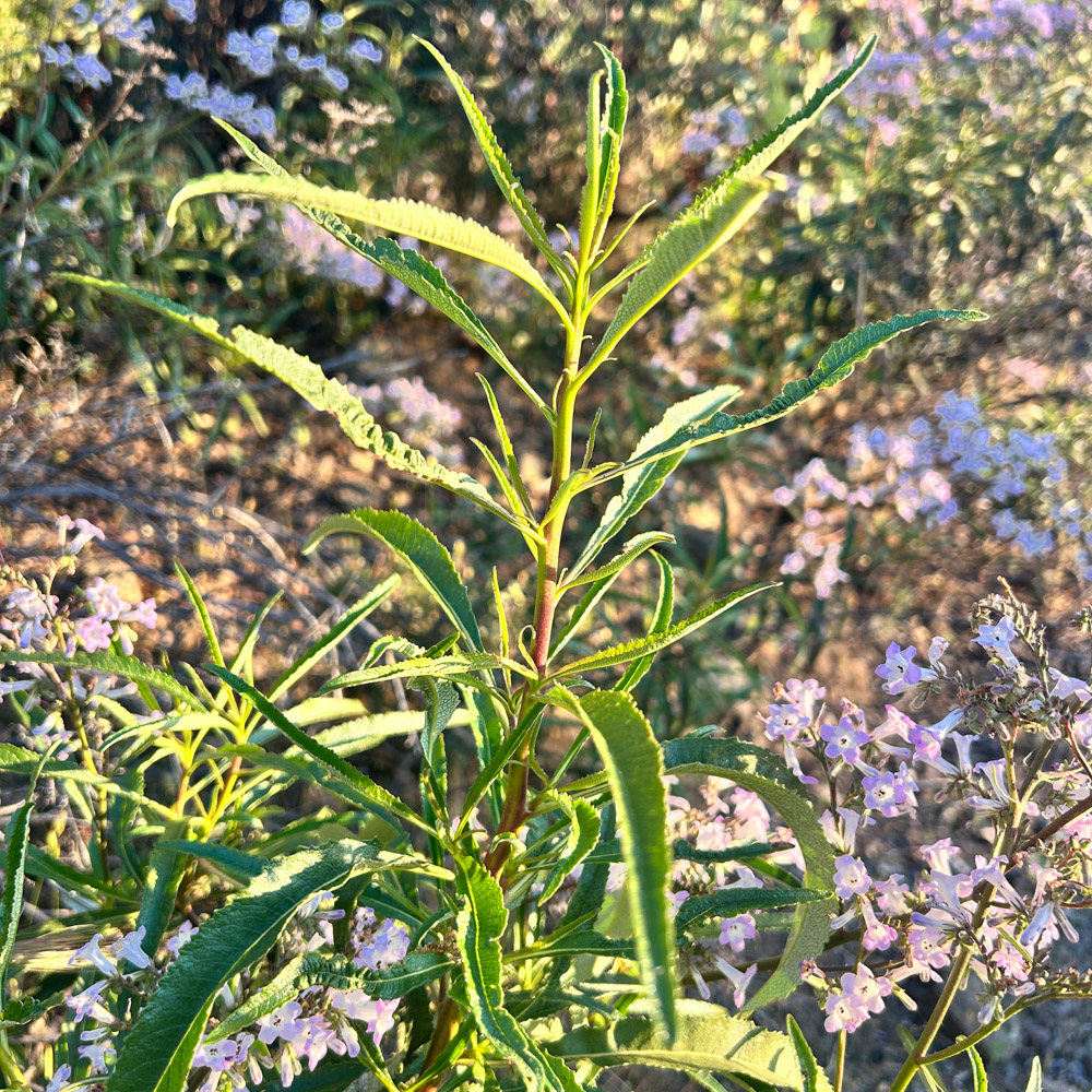
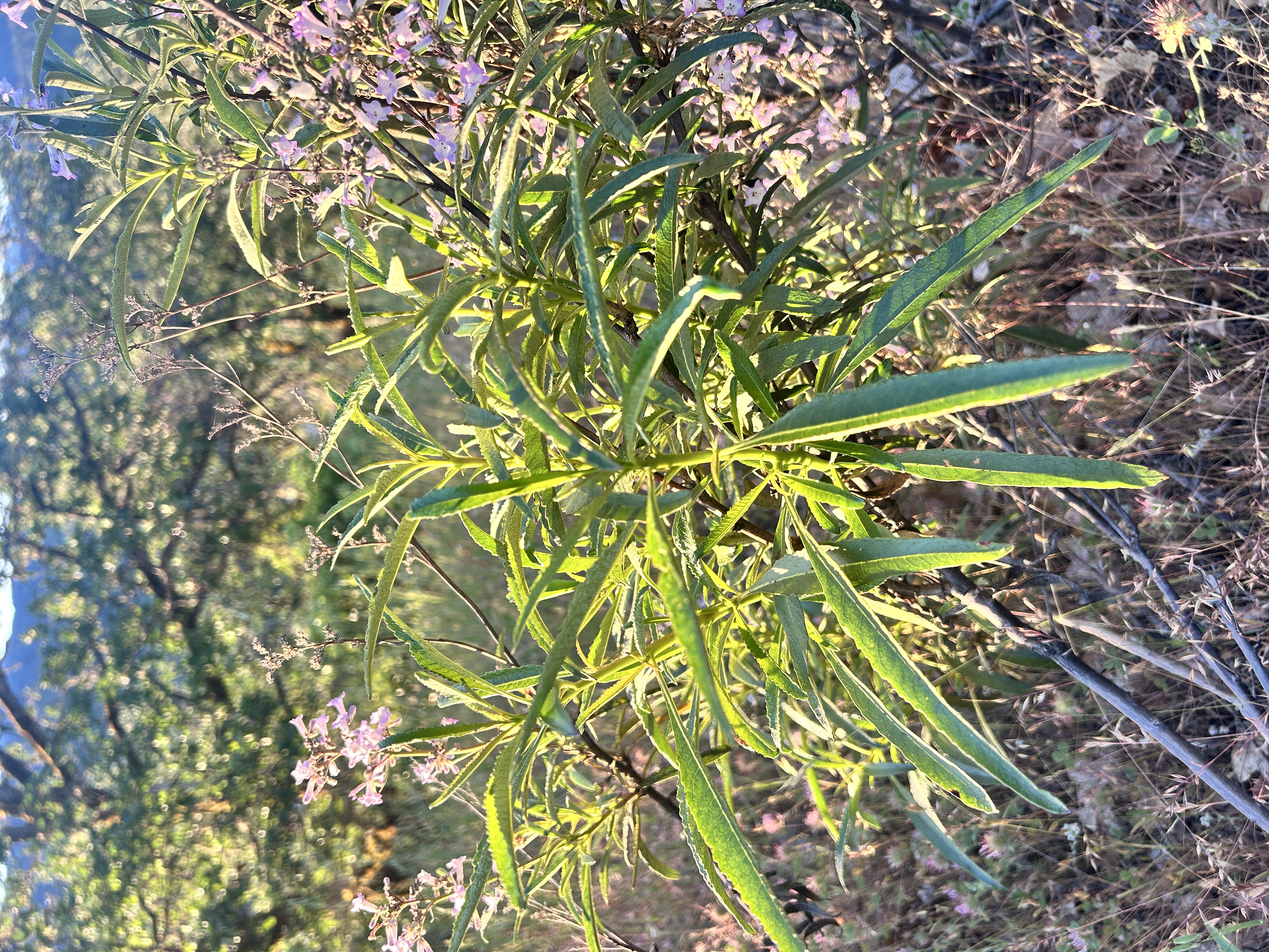
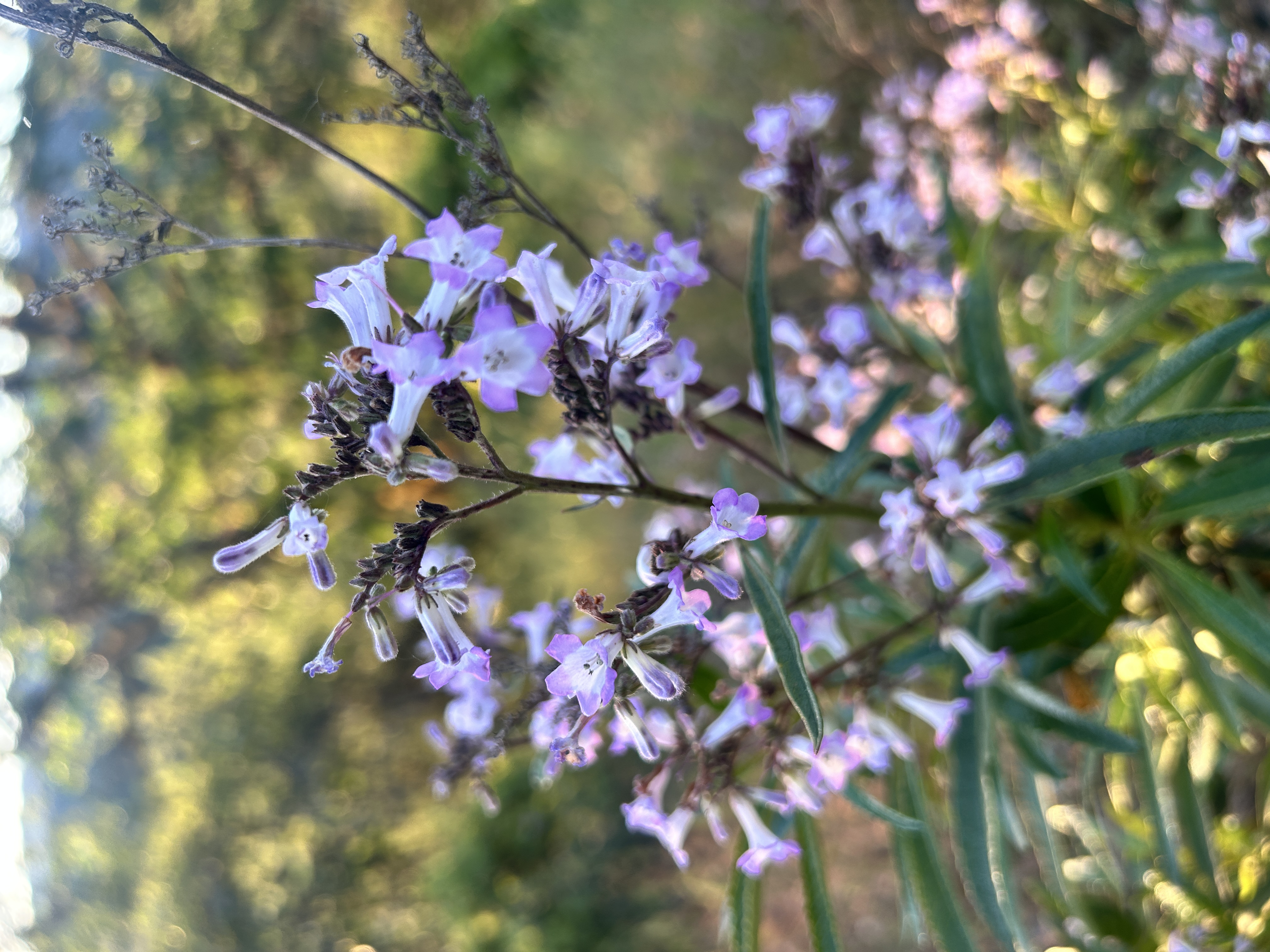
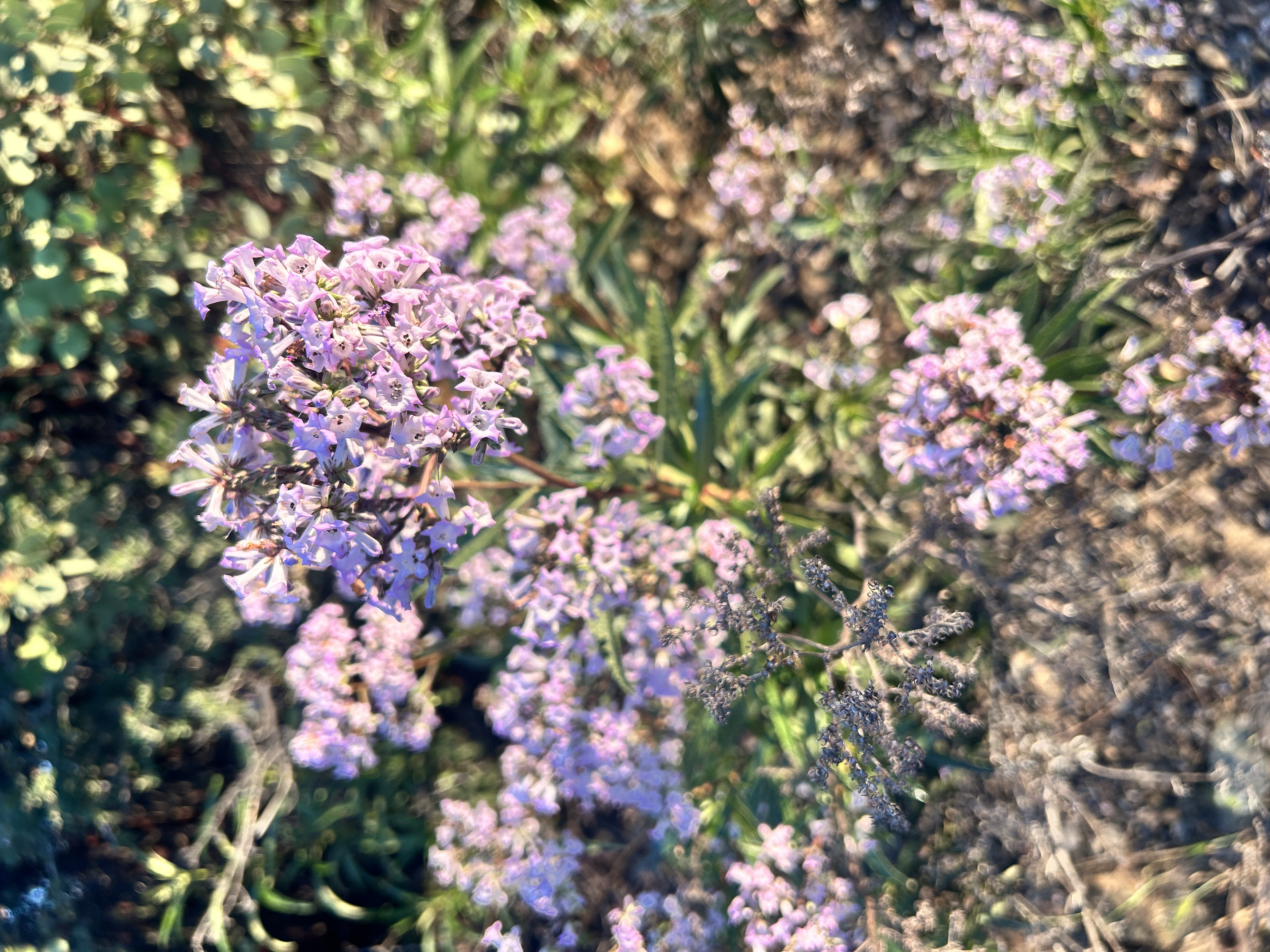
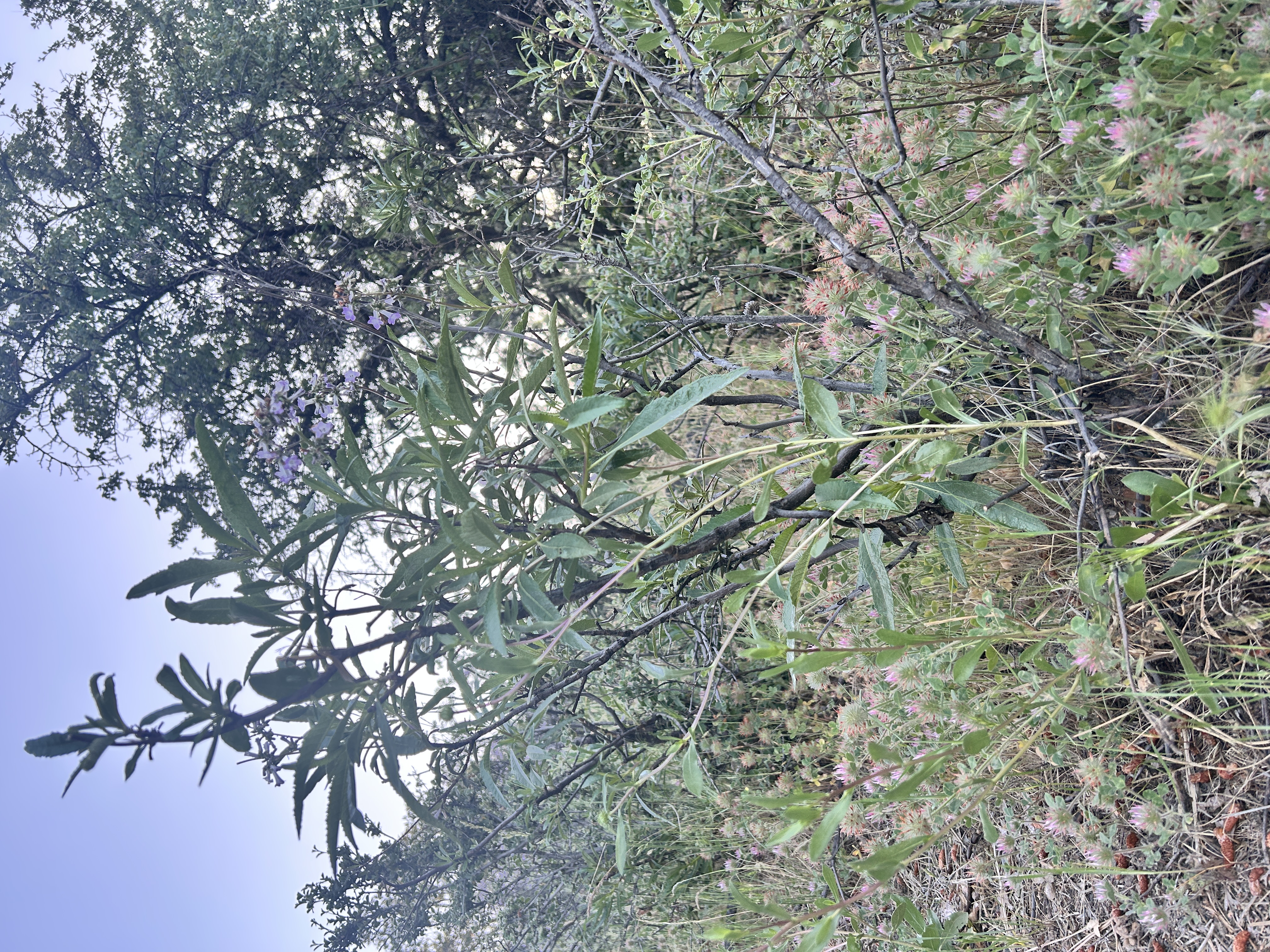
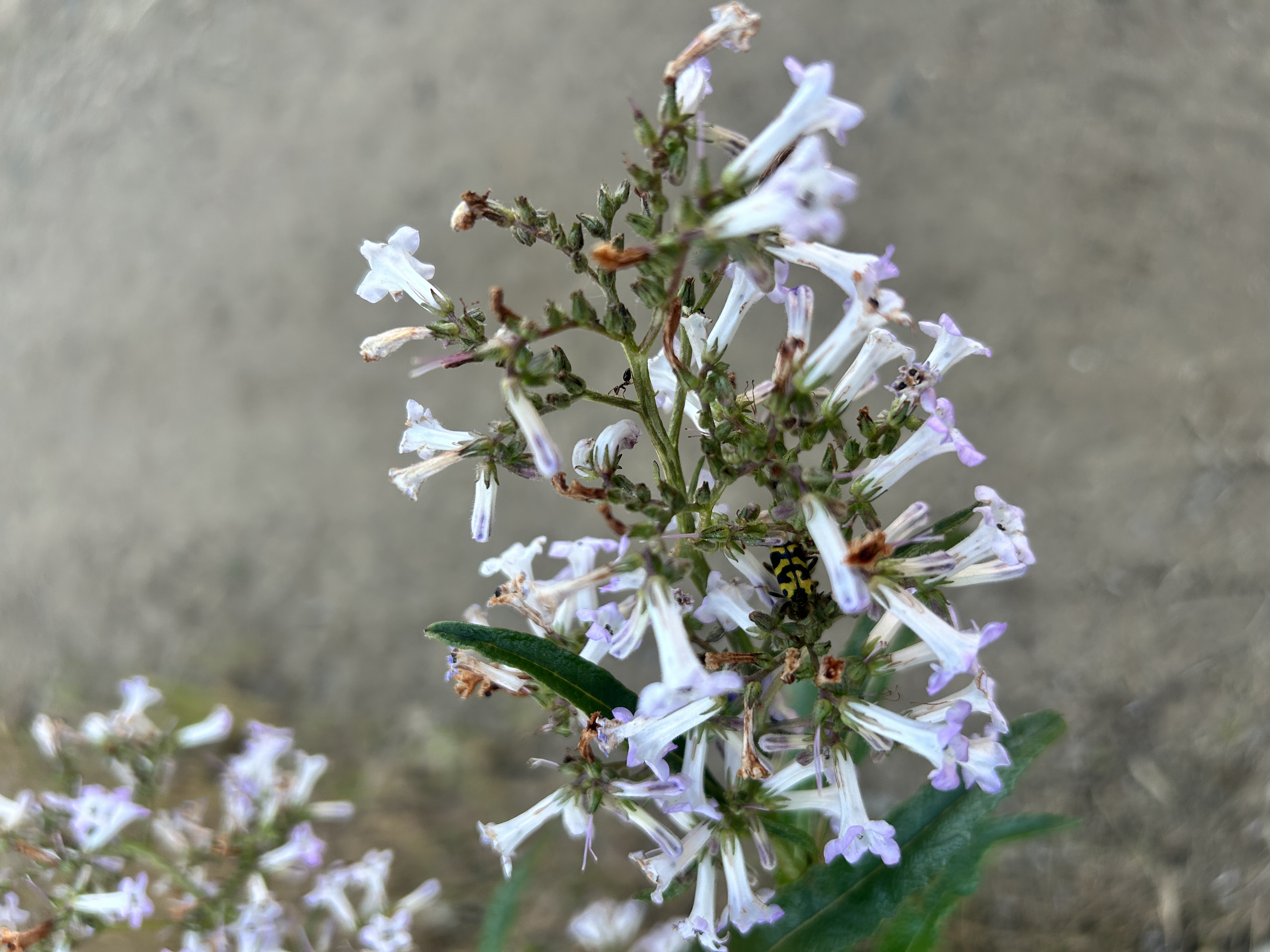
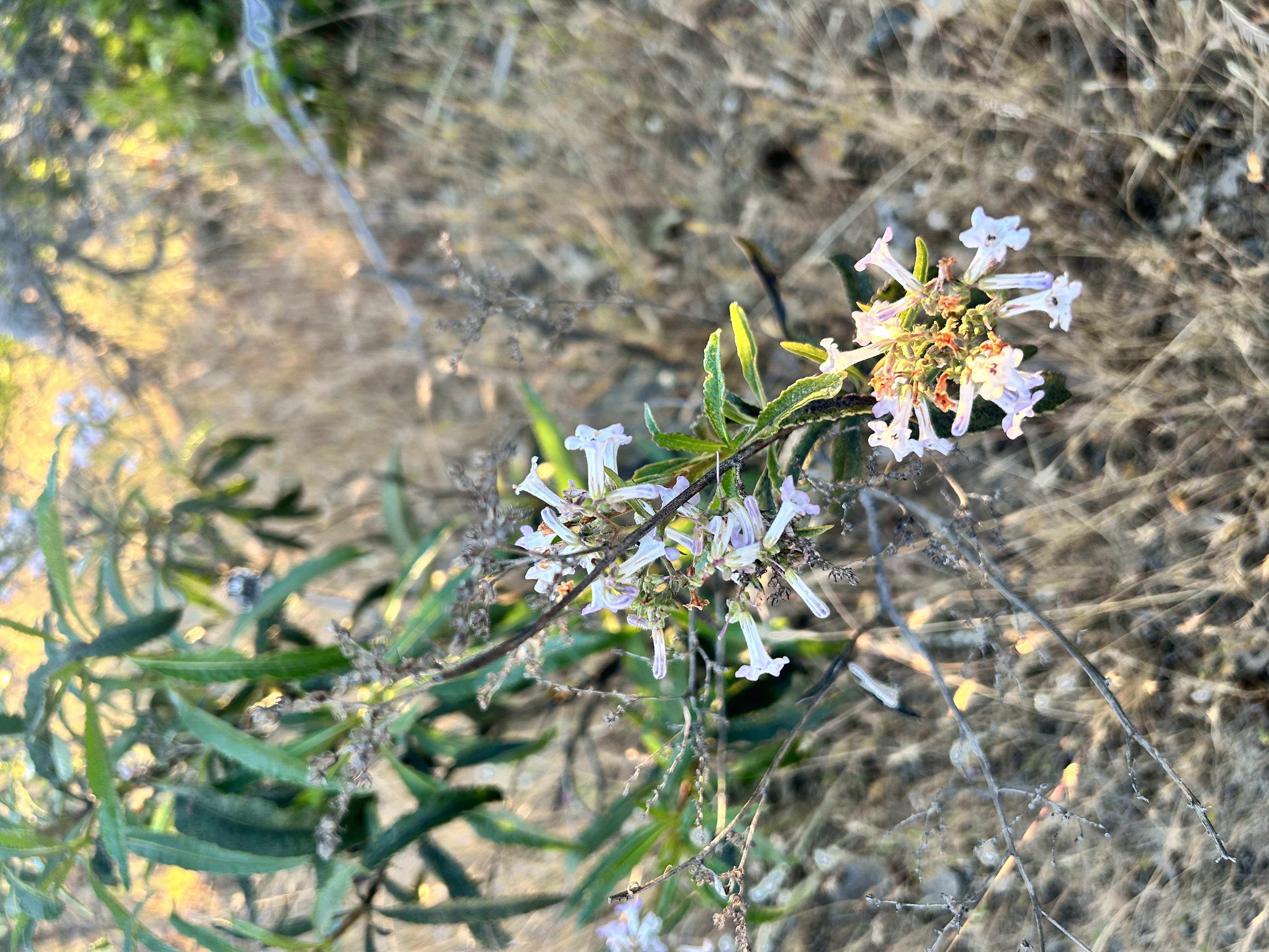
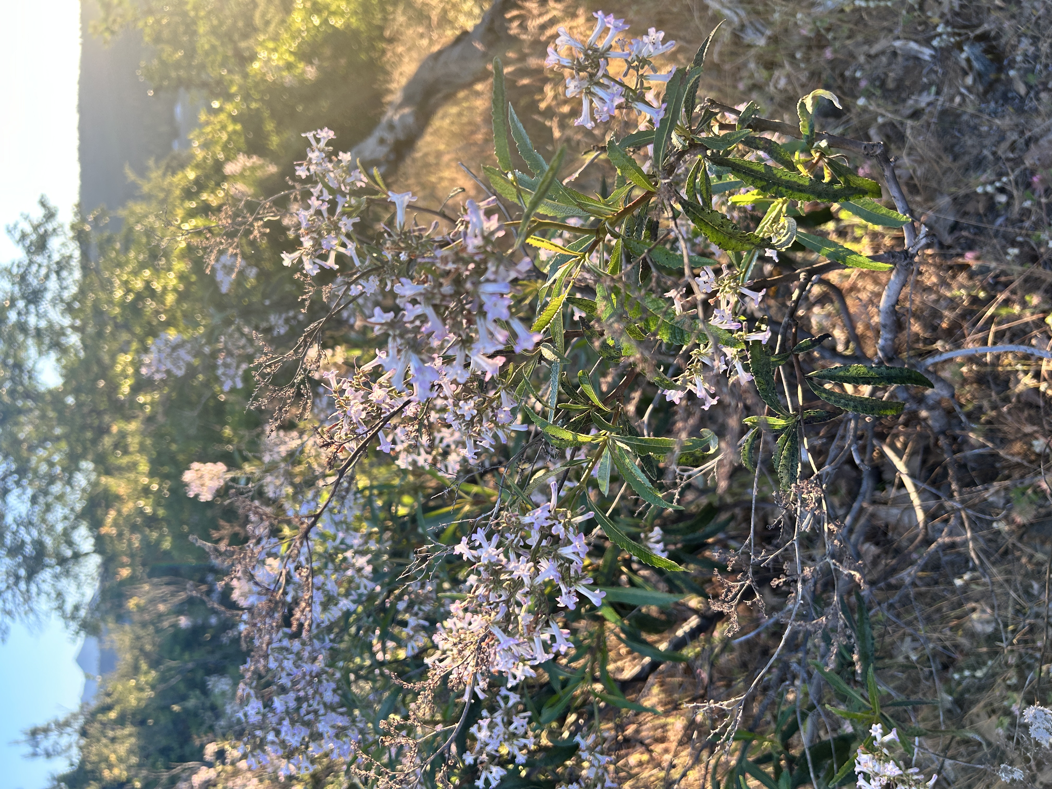
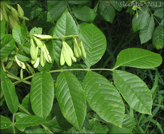
Within Trinity River watershed, one may encounter a distinctive shrub identified by its shiny, adhesive leaves and clusters of purple to white flowers. This species stands out, especially during its flowering period, when it becomes particularly noticeable among native flora. Yerba Santa (Eriodictyon californicum), whose name translates to “holy herb” in Spanish, is native to both the Trinity Watershed and the chaparral hills of California. Its importance stretches back millennia, as Indigenous peoples have used Yerba Santa as a medicinal plant, helping to aid symptoms of headache, colds, stomachache, asthma, hay fever, rheumatism and bronchial congestion.
Meet Yerba Santa: A Chaparral Specialist
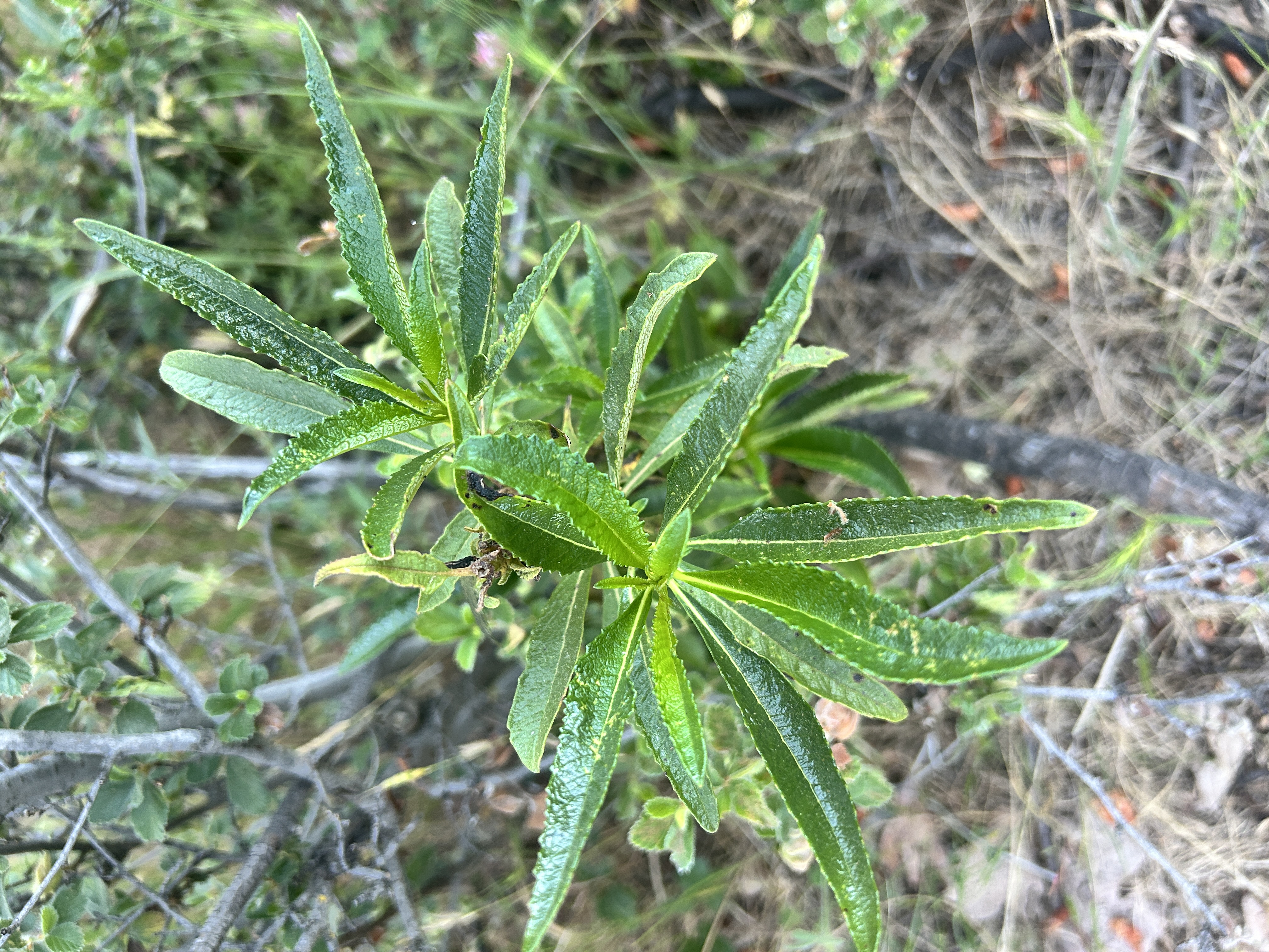
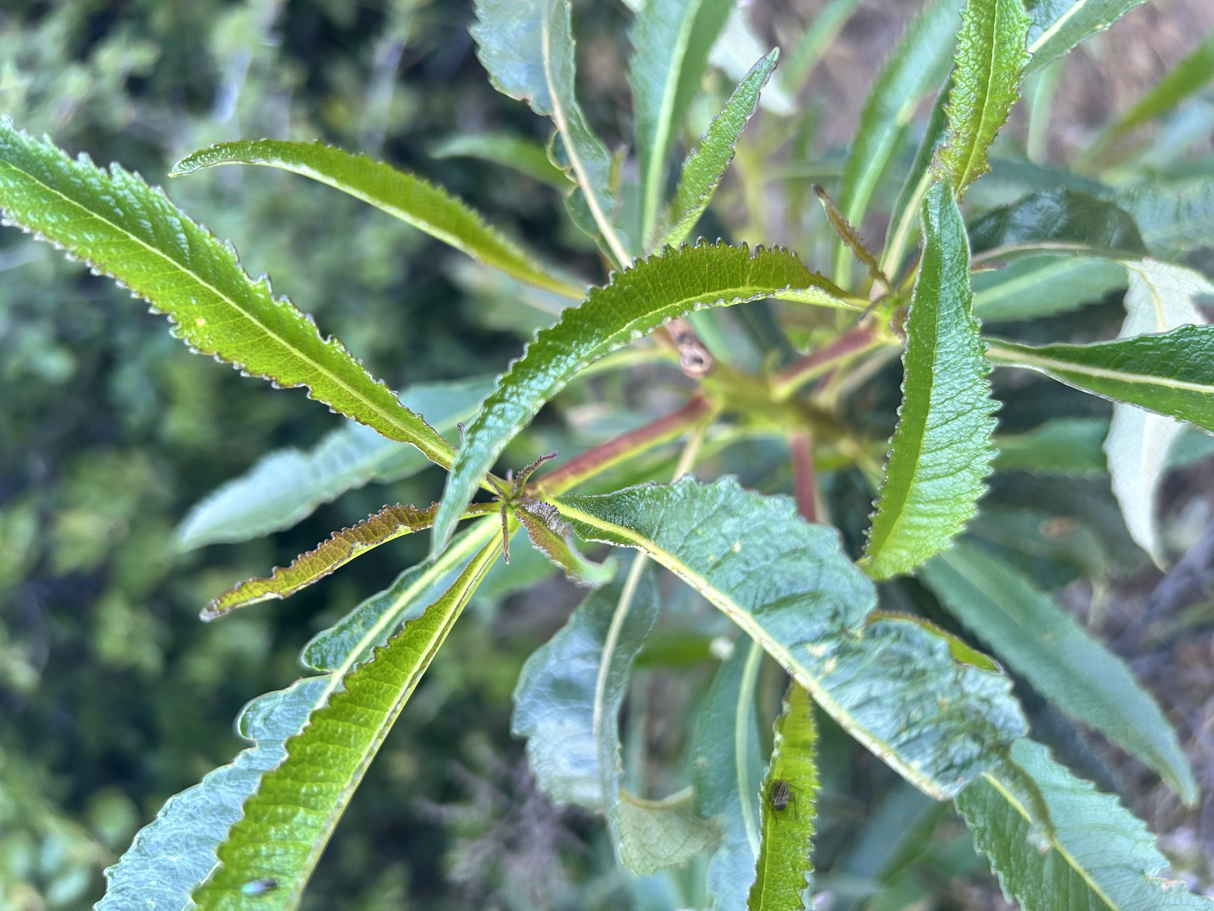
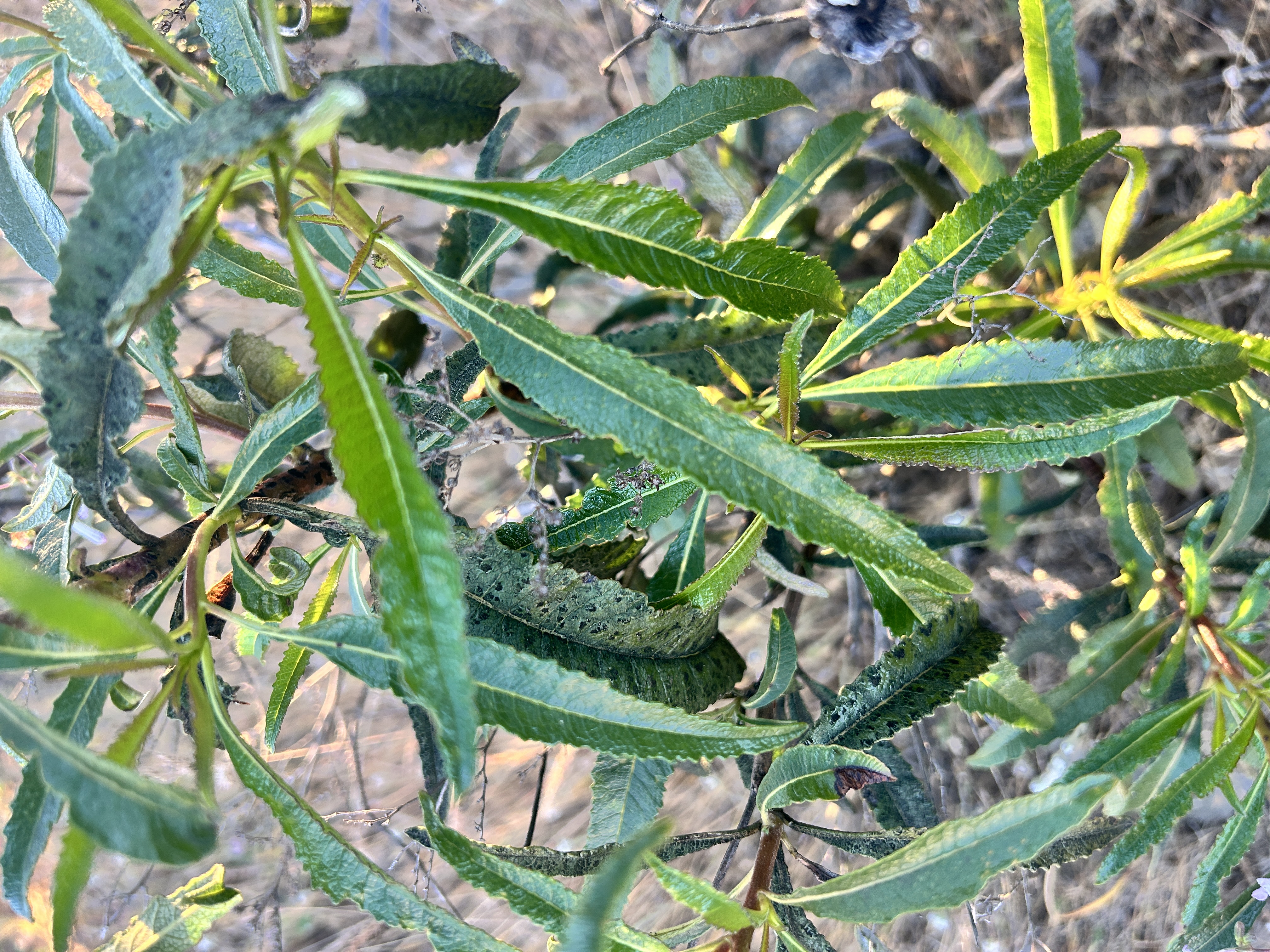
Yerba Santa is an evergreen shrub that typically grows 3–4 feet tall, with tough, leathery leaves coated in a natural resin. It’s scientific name Eriodictyon is rooted from a Greek compound word meaning “woolly net” which refers to the fuzzy underside of the leaves that acts to help the plant survive the hot, dry summers of our region by working to conserve water for the inner plant. The leaves are otherwise tough and leathery, saw toothed or straight, long, and slender (lanceolate), often sticky with resin, with alternate arrangement along the stem.
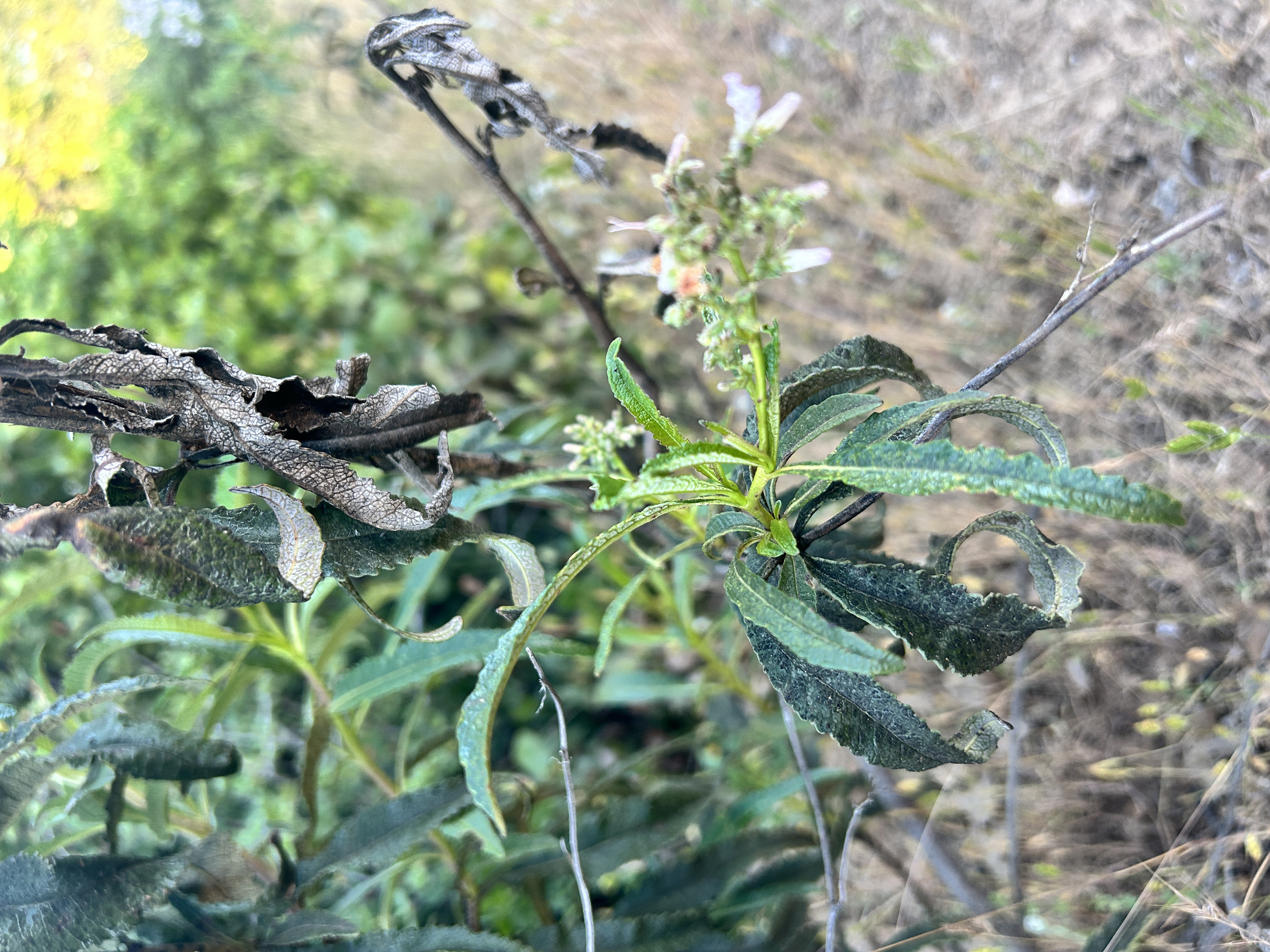
In spring, the plant produces showy, coiled clusters of trumpet‑shaped flowers ranging from white to light purple. The abundant and fragrant flowers provide a reliable nectar source for the honey bee (Apis mellifera), butterflies like the western tiger swallowtail (Papilio rutulus), hummingbirds, moths and other beneficial insects (5). It is also said that bees who visit the flowers of Yerba Santa make honey that is deliciously spicey and amber in color (1).
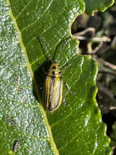
While the flowers are not specialized to a specific pollinator species, the plant does host the larvae and adults of the Yerba Santa leaf beetle (Trirhabda eriodictyonis) which feed exclusively on plants in this genus (5, 6).
Yerba Santa thrives in chaparral ecosystems where fire is common and essential to the plant’s success. While two-year old plants can reproduce by rhizome each fall flowers form into seeds and disperse sometimes lying dormant in the soil for decades. Come fire season in areas effected by fire, mature Yerba Santa rebounds via rhizome and can act as a pioneer species in an otherwise barren landscape. Additionally dispersed dormant seeds can be triggered by the heat or smoke of a wildfire encouraging mass germination. For this reason, botanists can refer to E. californicum as a “fire following” species (Emery 1988).
Yerba Santa seeds are also beneficial for wildlife. A single Yerba Santa flower produces between 2 and 20 tiny nutritious seeds which ripen in late summer feeding local birds and small mammals. While the seedlings and young plants are quite palatable, the bitter compounds in mature Yerba Santa leaves discourage most large herbivores. However, during winter the plant can become an important forage crop for black-tailed deer when other food sources are minimal (1).
Yerba Santa (Eriodictyon californicum) [TRRP/Kiana Abel]
Deep Roots: Indigenous Knowledge and Traditional Use
Yerba Santa has long been an important and useful plant for medicine. Due to indigenous use and teachings, the plant was introduced to missionaries and early non-Indian settlers. By the late 1800s Yerba Santa was widely accepted by American physicians and seen as a very valuable source for curing ailments. Though the plant lost prominence within American medicine in the 1960s due to the requirement of clinical trials for medicines, and Yerba Santa was not invested in for clinical trial (4) .
In California, Yerba Santa leaves were gathered by many different tribes throughout the state, including ancestors of the modern Yurok and Karuk tribes (3). According to the NRCSs Yerba Santa Plant Guide, California tribes including the Salinan, Ohlone, Miwok, Pomo, and Yokuts continue to use it for various medicinal purposes (1). The Amah Mutsun Tribal Band continue to gather and prepare it in part through the activities of the Amah Mutsun Land Trust (2).
Traditionally harvest focused on young leaves. Traditional practices taught by elders encouraged those harvesting to offer words of thanks or a physical gift, like sage or tobacco prior to harvest. This respectful approach created connection between the plant and its harvester.
The leaves can be used in several ways:
Brewed into a tea for coughs, colds, or asthma
Chewed fresh or dried into small herbal “chew balls”
Smoked or inhaled as a decongestant
Yerba Santa is naturally very bitter. But many have noticed that after chewing a cured leaf then drinking cool water tastes unexpectedly sweet. Today we know why: the plant’s compounds temporarily block the tongue’s bitterness receptors, making water taste almost like a mild sweet tea.
The Science Behind the Medicine
Yerba Santa leaves contain powerful plant chemicals, including rare flavanones like eriodictyol, homoeriodictyol, and sterubin. These compounds:
Act as free‑radical scavengers (antioxidants)
Help open bronchial airways
Loosen mucus, acting as natural expectorants
Block bitterness receptors on the tongue, creating that unique after‑sweetness
Researchers continue to study these compounds for potential use in cough syrups, throat lozenges, and even taste‑modifying medicines.
A Gangly Plant with Incredible Value
Yerba Santa plays an important ecological role in the Trinity River Watershed. It provides nectar for a wide range of pollinators, produces seeds that support birds and small mammals, and rebounds quickly after fire, helping stabilize and regenerate chaparral landscapes. Its long history of use by Indigenous communities, along with ongoing scientific study of its chemical compounds, highlights its continued cultural and medicinal relevance. Yes, Yerba Santa is common but also a valuable shrub that contributes to both the ecological and cultural heritage in California.
Below are a list of resources if you are interested in harvesting or cultivating this common yet important plant to our region!
As Public Affairs Specialist for the Trinity River Restoration Program, Kiana manages external communications, media relations, and stakeholder outreach. She acts as a liaison between program initiatives and the public, transforming technical findings into compelling narratives that promote understanding of restoration initiatives on the Trinity River. Kiana holds a Batchelor’s in Art History, has spent most of her career in marketing and is focused at the TRRP on bridging the gap between public awareness and resource restoration and management.
By: Kiana Abel, Public Affairs Specialist – Trinity River Restoration Program
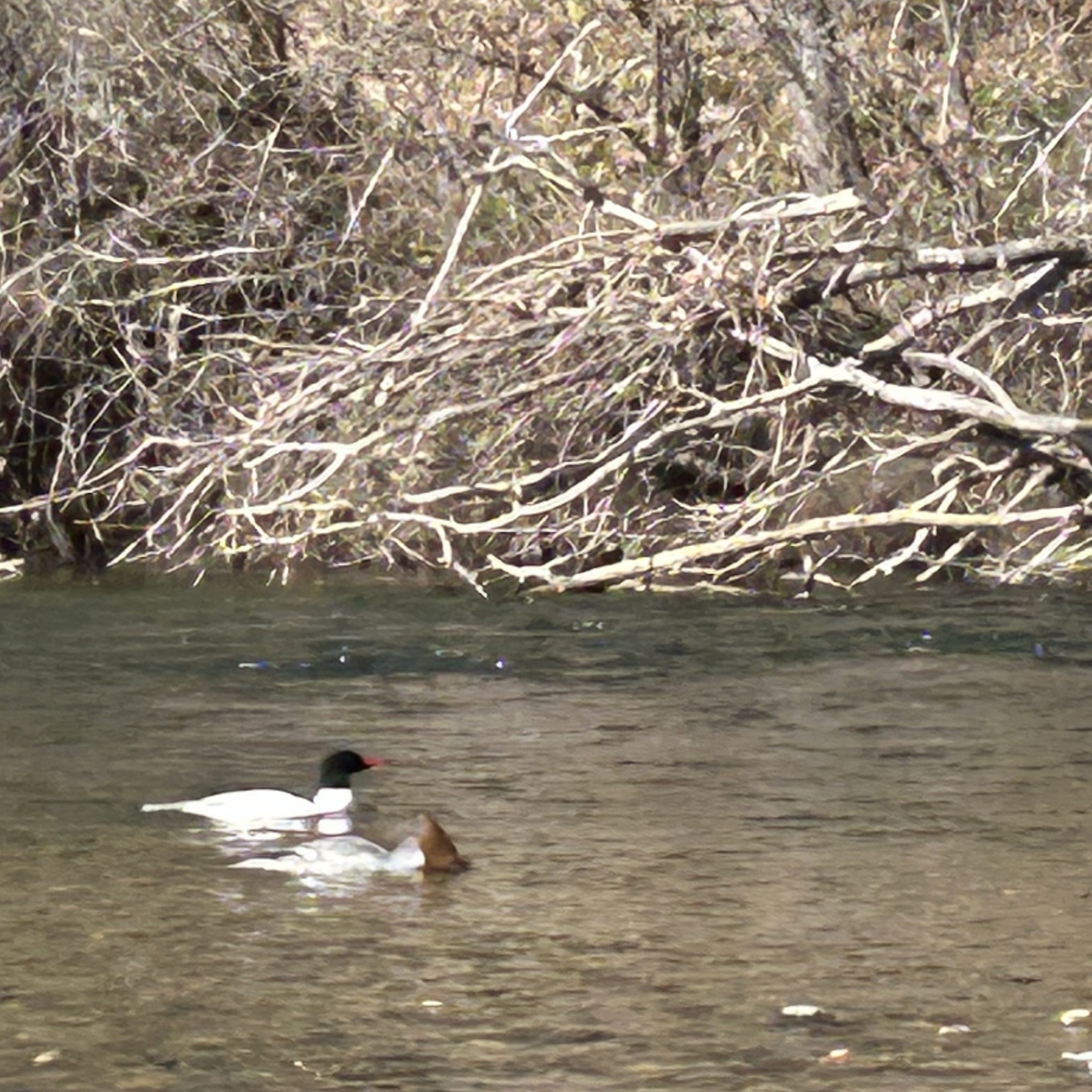
The Common Merganser (Mergus merganser) is, as the name suggests, very commonly seen when travelling the Trinity River corridor. Although common, they are striking when encountered. Males are bright white with dark green heads, while females wear elegant gray bodies with cinnamon-colored crests.
Both are unmistakable silhouettes gliding low over the water or“snorkeling” (swimming on the surface but with their heads underwater, looking for food) along the shallows.
Photo: Mergansers swimming in the Trinity River this past March. The female is shown “snorkeling” for food. [James Lee, Trinity River Restoration Program]
Beyond their striking appearance, mergansers may also be telling us something important about river ecology – especially when it comes to further understanding the early life stages of Trinity River salmon.
Life on the Trinity: A River Tailor-Made for Mergansers
Common Mergansers specialize in catching fish, and the Trinity River offers an exceptional winter buffet. With an abundance of young salmon available and with 60 years of consistent slow and clear winter flows, merganser population have benefited from perfect conditions for spotting and pursuing prey during the those months.
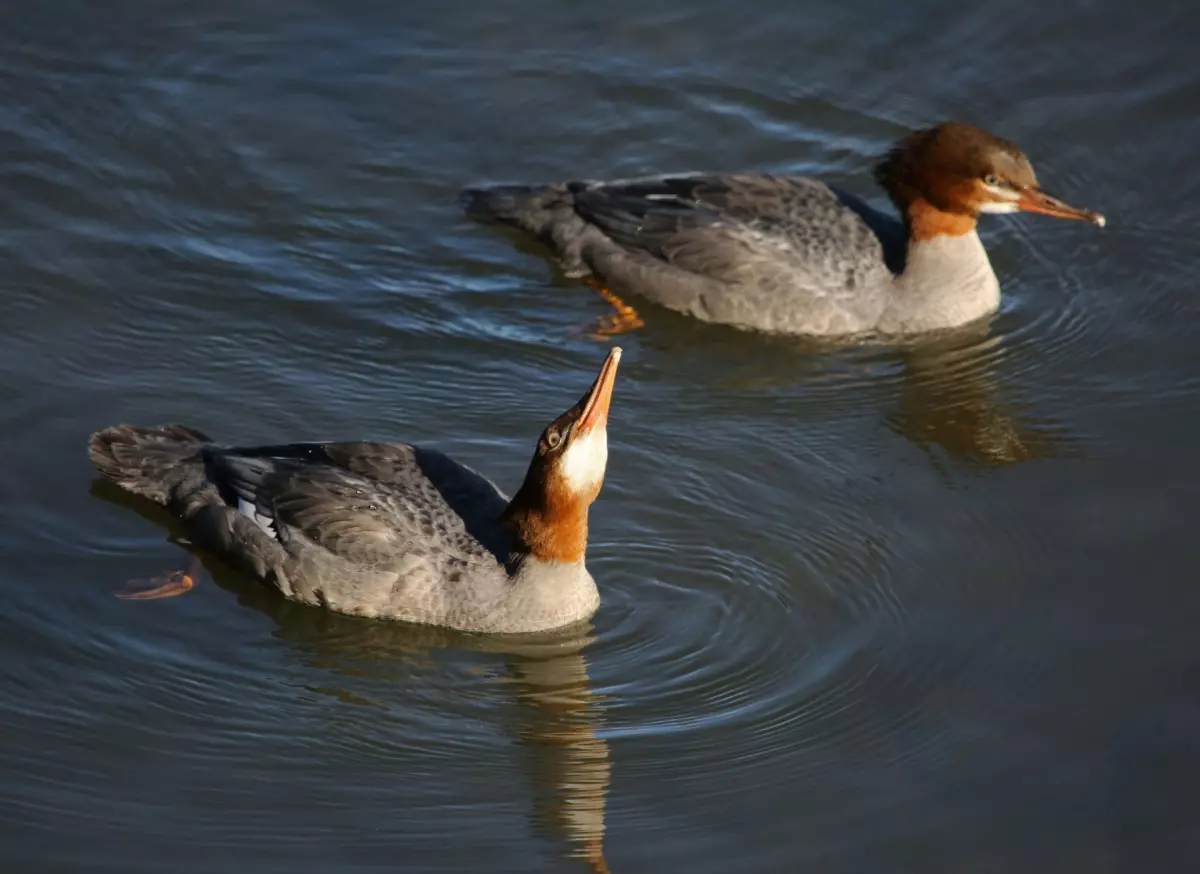
Their diet on the Trinity likely includes, mussels and salamanders but mostly they feed on a wide variety of fish, most notably, Chinook salmon fry. While young ducklings eat aquatic insects, adult mergansers may swallow a fish up to a foot long – check out this awardedphoto from the Autubon Field Guide.
Mergansers are excellent predators, feeding by dipping their heads underwater while swimming, scanning the riverbed for juvenile fish.
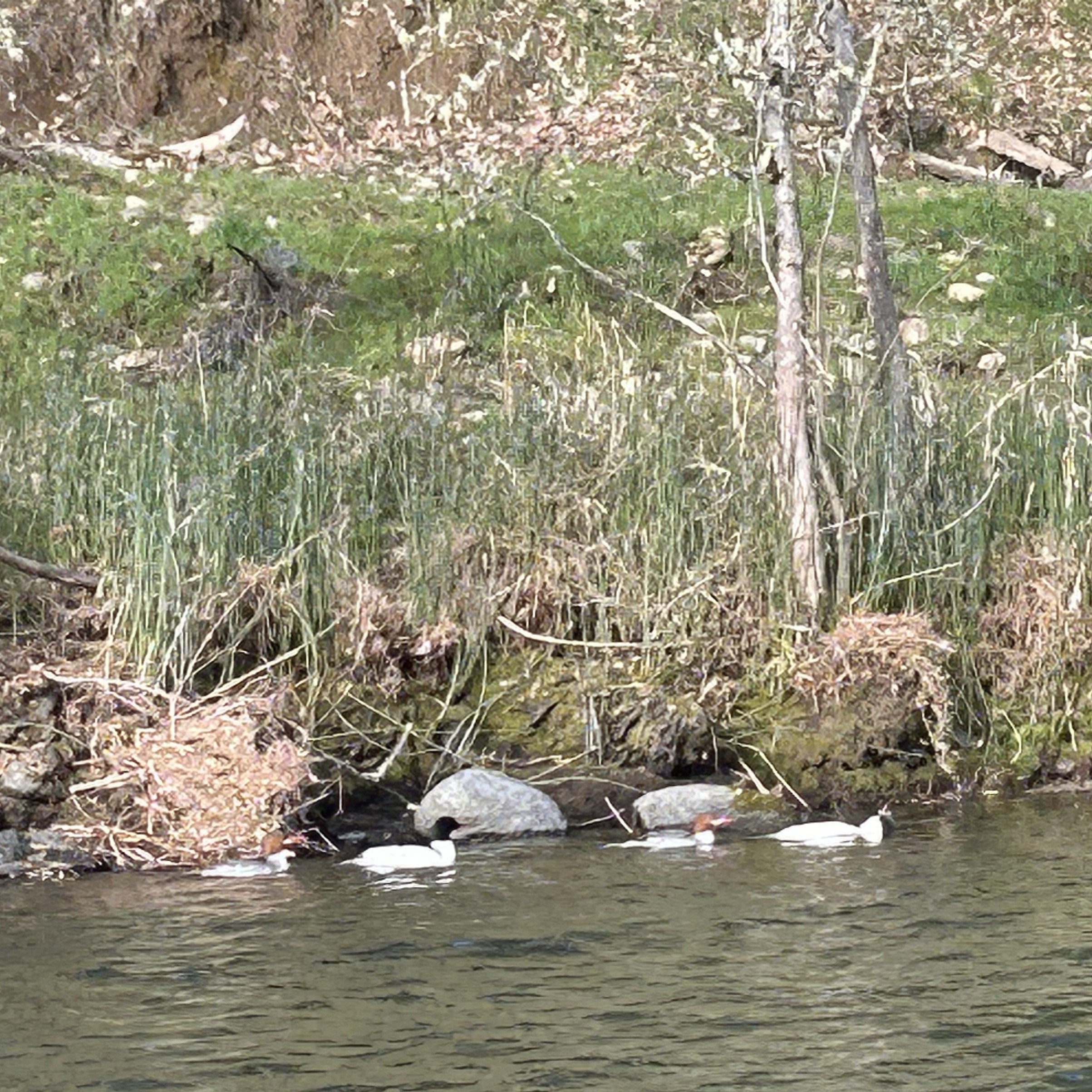
Two merganser pairs spotted in the Lewiston reach this past March. [James Lee, Trinity River Restoration Program]
A Growing Question: How Many Salmon Do They Eat?
Although common mergansers are a natural and important part of the Trinity River ecosystem, fish biologists have long wondered how significant their predation might be on young salmon and if that balance were out of sync due to low winter flows.
Two decades ago, Redwood Sciences Laboratory biologist Dr. C.J. Ralph offered a rough, informal estimate for the Trinity River: mergansers might consume millions of Chinook fry each year, given the combination of abundance and the seasonal availability of small, vulnerable salmon fry.
Recently, Trinity River Restoration Program staff revisited this question. A preliminary late winter float on the river counted 45 mergansers in just 6.2 miles—about 7.3 birds per mile. If that density were similar across the full 40-mile restoration reach, the river may host around 290 mergansers during peak fry emergence.
Using moderate assumptions from scientific literature – if about 450 fry are consumed per bird, per day (in prime conditions) – predation could reach into the millions over a two-month period.
While this estimate is intentionally conservative and includes many uncertainties, it begs the question – have mergansers benefitted from past flow management and preyed on Trinity River juvenile salmon at an unnaturally high rate due to managed conditions?
A Potential New Monitoring Effort: Counting Birds to Understand Fish
To explore this idea, scientists are considering a Before After Control Impact (BACI)-style study:
Measure merganser abundance during low, clear 300 cfs winter flows
Repeat surveys when flows are elevated (500–3,000 cfs)
Compare both to a stable flow control reach
A simple float survey by TRRP staff in March provided a primary snapshot. Additional surveys during variable flows will begin building the baseline needed for a robust analysis.
This effort is still in its infancy, but it reflects growing collaboration among partners interested in fish ecology, bird behavior, and flow management.
Could Mergansers Be a Clue to Where Young Salmon Are?
An especially creative idea emerging from early discussions is that mergansers might help answer another long-standing question: Where are Chinook fry distributed along the river during their first weeks of life?
Because mergansers concentrate where food is most dense, their distribution may mirror fry distribution. This could provide:
A new, low-impact way to monitor fry movements
Insights between emergence and lower-river screw trap detection
A broader understanding of habitat use during early rearing
In this way, mergansers might serve not only as predators, but also as bioindicators helping us better understand the juvenile salmon life cycle.
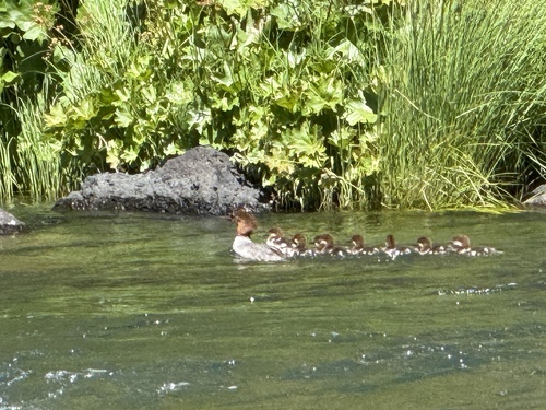
Despite their appetite, Common Mergansers are charismatic, lovely to see and ecologically important. They are one of the few waterfowl species that nest in high tree cavities, often returning year after year. They are agile swimmers, attentive parents – often adopting into their clutch and are stunning birds to observe.
Their seasonal presence on the Trinity River reflects both the river’s biological richness and the complex relationships among species that depend on it.
As the season continues, keep an eye out for these impressive divers, and stay tuned as scientists work to better understand the role they play in the story of Trinity River salmon and flow management.
As Public Affairs Specialist for the Trinity River Restoration Program, Kiana manages external communications, media relations, and stakeholder outreach. She acts as a liaison between program initiatives and the public, transforming technical findings into compelling narratives that promote understanding of restoration initiatives on the Trinity River. Kiana holds a Batchelor’s in Art History, has spent most of her career in marketing and is focused at the TRRP on bridging the gap between public awareness and resource restoration and management.
Summary of the Trinity Management Council’s March Quarterly Meeting
TMC Partnership Ring
The Trinity Management Council met in-person on March 25 and 26 in Willow Creek for a spring-quarter meeting to discuss the work shaping the Trinity River Restoration Program (TRRP). The meeting brought together leaders from multiple agencies and tribes who shared updates on operations, science, restoration work, and the long‑term stewardship of the river. The following highlights the main themes and takeaways from the session – the full notes will be posted (here) after approved by TMC at the June 2026 meeting.
Executive Director’s Report (TRRP Staff)
Mike Dixon opened the Executive Director’s report with an overview of current program operations, staffing realities, and fiscal constraints shaping TRRP’s workload. He noted that the office continues to operate under unusually heavy demands while key positions remain unfilled. A vacant physical scientist role—critical for flow scheduling and coordination with Central Valley Operations—was recently forwarded to Washington, D.C. for approval to recruit, which he described as a welcome development given the cumulative burden on remaining staff. He also shared that he has now officially begun serving as Acting Deputy Area Manager for NCAO, adding another layer of responsibility during an already demanding period.
Dixon focused on challenges resulting from the Department of the Interior’s transition to the G‑Invoicing financial system. The timing of the shift created widespread confusion across bureaus, leaving TRRP temporarily unable to access or spend funds transferred from partner agencies. Dixon credited TRRP Secretary, Samantha Maier, for stepping far beyond her normal duties to troubleshoot and restore functional financial workflows, ensuring the program could once again move money to partners and implement planned work.
On the operational front, Dixon provided a brief but important update on the escapement monitoring negotiations among Reclamation, CDFW, and the Hoopa Valley Tribe. A mediation team has been hired to help guide the parties toward an MOU addressing monitoring at the Lower Trinity River weir sites. He cautioned, however, that due to the delayed contracting timeline, no new agreement will be completed in time to change monitoring approaches for 2026, leaving the program in a “status‑quo” posture for one more year.
Dixon also reported meaningful progress on long‑requested temperature control planning at Trinity Lake. After years of delays the Value Planning Study for a Trinity Lake Temperature Control Device is now scheduled for early December. This study will convene technical experts from Reclamation regional offices, Denver TSC, and potentially DWR to evaluate feasible alternatives for selective withdrawal infrastructure. A summary of conceptual options is expected by March following the study session.
Finally, in lieu of Kristin Hiatt later in the day, he provided a re-consultation update for the Long-Term Operation of the Trinity River Division. The Biological Assessment is entering high‑level policy review and the cooperating agency Supplemental EIS is expected to circulate soon for a 30‑day Cooperating Agency Draft review period. If the schedule holds a public draft should be released this summer.
Implementation Branch
Implementation Branch Chief, James Lee, provided a thorough walkthrough of ongoing and upcoming channel rehabilitation, sediment management, and watershed-related activities. The update emphasized construction progress, design timelines, interagency coordination, and long‑term project sequencing.
Lee confirmed that Sawmill Restoration is expected to finish civil construction this year. The site is being transformed from a long‑used gravel excavation and processing area into a rehabilitated channel and floodplain complex.
Lee noted that the Evans Bar Restoration Project in Junction City was originally expected to start construction this year, but the Federal team reported significant delays caused by the government shutdown that postponed value engineering (VE) study. The VE is now complete and provided extensive recommendations to the design team who are now working toward 60% design, estimated to be complete by June. Due to these delays, the project will not be ready to implement in 2026. The team noted communication with adjacent private landowners, who are concerned about access and public use.
Lee discussed upcoming projects like the Rush Creek Confluence Restoration Project, an older conceptual design that TRRP intends to advance into a 60% design, bringing the project into the pipeline for construction in the next several years. Also on the forefront is the Sky Ranch Project (Junction City) remains at 60% design due to delays with Federal land ownership transfers.
Lastly, Lee updated the TMC regarding the Sediment & Wood Augmentation project within the Steel Bridge Area which is the first use of the new Sediment and Wood Environmental Assessment. A presentation with details for the project was given by the Physical Workgroup Coordinator, Smokey Pittman at the end of the meeting.
James reported on several watershed restoration projects funded through NFWF:
Deadwood Creek: NEPA and cultural compliance are complete; implementation expected in June.
Salt Creek: Strong progress on compliance, but funding challenges may limit construction.
East Branch of East Weaver Creek fish passage: Construction is scheduled for 2026.
Browns Creek Water Resilience: Two landowners recently expressed interest, though archaeological concerns may reduce participation.
Smith Pit: The Hoopa Tribe is pursuing design funding for restoration and the TRRP has committed to assisting with Environmental Compliance.
Public Outreach & Communications
Kiana Abel, Public Affairs Specialist, reported continued growth and strong engagement across TRRP’s public outreach platforms. The TRRP Facebook page surpassed 2,040 followers, with flow‑related updates again generating the highest interaction. She highlighted the recent installation of the new interpretive sign at Upper Conner Creek, completed in partnership with the Yurok Tribe Construction Corporation, and noted encouraging signs of native species using the restored floodplain.
Kiana reviewed recent issues of The River Riffle, which featured contributions from staff and partners covering local mushrooms, wildlife observations at restoration sites, and program updates. She also described ongoing development of the 2025 TRRP Annual Report, which will present a 25‑year narrative of adaptive management, organized across major program tools and science areas.
She shared several website improvements completed this quarter, including expanded Science on Tap archives, updated sediment and wood augmentation pages reorganized with past projects to increase accessibility for the public. Seasonal outreach efforts included flow notifications, construction notices, and direct communication with landowners near project sites. Kiana noted that recent in‑person conversations with residents have been positive and constructive.
She concluded with a preview of the upcoming outreach calendar, including multiple Science on Tap presentations, community sustainability and plant‑exchange events, school field programs, and a river tour for Cal Poly Humboldt, scheduled in June. Additional coordination is underway for tours with the Salmonid Restoration Federation. These efforts continue to expand community understanding and visibility of TRRP’s work along the Trinity River.
Science Branch
Eric Peterson, the TRRP Science Coordinator, provided an update covering major science initiatives, modeling work, monitoring reviews, and project proposals.
Limiting Factors Analysis (LFA)
The LFA is one of TRRP’s most significant multi‑year science efforts. Eric explained that:
TRRP is in Phase 2, where contractors are implementing the study plan.
The contractor, Kramer Fish Sciences, will deliver a final report in August 2026.
A June 23 lifecycle model workshop will train staff and work groups on using the population model.
The LFA now includes intense collaboration between:
Kramer’s modeling team
TRRP’s Interdisciplinary Team (IDT)
The Scientific Advisory Board (SAB)
Some challenges include:
The lifecycle model cannot fully separate spring and fall Chinook juveniles due to limited data.
The model will still integrate adult distinctions where possible.
A special TMC meeting on Aug. 20 is planned for presentation of the final LFA report.
Central Valley Operations Update (Elizabeth Hadley, Reclamation)
Elizabeth Hadley, reported that Trinity Reservoir is at 91% capacity, with a projected peak near 94% in April. Despite early‑season storms, Northern California’s snowpack remains well below average, and warm temperatures are expected to produce only modest runoff. As a result, the CVP will rely more heavily on stored water through the spring and summer.
Hydropower operations continue to face constraints. Trinity Powerplant Unit 1 has completed its scheduled maintenance, while Unit 2 will be offline from November through early March. At Spring Creek Powerplant, one unit remains in extended overhaul until late this year.
Looking ahead, Elizabeth noted that a division‑wide transformer replacement program is planned for 2029–2031, requiring close coordination with TRRP to avoid conflicts with environmental flow needs. Workforce shortages also persist, though hiring is underway for plant mechanics and an electrical program manager, with additional recruitments expected later this year.
Trinity River Hatchery Update – (Derek Rupert, Reclamation)
The hatchery report noted that spring and fall Chinook and steelhead production targets are on track to be met this season. Coho salmon, however, returned in very low numbers, limiting the number of young fish that could be produced for the coming year.
A major focus of the update was the hatchery modernization project. Staff recently visited modern facilities in Idaho and Washington to gather ideas for the Trinity River Hatchery redesign. The updated facility is expected to include new adult holding ponds, a streamlined spawning building, improved water‑quality screening, updated incubation areas, and welcoming visitor spaces such as viewing windows and educational areas. The design package is expected this spring, with construction projected to begin in late 2026, depending on funding. Additional support will be needed to fully realize the modernization vision, including upgrades that are not yet covered by existing budgets.
Hatchery Integration Discussion– (Mike Orcutt & George Kausky Hoopa Valley Tribal Fisheries)
A joint discussion led by tribal representatives highlighted the need to better integrate hatchery operations with habitat restoration and fisheries management. Because each of these areas—habitat, hatchery, and harvest—tends to operate within its own system, the presenters emphasized that stronger coordination could improve salmon recovery.
Topics included the benefits of using more natural‑origin fish in hatchery broodstock, strategies for reducing domestication effects in hatchery fish, and how release timing and marking practices can shape downstream outcomes. Participants also discussed the importance of strengthening basin‑wide coordination and ensuring tribal co‑management remains central to future decision‑making.
Large Wood Implementation, Monitoring, and Management– (Reuben Smit, USFWS)
The presentation on large wood focused on how logs and natural woody material support healthy river ecosystems. Large wood helps form pools, create sheltered areas for young fish, and shape side channels. It also influences sediment movement and floodplain function.
Long‑term monitoring shows that placed wood often evolves into more complex structures over time. At some sites, pieces grow into full logjams, while at others, they move downstream and help seed new habitat features. Based on these findings, monitoring has shifted from counting individual pieces to assessing the volume, structure, and function of wood additions. The team will continue refining monitoring methods to better understand long‑term benefits.
2026 Gravel Augmentation Plan (Smokey Pittman, Applied River Sciences/Hoopa Valley Tribal Fisheries)
The gravel augmentation plan for 2026 focuses on supporting salmon spawning habitat in one of the most sediment‑starved reaches of the Trinity River. The Steel Bridge Day‑Use Area was selected for gravel placement after reviewing all existing sites. Crews will add approximately 2,000 cubic yards of spawning gravel to the inside bend of the river, where flows can shape it into riffles and bars.
In addition to gravel, several large logs made available through hazard‑tree removal near the site will be placed to help capture sediment and enhance habitat structure. The project will be monitored with drone surveys, tagged logs, and spawning‑season field observations. The Physical Work Group also plans to refine long‑term monitoring and objective‑setting for future gravel projects.
On the second day of the meeting, three major action items came before the TMC and all three passed with unanimous support. These included:
The approval to fund two FY26 science proposals
Advancing design for a critical fish‑passage project at Oregon Gulch in Junction City, Ca.
Selecting the 2026 spring flow hydrograph under the Program’s environmental flow management
Each decision is summarized below
FY26 Research Proposals (Eric Peterson, TRRP)
The Council first considered two science proposals that had been deferred from June due to budget uncertainty. With the FY26 appropriations now clarified, the TMC moved forward on both:
S3 Fish Production Model Upgrade
Led by USGS, this project enhances the juvenile salmon growth model by incorporating variable food consumption, replacing the current single‑rate assumption. The upgrade will calibrate the model using foraging data and juvenile salmon stomach contents, making the tool more sensitive to real ecological conditions.
Thermal Heterogeneity Study Using Pond Turtles
The Hoopa Valley Tribe and Applied River Sciences will survey biological response to temperature variation using northwestern pond turtles as indicators. Turtles remain in microhabitats longer than salmon fry, offering a clearer signal of thermal benefits from channel rehabilitation work.
After robust discussion, including how non‑fish wildlife objectives fit within the program’s legal mandates, the TMC unanimously approved both proposals. Members noted that the studies align with adopted science plan priorities and will generate valuable insights for flows, sediment and wood augmentation and channel rehabilitation restoration tools.
Oregon Gulch Culvert Fish Passage Project (James Lee, TRRP)
The second decision centered on the long‑problematic culvert at Oregon Gulch on Sky Ranch Road. The culvert is a full barrier to salmon and steelhead and contributes to recurring road failures, yet past attempts to design a replacement stalled due to landowner concerns.
Following new commitments from Trinity County to assist with landowner coordination—as well as clarity that the County will not fund construction—the TMC unanimously approved funding for the design phase of a fish‑friendly replacement. Once a design and cost estimate are complete, TRRP and partner tribes will seek outside construction funding. If external funding cannot be secured, the project can be reconsidered through a future watershed prioritization process.
Members expressed optimism that a shovel‑ready design will create new opportunities for state, federal, or philanthropic funding to restore access to miles of potential habitat.
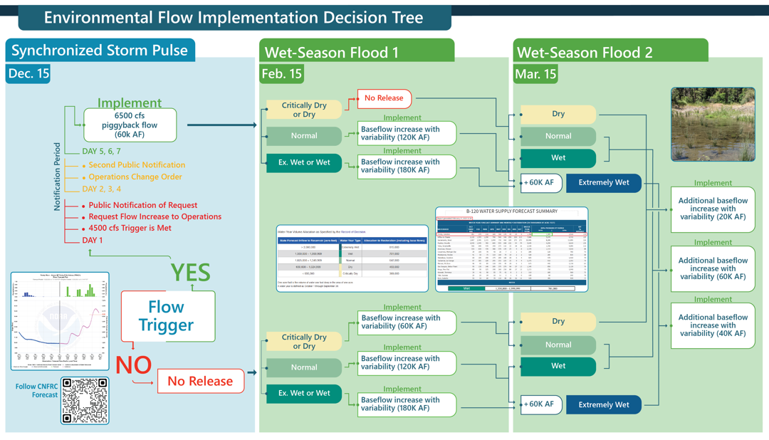
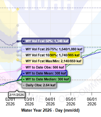
Hydrographrecommendation for the remainder of Water Year 2026 (Patrick Flynn, Trinity County)
This year marks the second cycle of the three‑year winter flow variability experiment. With both February and March B120 forecasts classified as “Dry”, the program implemented a 20,000 AF elevated baseflow beginning March 16.
For spring flows, the Flow Workgroup presented two sets of hydrographs for the TMC’s consideration:
Set A: Emphasizes geomorphic benefit, taking advantage of the winter synchronization peak
Set B: Emphasizes extended inundation for riparian seedling recruitment and amphibian needs
While fish models showed limited sensitivity between the options, non‑fish models—including cottonwood recruitment, foothill yellow‑legged frog habitat, and bedload transport—consistently favored Set A under both dry and normal April B120 conditions.
The TMC unanimously adopted Set A, with the appropriate variant triggered by the April B120 determination. Members also highlighted the importance of continued analysis of Safety‑of‑Dams releases, which influence winter flow dynamics and are being fully evaluated in Reclamation’s ongoing EIS.
“Stage 0” Watershed Restoration at Corral Gulch (Bridger Cohen, WRTC)
TMC received a detailed presentation on the Corral Gulch meadow restoration project performed by the Watershed Research and Training Center, the Yurok Tribe, in cooperation with the US Forest Service. The restoration followed a “Stage 0” valley reset in the South Fork Trinity watershed – the second known project following this concept design in Trinity County. The project reconnected the historic floodplain, has thus far raised groundwater levels, and dramatically slowed a previously channelized flow. Early monitoring shows remarkably fast hydrologic response, vegetative regeneration, and renewed wildlife use. This presentation sparked productive discussion about restoration techniques, long‑term monitoring, and opportunities for applying similar approaches in other areas in the Trinity River watershed.
Looking Ahead
The meeting closed with planning for the June session, which will include FY27 budget development, additional environmental flow evaluation study plans, and early discussion of the next TRRP science symposium. Council members also requested a future briefing on how safety‑of‑dams releases are analyzed relative to flow scheduling and biological performance, to ensure full transparency in hydrologic decision‑making.
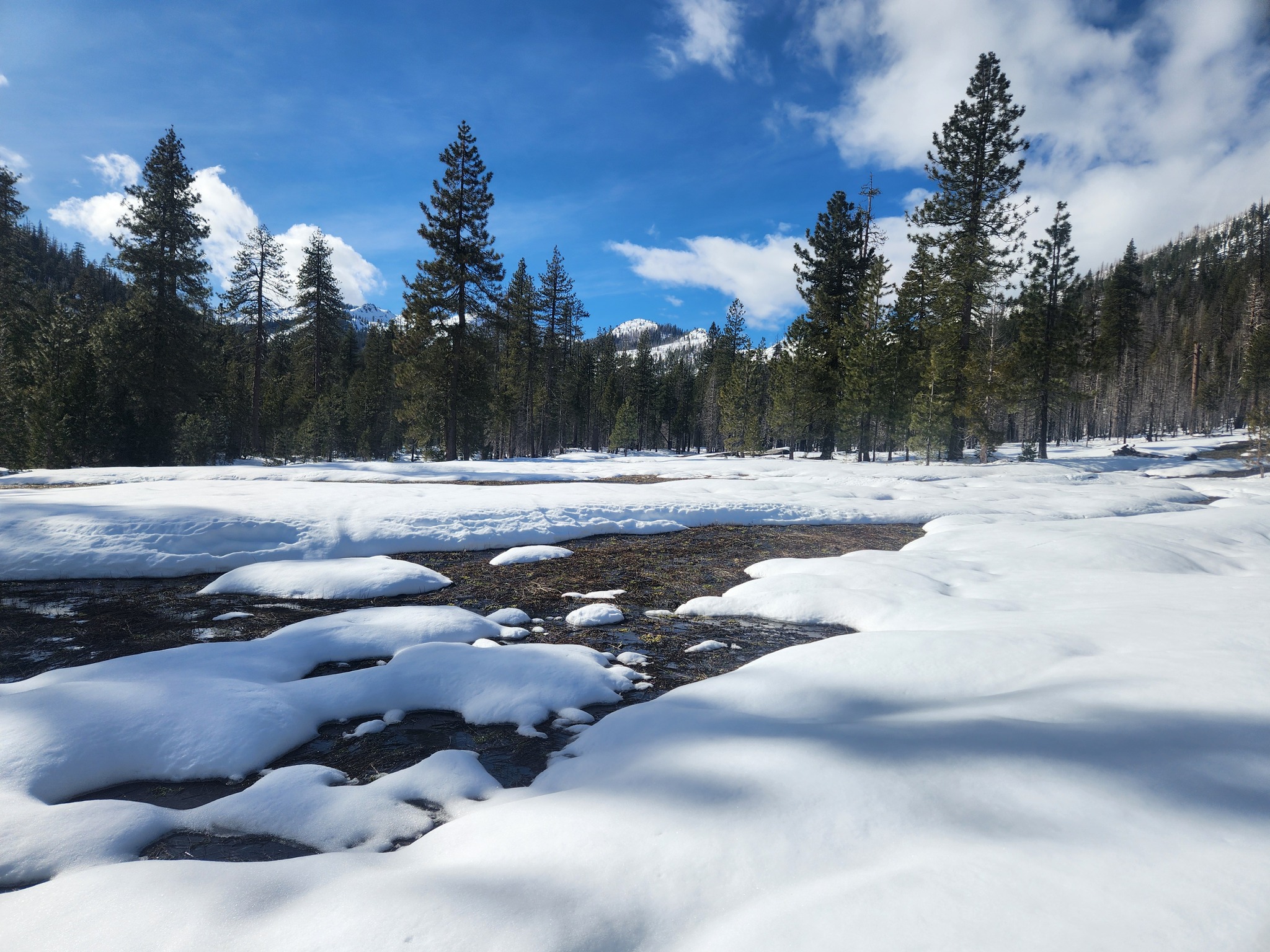
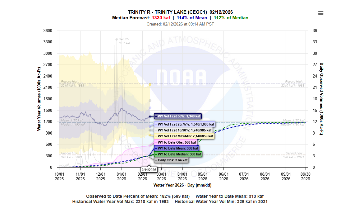
March Forecast – “Dry” with potential for “Normal”
Surveyors from the Watershed Training and Research Center are encountering minimal snow pack and melt in the Trinity Alps.
A swale has melted out in a meadow to be traversed on the route to the snow course during the February snow surveys conducted by the Watershed Research and Training Center. [Watershed Research and Training Center]
Snow Survey Results (from February)
“This was one of the wettest snow surveys in recent history for our crews.” Josh Smith, Watershed Stewardship Program Director described. “It rained at 7,000′ and every ephemeral swale had running water. It was a maze of streams running through the meadows and forests that made travel difficult and time consuming. We hope that the temps drop and/or we get some more snow storms in the near future!”
From a WRTC Facebook Post: February 2026 statistics, with February 2025 measurements in parentheses for comparison.
Bear Basin
Red Rock Mountain
Shimmy Lake
Snow height
40″ (80.5″)
41″ (101.5″)
51.5″ (99″)
Snow Water Equivalent
16.5″ (32.5″)
16″ (43.5′)
21″ (42.5″)
Trinity River Watershed Mar. Forecast
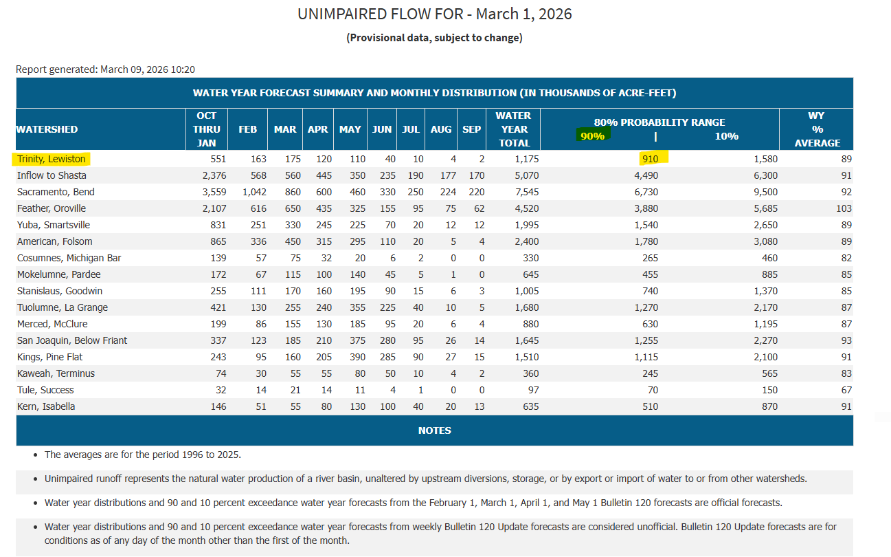
The volume of environmental flow releases for the Trinity River Restoration Program’s Wet-Season Baseflow Period (Feb. 15-Apr. 14) are determined by a conservative monthly inflow projection for Trinity Reservoir from the California Department of Water Resources (90% B120) in February, March with the final determination in April.
The current period within the Trinity River Restoration Program environmental flow management is the Wet-Season Baseflow Period. The California Department of Water Resources March 90% B120 declaration was published on Mar. 9 as “Dry” with the 90% determination at 910,000 acre feet.
Screenshot taken from the California Department of Water Resources March B120
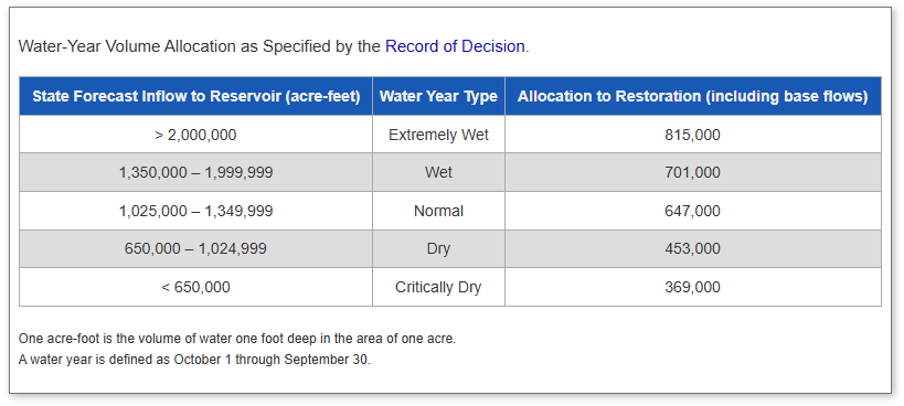
The Program’s Water-Year Volume Allocation as specified by the Record of Decision is outlined in the table below. The far left column is the threshold amount of state forecasted inflow in the Trinity Reservoir listed in acre feet which determines the center column, water year type. Then in the right column is listed the allocation to restoration for that water year, which includes baseflows.
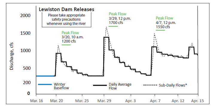
With a Mar. B120 determination of “Dry” the Mar. 15 – Apr. 15 period will increase releases from 300 CFS (winter baseflow) to the Trinity River by adding 20,000 AF into the schedule during this period.
The hydrograph using 20K AF during the next period is the following:
Schedule of recommended flow releases from Lewiston Dam to the Trinity River during the Elevated Baseflow Period (Mar. 15 – Apr. 14).
In April, the Program implements a spring snow-melt and recession hydrograph following the final B120 water year determination by the Department of Water Resources, which is typically announced around Apr. 10.
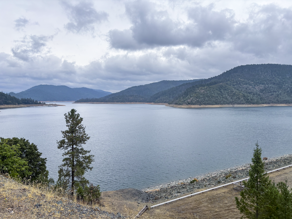
Trinity Reservoir
Current reservoir data does not play a role in the WY26 forecast or determinations, however levels are important to keep track of and can be accessed by following this link: Trinity Reservoir Daily Data (CDEC) – click the link for daily data.
Ecology in Motion: Wildlife Interactions After River Rehabilitation
By: Simone Groves, Riparian Ecologist, Hoopa Valley Tribal Fisheries with contributions fromJames Lee, Implementation Branch Chief and Kiana Abel, Public Affairs Specialist – Trinity River Restoration Program
Disturbance: A Natural Driver of River Ecosystems
Disturbance is a fundamental ecological force across western North America. At small scales, a fallen tree opens space and sunlight; at larger scales, wildfire or major floods reshape entire landscapes. Historically, the Trinity River experienced seasonal floods that scoured floodplains, deposited sediment and wood, and reset vegetation communities. These events initiated ecological processes that made the river corridor dynamic and biologically rich.
Succession in River Environments
Following major disturbance, the floodplains of rivers like the Trinity River undergo predictable successional phases. After high flows deposit bare gravel and sand, these new surfaces become recruitment beds for species like black cottonwood (one of the clearest examples of primary succession along the Trinity). In other cases, where vegetation is cleared but soils and roots remain, secondary succession accelerates recovery. In both processes, disturbance serves as the starting point that enables riparian vegetation to establish, mature, and ultimately support riparian wildlife.
Riparian Vegetation Depends on Disturbance
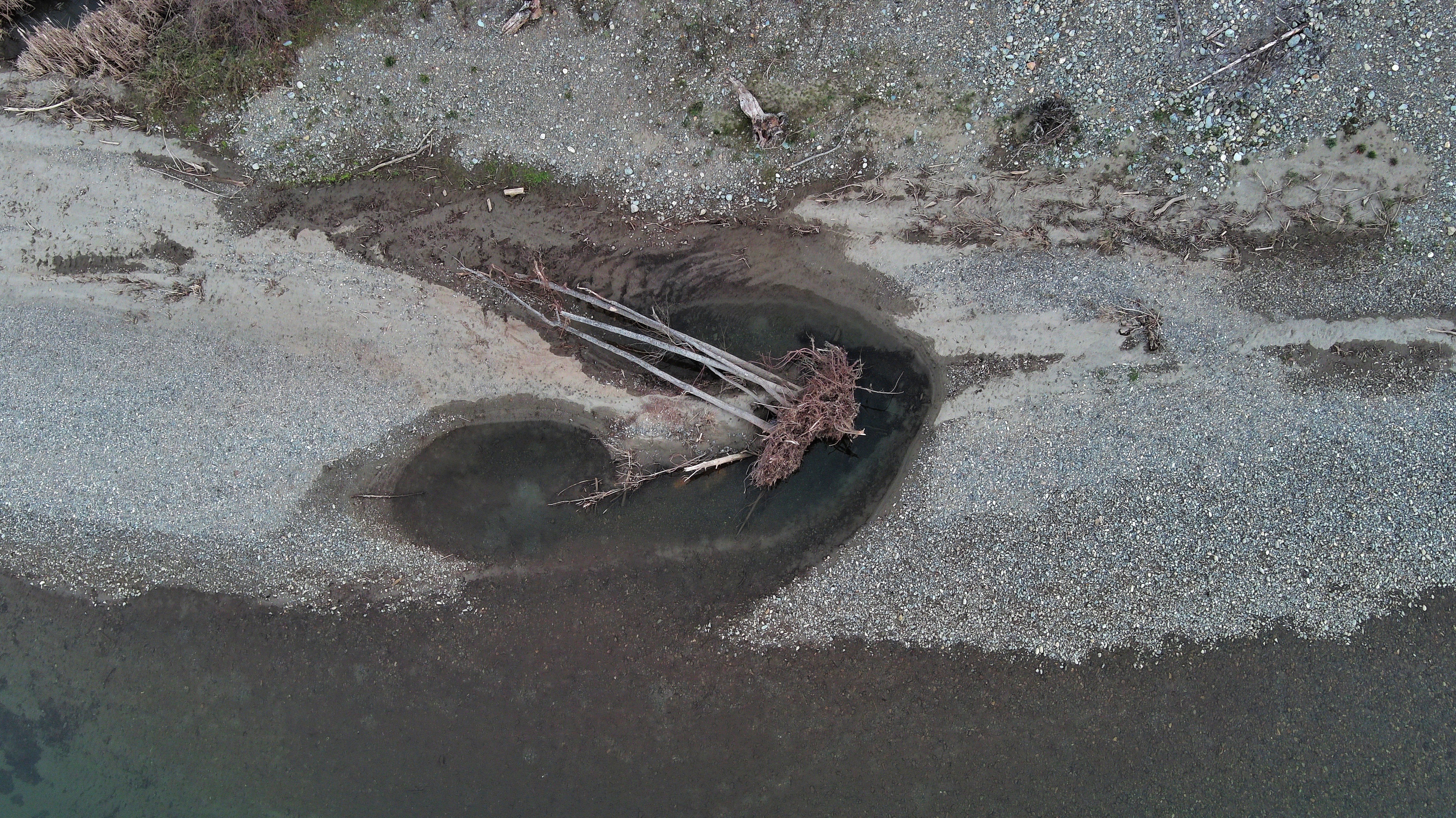
Recently deposited sediment and wood which were naturally recruited during winter storms along with channel rehabilitation (2024) and flow management on the Trinity River. [Aaron Martin, Yurok Tribal Fisheries Department]
Riparian habitats occupy a small fraction of the landscape, yet they are used by most wildlife species in the Trinity River watershed during some part of their life cycles. Without periodic disturbance, riparian vegetation is gradually replaced by upland species that are less valuable to wildlife. The river once maintained this vegetation naturally through regular high flow events. Today, with Trinity and Lewiston Dams reducing the timing and magnitude of floods, the natural disturbance regime has been significantly altered.
Because large, channel-shaping floods no longer occur downstream of the dams, channel rehabilitation and the use of big machines to lower floodplains has become an essential tool to reintroduce areas no longer available to the river for primary and secondary succession. Recently completed projects such as the Upper Connor Creek and Oregon Gulch Channel rehabilitation projects in Junction City, Ca. are two such examples. While the designs were unique to each location overall each project aimed to lower floodplain surfaces, reconnected the main stem Trinity with floodplain areas, increase channel complexity, and distribute large wood to mimic features historically formed by floods. Although mechanical disturbance differs in scale and timing from natural floods, it provides the ecological reset needed to restart successional processes.
Observed Wildlife Response
As new surfaces at Upper Connor Creek stabilized during and after construction, wildlife quickly responded.
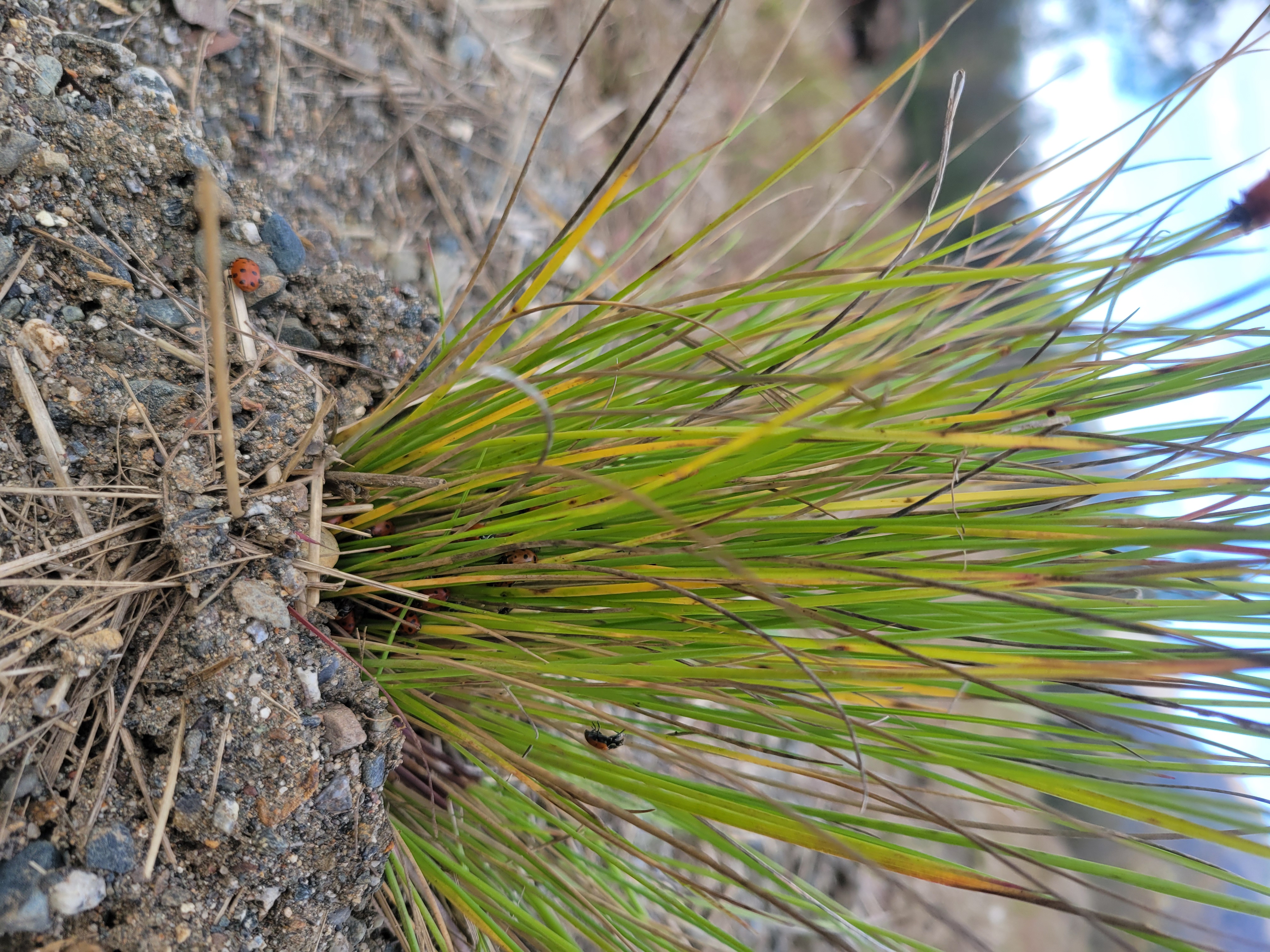
Insects were among the earliest arrivals. Butterflies and native bees collected salts on wet sediments, velvet ants moved rapidly across disturbed soils, and dragonflies patrolled the project perimeter. As winter approached, clusters of lady beetles gathered within the shelter of planted bunchgrasses.
A velvet ant at Upper Conner Creek.Velvet ants are fast and hard to photograph!Butterflies enjoying salts from newly disturbed and wetted floodplain.An ant hill in sediments at Upper Conner CreekLady bugs hide in the stalks of newly planted grasses during the cold months.
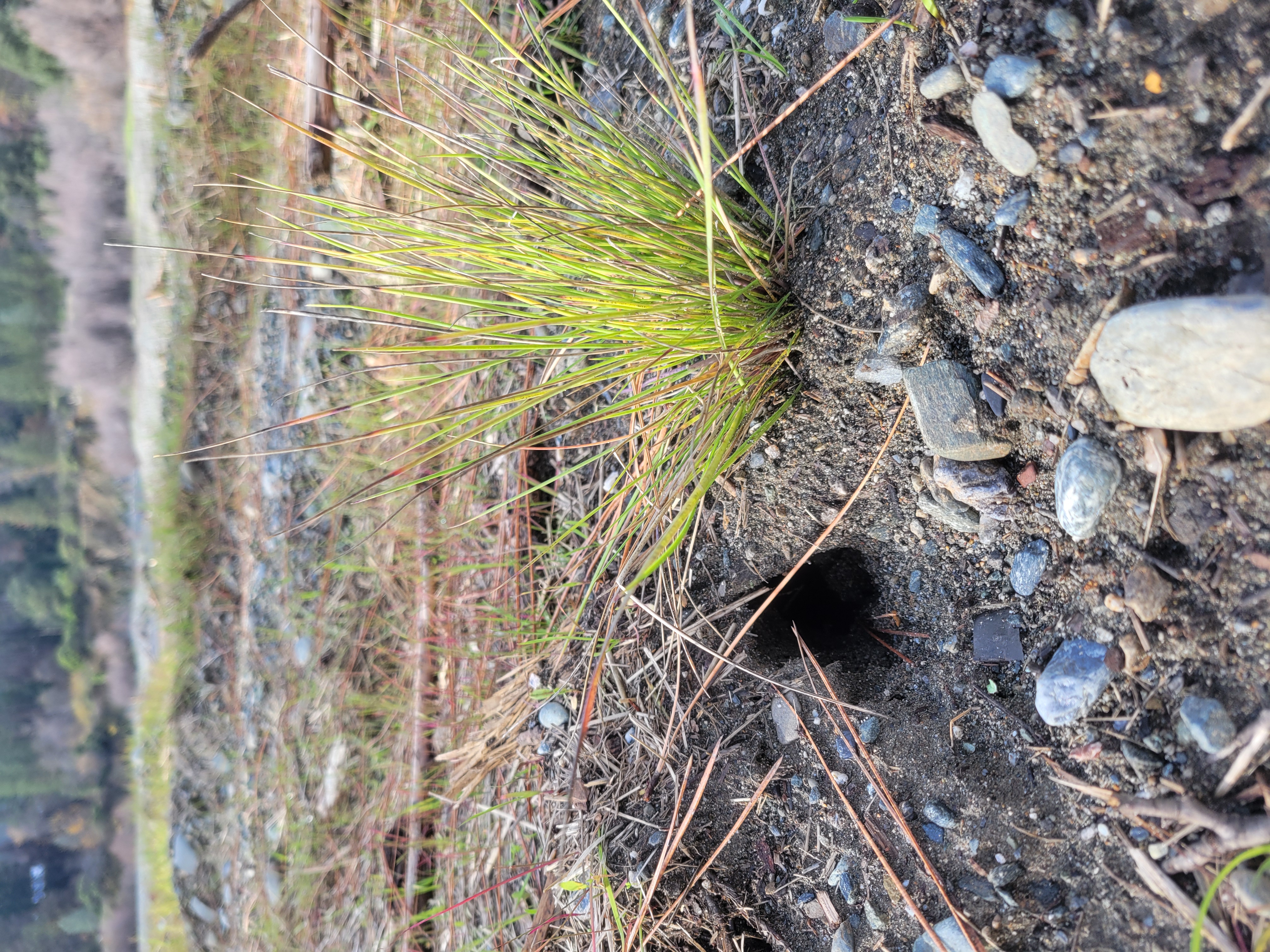
Small mammals moving up the food chain, rodents moved in to the area soon after excavation stopped. Evidence of ground squirrels, and mice were found occupying large wood structures and burrows developed near newly planted bunch grasses.
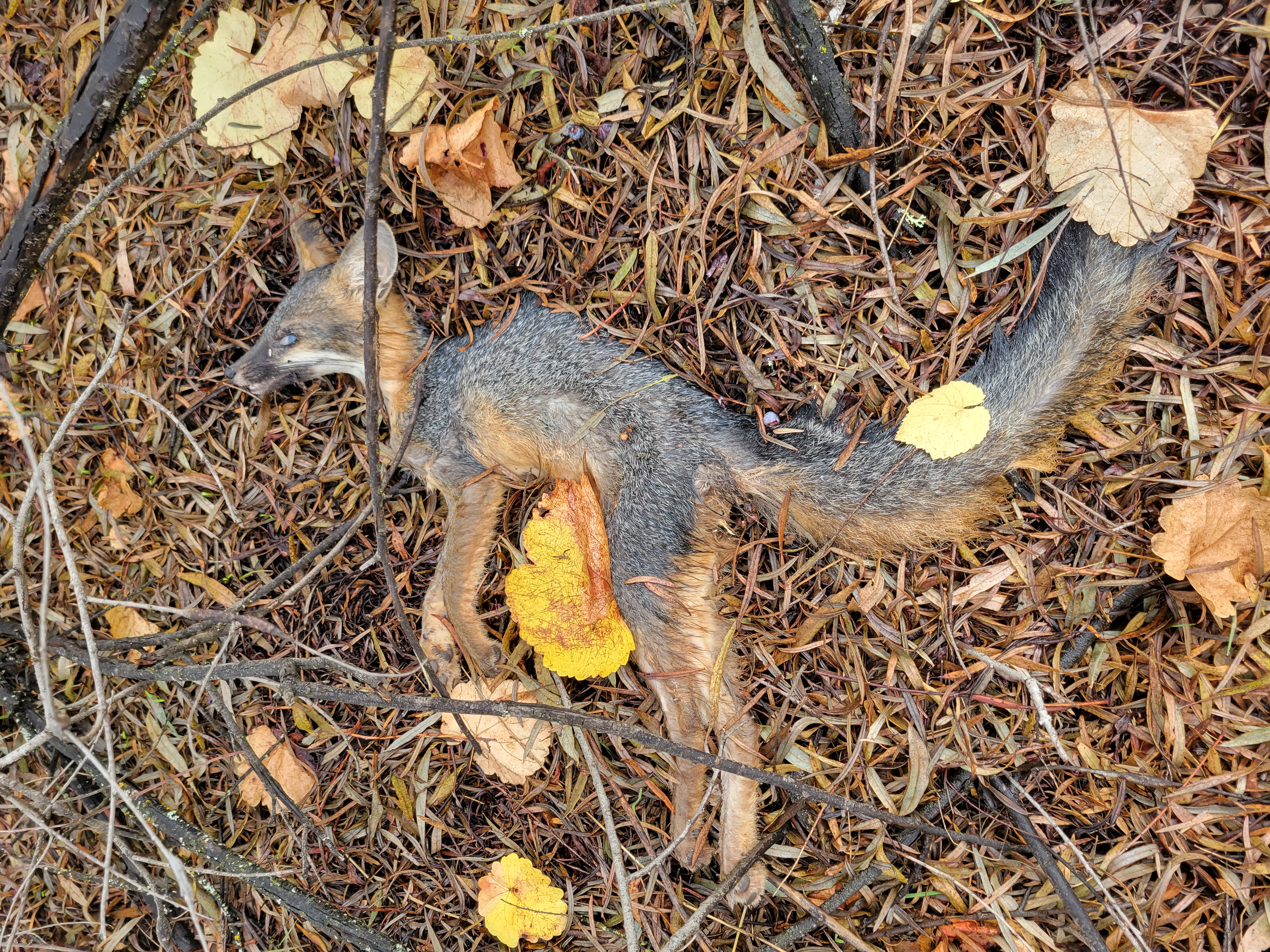
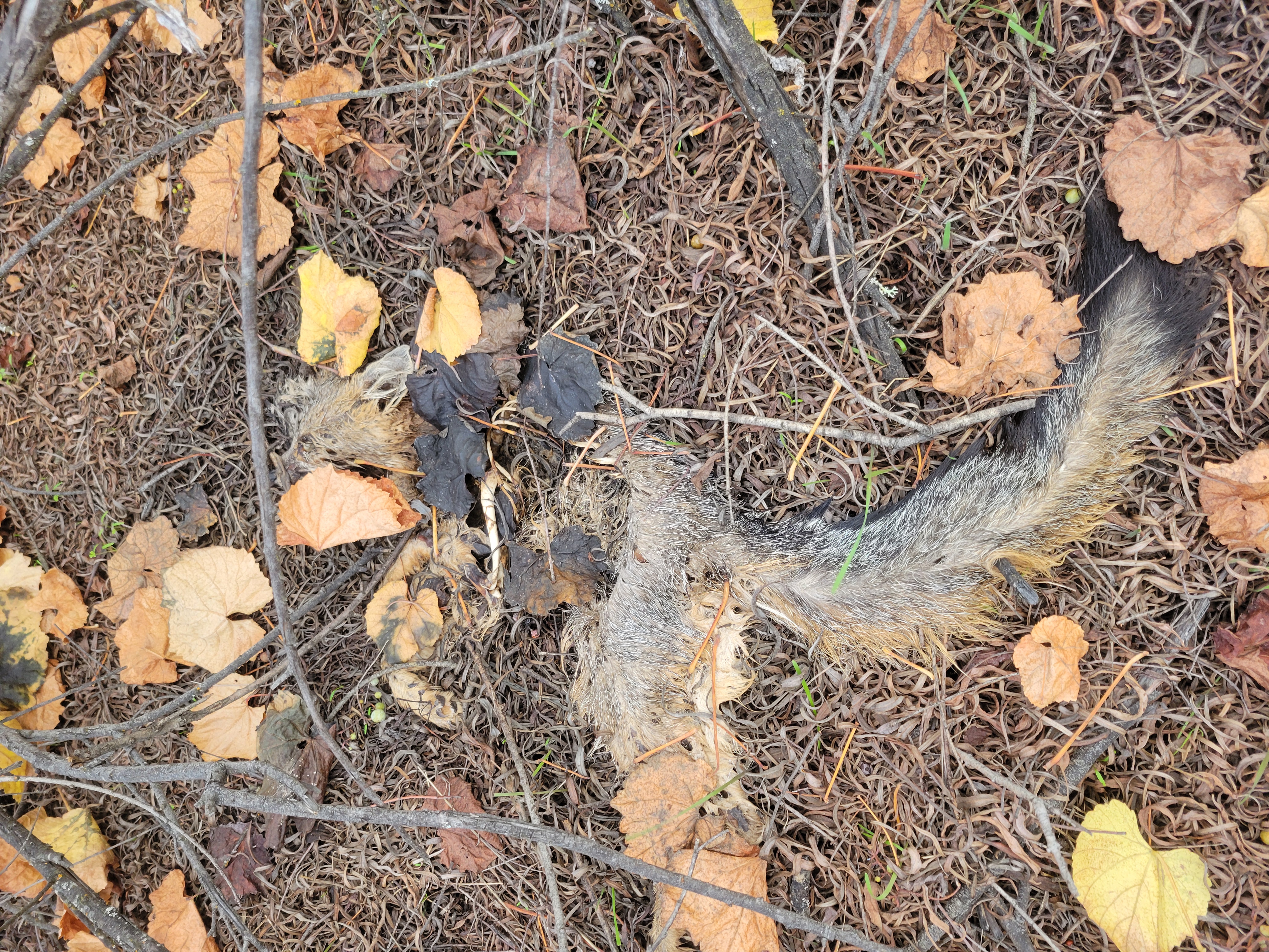
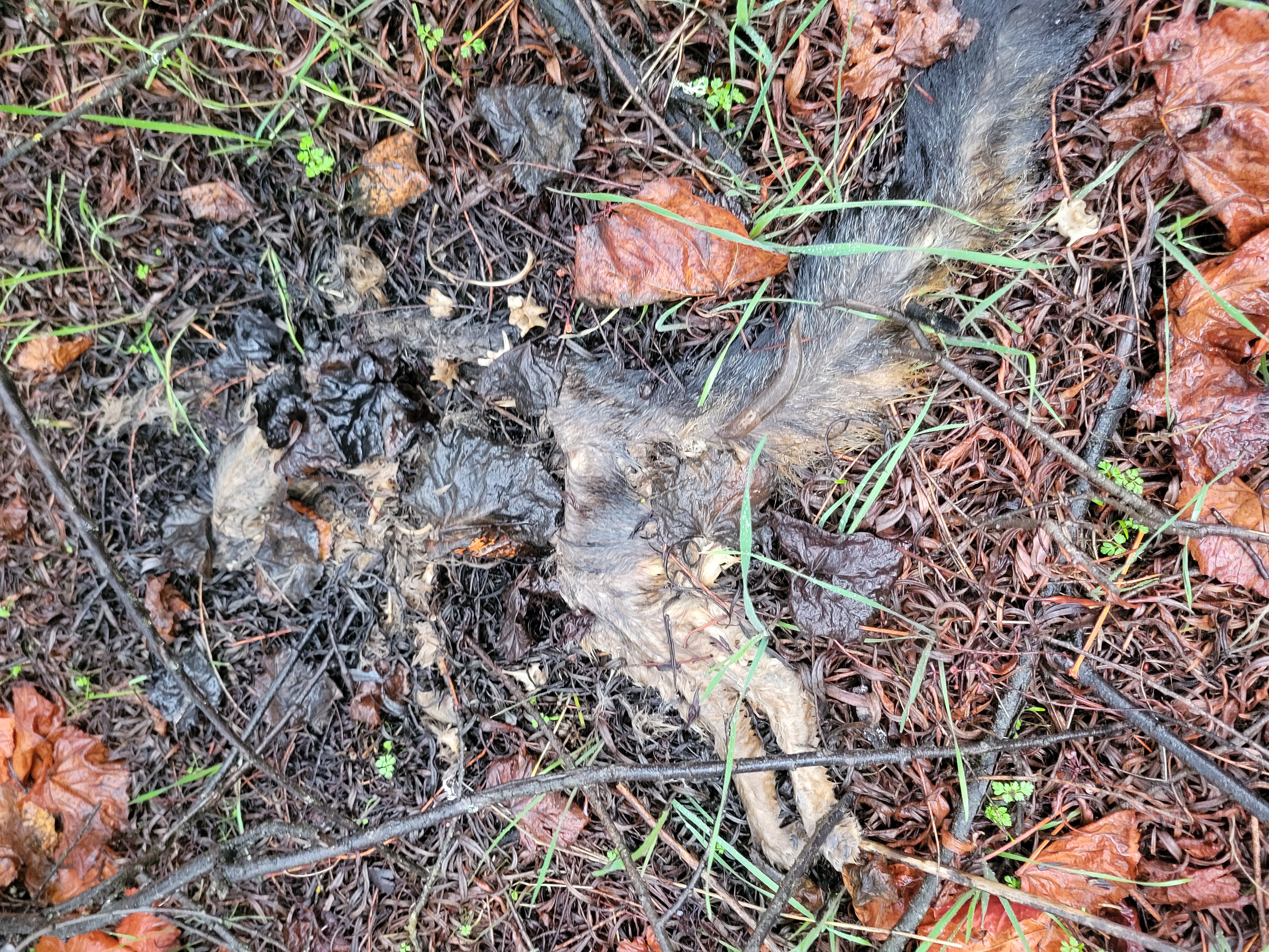
Gray fox activity increased the following spring, including a mother using the site to forage for rodents supported by the new habitat conditions. Although one fox pup later died on-site from what appeared to be disease, the presence of fox highlights their role as early participants in post-disturbance ecosystems.
A kit perished from disease.The same kit decomposing over time.The same kit decomposing over time.Fox scat at the project site.Fox scat at the project site.Fox scat at the project site.
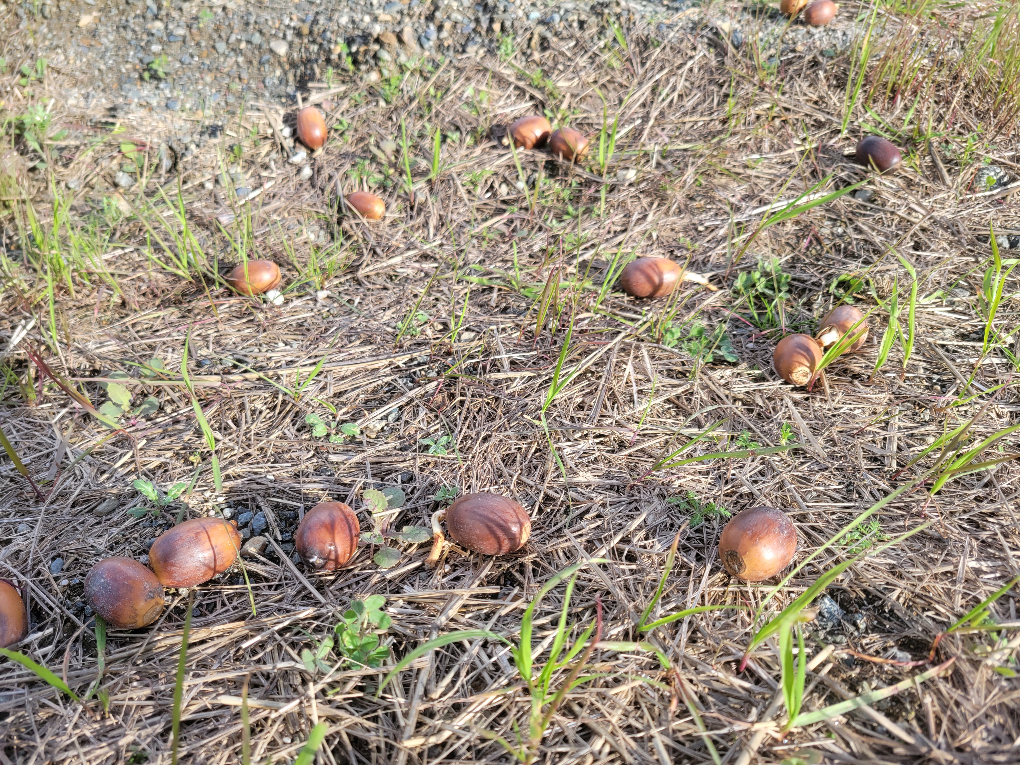
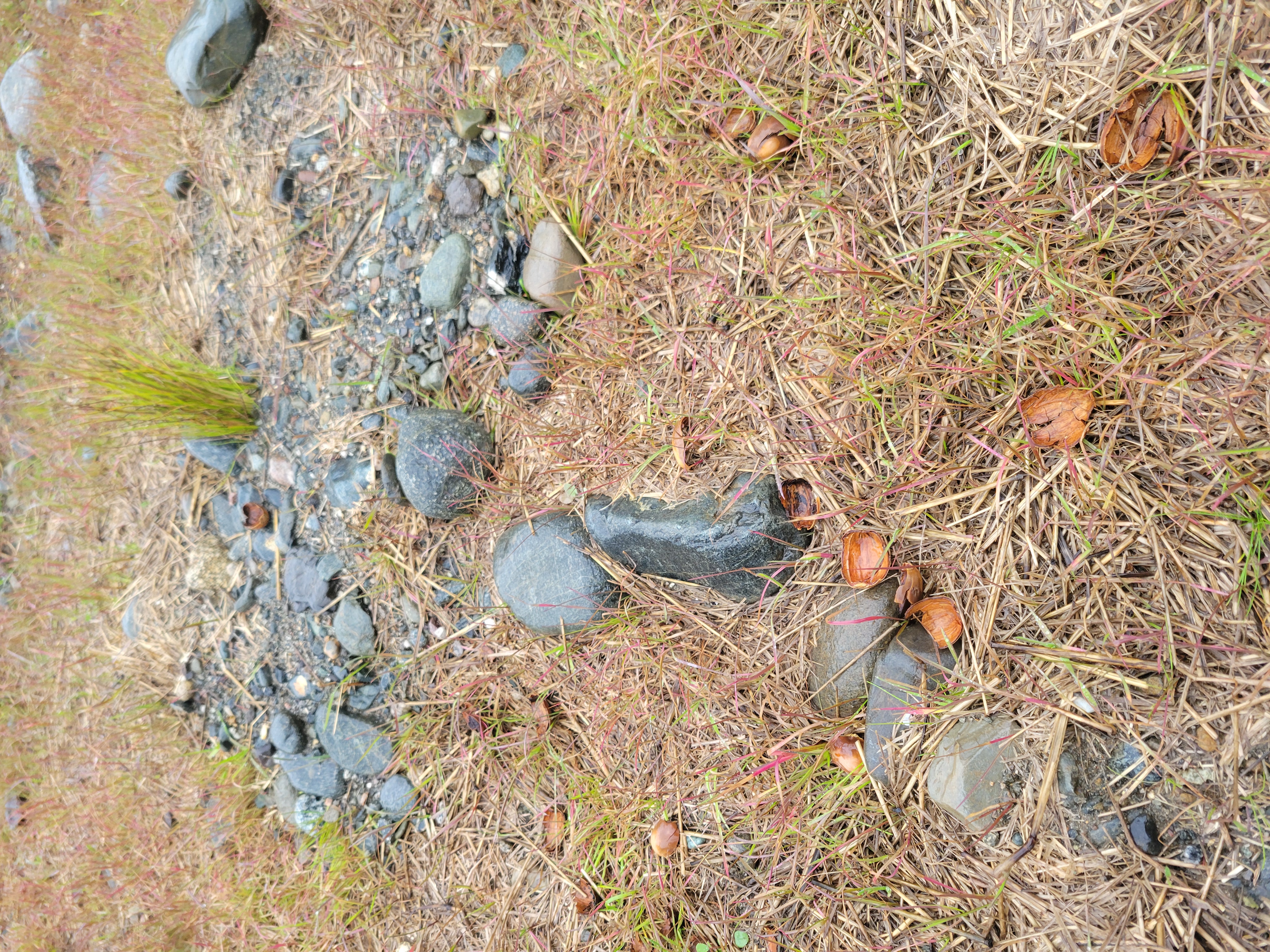
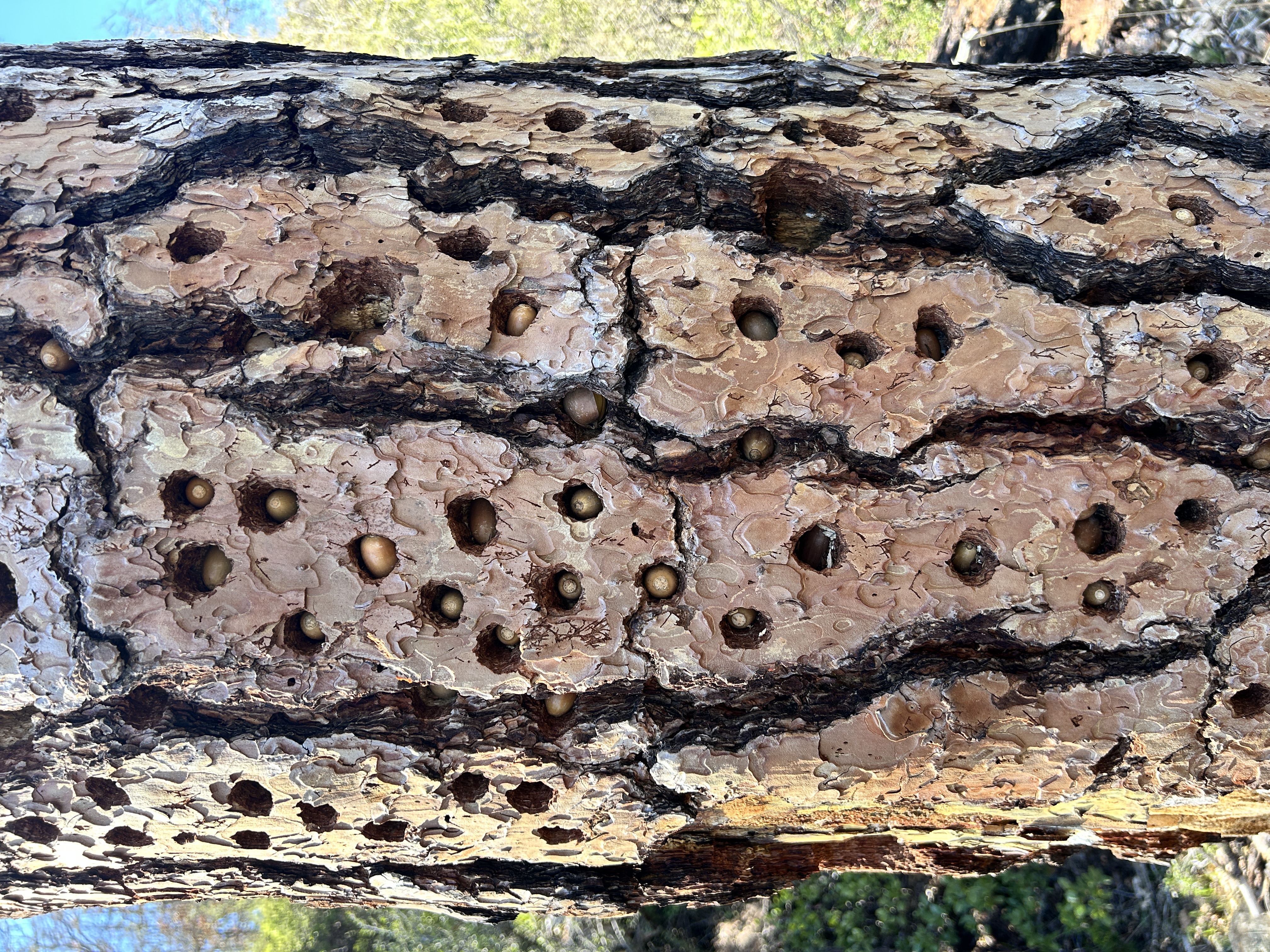
Acorn woodpeckers took advantage of acorns dispersed during revegetation efforts, caching them in nearby upland forests. While it is too early to evaluate long-term oak establishment, this interaction illustrates how wildlife intersects with restoration actions.
Crews harvested acorns from an oak woodland to be used at the project site.An acorn sprouting an oak tree.Acorns placed in upland areas at the Upper Conner Creek restoration site are sprouting alongside the grass seed. Evidence of acorn harvest.Deer scat in the seed dispersal area.An area acorn woodpecker has been very busy!
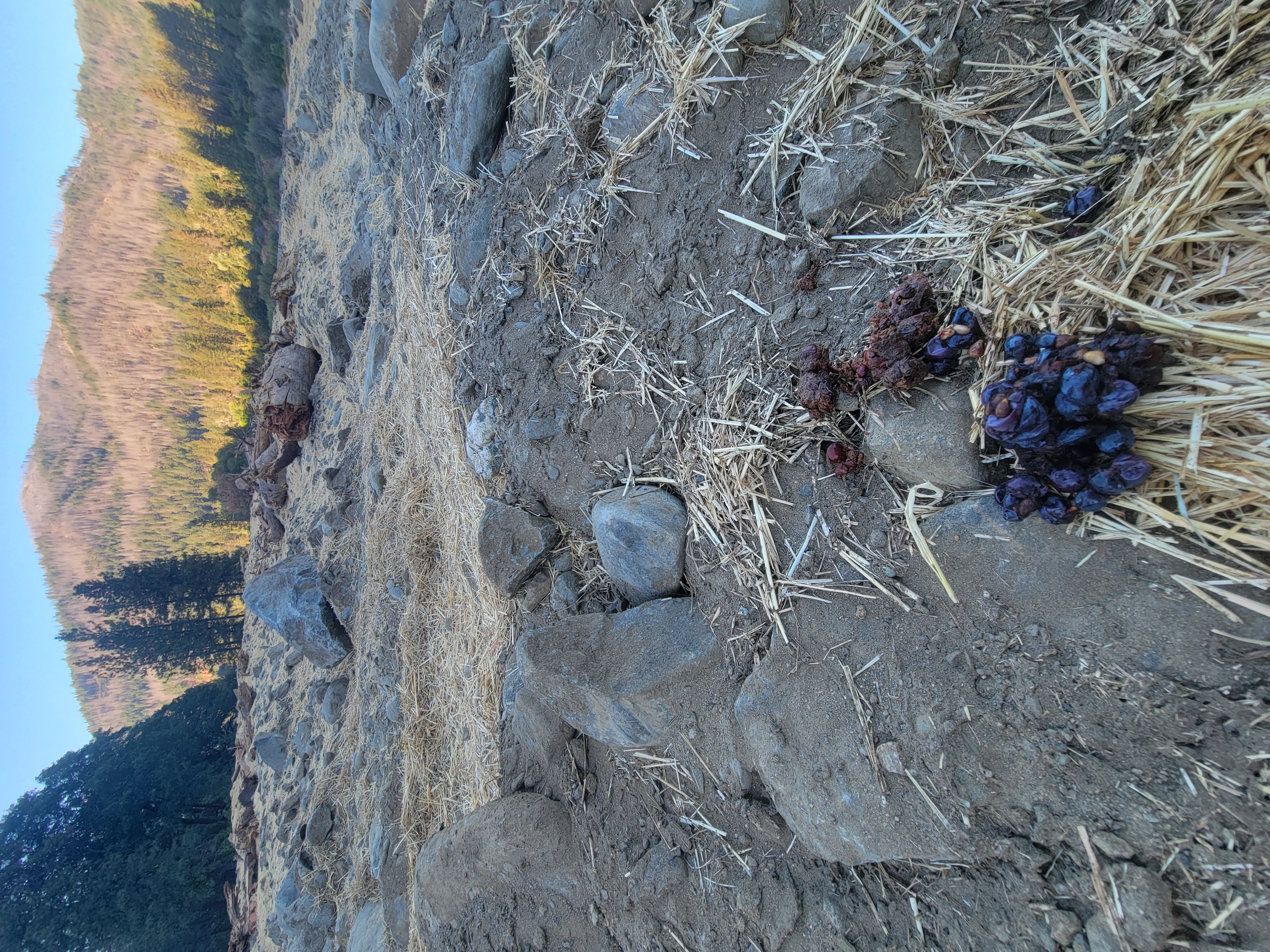
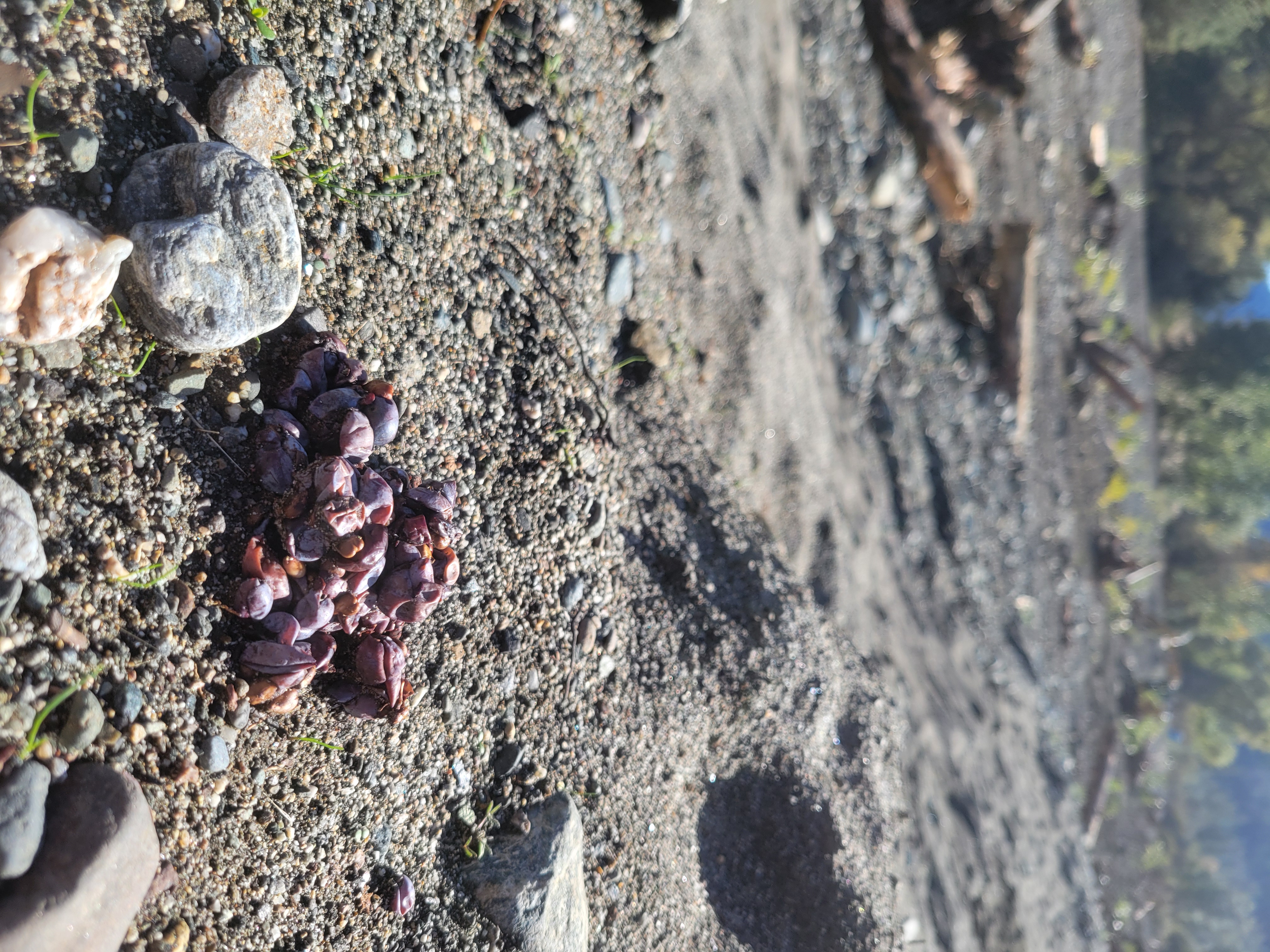
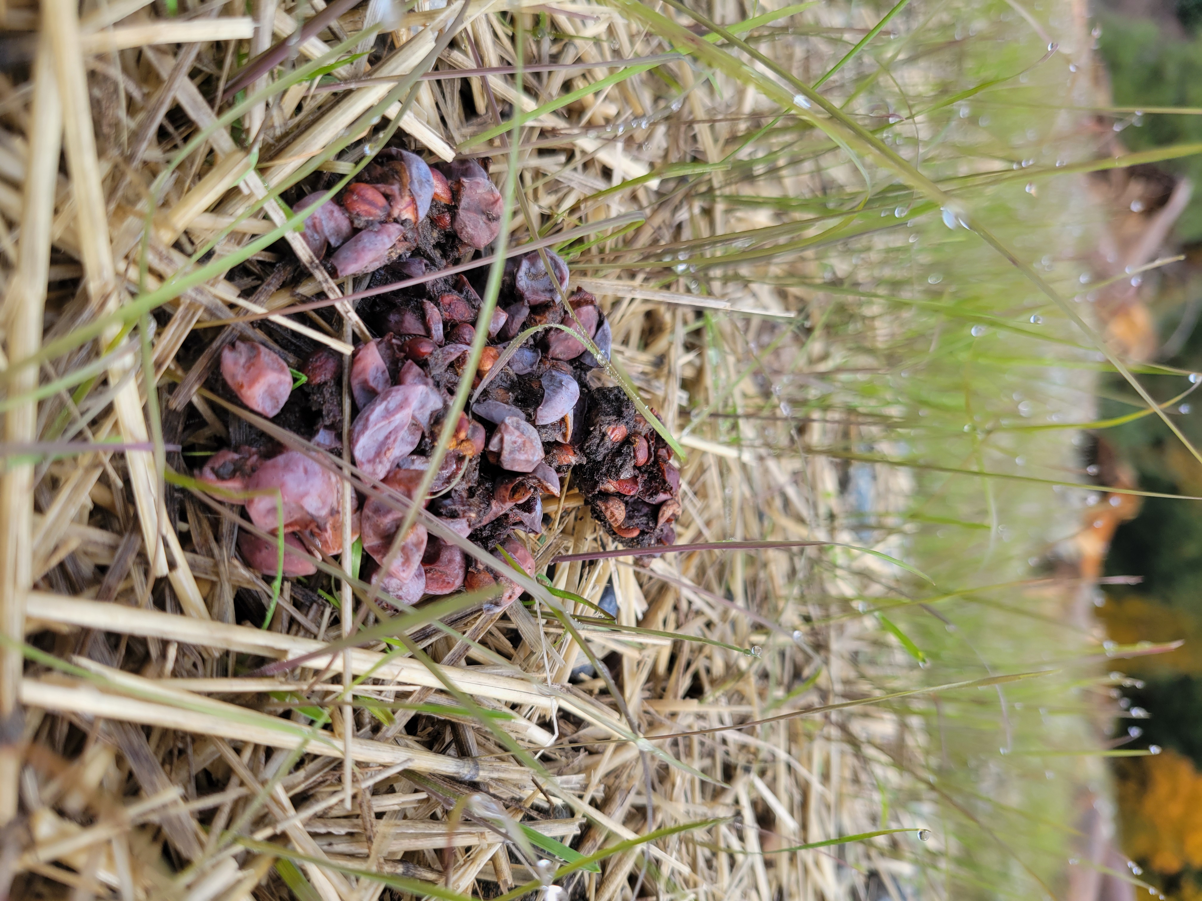
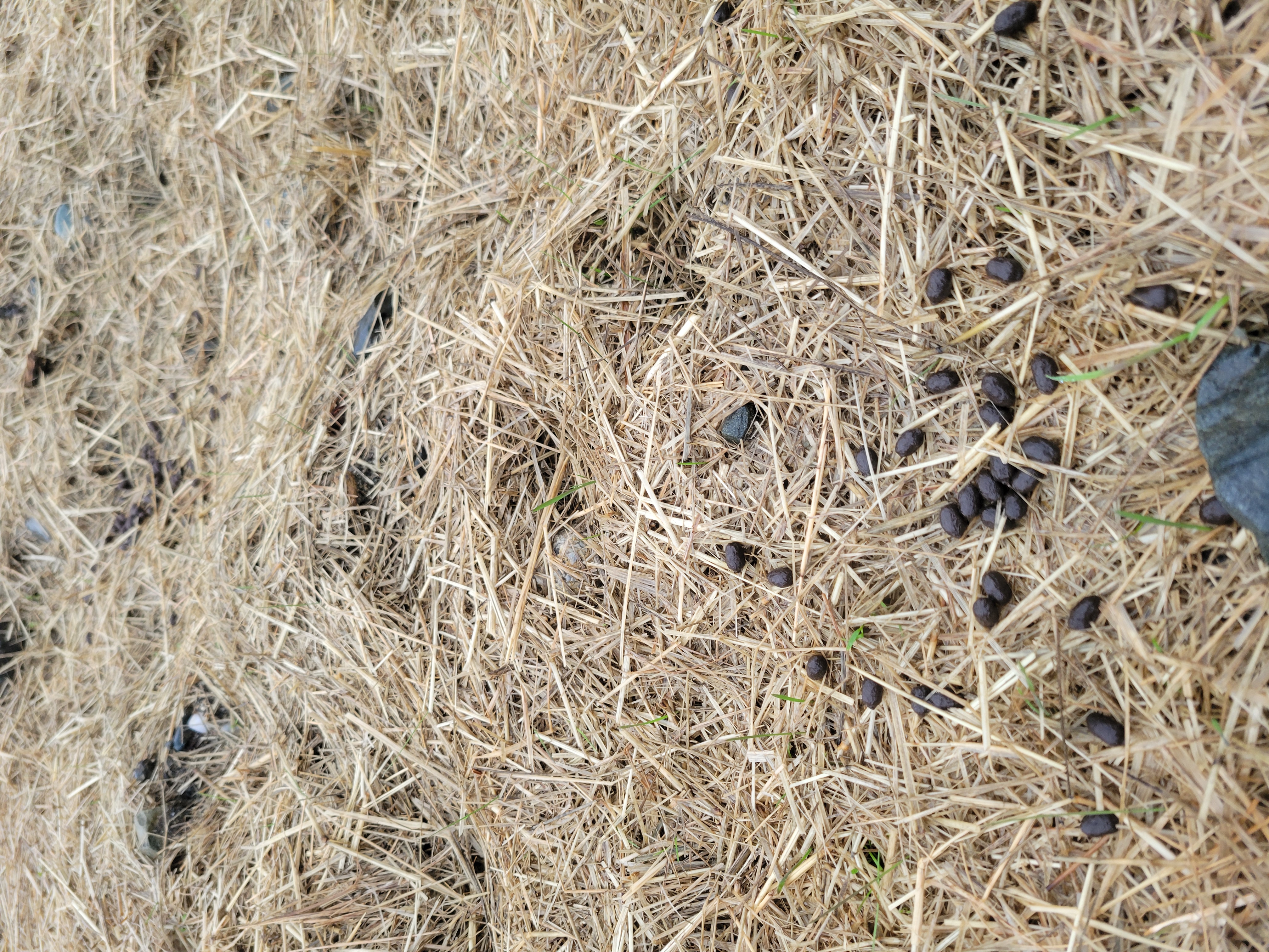
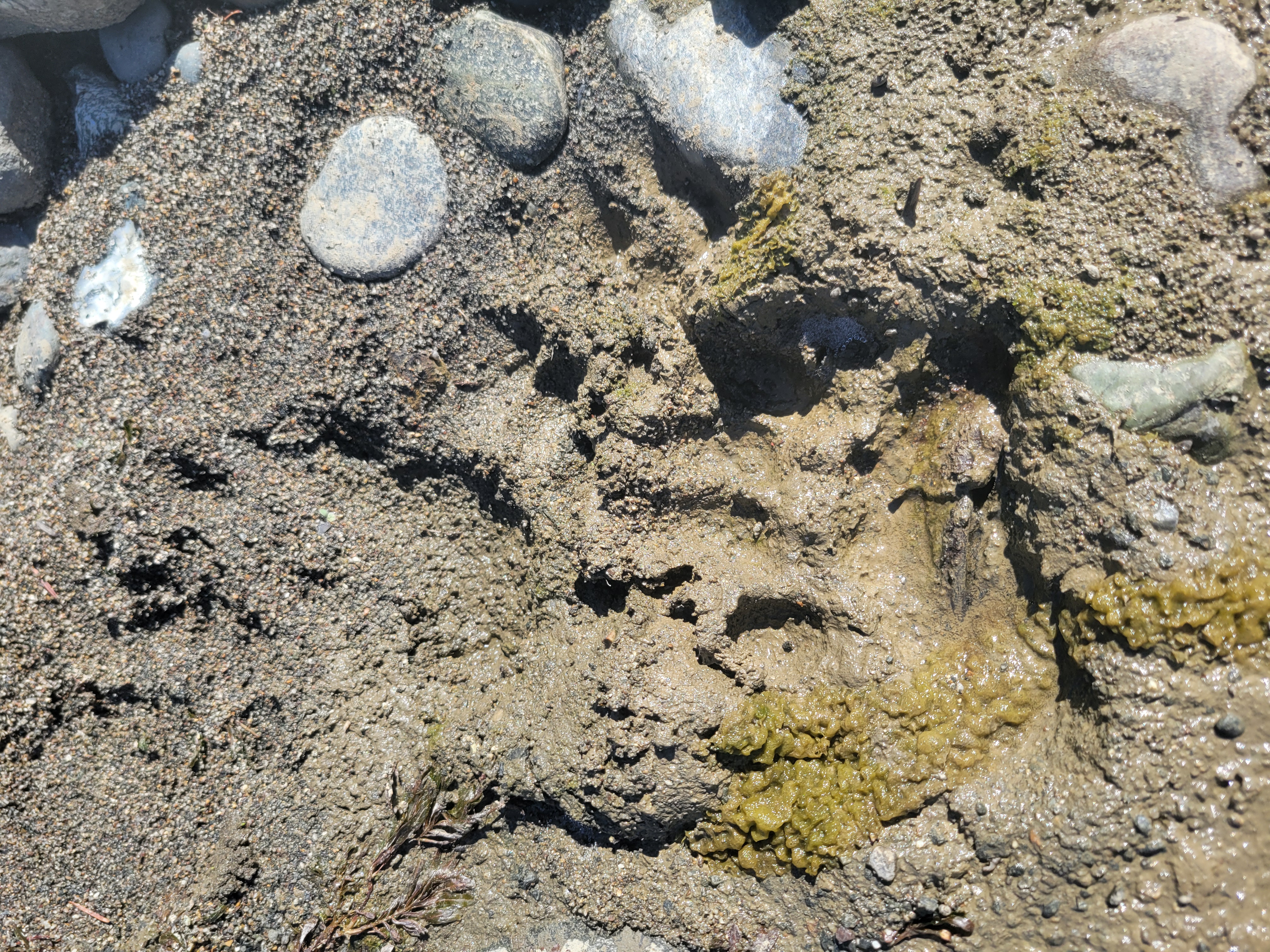
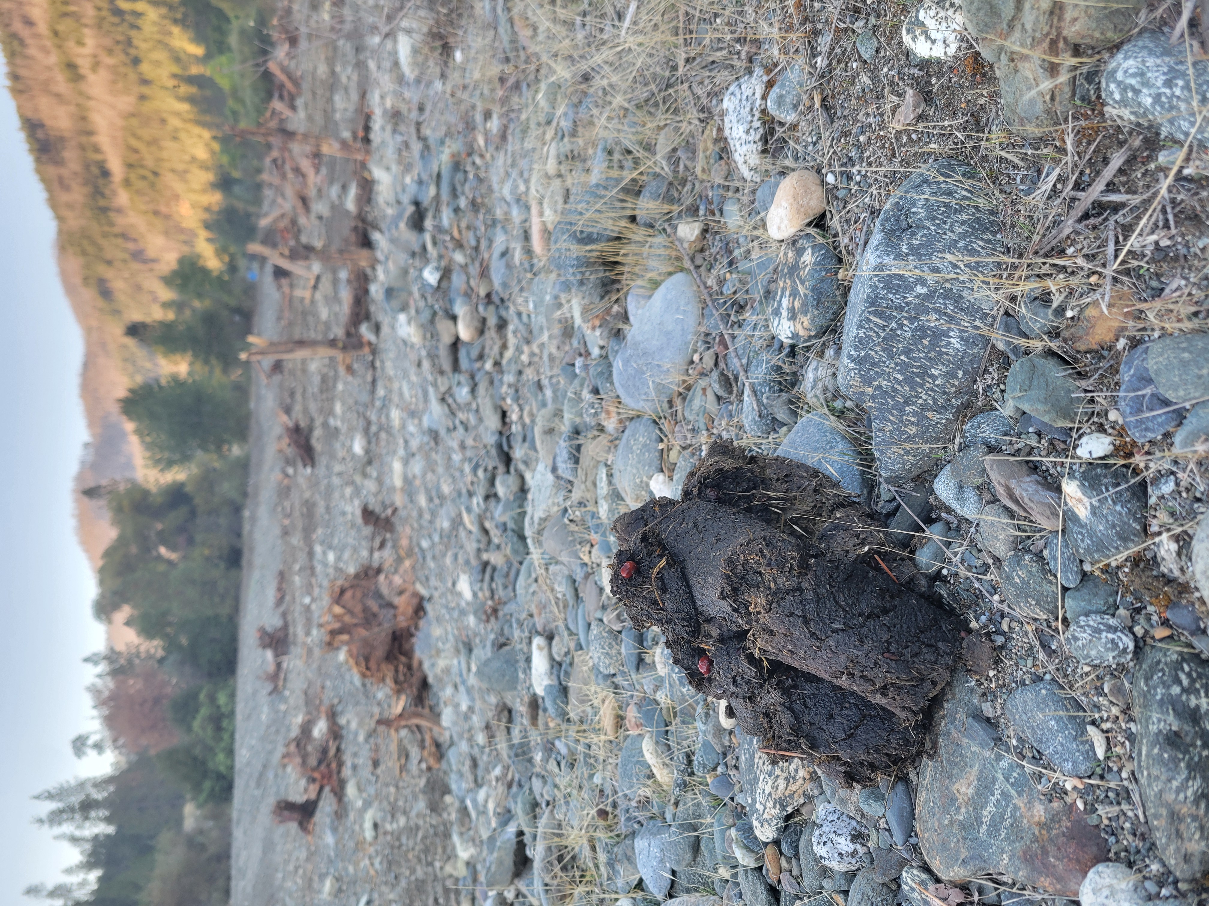
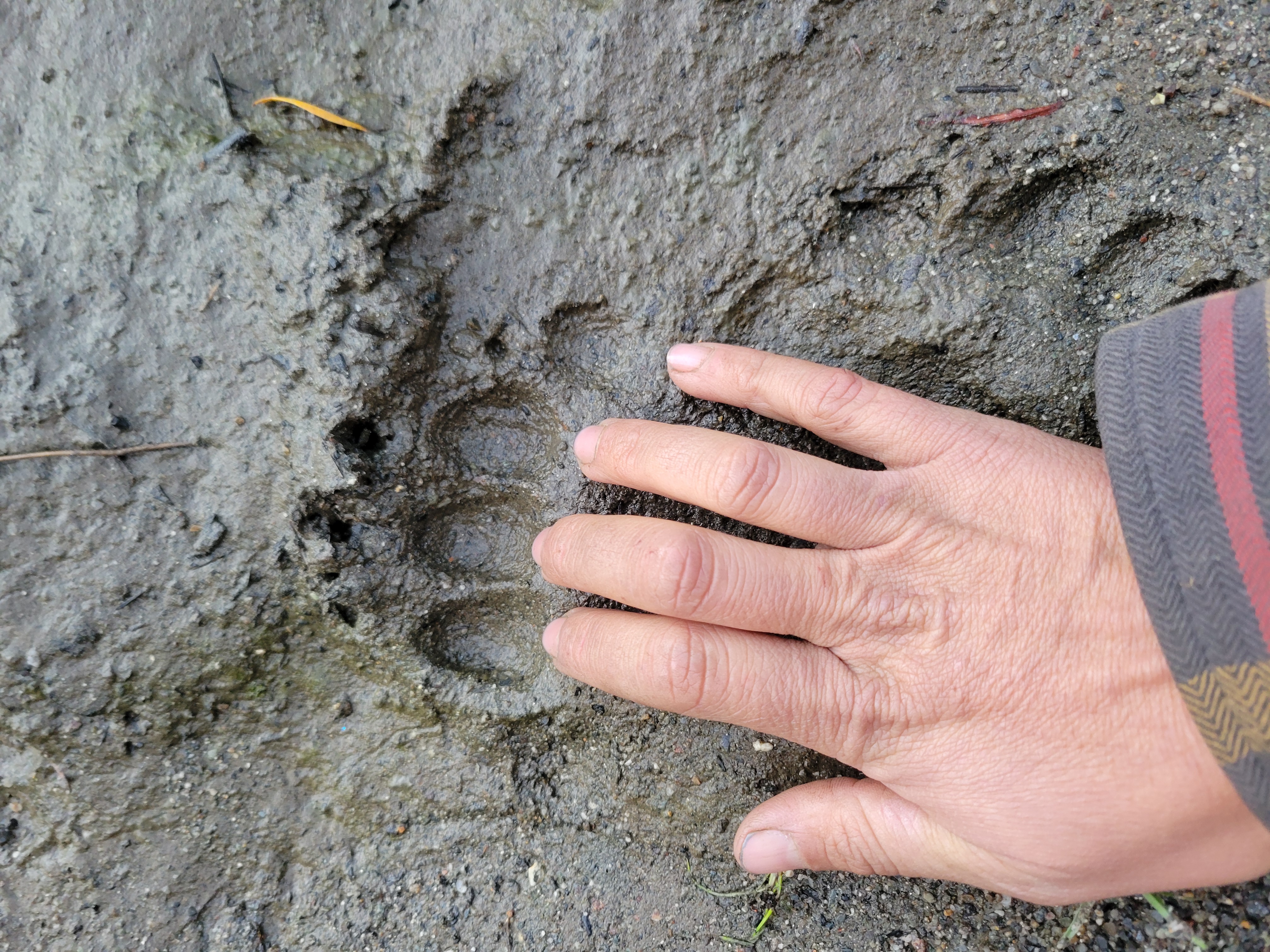
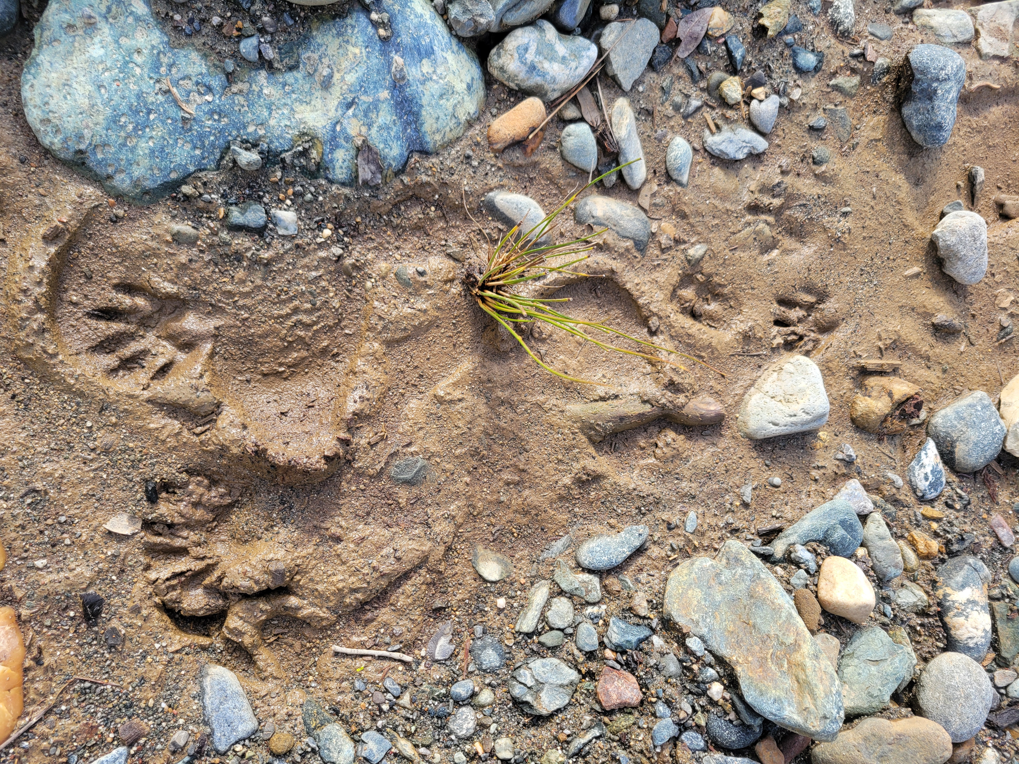
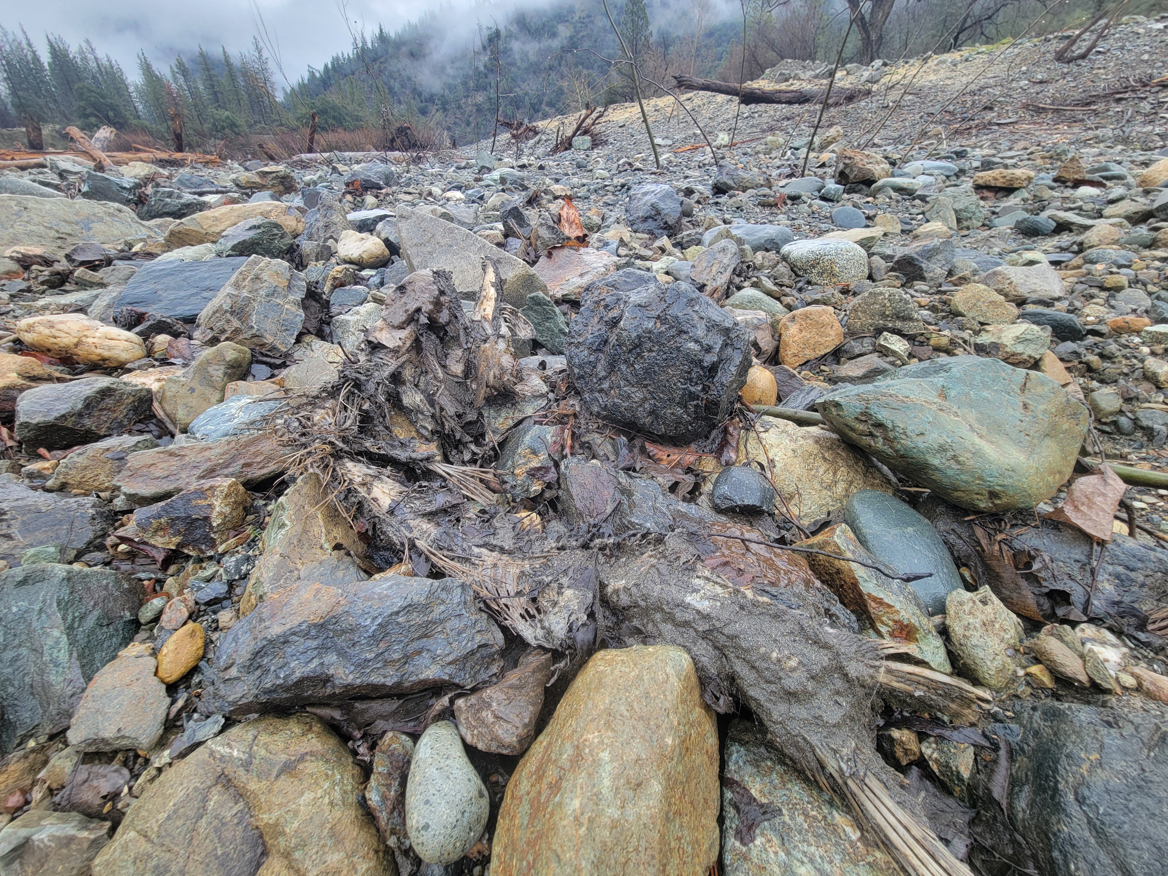
Bears frequently visited the site, leaving tracks and scat near preserved patches of California grape that were intentionally maintained during construction. Bears also contribute to revegetation by dispersing seeds from parent plants elsewhere along the river corridor.
Likely a bear print in the mud.Bear prints at Upper Conner Creek.Maybe a cougar print?Bear scat on the project site.Bear prints in the mud.A salmon carcass.
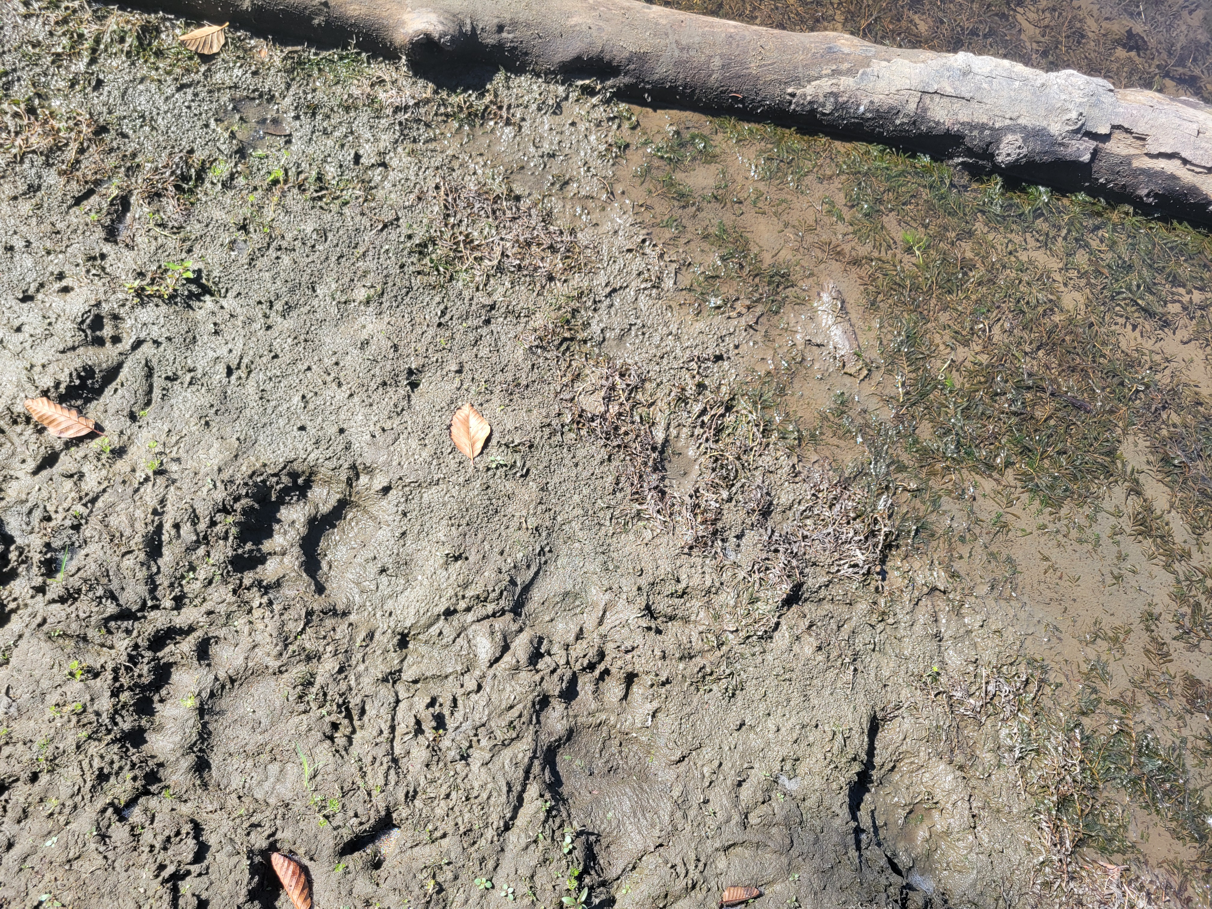
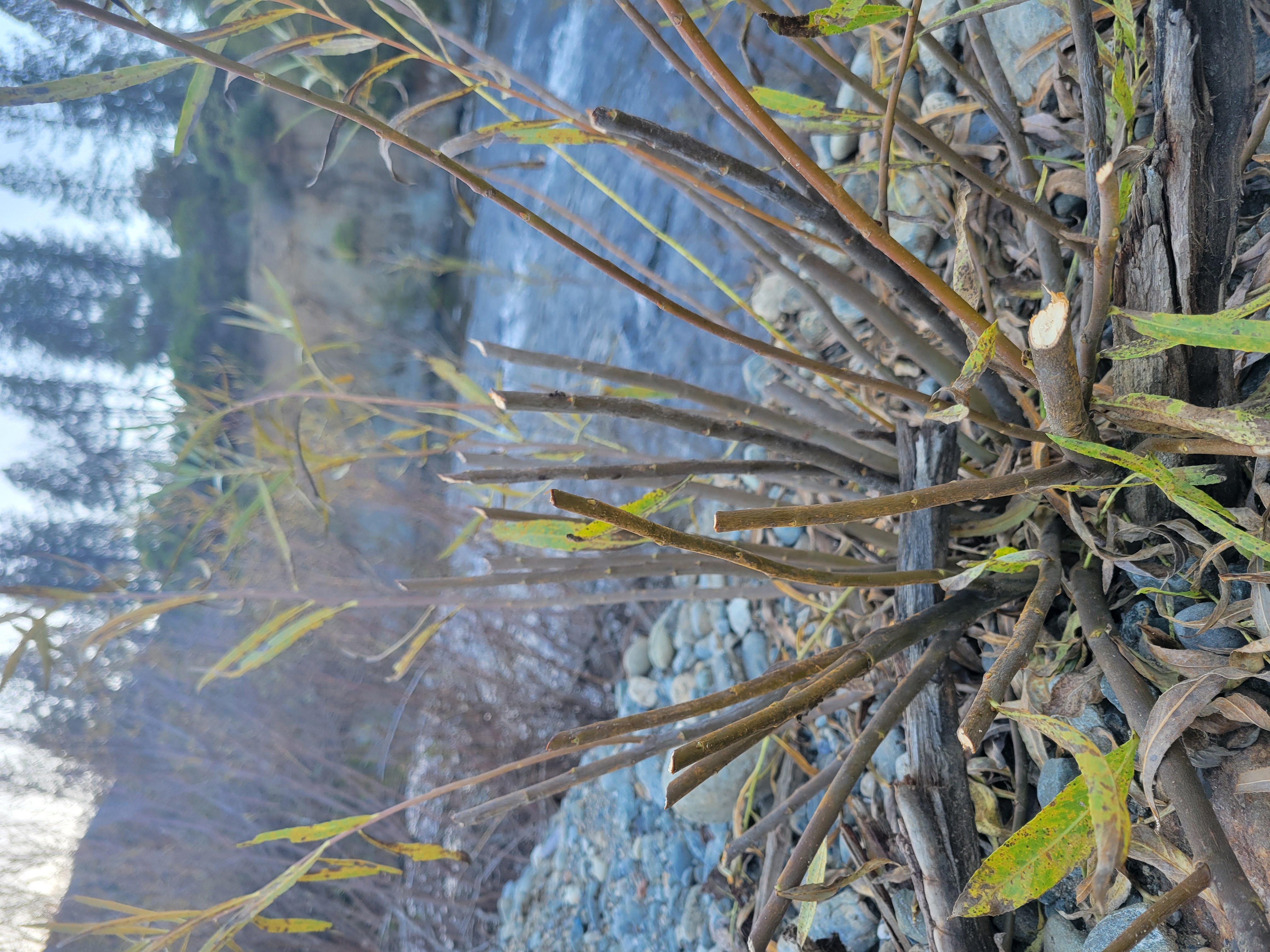
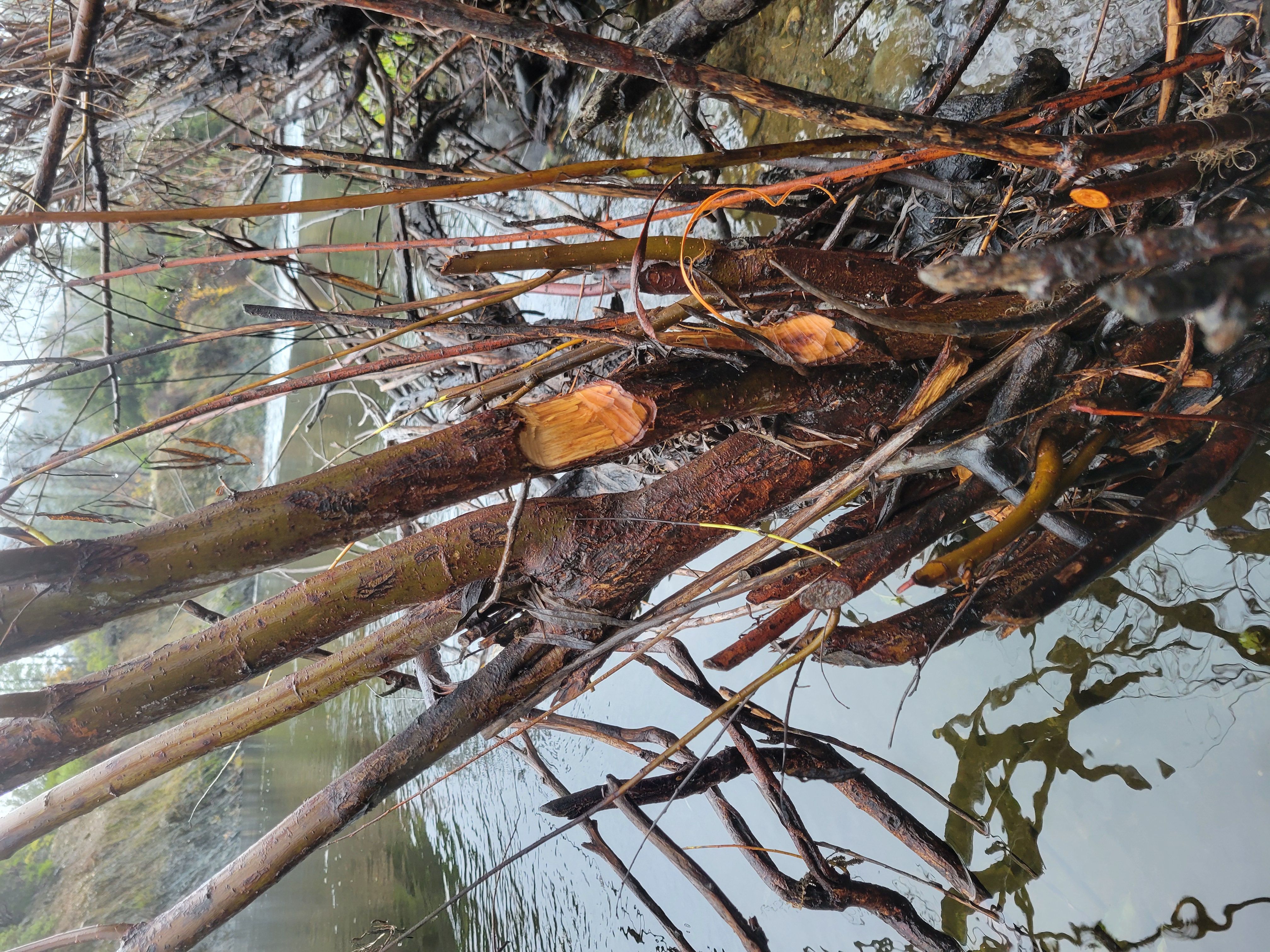
Beaver activity increased as willows became established. Although their role in thinning willow stands is not well documented, beavers strongly influence species composition by selectively cutting cottonwood and ash while leaving certain willow species. Many cut stems resprout vigorously, expanding the footprint of riparian vegetation.
Evidence of beaver browse at the site.The cuts look clean until you look close.Evidence of beaver browse.Evidence of beaver browse.Evidence of beaver browse.Evidence of beaver along the river corridor.
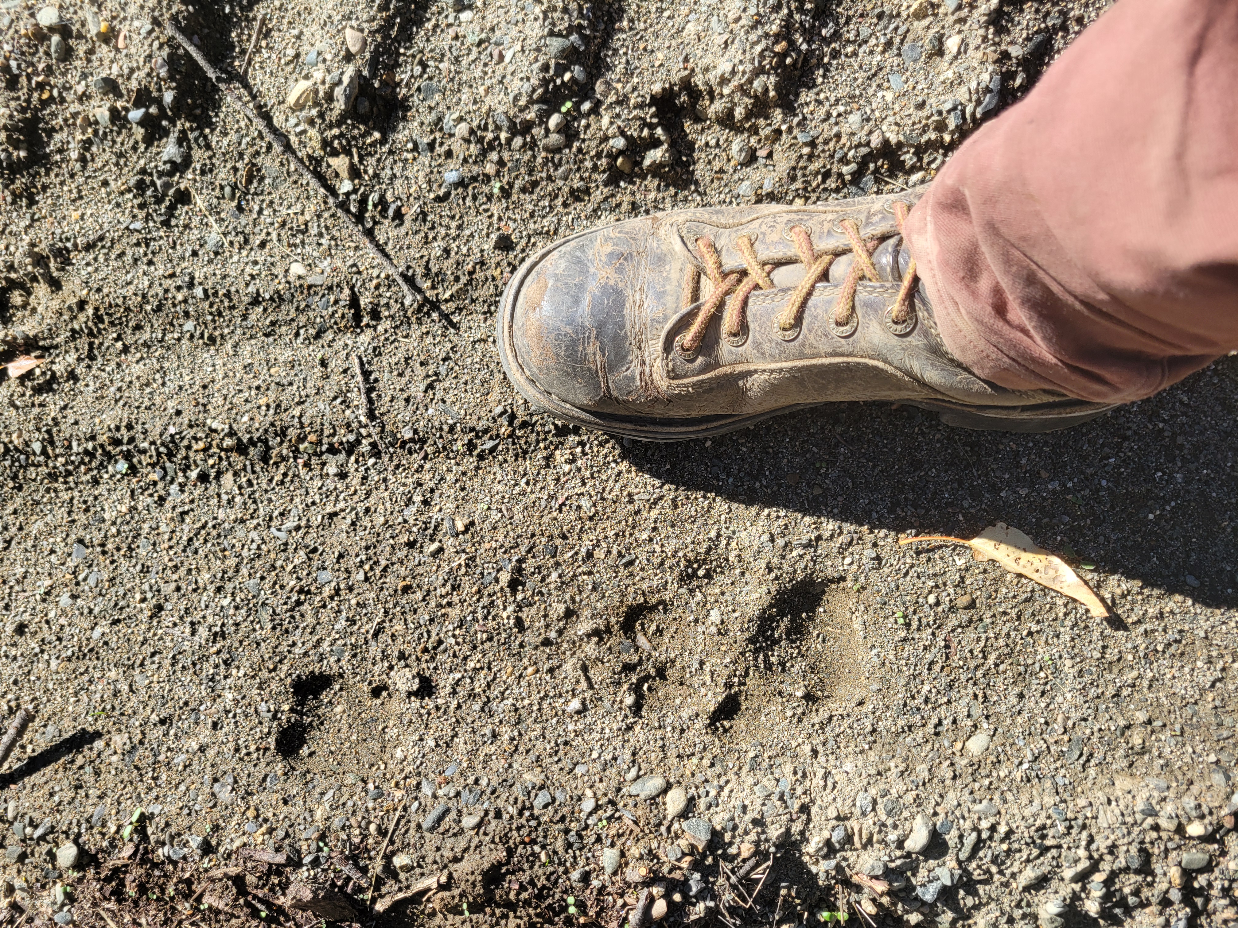
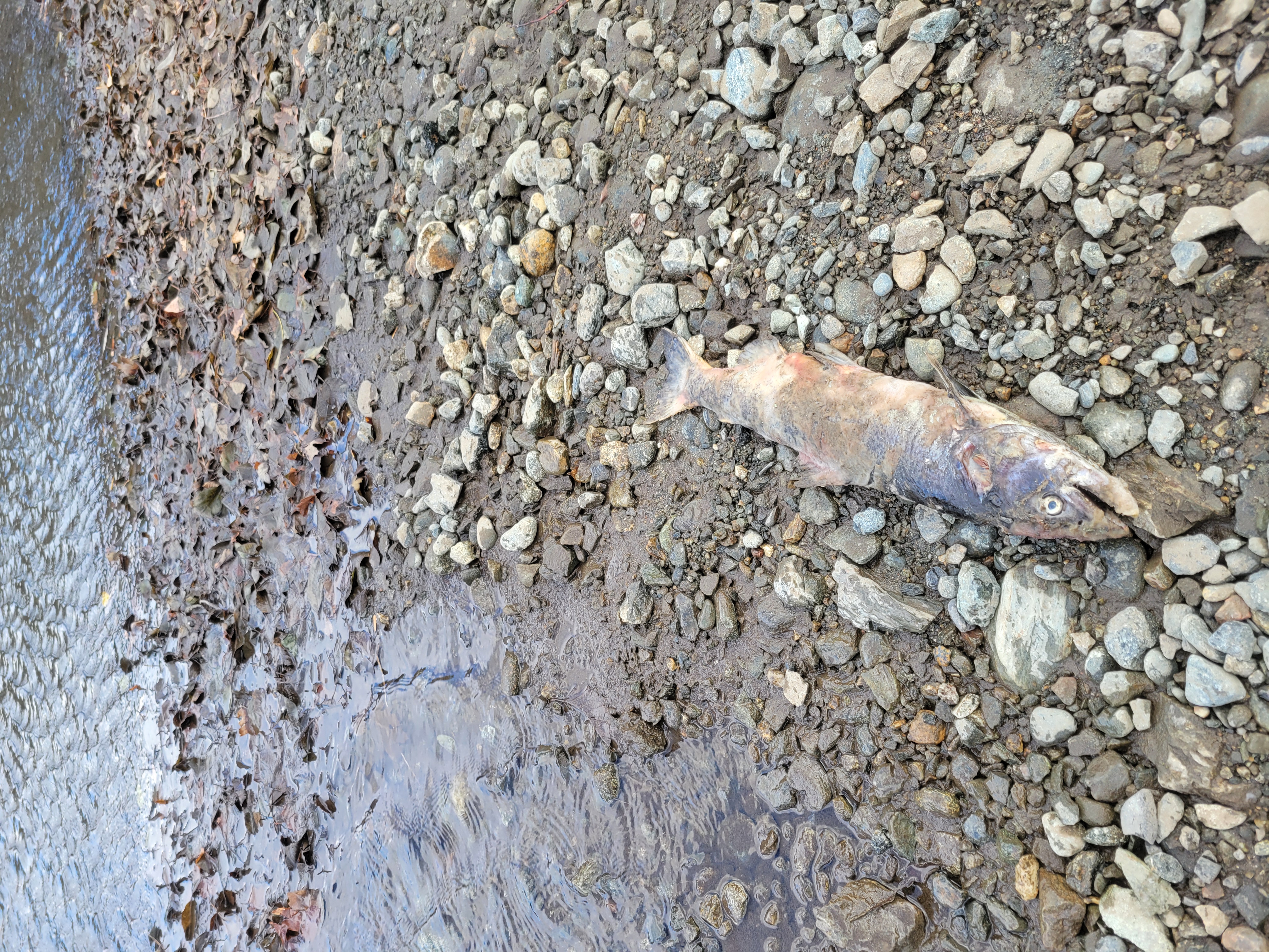
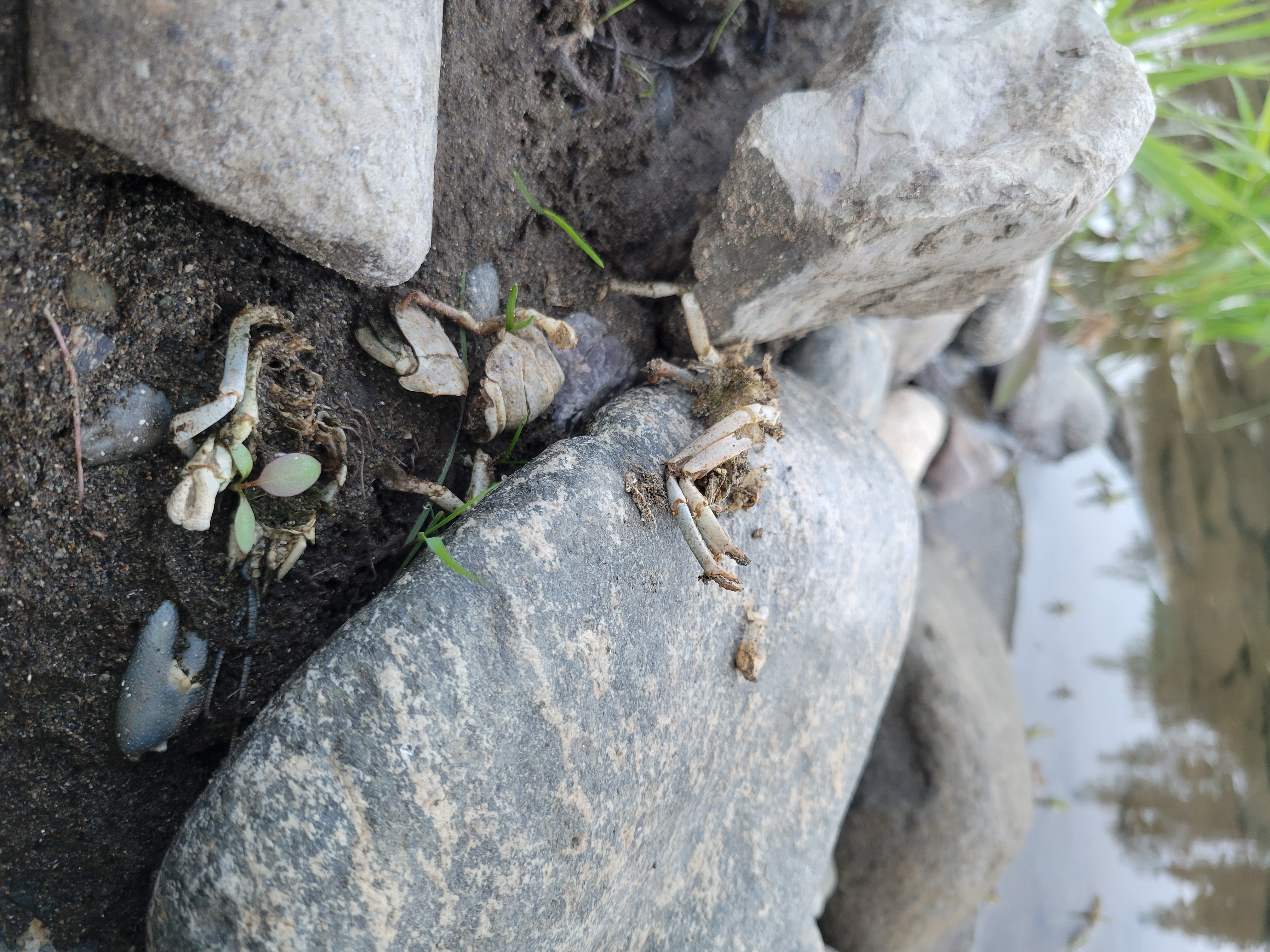
Predators like mink, racoon and river otter leave their mark with tracks and scat on newly deposited sediments and near planted vegetation. Their presence reflects the site’s increasing habitat complexity and improved food availability.
Crawdad consumed by a predator at Upper Connor Construction site.Tracks of an unidentified predator and it’s young in fresh sediment deposits around a planted plug of bunchgrass.This Chinook carcass was deposited with scat.
The Disturbance–Succession Loop in Action
The rapid and varied wildlife responses at Upper Connor Creek demonstrate the close link between disturbance and ecological renewal. While mechanical disturbance may seem disruptive during construction, it re-establishes the foundational conditions that riparian vegetation—and the wildlife depending on it—require. In a system constrained by dams, channel rehabilitation functions as a surrogate for natural forces that once shaped the Trinity River.
As the site continues to develop, ongoing observations will help refine how future projects balance engineering and ecology. With each restored floodplain, we gain a clearer understanding of how planned disturbance supports a dynamic and resilient river ecosystem.
Unless otherwise noted, all photos were provided by Simone Groves, Riparian Ecologist – Hoopa Valley Tribal Fisheries Department.
McKelvey, Kevin S. 2015. The effects of disturbance and succession on wildlife habitat and animal communities [Chapter 11]. In: Morrison, M. L.; Mathewson, H. A., editors. Wildlife Habitat Conservation: Concepts, Challenges, and Solutions. Baltimore, MD: Johns Hopkins University Press. p. 143-156. https://research.fs.usda.gov/treesearch/48033
Timothy J. Beechie, David A. Sear, Julian D. Olden, George R. Pess, John M. Buffington, Hamish Moir, Philip Roni, Michael M. Pollock, Process-based Principles for Restoring River Ecosystems, BioScience, Volume 60, Issue 3, March 2010, Pages 209–222, https://doi.org/10.1525/bio.2010.60.3.7
Hobbs, N. T., and R. A. Spowart. “Effects of Prescribed Fire on Nutrition of Mountain Sheep and Mule Deer during Winter and Spring.” The Journal of Wildlife Management, vol. 48, no. 2, 1984, pp. 551–60. JSTOR, https://doi.org/10.2307/3801188. Accessed 11 Feb. 2026. https://www.jstor.org/stable/3801188
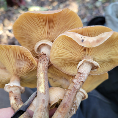
Exploring Seasonal and Habitat Patterns of Trinity County Fungi
By: Kiana Abel, Trinity River Restoration Program. Article has been adapted from Kyle Sipes Science on Tap presentation, “Mushrooms of Trinity County: From the South Fork to the Scott Mountains“ January 28, 2026.
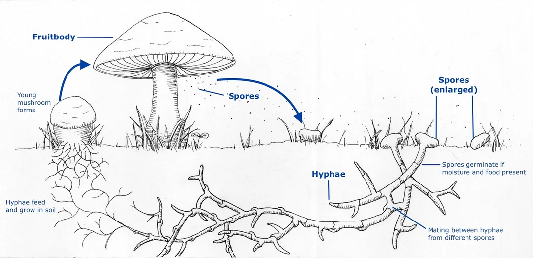
Trinity County, located in Northern California, provides a variety of habitats for wild mushrooms. Over 800 species of mushroom-forming fungi have been documented in Trinity County (iNaturalist). In January we welcomed Kyle Sipes, avid mushroom enthusiast, to present, “Mushrooms of Trinity County: From the South Fork to the Scott Mountains” at our Science on Tap event. If you missed his presentation and are interested in foraging for mushrooms, we hope to summarize the presentation here and share some of the tools for mushroom identification. Most notably, his presentation was structured around understanding preferred habitat, symbiotic relationships and key identifying features of individual mushroom types. In this article we hope to give an outline of mushroom hunting through forest types indicating seasonality, habitat details and identification tips. We will explore the life history of mushrooms to enhance understanding of their role within forest ecosystems.
Mushrooms are the fruiting bodies of fungi, and their life history begins with microscopic spores released into the environment. When conditions are favorable; adequate moisture, temperature, and a suitable substrate, these spores germinate into thread-like structures called hyphae. Hyphae grow and branch underground to form a network known as mycelium, which is considered the main body of the fungus, not the fruiting part that we see above ground.
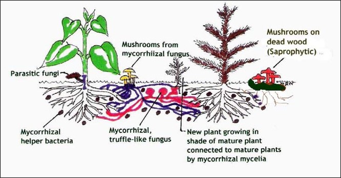
From there, fungi interact with their habitat either as a decomposer, in a symbiotic relationship, or as a pathogen or parasite to their host. While unique, each interaction reflects the adaptability of fungi and their importance in nutrient cycling, forest ecology, and plant health.
Gwinnett County Master Gardeners Association
Decomposers (Saprotrophic Fungi) Break down dead organic matter such as fallen leaves, wood, and plant debris, recycling nutrients back into the soil.
Decomposer fungi play a critical role in forest ecosystems by breaking down dead organic matter such as fallen leaves, logs, and plant debris. This process recycles nutrients back into the soil, enriching it for future plant growth. In Trinity County, several mushrooms act as decomposers. Lion’s mane (Hericium erinaceus), for example, grows on dead or dying hardwood logs and is known for its cascading white spines. Turkey tail (Trametes versicolor), another common decomposer, forms colorful, fan-shaped brackets on decaying wood and is widely recognized for its medicinal properties. These fungi accelerate the decomposition of lignin and cellulose, substances that are otherwise slow to break down, making them essential for maintaining soil health and supporting the forest’s nutrient cycle.
Symbiotic fungi (mycorrhizal)Form mutualistic partnerships with plant roots, exchanging water and minerals for sugars produced by photosynthesis; this relationship is critical for forest health.
A symbiotic relationship between trees and mushrooms is a mutualistic partnership where both organisms benefit. Most edible and forest mushrooms form mycorrhizal associations with tree roots. In this relationship, the mushroom’s underground network of filaments (mycelium) attaches to the tree’s root system. The tree provides the fungus with carbohydrates produced through photosynthesis, while the fungus helps the tree absorb water and essential minerals like phosphorus and nitrogen from the soil. This exchange strengthens tree health, improves soil structure, and supports the growth of the mushroom. These partnerships are species-specific as certain mushrooms only pair with particular trees, such as chanterelles with Douglas fir or boletes with pine and fir.
Pathogens or ParasitesInfect living plants or trees and sometimes cause disease—these are often referred to as fungal pathogens.
Unlike decomposers, pathogenic or parasitic fungi infect living plants or trees, often causing disease or structural damage. These fungi extract nutrients from their hosts, sometimes weakening or killing them. In Trinity County, an example is west coast reishi (Ganoderma oregonense), which causes white rot in living trees and can eventually lead to tree failure. While these fungi can be harmful to individual trees, they also play a role in forest dynamics by creating gaps in the canopy that allow new growth and biodiversity.
Common Mushrooms in Trinity County – By Forest Type
Finding mushrooms in Trinity County changes dramatically with the seasons. Knowing when and where to look is key for successful and safe foraging. Each season brings different species that thrive under specific forest conditions and tree associations. This guide outlines the most common mushrooms found in the county, their preferred habitats, and identification tips to help you distinguish between varieties.
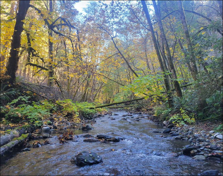
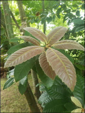
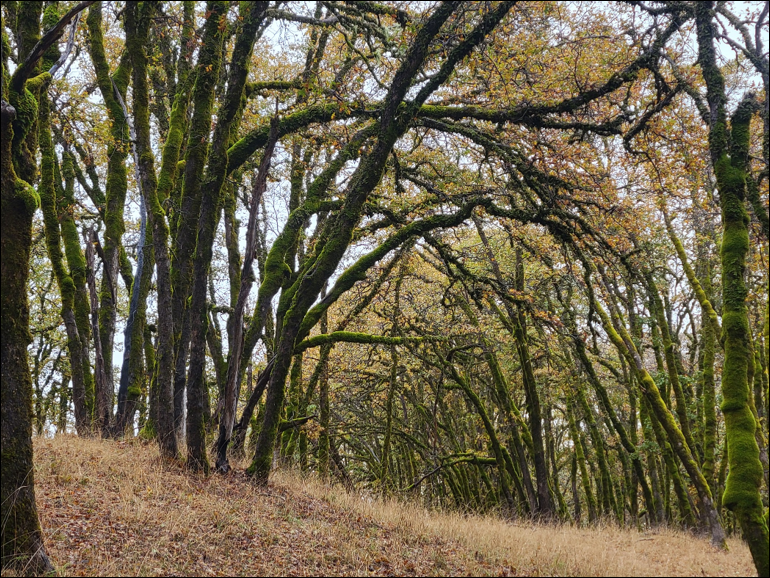
Riparian Hardwood Forests
Photo curtesy of Kyle Sipes
The Riparian Hardwood Forests are primarily situated alongside rivers or streams with varying degrees of proximity to the water’s edge. These ecosystems connect aquatic and upland areas through dynamic water flow. Various plant species thrive in different hydrologic zones based on their dependence on water. In Trinity County the streams and rivers that comprise riparian areas are the Trinity River, North Fork Trinity River, South Fork Trinity River, not to mention smaller creeks like Coffee Creek, Canyon Creek or Hayfork Creek. Hardwood tree species that are found in riparian river corridors are cottonwoods, like black and Fremont cottonwood, Oregon ash, white alder (the most common riparian tree) and tree willows like red and shiny willow. It is vitally important to understand and identify riparian trees when mushroom hunting.
Cottonwoods (Populus spp.)Black CottonwoodFremont CottonwoodOregon Ash (Fraxinus latifolia)Oregon Ash (Fraxinus latifolia)White Alder (Alnus rhombifolia)White Alder (Alnus rhombifolia)Red WillowRiparian Hardwood Trees of Trinity County
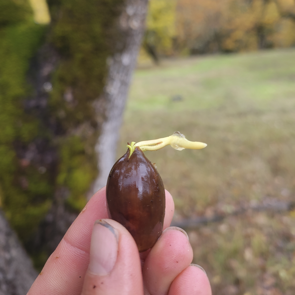
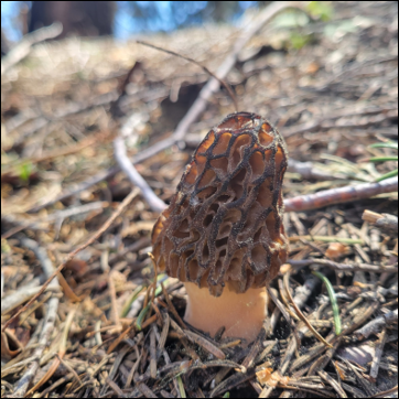
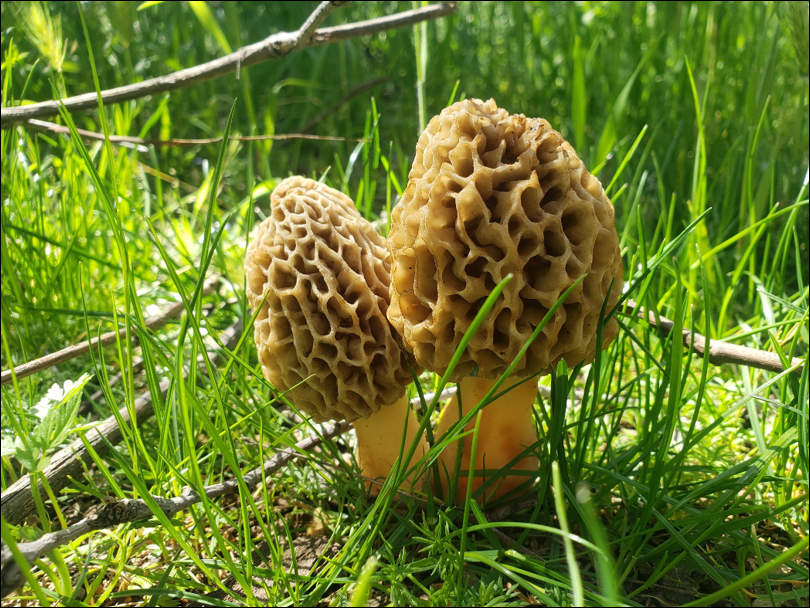
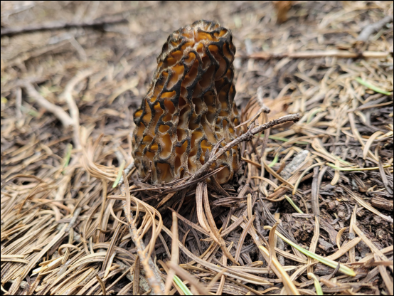
Riparian morels (Morchella species) emerge after the first warm rains, typically March through May. A prized edible that grow with cottonwood, Oregon ash and apple trees here in Trinity County. They are known to populate disturbance areas affected by flood, fire or fallen trees.
Identification Tips:
Honeycomb-like cap with pits and ridges.
Hollow stem and cap when sliced open – a key indicator of a true morel.
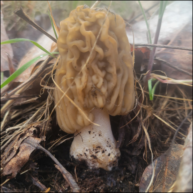
A related species to the morel that may indicate you are slightly early in your search for true yellow morels. Like the yellow morel, the thimble cap occurs with cottonwood species and is as thought to be as delicious as the yellow morel yet restricting consumption of this mushroom is advised (iNaturalist)
Identification Tips:
Wrinkled cap (versus honeycomb-like) with pits and ridges
Pithy filled stem that goes all the way to the cap when sliced open
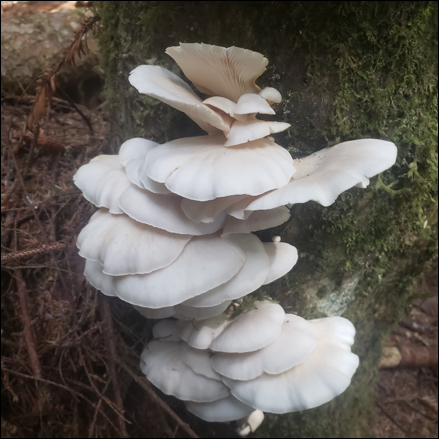
Oyster mushrooms, often seen in restaurant dishes, grow on riparian hardwoods like cottonwood, ash, willow, and alder. They are a safe choice for beginner foragers due to the lack of dangerous look-alikes.
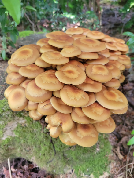
Honey mushrooms are a parasitic mushroom that infects their host as they feed from it. It is only edible if cooked significantly well, otherwise if undercooked it can make you sick.
Identification Tips:
It grows in big clusters at the base of the tree.
Gills run slightly down the stem.
Has a prominent skirt on the stem called an annulus
Honey Mushroom (Armillaria spp.)
Low Elevation Mixed Conifer-Hardwood Woodland
Moving away from the rivers and into the low elevation mixed woodlands look for Douglas fir (Psuedotsuga menziesii), Tanoak with populations in western Trinity and Coffee Creek, madrone and Ponderosa pine (Pinus ponderosa). Most mushrooms in this area will populate in the early fall with first rains and prior to frost or snow.
Douglas fir (Psuedotsuga menziesii)Douglas fir ConeTanoak (Notholithocarpus densiflorus)Tanoak (Notholithocarpus densiflorus)Tanoak (Notholithocarpus densiflorus)Ponderosa Pine (Pinus ponderosa)Low Elevation Mixed Conifer-Hardwoods of Trinity County
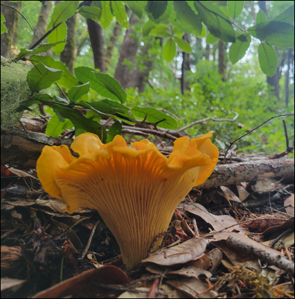
Chanterelles are a mycorrhizal associate with Douglas fir and true fir trees and if found make for a prized edible when found. Look for chanterelles in the fall after the first rains. The cascade chanterelle (Cantharellus cascadensis) does have poisonous look-alikes to watch out for, including the Jack O’ Lantern (Omphalatus olivescens) in Trinity County and others not yet found in Trinity such as the False Chanterelle (Hygrophoropsis aurantiaca).
Identification Tips:
Has ridges or false gills that run down the stem.
Grows with Douglas fir out of the ground (not from the wood)
When cut in half, the flesh is orange outside and white inside
Should not be confused with the Jack-o-Lantern mushroom or False Chanterelle.
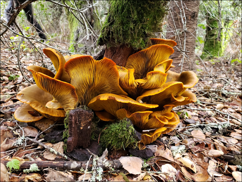
A showy beautiful mushroom that grows at the base of oak trees attached to the wood itself. The Jack O’ Lantern mushroom can make you very sick if ingested and can be confused with the cascade chanterelle.
Identification Tips:
True gills, bladelike structures.
When cut in half, the flesh is orange all the way through.
Grows from the wood of oak trees.
Should not be confused with the cascade chanterelle.
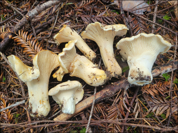
White chanterelles are symbiotic with Douglas fir and tanoak trees and like the orange chanterelle make for a prized edible when found. Look for white chanterelles in early fall after rains but prior to freezing.
Identification Tips:
Has ridges or false gills that run down the stem.
White to cream colored
Grows with Douglas fir & tanoak out of the ground (not from the wood)
Gets soggy with rain as time progresses through the fall.
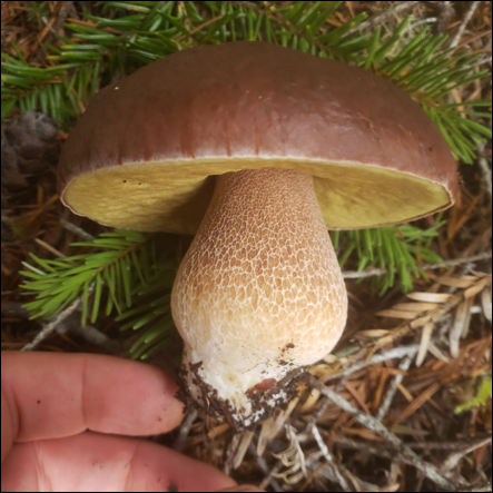
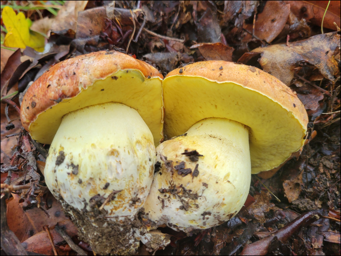
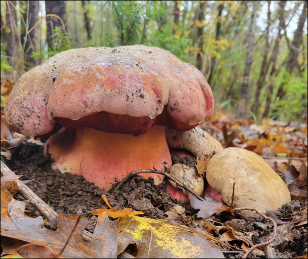
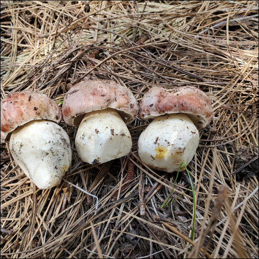
Royal boletes, including King and Queen varieties, are prized edibles from the porcini family. They thrive in early fall rains but do not persist through winter. Typically found near tanoak and true oak, these mushrooms form strong mycorrhizal bonds with roots, enhancing tree health and soil nutrient cycling.
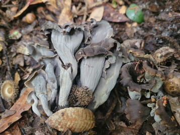
Black trumpets are more common in Western Trinity County than other areas due to the mushrooms relationship with tanoak. These saprotrophic mushrooms decompose dead organic matter, recycling nutrients into the soil and can also be found near black oak, and live oak. They grow in the winter months and can be recognized by their distinct color, shape, and smell.
Identification Tips:
Color is black, grey or sometimes dark brown
Look like trumpets with wavy edges rolled outwards.
Hollow from the base to the edge.
Does not have gills or pores.
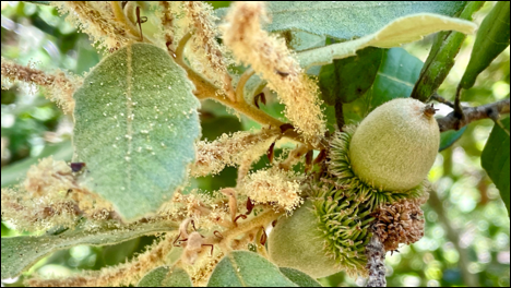
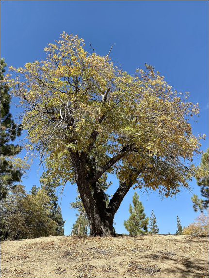
Oak Woodlands
Trinity County Oak Woodland [Kyle Sipes]
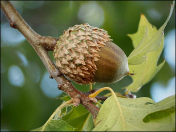
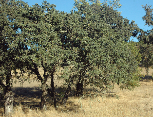
Oak woodlands are another lower elevation forest of Trinity County made up of trees such as white oak, black oak and blue oak. In these types of forests, most mushrooms in Trinity County grow with black oak, so learning to identify this tree is important when foraging!
Black Oak (Quercus kelloggii)Black Oak (Quercus kelloggii)Black Oak (Quercus kelloggii)Blue Oak (Quercus douglasii)Blue Oak (Quercus douglasii)Blue Oak (Quercus douglasii)White Oak (Quercus garryana)White Oak (Quercus garryana)Oak Woodland trees of Trinity County
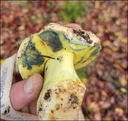
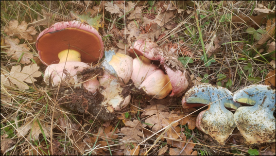
Beautiful yet very toxic mushroom that will fruit under oaks at the same time as butter boletes.
Red pores and cap
Bruises blue on the inside when bisected
Spongy underside and a bulbous stem
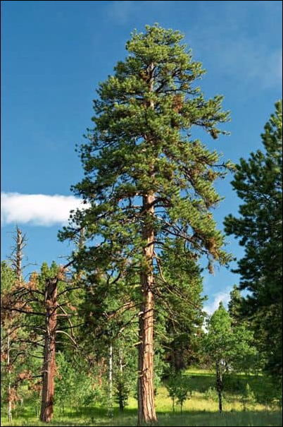
High Elevation Conifer Forests
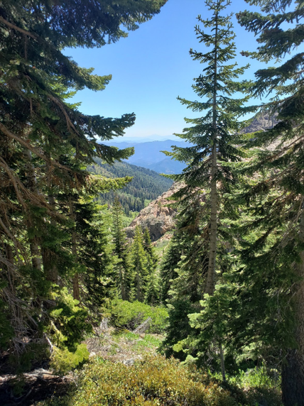
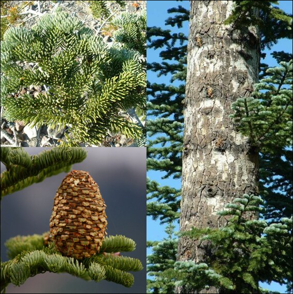
High elevation conifer forests are characterized by dense stands of evergreen trees, primarily conifers such as white fir, Shasta red fir and sugar pine. These forests typically occur at elevations above 3000 feet and are often found on steep, exposed slopes.
In the Trinity Alps, upland morels are the most commonly found edible mushroom. Some species of morels thrive in areas affected by wildfires. The nutrient-rich soil created by fires fosters morel growth, usually within one to two years after a burn but some species don’t appear until several years post-fire. Fires reduce competition and help spores germinate, forming helpful relationships with surviving trees. This makes recent burn sites ideal for spring foraging, resulting in plentiful morel harvests.
There are about 4 to 6 species of morels that adapt well to burn areas, and although they are hard to distinguish, different species appear in these fire-affected zones at various times.
White fir (Abies concolor)White fir (Abies concolor)Shasta red fir (Abies magnifica)Shasta red fir (Abies magnifica)Sugar Pine (Pinus lambertiana)Sugar Pine (Pinus lambertiana)High Elevation Conifers of Trinity County
Besides the burn morels that occur 1-3 years after a burn, Morchella snyderi will be a mushroom to keep your eye out for. M. snyderi occurs in high elevation areas 3-4 years after a burn in undisturbed true fir forests, more commonly found near Mt. Shasta, but can be found in the Marbles and Trinities.
Look for morels a few weeks after the snow has receded.
Occurs in undisturbed true fir forests and several year old burns of the same forest type.
Occurs in the Trinities and very common around Mt. Shasta.
Also found in the high elevation conifer forests are the King Bolete. Look for these a few weeks after the fruiting of morels in true fir forests.
Pores instead of gills. Reticulation on stipe
Occurs with true firs approximately 2 weeks after the morel flush.
Often grows as shrumps.
Not as good as fall porcini but still an excellent edible
Photos provided by Kyle Sipes – unless otherwise noted on the image.
The January 28, Science on Tap event was recorded with the presenters permission.
Recorded January 28, 2026
Kiana Abel, Public Affairs Specialist
As Public Affairs Specialist for the Trinity River Restoration Program, Kiana manages external communications, media relations, and stakeholder outreach. She acts as a liaison between program initiatives and the public, transforming technical findings into compelling narratives that promote understanding of restoration initiatives on the Trinity River. Kiana holds a Batchelor’s in Art History, has spent most of her career in marketing and is focused at the TRRP on bridging the gap between public awareness and resource restoration and management.
Water Year ’26 thus far has been a rain driven year for storage in Trinity Reservoir. Current storage is a product of early season rain plus elevated levels at beginning of the water year.
Trinity Reservoir September 29, 2025 [Kiana Abel, Trinity River Restoration Program]
In October, Trinity measured in at 70% full with 1.7 million acre feet. Seasonal storms pushed storage over 2 million acre feet (or 84%) in early January leading reservoir managers to implement reservoir management releases after a synchronized storm pulse flow was paired with a post-December 15 storm. By the end of January a lack of rain and snow returned releases to winter baseflow (300 cfs).
Feb. Forecast – California-Nevada River Forecast Center
February’s long range weather forecast is thus far looking a bit more wet than late January.
The volume of environmental flow releases for the Trinity River Restoration Program’s Wet-Season Baseflow Period (Feb. 15-Apr. 14) are determined by a conservative monthly inflow projection for Trinity Reservoir from the California Department of Water Resources (90% B120) in February, March with the final determination in April.
Prior to the official determination, which is published around the 10th of the month, water managers follow the California-Nevada River Forecast Center Median forecast for Trinity Lake inflow to stay abreast of the water year projections thus far.
The graph (shown in screen shot above) can be a little daunting to read, but when armed with the appropriate information is discernable for any viewer.
The Program’s Water-Year Volume Allocation as specified by the Record of Decision is outlined in the table below. The far left column is the threshold amount of state forecasted inflow in the Trinity Reservoir listed in acre feet which determines the center column, water year type. Then in the right column is listed the allocation to restoration for that water year, which includes baseflows.
Return now to an enlargement of the CNRFC forecast screenshot from Feb 13. Check out the light grey box “WY Vol Fcst 10/90%: 1,740/985 kaf” which reads longform as the following;
As of Feb. 11, the 10% of probability for Trinity Lake Inflow is predicted as 1,740,000 acre feet and the 90% of probability is 985,000 acre feet. Translated there is a 10% probability that the Trinity Allocation is predicted as “Wet” and a 90% probability as “Dry”.
As managers track the predicted inflow via CNRFC, the Program’s Flow Workgroup develops hydrograph scenarios to use when the final determination is published by the California Department of Water Resources. The two agencies use different methods when it comes to these prediction tools, the California Department of Water Resources uses data that has a weighted average to compute statewide Snow Water Equivalent (SWE) and is known as a more conservative forecast method when comparing the two.
Wet-Season Baseflow Period (Feb. 15 – Apr. 14)
The next period within the Trinity River Restoration Program environmental flow management is the Wet-Season Baseflow Period, which initiates Feb. 15. The California Department of Water Resources February 90% B120 declaration was published on Feb. 9 as “dry” with the 90% determination at 735,000 acre feet.
With a Feb. B120 determination of “Dry” or “Critically Dry” the Feb 15-Mar. 15 period will not increase releases to the Trinity River and Lewiston Dam flows will remain at 300 cfs (winter baseflow) until Mar. 15.
Prior to the next period (Apr. 15 – variable), the Program has a check-in on Mar. 15 to adjust flows based on the March 90% B120 declaration. In April, the Program implements a spring snow-melt and recession hydrograph following the final B120 water year determination by the Department of Water Resources.
By: Chris Laskodi M.S., Fisheries Ecologist, Yurok Tribal Fisheries Department
Stoneflies from the family Perlidae aka Golden Stones
If you are a fly fisherman on the Trinity River, you know one of the top flies in the winter is a golden stone nymph. Unsurprisingly, these stoneflies are one of the most common benthic macroinvertebrates found on the Trinity River. They are especially prevalent in the winter and early spring as most of the other insects have already completed their lifecycle and are growing to emerge the following year.
Photo: A stone fly imitation designed to look like the real thing. [Chris Laskodi, Yurok Tribal Fisheries Department]
These stoneflies typically emerge in late spring so they are almost fully grown and are just packing on calories for the next stage of their life cycle. They are avid hunters and consume anything that can fit in their mouths (mostly Chironomids and Baetid larvae). This hunting activity makes them susceptible to entering the drift either voluntary or involuntary potentially providing a tasty morsel for salmonids that are large enough to eat them. TRRP scientists have noticed an uptick of these stoneflies in the last few months during their regular benthic macroinvertebrate surveys providing insight into the stonefly’s behavior.
A stonefly from the family Perlidae captured in a recent benthic macroinvertebrate sample.A Steelhead caught by the author. Note the golden stone imitation in its jaw.
Photos provided by the author.
Chris Laskodi, M.S., Fish Ecologist – Yurok Tribal Fisheries Department
Chris serves as the fish biologist/ecologist for the TRRP in the program’s Science branch. Chris has worked on the Trinity River since 2015, previously serving as a fish biologist for the Yurok Tribe and a fisheries technician for the US Fish & Wildlife Service. Chris holds a B.S. in Wildlife, Fish and Conservation Biology from the University of California, Davis and a M.S. in Aquaculture/Fisheries from the University of Arkansas at Pine Bluff. In his free time, Chris enjoys taking friends and family fishing on one of the many watercraft available to him.