
REASON FOR ACTION
Regulated flows from the Trinity River Division dams have affected the river in numerous ways (see also Flow Overview). The regulated flows lack the force to maintain channel diversity and are unable to reach the historic floodplains. Steady low flows enabled vegetation to grow thickly on low banks of the river. Productive floodplain habitats became inaccessible to fish. Coarse gravel and large woody debris could no longer flow from the watershed past the dams and into the lower river.
Adding to this list of problems, a century of large scale dredge and hydraulic mining preceding the dams created very unnatural channel forms. Floods in the early- to mid-1900’s reworked some of the tailings piles, but flow regulation began long before the river could fully recover a natural form. Steep banks and high terraces remain common features on the river today.
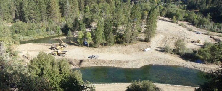
Construction work on the floodplain at the Sawmill Channel Rehabilitation site in 2009.
Higher flow releases authorized by the Record of Decision will have the ability to improve these situations, but with a cap of 11,000 cubic feet per second (cfs) for restoration flows, it will take time. The river channels and fish habitats need a jump-start with channel rehabilitation.
TRRP REHABILITATION SITES
The second element of the Program’s restoration strategy directs the creation of a dynamic alluvial channel exhibiting characteristics of the pre-dam river, but at a smaller scale. This rehabilitation of channel form is intended to work with flows over time to restore the river and its fisheries. This combination of channel rehabilitation and river flow is expected to reconnect the river to its floodplains, promote alternate bar sequences and low-velocity habitat for salmonid fry; increase habitat complexity; and allow the river to maintain itself as an alluvial system in both treated and untreated areas.
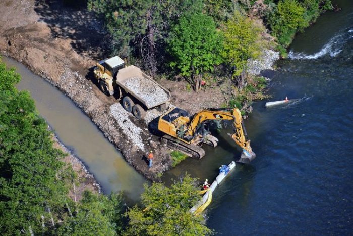
Channel Rehabilitation at Bucktail 2016. Photo by Kenneth DeCamp
The ROD calls for 47 channel rehabilitation projects in the upper 40 miles of river below Lewiston Dam. Through adaptive management and monitoring, projects now include construction of natural riverine features such as floodplains, point bars, forced meanders, mid-channel islands, side channels, and alcoves. These more complex designs have increased the overall costs and extended the schedule for bank rehabilitation beyond what was described in the Flow Study.
RESTORATION PAGES
Science and Adaptive Management