
New Gravel Augmentation Sites Proposed Beginning Winter 2023/2024
The Trinity River Restoration Program draft Sediment and Wood Augmentation Environmental Assessment/Initial Study (EA/IS) is closed for public comment. The public comment period was October 10 to November 22, 2023. This EA/IS explains the need to develop additional augmentation sites upstream of Indian Creek on the Trinity River mainstem as well as how the actions will be implemented. The purpose of this notice is to invite you to provide comments you may have about the EA/IS during a public comment period, pursuant to 40 CFR § 1506.65.
- 5 Council on Environmental Quality (CEQ) National Environmental Policy Act Implementation Regulations. 40 CFR Parts 1500–1508 (2020).
Background
Following the 2000 Record of Decision (ROD), the U.S. Department of Interior (DOI) established TRRP to restore the fisheries of the Trinity River affected by dam construction and related diversions of the Trinity River Division of the Central Valley Project1.
Administered by the U.S. Bureau of Reclamation (Reclamation), the TRRP is a partnership of federal and state resource agencies, Tribes, and Trinity County. The Program works to restore the processes and attributes of a properly functioning river to support the recovery of diminished salmon and steelhead populations while retaining Trinity and Lewiston Dams deliveries of water and power to California’s Central Valley.
New Augmentation Sites Goals and Objectives
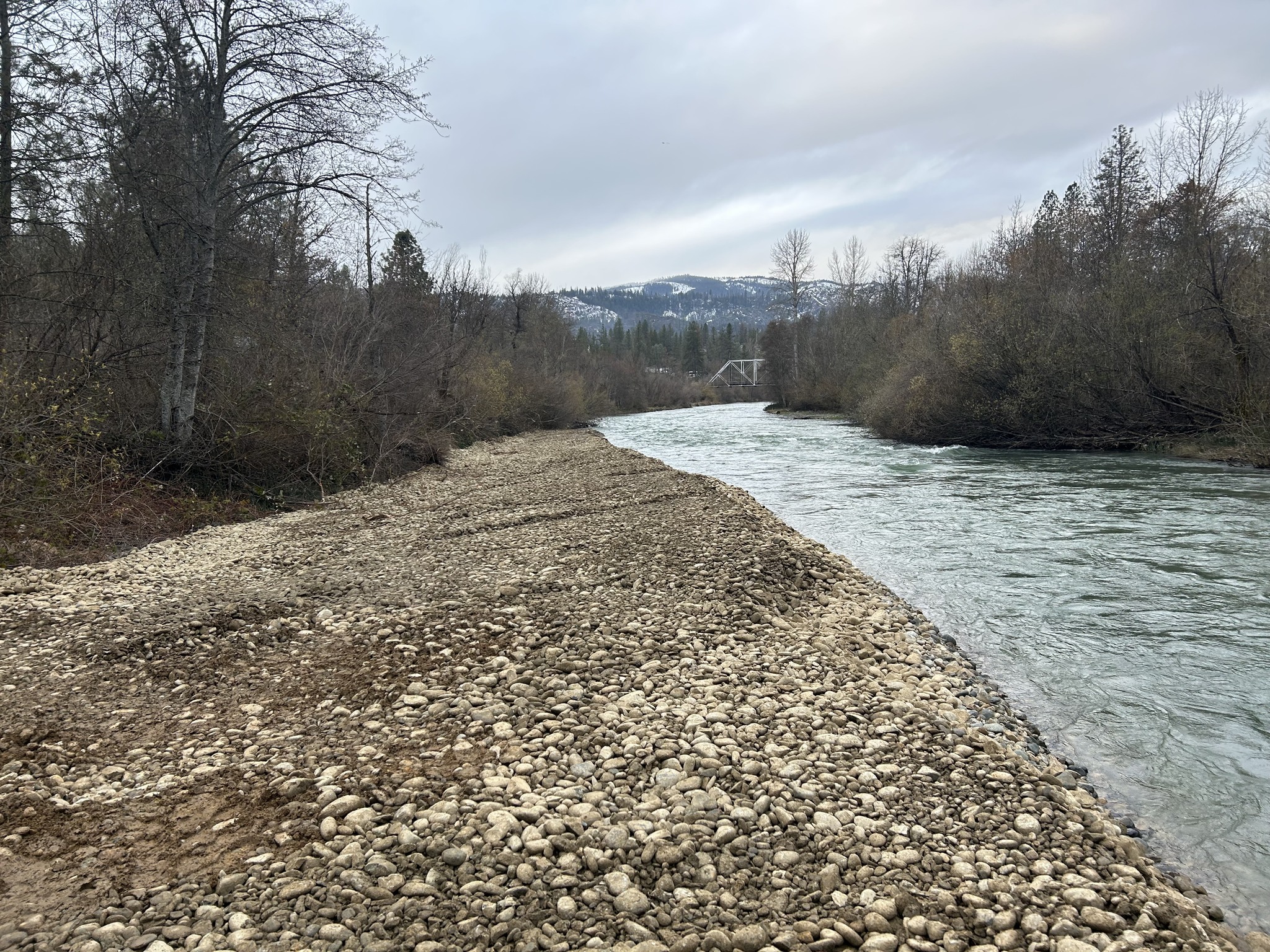
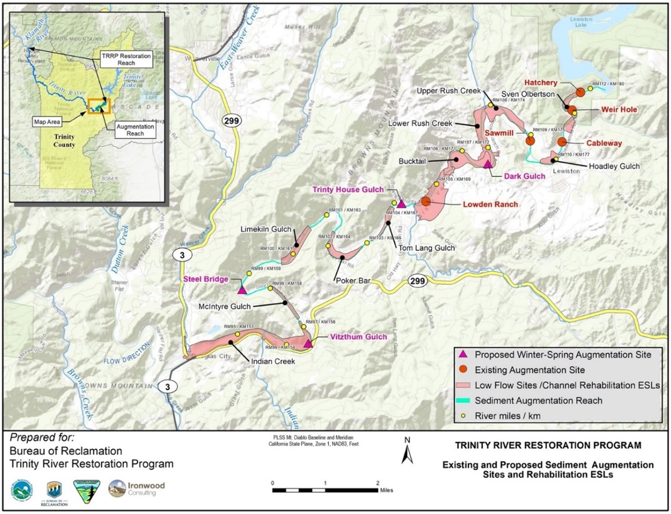
Currently, TRRP augments gravel at five permitted sites below Lewiston Dam (Figure 1). For augmentation purposes, we propose to add four new sites. From upstream to downstream, the new proposed sites include Dark Gulch, Trinity House Gulch, Steel Bridge, and Vitzthum Gulch (Figure 1). The potential benefits of augmenting in new areas of the Trinity River upstream of the confluence of Indian Creek include:
- Creating bars and pools in the river channel by encouraging the scour and fill processes that form them.
- Providing additional juvenile rearing habitat in the river channel as opposed to floodplain rearing habitat that is only made available during high flows.
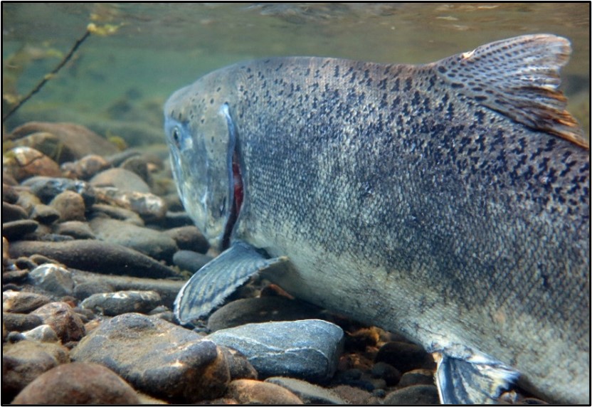
- Creating and maintaining spawning beds for redd formation by adult salmon.
- Improving the overall elements of channel complexity.
A deficit of sediment and wood occurs because Trinity and Lewiston dams not only trap water but also the supply of sediment and wood from upstream areas. Gravel, cobble, fine sediment, and wood supplied by the river’s tributaries like Rush Creek, Deadwood Creek, and Indian Creek, for example, help balance the river’s ability to transport material to downstream areas. With a substantial portion of the watershed blocked by the dams that would otherwise supply sediment to the Trinity River, the river section closest to Lewiston Dam (near River Mile [RM] 112; Figure 1) transports sediment quicker than the river can naturally replace it. Trinity River analyses indicate that the deficit of gravel and small cobble extends downstream to Indian Creek3 (at RM 94), but current TRRP augmentation sites cannot adequately transport sediment throughout that section of river4. After the confluence of Indian Creek, other tributaries like Reading Creek, Weaver Creek, and Browns Creek supply enough gravel and small cobble to balance the “sediment budget.” For that reason, TRRP proposes new augmentation sites upstream of Indian Creek only. As long as the dams are in place, there will be a need to add material (e.g., gravel and wood) that would otherwise be provided naturally from the blocked watershed area above the dams.
- 3 Active gravel bar area is especially low in the mainstem Trinity River between Grass Valley Creek and Indian Creek (https://www.trrp.net/library/document/?id=2521).
- 4 Gaeuman (2020) reported that a large share of the gravel introduced into the river deposited close to the augmentation points. (https://www.trrp.net/library/document/?id=2464
General Description of Proposed Action
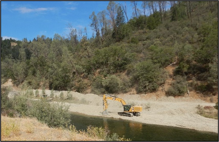
Varying sizes of sediment and wood would be introduced in proximity to proposed new gravel augmentation sites, in addition to existing sites, based on site-specific annual recommendations from the TRRP’s Physical Workgroup and Riparian and Aquatic Workgroup (https://www.trrp.net/gravel-physical-workgroups/ and https://www.trrp.net/riparian-aquatic-ecology-workgroup/).While annual augmentation recommendations would depend on the water year, location, and site-specific needs, in general, sediment from 0.04 inches to 5 inches in diameter, and wood from slash to whole trees with root wads would be added during winter or spring placement. Sediment additions would generally range from 500 to 2000 cubic yards (50 to 200 trucks full) at a location, and wood additions would not exceed 700 pieces of varying sized wood per site per year.
Sediment would be trucked into sites from Sawmill for winter or spring placement, or the processing of local material (e.g., tailings piles) at Dark Gulch and Trinity House Gulch will reduce material hauled onsite. Sediment augmentation might also include larger cobbles to support long-term gravel bar development and habitat in the area.
TRRP would work with locals to minimize the impact of trucking on their neighborhoods. Trucking speeds would be kept slow and hauling schedules would be timed to minimize residential impacts. If used, County or private roads would be maintained, and public safety would be supported by signage and other safeguards.
Possible Impacts
The Public Draft EA/IS for this proposed management action addresses potential impacts to:
- Water and air quality during sorting and augmentation
- County-maintained roads and the public during sediment and wood transportation through neighborhoods along the river
- Local communities from noise during rock processing and placement
- Cultural resources and historic properties
- The fishery, wildlife, vegetation, and wetlands
- Hydrology and flooding
- Visual resources, land use, wild and scenic rivers, and recreation
- Mineral resources, geology, and geologic hazards
Proposed Project Schedule
To comment on this Sediment and Wood Augmentation EA/IS:
- Please provide all comments by November 22, 2023, to be fully considered by TRRP staff.
- Send your comments via mail to:
Sediment and Wood Augmentation Public Comment
C/O Trinity River Restoration Program
P.O. Box 1300
Weaverville, CA 96093 - OR send your comments via email to info@trrp.net. Be sure to include the word AUGMENTATION in your email’s subject line.
Public Scoping:
March 17 – April 17, 2022
Draft EA for public comment:
October 10, 2023 – November 22, 2023
Final EA and Decision:
Winter 2023/2024
Proposed implementation:
Use of newly permitted augmentation sites for processing mine tailings or placing sediment and wood in the river could begin as early as winter 2023/2024.