
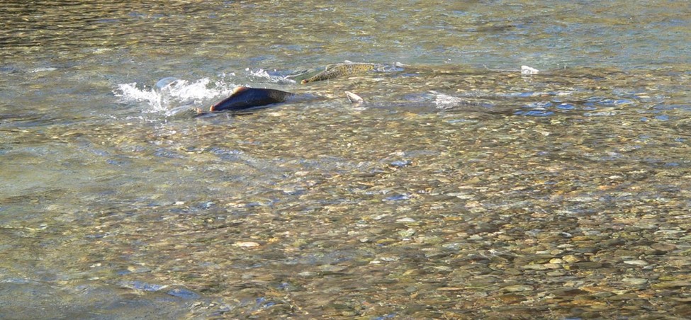
When you go down to the river, it’s hard to ignore the assortment of sediment on the bed and banks – from sand and silt, to gravel, to larger cobbles, to the largest of boulders. Seeing rocks that contrast so strongly with the rough, jagged ones in the surrounding hills might beg the question – how did these get here, where did they come from, and how long ago did they arrive?
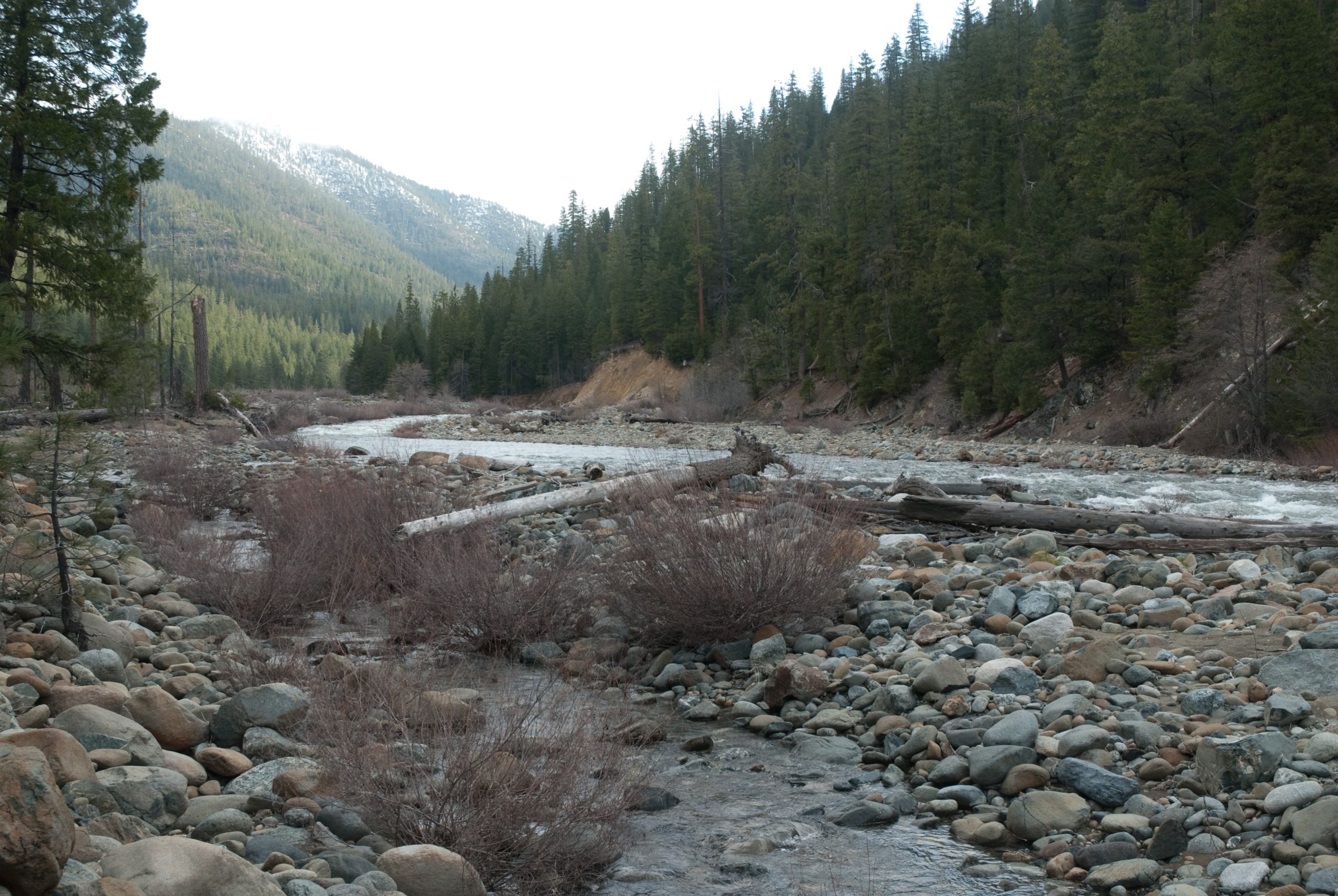
If a rock is rounded, more likely than not [1] it was transported by the river in a series of floods, originated from higher up in the watershed. Depending on the size these rocks may have arrived recently – perhaps as recently as the last flood. Large, rounded boulders that appear to be too large to have been rolled down the river on their own may have been in place since the last natural 100-year or 500-year flood and may remain there forever, or at least as long as Trinity and Lewiston dams are in place.
[1] Gold miners washed much sediment into Trinity River valleys from ancient riverbeds created from tectonic lifting that are presently high up on mountain slopes.
A river’s function
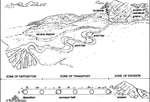
Besides the ecological benefits that rivers provide us, they have two pivotal functions in nature – to move water and to move sediment from the mountains to the ocean (the process is illustrated below). As both water and sediment flow downstream, they interact with each other to create a mosaic of pools, riffles, runs, islands, meanders, bars, and all of the other physical features that draw people, plants, and animals to a river.
The Trinity Watershed is situated in a relatively young, steep, and highly erodible mountain range, and is therefore blessed with a plentiful supply of sediment. A healthy sediment supply is beneficial to fish, invertebrates, and floodplain vegetation. However, due to the placement of two dams in the Trinity River’s upper watershed an important element of restoration is giving gravel to the system below a dam since the river’s natural sediment supply is blocked. We know rivers below dams need a replenished sediment supply, however, a key question that geomorphologists continue to study is how much sediment, and what size distribution of sediment should be added? These factors are difficult to determine and are constantly being re-evaluated as part of our adaptive management program.
How we calculate amounts for placement
Gravel augmentations to the river are first determined using a defined sediment budget specific to the Trinity. Also, at some point below most dams, a river’s tributaries provide a sufficient supply of sediment to support the physical processes and biologic populations in the river. On the Trinity, that point is considered to be just below the junction of Indian Creek. In years past, during floods, the amount of sediment moving along the bottom of the river (called ‘bedload’) was directly measured with large strainers placed on the riverbed. Data obtained from the strainer monitoring station have indicated that minor floods may move 2,000-3,000 tons of bedload (the monitoring station that is nearest to Indian Creek is located just upstream of Douglas City campground). At this same location, larger floods may move 15,000-30,000 tons of bedload past the monitoring station. The Trinity Record of decision provided the program with a framework of how much sediment should be applied to the river below the dam with the expectation that geomorphologists study current conditions through time and then adapt management based on results found.
After many years of physically sampling bedloads, program scientists switched to a more efficient and safer technique called acoustical monitoring. This method uses underwater microphones to quantify the amount of sediment during floods by measuring the amount of noise generated by rocks rolling on the bed. The physical data collected from the past is then compared to the measured volume of noise and produces a calculated volume of sediment rolling past. Scientists then scale annual sediment augmentation projects to these measured amounts. Additionally, the riverbed is periodically surveyed below sediment augmentation sites to determine whether the effects of placements are positive or negative. If too much sediment is noted, this information is used to scale back future sediment augmentation plans. If you were to compare the original amounts of sediment proposed in the Trinity Record of Decision to what we add today, ROD volumes were 2-3 times higher!
Size matters
As for size, the high end of the size distribution of sediments is the grain diameter that salmon can move to construct redds, or nests in which they place their eggs for incubation. Salmon can spawn in gravels with a median diameter up to about 10% of their body length. This leads to gravel being placed in the river that was filtered through a 4-inch screen. The lower end of the size distribution of sediment for redd building is considered to be in the size range of small gravel, and so the sediment mixtures for placement in the river are also screened to remove sand and silt. If the sediment is too small, it just flushes all the way down the river during floods and doesn’t remain to provide any benefits. If the sediment is too large, it stays close to the augmentation site and causes the riverbed to become coarser there. The need for small to large gravels for placement makes considering the size distribution between these end points important. Too many small gravels make the riverbed overly mobile and easy to scour, which endangers salmon eggs incubating in the bed. However, a grain-size distribution that is skewed towards larger particles makes the riverbed too stable, so that salmon are unable to move the sediment when attempting to construct a redd. These considerations make the size class of sediment another subject of adaptive management, and over time TRRP has reduced the size of sediment that is added to the river. Studies have also pointed toward ways that coarse sediments (gravel and cobble) interact with fine sediment (sand and silt), and restoring a natural balance of these grain sizes is an objective of the sediment augmentation program at the TRRP. In the future you may hear of sediment with a more natural size distribution (e.g., “bank run material”) being used in sediment augmentation projects.
Filling deep pools
When you observe a river during typical baseflows, pools are calm while riffles are noisy, turbulent and swift. From an above water view, its natural to think that sediments would settle from these active riffles to its calmer neighboring pools. During low flow, if you look underwater, the river only has the power to move finer sediments, like sand and silt. Conversely, coarse sediment, such as gravel and cobble move only when the hydrology of the river is powerful with high flow or flooding.
When rivers flood, we see something that river scientists call a “flow reversal”. Flow reversal is when deep pools transition into a high-energy environment where flow velocity is more vigorous than on riffles. In this instance water meets the pool (and its surrounding environment, like bedrock) with force and activates sediments of different sizes within the pool. These sediments are “scoured” from the pool and placed on the riffle below it typically expanding a pool’s depth and also building the riffle below. Next time during a high flow, check out the way a pool churns and take note to notice the way water interacts with the riffle that lye underneath. During high discharges, flows on riffles are comparatively slow because the surface is not as deep. This interaction causes the water to “feel” the bed and slow due to its rough texture. These interactions cause sediment to deposit on riffles and scour from pools during high flows. The size of sediments that move are directly correlated to the amount of water flowing down the river and these events are the force behind building the riffles and pools of the Trinity River.
TRRP sediment augmentation projects have sometimes been thought to contribute to the filling of deep pools in the river and there have been cases where pool depths have decreased in areas that the TRRP has worked to restore the river. However, TRRP studies have shown that this tends to occur where stream power decreases in the channel from lowering the elevation of adjacent floodplains and vegetation, which causes the flow to spread out instead of concentrate in the channel. In many areas of the Trinity River, lowering floodplains is necessary to reconnect them with the river during floods for the benefit of the fish, wildlife and plants that live there. This conundrum is another subject of adaptive management, and TRRP often avoids actions that would have a strong likelihood of affecting pool depths so that holding habitat for over-summering fish such as spring-run Chinook salmon remains available.
The next time you visit the Trinity River, take a close look at the sediments that you see. Depending on the time of year, you may see salmon redds constructed of gravels. You will also most likely find aquatic invertebrates and biofilm living on the gravel and cobbles surfaces. Dig into a sand and silt deposit along the channel margins and you might find juvenile lamprey wriggling around in these materials. You will certainly see how sediment forms the shape of the river. And hopefully you’ll come away with a greater appreciation of sediments that are the building blocks of the Trinity River!