Ecology in Motion: Wildlife Interactions After River Rehabilitation
By: Simone Groves, Riparian Ecologist, Hoopa Valley Tribal Fisheries with contributions fromJames Lee, Implementation Branch Chief and Kiana Abel, Public Affairs Specialist – Trinity River Restoration Program
Disturbance: A Natural Driver of River Ecosystems
Disturbance is a fundamental ecological force across western North America. At small scales, a fallen tree opens space and sunlight; at larger scales, wildfire or major floods reshape entire landscapes. Historically, the Trinity River experienced seasonal floods that scoured floodplains, deposited sediment and wood, and reset vegetation communities. These events initiated ecological processes that made the river corridor dynamic and biologically rich.
Succession in River Environments
Following major disturbance, the floodplains of rivers like the Trinity River undergo predictable successional phases. After high flows deposit bare gravel and sand, these new surfaces become recruitment beds for species like black cottonwood (one of the clearest examples of primary succession along the Trinity). In other cases, where vegetation is cleared but soils and roots remain, secondary succession accelerates recovery. In both processes, disturbance serves as the starting point that enables riparian vegetation to establish, mature, and ultimately support riparian wildlife.
Riparian Vegetation Depends on Disturbance
Recently deposited sediment and wood which were naturally recruited during winter storms along with channel rehabilitation (2024) and flow management on the Trinity River. [Aaron Martin, Yurok Tribal Fisheries Department]
Riparian habitats occupy a small fraction of the landscape, yet they are used by most wildlife species in the Trinity River watershed during some part of their life cycles. Without periodic disturbance, riparian vegetation is gradually replaced by upland species that are less valuable to wildlife. The river once maintained this vegetation naturally through regular high flow events. Today, with Trinity and Lewiston Dams reducing the timing and magnitude of floods, the natural disturbance regime has been significantly altered.
Because large, channel-shaping floods no longer occur downstream of the dams, channel rehabilitation and the use of big machines to lower floodplains has become an essential tool to reintroduce areas no longer available to the river for primary and secondary succession. Recently completed projects such as the Upper Connor Creek and Oregon Gulch Channel rehabilitation projects in Junction City, Ca. are two such examples. While the designs were unique to each location overall each project aimed to lower floodplain surfaces, reconnected the main stem Trinity with floodplain areas, increase channel complexity, and distribute large wood to mimic features historically formed by floods. Although mechanical disturbance differs in scale and timing from natural floods, it provides the ecological reset needed to restart successional processes.
Observed Wildlife Response
As new surfaces at Upper Connor Creek stabilized during and after construction, wildlife quickly responded.
Insects were among the earliest arrivals. Butterflies and native bees collected salts on wet sediments, velvet ants moved rapidly across disturbed soils, and dragonflies patrolled the project perimeter. As winter approached, clusters of lady beetles gathered within the shelter of planted bunchgrasses.
A velvet ant at Upper Conner Creek.Velvet ants are fast and hard to photograph!Butterflies enjoying salts from newly disturbed and wetted floodplain.An ant hill in sediments at Upper Conner CreekLady bugs hide in the stalks of newly planted grasses during the cold months.
Small mammals moving up the food chain, rodents moved in to the area soon after excavation stopped. Evidence of ground squirrels, and mice were found occupying large wood structures and burrows developed near newly planted bunch grasses.
Gray fox activity increased the following spring, including a mother using the site to forage for rodents supported by the new habitat conditions. Although one fox pup later died on-site from what appeared to be disease, the presence of fox highlights their role as early participants in post-disturbance ecosystems.
A kit perished from disease.The same kit decomposing over time.The same kit decomposing over time.Fox scat at the project site.Fox scat at the project site.Fox scat at the project site.
Acorn woodpeckers took advantage of acorns dispersed during revegetation efforts, caching them in nearby upland forests. While it is too early to evaluate long-term oak establishment, this interaction illustrates how wildlife intersects with restoration actions.
Crews harvested acorns from an oak woodland to be used at the project site.An acorn sprouting an oak tree.Acorns placed in upland areas at the Upper Conner Creek restoration site are sprouting alongside the grass seed. Evidence of acorn harvest.Deer scat in the seed dispersal area.An area acorn woodpecker has been very busy!
Bears frequently visited the site, leaving tracks and scat near preserved patches of California grape that were intentionally maintained during construction. Bears also contribute to revegetation by dispersing seeds from parent plants elsewhere along the river corridor.
Likely a bear print in the mud.Bear prints at Upper Conner Creek.Maybe a cougar print?Bear scat on the project site.Bear prints in the mud.A salmon carcass.
Beaver activity increased as willows became established. Although their role in thinning willow stands is not well documented, beavers strongly influence species composition by selectively cutting cottonwood and ash while leaving certain willow species. Many cut stems resprout vigorously, expanding the footprint of riparian vegetation.
Evidence of beaver browse at the site.The cuts look clean until you look close.Evidence of beaver browse.Evidence of beaver browse.Evidence of beaver browse.Evidence of beaver along the river corridor.
Predators like mink, racoon and river otter leave their mark with tracks and scat on newly deposited sediments and near planted vegetation. Their presence reflects the site’s increasing habitat complexity and improved food availability.
Crawdad consumed by a predator at Upper Connor Construction site.Tracks of an unidentified predator and it’s young in fresh sediment deposits around a planted plug of bunchgrass.This Chinook carcass was deposited with scat.
The Disturbance–Succession Loop in Action
The rapid and varied wildlife responses at Upper Connor Creek demonstrate the close link between disturbance and ecological renewal. While mechanical disturbance may seem disruptive during construction, it re-establishes the foundational conditions that riparian vegetation—and the wildlife depending on it—require. In a system constrained by dams, channel rehabilitation functions as a surrogate for natural forces that once shaped the Trinity River.
As the site continues to develop, ongoing observations will help refine how future projects balance engineering and ecology. With each restored floodplain, we gain a clearer understanding of how planned disturbance supports a dynamic and resilient river ecosystem.
Unless otherwise noted, all photos were provided by Simone Groves, Riparian Ecologist – Hoopa Valley Tribal Fisheries Department.
McKelvey, Kevin S. 2015. The effects of disturbance and succession on wildlife habitat and animal communities [Chapter 11]. In: Morrison, M. L.; Mathewson, H. A., editors. Wildlife Habitat Conservation: Concepts, Challenges, and Solutions. Baltimore, MD: Johns Hopkins University Press. p. 143-156. https://research.fs.usda.gov/treesearch/48033
Timothy J. Beechie, David A. Sear, Julian D. Olden, George R. Pess, John M. Buffington, Hamish Moir, Philip Roni, Michael M. Pollock, Process-based Principles for Restoring River Ecosystems, BioScience, Volume 60, Issue 3, March 2010, Pages 209–222, https://doi.org/10.1525/bio.2010.60.3.7
Hobbs, N. T., and R. A. Spowart. “Effects of Prescribed Fire on Nutrition of Mountain Sheep and Mule Deer during Winter and Spring.” The Journal of Wildlife Management, vol. 48, no. 2, 1984, pp. 551–60. JSTOR, https://doi.org/10.2307/3801188. Accessed 11 Feb. 2026. https://www.jstor.org/stable/3801188
Ceratonova shasta (C. shasta) is a microscopic parasite that is native to rivers of the Pacific Northwest, including the Klamath and Trinity Rivers. Infection is most severe for juvenile salmon but can impact returning adults as well. The impact of an infection is highly influenced by water conditions like temperature, flow, and seasonality. If conditions are right for the parasite’s host worm, C. shasta can rapidly proliferate and lead to severe infections that can be devastating to populations. In 2021, after years of drought that impacted river conditions juvenile salmonid deaths from C. shasta in the lower Klamath reached into the hundreds of thousands [1, 2].
To survive, C. shasta needs two hosts
1. A carpet of tiny worms C. shasta starts its life inside a freshwater worm, called Manayunkia occidentalis. The worm, smaller than an eyelash, lives in mud and on rocks below the surface of a river or reservoir in colonies that can resemble an underwater carpet. Inside the worm, the parasite grows and turns into a new form called an actinospore. Once an actinospore, the worm releases the microscopic parasite to float in the water column and wait for its next host [3].
2. Salmon and Trout As they swim young salmon breath in the actinospores allowing the parasite to attach to the gills and then enter the fish’s body. The parasite then travels to the fish’s intestines, where it multiplies and causes internal damage. This makes the fish sick and weak, causing many to succumb to the infection. The cycle continues when infected fish (including adults) release more spores back into the water after they die.
Jerri Bartholomew Ph.D. explains the complex lifecycle of C. shasta and her discovery of the second host involved in the disease. She presents some of the questions being explored in a collaborative effort to help salmon survive in the Klamath River.
Are Adult Salmon Affected?
Adult salmon can be infected with C. shasta however the severity is influenced by other stressors. Typically, adults encounter the microscopic spores during upriver migration through areas with high spore loads (like the lower Klamath River during spring/summer). If the fish is stressed from high water temperatures, poor conditions or other pathogens, C. shasta could lead to pre-spawn mortality or failure to spawn. Although typically resistant, if infected, adults can act as a carrier of the parasite – shedding spores when they die and decompose. If the spores are shed in a system that does not have adequate flushing flows during the ensuing winter months, juveniles from the area could be affected. While some disease impacts to adult salmon are possible, if conditions in the river are favorable, adults are generally more resistant to effects of the disease than juveniles.
The Klamath River
Salmon health and vitality is of utmost importance for Klamath indigenous groups like the Yurok, Quartz Valley, Karuk, and Hoopa Valley Tribes. For millennia salmon have provided sustenance and are celebrated as integral to the health of people, culture, tradition, and economy. The continued decline of salmon due to C. shasta and other human-enhanced factors are deeply felt by local people and led to the decade’s long advocacy to remove four hydroelectric dams on the Klamath River.
In 2023 and 2024 these dams on the Klamath River were removed, allowing salmon, steelhead and lamprey to reconnect to 400 miles of spawning habitat. It is the largest dam removal project in U.S. history, to date. Ecological goals for dam removal are to improve water quality, restore resources to Klamath River Tribes, restore habitat for salmonid species, and improve the health of salmon and steelhead [5].
The Klamath River is home to several salmon species that are important to Native American tribes, commercial and recreational fishers, and the ecosystem as a whole. Although infections occur in all species of juvenile salmon or trout, if the parasitic worm host is allowed to thrive, results can be devastating for some salmon species. One such species of concern are Coho salmon, which are recognized as “threatened” in the Klamath and the Trinity and are especially vulnerable to population scale impacts from large scale fish kills propagated by parasites.
Toxic algal blooms were a problem in the stagnant waters sitting behind the dams on the Klamath River since the dams were built. Photo by Stormy Staats/Klamath Salmon Media Collaborative via KRRC.
What made the lower Klamath River a hotspot for C. shasta? Below Iron Gate dam, the primary reasons were twofold. First, scouring events from winter storms were blocked by dams failing to disperse sediment. Second, waters held in several chains of reservoirs warmed. Ultimately these combining factors led to robust habitat conditions for the parasite’s aquatic worm host. Fish heath experts in the Klamath Basin are hopeful that dam removal will mitigate previously favorable growing conditions for the host worm [6]. Removal of JC Boyle, Copco 1 & 2 and Iron Gate dams will allow for a more natural flow of water from tributaries and potentially help to scour growth of the host worm with winter storms.
Hope for Trinity River Fish Populations
The Trinity River joins the Klamath River approximately 44 miles above the ocean, so its fish are subjected to the conditions of the lower Klamath River during their migrations. Beginning in late winter juvenile chinook begin to migrate downriver feeding on drift invertebrates, resting and digesting in warmer slower waters. Once they meet the mild saline waters of the Klamath estuary, they begin a smoltification process where their bodies change and adapt from freshwater to saltwater. Cold temperatures and salinity may reduce progress of disease, but do not eliminate infection [1].
Because of their migration paths, Trinity River fish populations were part of the juvenile fish kill on the Klamath River in 2021. This event, along with historic drought conditions that followed, allowed for pathogens like C. shasta to play a significant role in returning adult escapement. Since most Chinook exhibit a 3-5 year life cycle, we’re still experiencing the loss of these juvenile fish today. Historically low returns of adult chinook salmon have prompted recreational fishery managers to close in-river salmon fishing seasons for a third consecutive year [8, 9]. Although the immediate impacts have been devastating for recreational anglers and river enthusiasts, there are many hopes (and also many unknowns still to be learned) following the removal of the dams. The primary hope for Trinity River outmigrant fish to experience less frequent and less severe infections once they reach the Klamath River so that juveniles as well as adults can manage natural stressors and thrive.
Klamath Fish Health Assessment Team
The Klamath Fish Health Assessment Team (KFHAT) is a technical workgroup which formed during the summer of 2003 with the purpose of providing early warning and a coordinated response effort to avoid, or at least address, non-hazardous materials related fish kill events in the anadromous portion of the Klamath River basin [10].
To accomplish this goal, KFHAT created a network of experts and monitoring efforts through which information about current river and fish health conditions in the Klamath Basin can be shared among participants, the general public, and resource managers.
Every year, beginning in late April, members of KFHAT hold meetings to assess Klamath Basin fish health along the Klamath and Trinity Rivers and their main tributaries. The group publishes observations as well as a readiness level map based on those observations on a public facing website: Klamath Fish Health Assessment Team (KFHAT) after each meeting.
How are juvenile populations fairing this out-migration season? The wet winter of 2024/2025 has set the system up with favorable fish health conditions, but our area’s typical hot July weather can lead to stressful lower river environments. Thus far the 2025 monitoring season has seen some irregularities with regards to concentration of C. shasta. Klamath Basin water quality monitoring is implemented annually by a team at Oregon State University and recent monitoring results are showing higher than normal spore counts of C. shasta in geographic areas that are puzzling scientists [10]. In the lower river, screw traps are catching Trinity River hatchery-released yearlings from the fall and spring brood stocks with infections [10]. Although these conditions exist each year, they vary in severity and salmon evolved to this specific weather pattern. The species stay healthy by seeking cold water refugia located in deep stratified pools and cold-water tributary mouths during the hottest weeks of the year. Also typical to the area, wildfire can aid conditions when smoke sits in drainages, reflecting the sun’s heat back into the atmosphere and therefore cools air and water temperatures.
Although this year’s conditions thus far are concerning (note the yellow readiness levels in the map above), many juvenile salmon are in the last stages of migration to the ocean and are likely in the lower Klamath river undergoing smoltification or learning to live in their new ocean environment. What will conditions be when they return to spawn in our river in 2028, 2029, or 2030? Of course, only time can tell, but with the removal of four Klamath Dams, river managers are hopeful that, when it comes to controlled conditions, Trinity and Klamath run salmonids will have a more favorable environment than what populations have encountered for over six decades, and they might be more favorably armed to withstand what mother nature may bring their way.
Thank you to Dan Troxel, California Department of Fish and Wildlife lead on the Klamath Basin Fish Health Assessment Team and Morgan Knechtle from California Department of Fish and Wildlife for providing detailed edits to this article.
As Public Affairs Specialist for the Trinity River Restoration Program, Kiana manages external communications, media relations, and stakeholder outreach. She acts as a liaison between program initiatives and the public, transforming technical findings into compelling narratives that promote understanding of restoration initiatives on the Trinity River. Kiana holds a Batchelor’s in Art History, has spent most of her career in marketing and is focused at the TRRP on bridging the gap between public awareness and resource restoration and management.
By: Michael Dixon, Executive Director – Trinity River Restoration Program
Wait, bats? Of the river? Yes! A river is more than its bed and banks, it is also intricately tied to the valleys, canyons, and forests through which it flows. Many North American bats are tightly associated with proximity to both forest cover and water (e.g. Dixon 2012), and the bats of the Trinity River watershed follow suit. In fact, some of our bats do almost all of their foraging over and near water, which in a dry, mountainous landscape like ours, means over the Trinity River and its tributaries.
Bats fly into a Texas sunset. [US Fish and Wildlife Service]
Bats are the second largest order of mammals in the world, with >1,400 species on every continent except Antarctica, though a majority of those species are in the hyper-diverse tropics. The Klamath Mountains, through which the Trinity River flows, are home to at least 18 species (Reiss, Kauffman, and Feldman 2022). Some of these are year-round residents and are known to hibernate locally, whereas others migrate to warmer climates during the winter. All of our local bat species echolocate, meaning they essentially “yell” in very high frequency sound and then listen for the echoes (the same concept as sonar), which helps them navigate and feed in a dark world.
While the incredible worldwide diversity of bats includes many unique feeding styles such as nectar-feeding flower pollinators, fruit eaters, and (a bat fan favorite) bats that fish for food like the super cool fish-eating myotis, all of the bats in the Trinity watershed eat invertebrates like insects and spiders. That said, there’s a remarkable range of ways that they do that. Let’s take a look at a few of the species that call the Trinity River watershed home.
Myotis species
A little brown bat. [USFWS/Ann Froschauer]
Of the bats discussed here, the five or more small, brown, round-eared species of Myotis in our area are perhaps the closest to what people think of when they think of a “bat”. Their appearance exemplifies the German word for bat, Fledermaus or “flutter mouse”, though bats are much more closely related to deer, whales, and carnivores than to rodents.
Yuma myotis (Myotis yumanensis) are among the most frequently encountered species in the region and are “aerial insectivores”, meaning they forage on flying insects. They can be found flying along forest edges but most commonly over slow-moving water, typically only a couple feet above the river. This is because while they will also take things like moths and beetles, they are strongly predisposed to hunting emerging aquatic insects like caddisflies and midges. They make low, repeated passes over water smooth enough for their echolocation to detect the disturbance of insects on the waters’ surface. In areas where few large trees are found, they will form maternity roosts in buildings; these are where large groups of females gather together to raise their pups until they are old enough to disperse. However, in areas of the West including parts of the Trinity River where there are healthy riparian areas with large, old trees, they will roost in things like hollowed-out old cottonwood trees. This is one of the reasons that the Trinity River Restoration Program attempts to avoid impacts to mature riparian forests when building our restoration projects.
Another Myotis worthy of note is the little brown bat (Myotis lucifugus). While they are less abundant than Yuma myotis in the Trinity River region (Pierson and Rainey 2007), they are strongly predisposed to roosting in buildings and thus relatively commonly encountered. They are noteworthy in that, while fairly generalist in their feeding habits, they eat disproportionately large numbers of mosquitoes, making them allies of their human neighbors (Wray et al 2018). They have quite a large range, extending from the subarctic to the southern US, and through the late 2000s were among the most common bats on in North America. However, they are now classified as endangered by the International Union for Conservation of Nature because of the catastrophic impacts of an introduced disease called white-nose syndrome; it is estimated that the eastern and midwestern populations of the species have declined by 90% since 2010.
Little brown bat (Myotis lucifugus) in a historic building. [Mike Dixon, Bureau of Reclamation]
Pallid bat
A pallid bat (Antrozous pallidus). Photo originally posted on ANAMALIA by Michael Durham/Minden Pictures, BCI
In contrast to the myotis bats described, pallid bats (Antrozous pallidus) are quite large, with a wingspan of up to 16 inches. Beyond their large size, they also have enormous ears that can be a third of their body length. This is because rather than catching insects on the wing, they are gleaners, meaning they hunt prey on structures or, in their case, the ground. They are still capable of echolocation, but their over-large ears also allow them to listen for the sounds of their prey and target them that way. They are particularly fond of scorpions, of all things. Their inconsistent use of echolocation and ground-hunting behavior also means they tend to hunt in more arid or open areas, but they still stay relatively close to water. They frequently roost in trees in northern California (Baker et al. 2008) but can also be loyal users of strategically located buildings as night roosts. Night roosts are places that bats hang out for a variety of reasons including rest, digestion, picking apart large prey items, and various social interactions including information sharing (Ormsby et al. 2007). For several years, I have observed congregations of 5-20 pallid bats in the same corner under my eaves almost every night when overnight lows temperatures exceed 45oF. I appreciate them keeping the front of my house scorpion-free!
Pallid bats (Antrozous pallidus) have frequently used this night roost on a cabin next to the East Branch of East Weaver Creek. [Mike Dixon, Bureau of Reclamation]
Hoary bat
Hoary bats (Lasiurus cinereus) are striking in appearance. Rather than the shades of brown with which bats are often portrayed, the hoary bat has dark fir with brightly frosted tips and a yellowish face. Also unlike many bats of the temperature regions, it doesn’t hibernate – rather, it spends its summers from the northern U.S. (including northern California) well into Canada, and then in the fall migrates sometimes over 2,000 km south to a winter range that extends from the Southwest into Central America (Cryan et al 2004).
A hoary bat (Lasiurus cinereus) roosting on the branch of a tree. [Paul Cryan USGS]
Rather than flying low over the water or ground or on the edges of forest, the hoary bat is a high-flying moth specialist that makes long passes over open water or the top of the forest canopy, sometimes flying almost 25 miles in a night of hunting. The coevolution of bats and moths has been a subject of long study, as there is evidence that echolocation by moth-hunting bats drove the evolution of ears and evasive behaviors in moths, which in turn changed how moth-specialist bats echolocate (Ter Hofstede and Ratcliffe 2016).
Hoary bats are more solitary than most of our bats and tend to roost individually by hanging from tree branches like dead leaves, but they can form large aggregations around landmarks during their long southward migrations. This means that after they leave our Klamath Mountains, they are often recorded in what would seem to be pretty unusual places for a bat – they have been observed swarming ships at sea and commonly recorded over the Farallon Islands 30 miles off the coast of San Francisco. These long, sometimes over-water migrations also presumably led to one of the more unlikely events in the history of bats – the colonization of the Hawaiian Islands over 1.3 million years ago by hoary bats from what is now the west coast of the U.S. In this single founder event, wayward bats established the most isolated bat population in the world, which has since diverged significantly into its own species, the critically endangered Hawaiian hoary bat (Lasiurus semotus).
Bats and people
I have already mentioned how a couple of our native bats benefit people by controlling pests, and that topic has been the subject of many publications. Suffice it to say, bats are very important to the ecology of the Trinity River watershed and provide services to its people here and throughout the world, but they can also be inconvenient and, occasionally, dangerous to people. Here are a few suggestions for living with bats.
First and foremost – while bats don’t “carry” rabies (it is also deadly to them), the abnormal behavior of rabid bats is what often brings them into contact with people. NEVER pick up a bat that you encounter. It is unlikely that it has rabies, but the consequences of contracting rabies are so serious that it is not worth the risk. If you encounter a bat in your house, shoo it out but do not handle if it all avoidable – you’d be surprised how thick of a glove a bat can bite through!
If you have the space for it, embrace an untidy yard. Long grass provides a home for large insects like crickets that are preyed upon by our gleaning bats. Leaving fall leaves until the following spring allows many types of caterpillars and beetle grubs to use them as winter cover, providing food for our aerial insectivores the following summer. Trees with loose bark cavities or large are used by many species for roosting and can be left as habitat where they do not cause a hazard.
Many species like to use buildings for day or night roosts or for hibernation. Sometimes this isn’t a huge deal – I already mentioned that I appreciate the night roost above a seldom-used door at my house, and even use their guano as a garden amendment. However, in confined spaces like the walls and attics of buildings, the guano can become smelly and damage walls, and bats roosting in those places sometimes find their way into parts of those buildings with people (not a good thing, as already discussed). Many pest control companies have experience with excluding bats in a humane way (essentially letting them fly out but not back in). If you need bats evicted from your home, try to wait until late summer when the pups have fledged, so as not to separate foraging mothers from their flightless pups.
If you’d like to encourage bats to use your property, you can build or buy prefabricated bat houses. The trick in a climate like that of the Trinity watershed with sometimes intensely hot days and cool nights is to find the right sun exposure. Nursing mothers and pups want a spot that will gather and retain heat into the evening but will not get so hot during the day as to be uninhabitable. There’s an element of trial and error (and luck) to getting bats to move in, but it’s a great way to provide wildlife habitat and help keep your bugs down. For more resources on gardening and bat houses, this is a great place to start: Bat Gardens & Houses – Bat Conservation International.
References
Baker, Michael D., Michael J. Lacki, Greg A. Falxa, P. Lee Droppelman, Ryan A. Slack, and Scott A. Slankard “Habitat Use of Pallid Bats in Coniferous Forests of Northern California,” Northwest Science 82(4), 269-275, (1 September 2008).
Dixon, Michael D. “Relationship between land cover and insectivorous bat activity in an urban landscape.” Urban Ecosystems 15 (2012): 683-695.
Ormsbee, Patricia C., James D. Kiser, and Stuart I. Perlmeter. 2007. Importance of night roosts to the ecology of bats in Michael J. Lacki, John P. Hayes, and Allen Kurta, eds. Bats in Forests – Conservation and Management. The John Hopkins University Press: pp 129-151.
Pierson, Elizabeth D. and William E. Rainey. 2007. Bat distribution in the forested region of Northwestern California. Report for California Department of Fish & Game, Contract #FG-5123-WM.
Reiss, Karen, Michael Kauffman, and Chris Feldman. Mammals in Michael Kauffman and Justin Garwood, eds. (2022). The Klamath Mountains – A Natural History. Backcountry Press. Pp. 428-430.
Ter Hofstede, Hannah M., and John M. Ratcliffe. “Evolutionary escalation: the bat–moth arms race.” Journal of Experimental Biology 219.11 (2016): 1589-1602.
Mike Dixon is the Executive Director of the Trinity River Restoration Program and a northern California native. He fell in love with the Trinity River and Klamath Mountains while assigned to his first duty station at Coast Guard Air Station Humboldt Bay. He received a Ph.D. in Conservation Biology from the University of Minnesota, Twin Cities, where his dissertation focused on the landscape ecology and population genetics of bats. He lives on a small, perennial tributary of the Trinity River near Weaverville.
Photo: The [much younger] author with a little brown bat in Voyageurs National Park
By: Derek Rupert, Fish Biologist – U.S. Bureau of Reclamation
Trinity River Hatchery Modernization Project
Federal funding has provided the opportunity to institute much-needed modernization for the Trinity River Hatchery. Trinity River Hatchery (TRH) is a Reclamation-owned, Central Valley Project mitigation hatchery which was established to produce juvenile salmonids to mitigate for the loss of fish habitat upstream of Lewiston and Trinity Dams. Both dams are integral components of the Trinity River Division of the Central Valley Project. Reclamation owns the Trinity River Hatchery and the associated lands. Reclamation’s Northern California Area Office has funded the California Department of Fish and Wildlife to operate and maintain the Trinity River Hatchery since the hatchery’s construction in 1963. Additional support for Trinity River Hatchery operations comes from the Hoopa Valley and Yurok Tribes.
One of the juvenile raceways at TRH. [Bureau of Reclamation]
Currently, the hatchery’s annual goal is to produce approximately 5 million juvenile salmonids. The Trinity River Hatchery produces spring run Chinook Salmon, fall run Chinook Salmon, steelhead, and the federally threatened Coho Salmon. These species are highly significant for economic, recreational, and cultural values of the region. Trinity River Hatchery produced fish support tribal, recreational, and commercial fisheries in the Klamath River, Trinity River, and Pacific Ocean. Additionally, Trinity River Hatchery is an important and notable location for Trinity County and Northern California, receiving thousands of local visitors, school groups, and tourists, annually.
After 60 years of continual use, Trinity River Hatchery infrastructure has become antiquated, fallen into disrepair, and/or has passed its expected operational life. These issues have led to inefficiency in water use (e.g., broken valves that cannot be shut), outdated aquaculture infrastructure (e.g., limited adult holding capacity), and personal health and safety concerns (e.g., sink holes). Issues with the water supply regulation, for instance, introduce risks to fish production, fish health, and the ability to safely maintain and efficiently operate infrastructure. These problems are compounded by the new requirements for hatchery operations under two Biological Opinions (WCR-2018-9118 and WCRO-2019-0414) and a Coho Salmon Hatchery Genetics Management Plan. The current hatchery configuration and components make implementation of these legal requirements difficult. Trinity River Hatchery does not have the space and facilities to meet the needs of these new legal requirements (e.g., lack of adult broodstock holding space). Modernization is needed to address current facility short falls and bring contemporary aquaculture components to Trinity River Hatchery.
The Northern California Area Office initiated a project to fully review Trinity River Hatchery infrastructure through a third-party consultant. In 2022, the Trinity River Hatchery Infrastructure Review and Alternatives Analysis was completed. The report detailed the current condition of the facility and its systems, evaluated the current and future production goals, identified cost effective and programmatically viable infrastructure alternatives, assessed the biological and environmental risks associated with these alternatives, and provided cost estimates for the alternatives. This report was used as the basis (i.e., feasibility study/appraisal report) for Northern California Area Office’s Bipartisan Infrastructure Law (BIL) application. The estimated cost for implementing the preferred alternatives was $65.9 million.
In early 2023, it was announced that the Bipartisan Infrastructure Law – Infrastructure Investment and Jobs Act (IIJA) would provide funding to modernize the Trinity River Hatchery. Through the IIJA, Reclamation looks to repair, upgrade, and/or rebuild Trinity River Hatchery infrastructure systems to meet the needs of modern aquaculture practices and technology. Major infrastructure systems that require modernization include the water intake, water treatment, water distribution, hatchery building, adult holding ponds, spawning building, effluent treatment facilities, office space, and maintenance buildings, along with many other components. A full list of key areas for modernization can be found in the Trinity River Hatchery Infrastructure Review and Alternatives Analysis document (Four Peaks Environmental 2022).
Once funding is secured, Northern California Area Office will begin working on developing permits and environmental compliance documents, seek the services of a qualified architecture and engineering firm for design, and plan for construction. Throughout the project, Northern California Area Office intends to work with our partner agencies and tribes, via a technical team. This large-scale project will take several years to complete.
Key Document Four Peaks Environmental. 2022. Trinity River Fish Hatchery Infrastructure Review and Alternatives Analysis. Prepared for U.S. Bureau of Reclamation.
Fish Biologists Turned Farmers: Growing Food for Juvenile Salmonids in a Regulated River System
Contributing Authors: Eric Peterson, PhD (TRRP), Chris Laskodi (Yurok Tribe)
Scientists measure flow at a benthic macroinvertebrate sample site on the Trinity River this March. [Kiana Abel, Trinity River Restoration Program]
Modern river science related to salmon restoration is everchanging due to the complex interplay of factors affecting their life cycle. There are man-made issues including habitat degradation, barriers to migration, harvest; as well as environmental, such as climate change, and ocean conditions. This makes it difficult to isolate and address specific issues as they are all interconnected. There is also intricacy in finding patterns to mimic regarding the complexity of change that our system presents us from year to year (think wet year vs dry year).
For many years river restorationists followed the mantra of “if you build it, they will come” thus resulting in habitat reconstruction efforts along identified areas within the 40-mile Trinity River Restoration Reach. This combined with increased releases from Lewiston Dam (starting in the year 2004) are thought to have led to the doubling of natural origin juvenile Chinook Salmon populations in the Trinity River (Pinnix et al 2022).
Even though we have seen a doubling of juvenile Chinook Salmon outmigrants from the Trinity River, adult returns remain lower than in the past. A decline of adult Chinook Salmon returns along the entire West Coast indicates there may be other issues than just in the rivers alone. Chinook Salmon have many limiting factors to survival and the Program can significantly influence only a portion of the Chinook Salmon’s life history – the riverine stages (returning adults to juvenile outmigration). Trinity River ecologists have been evaluating changes to restoration techniques to understand how to produce more robust juvenile salmon, and hopefully more returning adults, within the limited area and timeframe they inhabit the mainstem Trinity River.
One clue from decades long data collection is that the juveniles, although more in quantity, are smaller now than in the past– leading to the indication that growth rates might be inhibited during their rearing period. This indication has led program scientists to conduct a multi-year monitoring effort aimed at shedding a more definitive light on how food sources for juvenile salmonids interact with flow, temperature, scouring floods, and floodplain inundation on the Trinity River.
Until recent management changes, Lewiston Dam, was not managed to release variable flows that mimicked pre dam flows during the winter months. The lack of variation and flow has prevented several ecological processes, like scouring floods and floodplain inundation, and these seasonal floods build and break down algae which feed benthic macroinvertebrate communities which are the food supply for young salmon when they hatch and emerge from gravels.
Read on to explore the significance of algae, and the fish food within (benthic macroinvertebrates) alongside key functions of scour and inundation and how these important functions build the foodscape to aid juvenile salmonids within the Trinity River.
Trinity River Juvenile Salmonids
Juvenile Chinook Salmon. [Ken DeCamp]
Salmonids are a keystone species meaning their presence and activity have a disproportionately large impact on their ecosystem. Juveniles specifically play a crucial role in ecosystem health by serving as food for various predators in the river system, including other fish, birds, and mammals. As they grow into adults salmon are critical to support recreational, commercial and Tribal harvest as well as delivering important marine derived nutrients from the ocean back to inland ecosystems.
Trinity River salmonids that are native to our watershed each have unique life histories as well as habitat needs within the river system. Due to their cultural, economic and environmental influence the three native species of interest to the Program are Steelhead (Oncorhynchus mykiss), Coho Salmon (O. kisutch), and Chinook Salmon (O. tshawytscha). There are also two additional native anadromous species to the Trinity that have specific cultural and ecological significance; the Pacific Lamprey (Entosphenus tridentatus) and the Green Sturgeon (Acipenser medirostris).
Despite unique habitat needs these species do share common life-history requirements that are considered when making decisions regarding restoration of the fisheries. At the juvenile stage these requirements include;
Sediment vital in just the right amount. Spawning gravel that has a low amount of fine sediment helps water flow through the spaces between the eggs, which increases the chances of eggs hatching and young fish survival. However, too much sand and silt can suffocate both the eggs and fry, making it harder for the young fish to emerge successfully.
Diversity in temperature and flow. When digesting they require low-velocity, shallow habitats that provide temperatures for prime digestion. As they grow, a variety of habitat types are required that include faster, deeper water and instream cover;
Overwintering habitat. Coho salmon and steelhead must have abundant overwintering habitat composed of low-velocity pools and interstitial cobble spaces; and
Food availability. abundant food sources can increase their chances of survival during their migration to the ocean and ultimately, as adults, to return to spawn.
Regulated river systems, shaped by dams, levees, and other infrastructure, significantly disrupt the natural processes that support juvenile salmonids. Most significantly, habitat availability below a dam is limited by the loss of natural processes of rivers. Thus, the Program has been given five main tools to mitigate for the presence of the dam. Flow Management, Channel Rehabilitation, Sediment & Wood Augmentation, Watershed Restoration, and finally Adaptive Management.
The Trinity River Restoration Program utilizes channel rehabilitation to return low floodplain habitat to the river and its aquatic species. In recent rehabilitation projects like Oregon Gulch, the designs are intended to follow the Stage 0 restoration concept. Stage 0 restoration is a method for restoring rivers that focuses on resetting the river to allow natural processes to shape the landscape. The goal is to recreate environments where river processes can improve connections within the ecosystem. This approach helps create vibrant and self-regulating riparian and stream areas that can develop on their own over time.
The Program also utilizes variable flow management to help shape habitat. Until recently due to forecast methods and limited data, variability was only utilized during one season, the snow-melt peak and recession period (April through June, July and in wetter years into August). In water years 2023 and 2025 Program partners came to agreement that changing variability by reallocating water to key growth periods during the late winter and early spring months could help juvenile salmon become more robust.
Scour and Inundation: Key to River Function in Mediterranean River Systems
Scouring floods and floodplain inundation are two important river processes influenced by river releases. Scour and inundation’s ability to support young salmon rely heavily on the physical structure of the Trinity River.
Dr. Eric Peterson, Science Coordinator for the Trinity River Restoration Program, talks about the important ecological function of scour. Scour is a process in river systems that builds a rivers shape by rolling rocks and resets algae and bug populations.
Scour occurs during large winter storms when fast-moving water erodes the riverbed, moving sediments and changing the channel’s structure. This process helps to maintain river functions by exposing and transporting sediments, logs, and nutrients throughout the river system. Combined with flow, these elements contribute to a dynamic river design and are crucial for all life stages of salmon. Logs and sticks create hiding spots from predators and provide areas with optimal flow conditions for feeding. Deep scoured holes provide temperature diversity throughout the year. The movement of sediments and other detritus transfer nutrients to floodplains which provides a suitable substrate for algae and benthic-macroinvertebrate populations.
Chris Laskodi, Fish Biologist for the Yurok Tribe discusses the ecological function of inundation and drift for young salmon and the foods they eat during the winter months when rivers are swollen with water.
Inundation refers to the seasonal flooding of riverbanks and adjacent floodplain habitats during higher flows during the spring. This flooding is vital for rejuvenating riparian zones and promoting the growth of riparian vegetation. Inundated areas often serve as nurseries for juvenile salmonids, providing preferred temperatures for digestion and shelter from faster areas of higher flow within the main channel. The nutrients deposited during flooding can enhance algal and macroinvertebrate production, further supporting the growth of juvenile salmonids.
The Role of Algae & Benthic Macro Invertebrates in Juvenile Salmonid Success
Algae play a significant role in primary productivity, providing essential food sources for various aquatic organisms, including benthic macroinvertebrates, the favored food of out-migrating juvenile salmonids. Through photosynthesis, algae contribute to oxygen production, an essential requirement for many aquatic species. Additionally, algae facilitate nutrient cycling within the ecosystem helping to enhance habitat health.
Benthic macroinvertebrates are tiny invertebrates that live on the riverbed. While young salmon feed on both terrestrial and aquatic invertebrates, these organisms provide an essential source of food for juvenile salmonids. Common examples of benthic macroinvertebrates that juvenile salmon consume include mayflies, stoneflies, midges, and caddisflies. Moreover, these organisms serve as indicators of ecosystem health; their presence, diversity, and abundance can offer valuable insights into the ecological status of a river system. In addition to being food for juvenile fish, benthic macroinvertebrates contribute to the breakdown of organic matter, aiding nutrient cycling and improving overall ecosystem productivity.
Understanding the roles of algae, benthic macroinvertebrates, scour, and inundation in the Trinity River, a regulated river system, is essential for supporting juvenile salmonids. By recognizing the interconnectedness of these organisms and processes, ecologists can implement strategies that potentially promote a balanced ecosystem. Ensuring that algae and macroinvertebrate populations meet the demand of juvenile salmonids will enhance their health and survival contributing to the overall vitality of aquatic ecosystems.
Contributing Authors: Michael Dixon (TRRP), James Lee (TRRP), Eric Peterson (TRRP) & Kiana Abel (TRRP)
Interpretive sign design that sits off of Sky Ranch Road overlooking the Oregon Gulch Restoration Project, which finished and placed in FY2024. [Kiana Abel, Trinity River Restoration Program]
The Trinity River Restoration Program’s twenty-fourth year brought challenges and positive steps forward with agency collaborations, channel rehabilitation on the Trinity River, watershed restoration and environmental flow management.
Implementation Branch
In 2024 the Trinity River Restoration Program Implementation Branch acquired the training and licensure to fly a drone within the Trinity River watershed to better inform restoration practices and the community through aerial imagery. Small Unmanned Aerial Systems, also known as drones, are becoming a common place and vital tool for natural resource managers across the country. Drones provide a nimble, cost effective, easy to employ tool for collecting aerial photography and an array of topographic data.
In collaboration with agency partners and local landowners, the Program’s Implementation Branch completed the first phase of a two-year channel rehabilitation project in Junction City, Ca., the Upper Conner Creek Rehabilitation site. Crews restored 9.3 acres of riparian habitat, mulched and seeded upland areas, replanted riparian zones, added channel complexity and returned much needed low-flow habitat to juvenile Trinity River salmonids. The second phase of the project, to be completed in 2025, will further enhance habitat and recreational facilities for river enthusiasts in the area.
Upper Conner Creek Restoration Site shown in comparison of pre (left) and post (right) Phase I restoration via aerial photography. [Ken DeCamp, 2019 (left), Elliot Sarnacki, 2024 (right)].
Science Branch
The Program facilitated it’s first in-person Science Symposium since 2016 in Weaverville, CA. The four-day event covered presentations on fish populations; habitat, flow and temperature; and the physical channel form. Nineteen scientists from around the world with specialties in geomorphology, hydrology, biology, and ecology gave presentations throughout event discussing their mutual impact toward management actions with the mission of restoring anadromous populations of Chinook Salmon, Coho Salmon, and Steelhead. The presentations were recorded with the help of the California Great Basin Public Affairs team and are available by clicking to this page: Science Symposium.
In December, despite initial disagreement on changes to flow management, all 8 partners came to agreement to adjust the timing of flow thus providing the Trinity River a schedule of water releases to better match the needs of rearing juvenile salmonids for water year 2025. This includes the Program’s first ever synchronized storm pulse flow, which occurred with a Dec. 23 storm event.
In recent years, scientists across the Trinity River Restoration Program’s partnership have recognized that program actions have more than doubled production of juvenile Chinook in the Trinity River, yet those increases have not translated into larger runs of adult Chinook. Efforts in the 1990’s identified only a single limiting factor: juvenile habitat. It is now apparent that Chinook have additional limiting factors which may, or may not, be controllable by the Program. The science branch has engaged a contractor (Cramer Fish Sciences) to develop a new Limiting Factors Analysis (and to provide an independent evaluation of limiting factors). The process is underway and will examine all life stages including when Chinook are in the Klamath River, estuary, and the Pacific Ocean.
2024 Funding Sources
Allocations were received from two funds within the Bureau of Reclamation in Fiscal Year 2024 totaling 86.6% of the Program’s funding source. Additionally, the U.S. Fish and Wildlife Service provided funds for 3.1% of the total budget. Both organizations are administrators of the Trinity River Restoration Program and serve as agencies in the Department of the Interior for the United States Government. An additional 10.4% of funding came from the Infrastructure Investment and Jobs Act for the Upper Conner Creek Project.
The fiscal year 2024 budget allocations went to three primary areas as shown in Figure 4 (right).
Funding supported physical modifications to the river and the associated modeling, designing, permitting, and monitoring of physical and biological responses. Other partner agencies were funded and/or contributed in-kind services to support Trinity River Restoration Program activities. It should be noted that staff positions and agency assistance funding can shift between categories so the levels of funding in Administration, Implementation, and Science are not directly comparable between years.
Thank you to all of the staff across our partnership who have made this year so successful. Here’s to an even better 2025.
Mike Dixon, Trinity River Restoration Program Executive Director
Additional Accomplishments
Watershed Grantee Funding
The Program awarded $659,900 in fiscal year 2024 to two projects within the Trinity watershed. The grantees put forward $2,056,600 in matching funds for a total conservation impact of $2,716,500. The projects selected will improve aquatic habitat by reducing fine sediment delivery, improving fish passage, and pursuing increases to tributary flows in the dry season in tributaries of the Trinity River. We congratulate the grantees and are excited to see the outcome of each project. Please read below to learn about each grantee, proposal and award amounts.
Salt Creek Floodplain Restoration Project (CA) Grantee: Watershed Research and Training Center Grant Amount: . . . . . . . . . . . . . . . . . . . . . $470,900 Matching Funds: . . . . . . . . . . . . . . . . . $2,026,600 Total Project Amount: . . . . . . . . . . . . $2,497,500
This project is granted to improve 2,000 feet of heavily degraded salmonid habitat along Salt Creek, a South Fork Trinity River tributary, by reconnecting the creek to its historic floodplain using engineered and process-based restoration techniques. The project will increase aquifer recharge and storage for slow release to temper a thermal barrier for salmonids, restore geomorphic functions that will improve salmonid spawning gravels, create pools for summer cool water refugia, increase habitat heterogeneity for winter flow high-velocity refugia, and improve native riparian flora, all of which will increase the resilience of aquatic species from the impacts of climate change.
Upper Hayfork Creek Assessment and Planning Project (CA) Grantee: Watershed Research and Training Center Grant Amount: . . . . . . . . . . . . . . . $189,000 Matching Funds: . . . . . . . . . . . . . . $30,000 Total Project Amount: . . . . . . . . . $219,000
The Upper Hayfork Creek Assessment and Planning Project will assess over 17 stream miles and 700 floodplain acres within the upper Hayfork Creek watershed, a major tributary to the South fork Trinity River in California. The project goal is to identify restoration opportunities for the purpose of improving salmonid habitat quality and quantity. The Project will utilize GIS and LiDAR analyses, field measurements of salmonid presence and habitat characterization, and a comparison of ecological flow needs with water availability. The outcome of the Project will be one Restoration Assessment and Planning document presenting analysis, field data collection, and outreach results with a priority list of restoration projects and one restoration design to advance toward implementation.
In addition to the two new watershed projects mentioned above, one project that was granted Program funding was completed in 2024. Read below for the project accomplishments.
In September last year an opportunity to complete Phase I at the Indian Creek tributary restoration project arose from budgetary savings in FY24 and was approved by the Trinity Management Council by vote at the September quarterly meeting. While most of the project had been restored in 2021, a key upper portion of the Environmental Study Limit was omitted during restoration due to an active mining claim on BLM land. With the mining claim lapsed, the Program was presented with a narrow window to complete the stage zero project as it was originally designed.
After approval to allocate excess funds to the project, the Yurok Tribe Construction Corporation made quick work of leveling the highly degraded channel as the stage 0 floodplain design intended. In addition large wood structures were placed to encourage habitat formation. Large boulders were harvested and repurposed to supplement existing grade control in the downstream end of the project reach. Several previously installed groundwater wells that became buried in sediment were also restored.
Final Publications and Reports
Publications and Reports
Thermal Refugia and Tributary Monitoring August and September 2021
Report for the Trinity River Restoration Program (TRRP).
Martel, C. 2023. Hoopa Valley Tribal Fisheries Department, Hoopa, California.
Juvenile salmonids, such as steelhead, Chinook, and coho salmon, rely on cooler water, known as thermal refugia, to survive during warm weather and low-water conditions. In 2021, a particularly dry summer in the Trinity River basin forced these young fish to seek refuge in the lower reaches of tributaries, especially on the Hoopa Valley Indian Reservation (HVIR). This reliance highlights the importance of monitoring the health of these tributaries, as drought conditions can pose serious risks to salmon populations.
To address this concern, the Hoopa Valley Tribal Fisheries Department (HVTFD) conducted regular surveys of six tributaries on the HVIR, assessing environmental conditions to ensure the habitats remain safe for juvenile salmonids. Additionally, reports indicated that adult Chinook salmon were crowding at the mouths of these tributaries, suggesting that high temperatures in the mainstem Trinity River were preventing their migration into cooler areas. Monitoring efforts are crucial for documenting and addressing any negative impacts on salmon populations.
Juvenile Survival and Migration Rate Study
Report for the Trinity River Restoration Program (TRRP).
Hoopa Valley Tribal Fisheries Department (HVTFD). 2023. HVTFD, Hoopa, California.
Juvenile Chinook salmon in the Trinity River tend to experience cooler temperatures and migrate later than other populations in the Klamath Basin. This delayed migration can put them at risk as they navigate through the warmer, inhospitable conditions of the lower Klamath River, which has higher disease levels. There is limited information available about how well these out-migrating fish survive as they travel from the upper Trinity River through the lower Klamath.
To better understand their survival and migration patterns, the Hoopa Valley Tribal Fisheries Department utilized juvenile salmonid acoustic tags (JSATs) in Spring 2022. These tags are designed to track juvenile salmonids as they move through river systems. Each tag emits a unique code at specified intervals, allowing researchers to monitor individual fish using submerged acoustic receivers. An array of receivers was set up along the Trinity and Klamath rivers to collect data on tagged natural and hatchery fish released near Pear Tree Gulch, facilitating the measurement of survival rates, migration speeds, and pathways taken by these juvenile salmonids.
A Method for Scheduling Lewiston Dam Releases to Mimic Diel Variations in Flow on Unregulated Streams
Report for the Trinity River Restoration Program (TRRP).
Buxton, T. H. 2024. TRRP, Weaverville, California.
Diel oscillations refer to the regular, periodic fluctuations that occur over a 24-hour cycle in environmental conditions, such as temperature or water discharge in streams and rivers. In streams, these oscillations can have different causes depending on the season. In winter, they often result from the melting of snow during the day, which affects how water moves through the soil and streams. From spring to fall, variations are influenced by evaporation and solar radiation. During the day, evapotranspiration can draw groundwater up to the soil surface, while at night, water in the vadose zone shifts back downslope. Additionally, evapotranspiration may tap directly into groundwater reserves during the day, with replenishment occurring at night through interactions between the stream bed and surrounding soil. Understanding these diel oscillations is crucial for comprehending ecological processes and the behavior of aquatic organisms.
Mapping Active and Exposed Coarse Bars and Fine Sediment Deposits in the Restoration Reach of the Trinity River, California
Report for the Trinity River Restoration Program.
Buxton, T. H. and J. McSloy. 2024. TRRP, Weaverville, California.
In summer 2023, a mapping study of coarse and fine sediment deposits was conducted on the Trinity River, specifically between Lewiston Dam and the North Fork Trinity River. The study identified a notable deficit of fine sediment, particularly upstream, demonstrating insufficient fine deposits extending up to near Steiner Flat. In contrast, coarse bar areas showed significant growth, increasing by 45% from about 1.34 million square feet in 2014 to nearly 1.96 million square feet in 2023, alongside a 30% rise in the number of bars. This growth suggests that sediment management efforts, such as gravel augmentation, can effectively mimic natural sediment supply to the river.
Coarse bars were primarily found in areas of channel expansion, bends, and reconstruction projects, while fine sediment deposits were linked to similar factors, with vegetation playing an important role as well. The primary limitation on the accumulation of fine sediment appears to be the lack of supply from Lewiston Dam downstream. To address this deficit, the addition of fine sediment near the dam and increasing channel complexity could create more suitable environments for sediment deposition. Furthermore, introducing large wood and enhancing channel roughness could facilitate the development of both fine and coarse bars.
Trinity River Restoration Program Objectives and Targets Summary
Trinity River Restoration Program (TRRP). 2024. TRRP, Weaverville, California.
The finalized Objectives and Targets document, approved by the Trinity Management Council in 2022, outlines refined ecological goals for the Trinity River Restoration Program. The need for this update arose from the limitations of the Integrated Assessment Plan completed over a decade ago, which encouraged the need for a more organized and streamlined set of objectives. Starting with a workshop in 2013, the process faced delays but regained momentum after the TRRP Interdisciplinary Team provided new guidance in 2018.
In early 2021, the Fish, Flow, Physical, and Riparian and Aquatic Ecology technical workgroups presented their recommendations for new objectives and targets. This document summarizes their efforts, detailing how the previous objectives were assessed and the new ones developed. While some objectives are still conceptual and pending completion, the document aims to serve as a living resource that will be updated as progress is made. It is structured into five sections: four report on each workgroup’s recommendations, and the final section outlines the next steps for prioritizing, updating, and addressing outstanding questions regarding the objectives and targets.
East Weaver Creek Dam Intake Relocation & Dam Removal Project & McKnight Ditch Water Conservation Project
Report for the Trinity River Restoration Program.
Five Counties Salmonid Conservation Program. Weaverville, California. 2024.
A Trinity River Restoration Program watershed grant helped fund two important projects to restore salmon habitats in the East Weaver Creek area. These projects returned over 2 cubic feet per second of water to flow back into it. These projects improved habitat conditions for salmonids in more than 3 miles of the creek downstream from East Weaver Creek Dam and will also reconnect 2.5 miles of habitat upstream that had been blocked.
Environmental Reports and Findings
Sediment and Wood Augmentation along the Trinity River Restoration Reach Environmental Assessment and Initial Study
U.S. Bureau of Reclamation Trinity River Restoration Program (USBR-TRRP), North Coast Regional Water Quality Control Board, and U.S. Bureau of Land Management (USBLM). 2024. July, 2024.
DOI-BLM-CA-2023-0033-EA, CGB-EA-2022-028, California State Clearinghouse No. 2008032110. USBR-TRRP, Weaverville, California.
The Trinity River Sediment and Wood Augmentation Project aims to enhance the river’s health by creating better habitats for salmon and steelhead fish. Developed by the U.S. Department of the Interior and its partners, the project involves strategically placing sediment and wood in the river to support spawning and rearing habitats. This initiative is informed by previous environmental assessments and recommendations established in 2011.
The project complies with the National Environmental Policy Act (NEPA) and the California Environmental Quality Act (CEQA) to carefully evaluate its potential environmental impacts. The Trinity River Restoration Program (TRRP) will implement sediment placement at five key locations to improve the river’s ecosystem, ensuring it remains a vital resource for biodiversity and future generations.
Trinity River Variable Flow Project Environmental Assessment
Project Proponent and Lead Agency U.S. Department of the Interior Bureau of Reclamation – Trinity River Restoration Program. 2024. December 2024. CGB-ED-2024-047. USBR-TRRP, Weaverville, California.
The Trinity River Restoration Program plans to adjust water releases from Lewiston Dam to benefit salmon and steelhead fish during the winter and spring months. By shifting the timing of these releases while staying within authorized water volumes, the program aims to replicate natural river flow conditions more closely. This adjustment will help create habitats for young fish, improve conditions for their growth, and support earlier migration by providing necessary food sources and favorable environmental conditions.
The modified flows will occur in two key periods: the Flow Synchronization Period and the Elevated Baseflow Period. These changes are designed to enhance the river ecosystem by flooding rearing habitats before and during the emergence of fry, reducing cold water impacts in spring and early summer, and promoting the availability of food for juvenile fish. This project was previously recorded under tracking number CGB-EA-2024-011.
Contributing Authors: Todd Buxton (TRRP), Kiana Abel (TRRP)
Rivers are dynamic ecosystems shaped by multiple interacting and overlapping physical and biological processes. A fundamental aspect of a river’s ecology is sediment, which is the foundational underpinnings of habitats, influence for water quality, and support for wildlife. In this article, we explore terminology and features of Trinity River sediments, the building blocks of our river system.
What is Sediment?
Although it might seem obvious, all sizes of rocks fit into the larger family of sediments. Sediments are inorganic particulates that can be transported by water, wind, or ice and deposited and perhaps stored for long periods of time in a particular location. In rivers, sediment is further classified according to its diameter and composition:
Clay (Particles smaller than 0.002 mm): Clay transports while suspended in the water column and when deposited can store nutrients aiding the growth of biology when organics chemically bind to individual clay particles.
Silt (Particles 0.002 mm to 0.063 mm): Silt also transports suspended in the water column and can affect light penetration and aquatic plant growth, just as clay particles do. Clays and silts that cloud the water also provide cover for fish, which use the cloudy water as protection from predators and tend to survive at higher rates when available intermittently.
Sand (Particles 0.063 mm to 2 mm): Sand provides a medium for plants to establish and grow. This sediment type provides rearing habitat for juvenile lamprey when located in deposits below large rocks or trees, and acts as a filter to benefit water quality when deposited between gravel particles.
Gravel (Particles 2 mm to 64 mm): Ranging from the size of a small blueberry to a large kiwi, gravel offers essential spawning grounds for fish and invertebrates.
Cobble (Particles 64 mm to 128 mm): About the size of an orange, cobbles are the framework for bar deposits in river systems. When settled they form a surface that is difficult to mobilize from and creates roughness that encourages small particles to deposit on top of them. While waters flow over through and under these habitat formations the sediments caught provide a diversity of flow in depth and velocity which species depend on in streams.
Boulders (Rocks larger than 128 mm): These create physical barriers in rivers that help form log jams, leading to diverse flow patterns and detailed habitats for a range of organisms.
Sources of Sediment in River Systems
Fine sediments entering the confluence of the North Fork and the East Fork North Fork after rain dropped on the the Monument Fire scar in July 2023.
Sediment can enter river systems through multiple processes, each contributing to the overall sediment dynamics and ecology of the river. Key sources of sediment include:
Erosion: As water flows over land soil and rock can move with it. Depending on the landscape and the soil content these sediments can be delivered to rivers, especially during heavy rainfall or rapid snowmelt.
Runoff: Rain and melting snow can wash fine sediments from forests, fields, urban areas, roads, and construction sites into nearby streams and rivers.
Bank Collapse: Riverbanks can be eroded by the current of flowing water, particularly in areas with high flow velocities, resulting in banks collapsing directly into the water.
Tributary Inputs: Creeks can contribute sediment as they flow into larger rivers, contributing sediments from their own drainage basins.
Human Activities: Construction, mining, and land clearing can disturb soil and rock, increasing sediment loads in nearby rivers. Deforestation can also enhance erosion rates when tree roots are damaged or destroyed, leading to hillslope failures into streams.
Natural Events: Floods, landslides, wildfires and volcanic eruptions can rapidly introduce large amounts of sediment into river systems, altering habitats and turbidity.
Aquatic Organisms: Organisms can influence sediment storage by building dams (beavers) or webs between gravels to capture food and fines (net-spinning caddisfly). Organisms can also mobilize sediment when building nests (salmon) or grazing for food, such as crayfish winnowing fine sediments from amongst gravels.
When the slope of a river is greater than 2 percent, water moves quickly over rocks and other obstacles creating rumbling mountain streams. Moving downstream as the valley walls open and slope decreases a pool and riffle river system will form. The creation of alternating river bends is based on physical obstacles along the river’s path and water velocity which will form deep (pools) and shallow (riffles). The dynamic plays a crucial role in the movement and storage of sediment as the river runs its course to the ocean. A few key terms:
Pools: Pools are deep areas of the river that form over time with flow velocity that scours (or digs) small unstable sediments from the area. Pools offer dynamic habitat during different times of the year that include a varied temperature column in the summer months when waters slow within the river. In winter, during high flows, pools are areas where faster water occurs. The increase in speed in pools relative to their companion riffles is what is responsible for pools scouring to depths found in summer.
Riffles: During lower flows that occur in late spring through fall, faster currents are found in riffles because the water surface is steeper on them. Riffles are nursery areas for macroinvertebrates and help oxygenate the water and benefit species that thrive in turbulent conditions. High flows in winter that scour pools deposit sediments from the scour on riffles downstream, and in this way a pool-riffle sequence of habitats is formed and maintained on alluvial rivers.
Salmon and Sediment Interaction
Salmon are a keystone species in freshwater ecosystems, and their interaction with sediment is crucial for their lifecycle. During spawning, female salmon seek out gravel beds on riffles and near the streams banks to lay their eggs. These gravel beds, composed of appropriately sized sediment, are essential because they provide the necessary water flow to provide oxygen to fertilized eggs, ensuring their development to the fry stage.
Additionally, the composition and stability of sediment in spawning areas can influence the quality of habitat available for juvenile salmon. Fine sediments, often stirred up during high flow events, can cover spawning habitats, suffocating eggs and reducing the overall success of salmon populations when fines are overly present.
However, Trinity River geomorphologists are learning that too few fines also pose survival risks to salmon. When spaces between gravels where eggs are spawned are left open, turbulence is created through flow within the salmon nest and can jiggle eggs causing abrasion to the egg membrane, leading to mortality. Too few fines can also cause surface flows in a river to be conveyed entirely through a bar, sieving off the juvenile salmon onto dry bar surfaces for predation by birds.
Join us Feb. 26 for Science on Tap featuring Dr. Todd Buxton for “Fine Sediment in the Trinity River: History, effects, and current Impacts”
Maintaining a balanced sediment regime within pool and riffle systems is essential not only for river ecology but also for the conservation of salmon, whose life cycles are intricately tied to the health of their sediment-rich habitats. As we learn more about these systems, it becomes increasingly important to recognize how sediment influences river health and ecology, guiding conservation efforts to ensure the survival of these vital ecosystems.
We invite you to join us Wednesday, Feb. 26 for Science on Tap! Dr. Todd Buxton will dive into Trinity River Fine Sediment, history, effects and current impacts. The event is held at the Trinity County Brewing Company and starts at 6pm.
Contributing Authors: Ken Lindke (CFDW), Kiana Abel (TRRP)
Rivers are vital parts of our ecosystems, and they behave differently depending on the climate they flow through. In a Mediterranean climate, which is characterized by hot, dry summers and variable, wet winters, river flow can be particularly interesting. Let’s explore some important terms and concepts related to river flow that is represented in our unique climate and system.
John Hubbel
What is River Flow?
At its most basic, river flow, or discharge, is the volume of water that moves through a river over a specific period of time. On the Trinity River, flow is typically measured in cubic feet per second (CFS). Currently flow rates are measured in a few locations above and below Trinity and Lewiston Dams. Discharge on the Trinity River at Lewiston has been measured daily since 1911, when Model T’s were just rolling off of the assembly line!
There are very few rivers in California that experience full natural flow. Most Northern California rivers are managed through dams that generate power, create water diversions, or hold back water for later use. Dams block upstream deposits of water, wood and sediment and when managed narrowly have caused significant harm to riverine ecology downstream.
Understanding river flow both pre-dam and post-dam helps river ecologists to compare current management with the pre-dam natural conditions that species and their ecology developed within. This strategy aims to deepen understanding of the natural environment to provide favorable conditions for plants, wildlife, and people that depend on the river.
Why is River Flow Important?
The Trinity River’s flow is crucial for many reasons:
Ecosystems: Flow influences the types of plants and animals that live in and around the river.
Water Supply: The Trinity River provides drinking water, supports economic development, supplies irrigation for agriculture and generates power for millions of Californians.
Recreation: The Trinity River supports activities like fishing, boating, hiking, gold panning, wildlife viewing and swimming.
Key Terms Related to River Flow: Managed vs Natural
Natural Seasonal Flow: Although highly variable from year to year, undammed rivers in a Mediterranean climate, tend to exhibit seasonal patterns. During the rainy winter months, flow rates typically increase due to precipitation, the size and magnitude of that increase depends on seasonal patterns and the frequency of storm events. In the spring, snow in the mountains melts adding flow to the Trinity River and its watershed. Conversely, in summer, flow rates tend to slowly decrease as the dry season progresses.
Natural Base Flow: This is the normal level of water flow in a river during dry periods. It usually comes from groundwater and keeps the river flowing even when there hasn’t been rain for a while. In a Mediterranean climate, base flow can be low during the summer months due less water in the system and high evaporation rates. Baseflows are important for cold-blooded aquatic species like foothill yellow legged frogs who utilize slow water for rearing and then populate riverside riparian areas as adults.
Hydrograph: A graph that illustrates how the flow of water in a river changes over time. It shows time on the horizontal axis and the flow rate, usually measured in cubic feet per second, on the vertical axis. As the line on the graph rises, it indicates an increase in river flow (like after rain), and when it falls, it represents a decrease (such as during dry periods). Hydrographs are important for managing water resources, studying weather patterns as well and ensuring that environmental flow needs are met in regulated river systems.
Natural Surface Runoff: After it rains, water flows over the land and enters rivers. This is known as surface runoff. Winter rains in the Trinity watershed typically lead the tributaries and the Trinity River (below Douglas City) to a spike in flow. However, the impact is highly dependent on the water year, ground saturation and snow accumulation. Surface runoff provides additional wood, leaf litter and sediment to rivers which are the building blocks for healthy habitat creation in the Trinity system.
Over-bank floods: When there is a lot of rain in a short period, rivers can overflow their banks, causing over-bank floods. On the Trinity River over-bank floods are more likely to occur during the wet season and provide important ecological functions, including to Trinity River fish. These flows improve soil quality, provide prime growing grounds for aquatic insects and other fish food and help to reset the form of the river’s main channel through scour.
Environmental Flow: Is a management term that identifies the quantity and timing of water needed to sustain the health of river ecosystems, particularly downstream from a dam. Managing environmental flow is important for maintaining habitat for Trinity River salmonids and other wildlife that depend on the river. Within the environmental flows framework there are many methods for implementation. Since 2004, the Trinity River Restoration Program’s method for environmental flows were based on functional implementation of three periods, a summer baseflow (450 CFS), a fall/winter baseflow (300 CFS), and a spring snowmelt mimic hydrograph. Since 2016 local scientists have advocated to adapt this method by adding variable flows to the wet-season months (December – April) for the benefit of growing healthier juvenile salmonids.
Recommended Periods within the Environmental Flow Timeline for Water Year 2025
1. December 15 – February 15 – Synchronized Storm Pulse
A dam release synchronized to a natural storm event. The release is triggered by a CNRFC forecast for the Trinity River above North Fork that rises to 4500 CFS or more. Once initiated, the release would be triggered even if the forecast is reduced. The primary purpose is to reduce redd smothering by preventing fine sediment accumulation from tributaries, to maximize the synchrony between tributaries and the mainstem of the river, as well as recondition the streambed and align the ecology for salmon food production.
2. February 16 – April 15 – Wet Season Flood
Depending on forecast water year type in the California Department of Water Resources February B120 forecast and whether a synchronized flow has occurred, the Program may schedule flows above baseflow in the Feb. 15 to Apr. 15 timeframe. Depending on the March B120 forecast, the schedule may be adjusted as of March 15. The primary purpose of this is to inundate floodplains for aquatic food production and habitat for juvenile salmonids at the right time of year – similar to natural wet season flooding.
3. April 16 – Variable – Snowmelt Peak and Recession
The spring snowmelt peak and recession are an important annual migratory cue for both adult and juvenile chinook. The Program has implemented a spring snow-melt mimic release annually since 2004. CDWR April B120 forecast determines total volume of restoration flow releases. Water that has not been released for Storm Pulse Flows or Wet Season Flooding is scheduled for release during the Snowmelt Peak and Recession period. This schedule encompasses many purposes for river ecology and the salmonid life cycle.
4.Managed Base Flow
Baseflows released from Lewiston Dam to the Trinity River are currently managed at 450 CFS through the summer, shifting to 300 CFS on Oct 15 through the subsequent spring. This management strategy is a relic from the 1999 Flow Study and was put in place with the mindset that increasing baseflow in the summertime could help with river temperature management for migrating adult spring chinook. Flows reduce in the fall because temperature objectives are no longer needed. In addition, water managers leaned on water savings during the fall through the wet season so that accumulation in the system could be understood prior to use for diversions or river ecology. Fish biologists hypothesize that if current summer and fall management were adapted to a more natural hydrograph it may serve Trinity River salmonids and other wildlife better.
Prior to construction of dams on the Trinity River, flow and river temperatures were synchronized throughout the watershed with seasonal ecology. Storms and snow melt floods regularly altered the stream channel, transporting sediments, wood and rocks. Seasonally predictable disturbance helped maintain a healthy streambed and riparian forest. Disturbance was followed by growth, with wetted areas providing consistent habitat for insects, fish and frogs alike. Even though each year provided different conditions, there was predictability with which aquatic and riverine species, like salmon, evolved to exploit.
Since the foundational 1999 Trinity River Flow Evaluation Report, more than 20 years of scientific research within the Trinity River Basin and from rivers across the world have improved outcomes for Trinity River salmonids. This wealth of new and improved knowledge has made scientists within the Program increasingly aware that changes to flow management have the potential to increase the strength and resiliency of juvenile salmonids produced in the Trinity River.
One important revelation is that elevated releases that continue through late spring and into the summer have kept water too cold for optimal juvenile salmon growth. Larger fish have a better chance of survival in the ocean, so improved flow management that can provide better temperatures for growth is likely to improve survival and subsequent adult returns. Further, Program scientists have found that the majority of young Chinook Salmon have already left the restoration reach by the time elevated spring releases provide access to restored habitats created by the Program over the last 18 years, including floodplains and side channels.
Many studies have shown that when floodplains and side channels get wet at the right time of year when juvenile salmon can use them, then they can take advantage of all the extra food that those habitats create. When fish can access important habitat, increase their food consumption, and have the right temperatures for growth, they can grow faster, get bigger, and survive better.
Recommendations for Change
Changes to Trinity River flow management to partially mimic the seasonality of natural flow were approved by the Trinity Management Council this past September. Program partners in our Flow Workgroup technical advisory committee developed a collaborative proposal that met ecological objectives and accommodated recreational considerations requested by Trinity County. The proposal also needed to adhere to existing environmental regulations. Following the affirmative Trinity Management Council vote in September, the recommendation is now awaiting approval by the U.S. Department of the Interior.
Water Year 2025 environmental flow management is designed to partially mimic natural seasonality so that river ecology can build around flow as it did prior to dams. These managed flows do not strictly follow the natural ecology of the watershed, but rather they represent management that strikes a balance between ecological needs, water availability, and other management and infrastructure constraints. Scientists hypothesize that adding pulse flows, increasing flow in winter, and decreasing flow in the spring and summer could be beneficial to Trinity River salmonids. However, there is no recommendation for this water year to reduce minimum baseflows in summer or fall.
First Recommended Change: Synchronized Storm Pulse
The first recommended sequential change is the two-month Synchronized Storm Pulse period (December 15-February 15) where there may be one peak flow of 6,500 cubic feet per second released from Lewiston Dam timed to match a natural storm event. This synchronized flow would consist of a rapid flow increase release held for a short period then reduced to 750 cubic feet per second. A synchronized storm pulse would only be triggered if the river is predicted to be at least 4,500 cubic feet per second near the North Fork Trinity River. No synchronized release would occur if the river is not predicted to reach that level between December 15 and February 15.
Winter storm pulses provide many ecological benefits, primarily by causing streambed disturbance. Sediments ranging in size from sand to large gravel are displaced and moved downstream, and wood in the channel can be moved or cause erosion in the channel that increases habitat diversity. Fine sediments rich in nutrients are also washed onto upland riparian areas that are typically dry. As waters recede, nutrients remain to help develop a healthy riparian community of plants and animals. For salmon, the disturbance from big powerful storms provides opportunity for small, soft-bodied bugs to proliferate, which are an excellent food source for small juvenile salmonids as they emerge from the gravel.
Pre-dam Trinity River flows at Lewiston (colored lines), and a typical normal water year flow release after 2000 (black line).
Since 1960’s, with very few exceptions, typical winter flow releases from Lewiston Dam have remained under 300 cubic feet per second. When big storms pass through, tributaries deliver trees, nutrients, and all sizes of sediment, which enter the Trinity River where flows are artificially low due to limited dam releases. Often there is not enough flow in the Trinity River to move these deliveries from tributaries, so they settle out quickly. Where Deadwood Creek enters the Trinity River, large fine sediment deposits from the 2018 Carr fire have immediately settled into slow waters in recent years resulting in two negative effects. First, the tributary delta has formed unnaturally, and second fine sediments have smothered and suffocated salmon and steelhead eggs in the gravel.
Second Recommended Change: Wet-Season Flood
The second recommended change is the two-month (February 16 – April 15) Wet-Season Flood period, during which dam releases would be elevated above the typical 300 cfs baseflow with some variability. The amount of water released during this period depends on seasonal snow and rain accumulation and a conservative forecast of inflow to Trinity Reservoir from the California Department of Water Resources (90% B120).
These beneficial floods push water onto floodplains and keeps them wet for months, which essentially converts terrestrial habitat into aquatic habitat just as salmon and steelhead begin to emerge from the gravel and populations increase. This seasonal aquatic habitat grows food for fish and provides slow water habitat for small fish to rest, grow, and escape many aquatic predators.
Oregon Gulch floodplain inundation in March 2024 provided habitat for millions of juvenile salmonids and other aquatic species. Aaron Martin, Yurok Tribal Fisheries Department.
Snow Melt Peak and Recession
The Snowmelt Peak and Recession period has been implemented on the Trinity River for the past 20 years. The action provides important migration cues for adult and juvenile salmonids. Peak flows can provide many of the benefits that winter storm pulse flows provide earlier in the year, resetting the base of the food web and delivering nutrients to riparian areas. Receding flows trigger spring Chinook Salmon returning from the ocean to migrate toward over-summer habitat. Additionally, juvenile salmon and steelhead migrate out of rivers, to the ocean, as habitat availability decreases with dropping flows.
Proposed changes to flow management in 2025 would use the same volume of water that has been available since 2000, so any water released for a synchronized storm pulse or wet season flood would be borrowed from the spring snow melt release. As a result, releases would slow earlier, reducing cold-water impacts to fish growth while providing ecological benefits earlier in the year. Adjustments to flow management that more closely align dam releases with natural ecological processes are intended to also benefit other aquatic and semi-aquatic species, such as Foothill Yellow Legged frogs and Northwestern Pond turtles.
As mentioned, the recommendations presented for water year 2025 are designed to partially mimic natural seasonal processes so that ecological function can develop on the seasonal timeline, as it did for millennia prior to dam construction. Program scientists have long known that these recommended changes are necessary for making progress toward producing stronger healthier Trinity River fish populations.
If changes are approved by the Department of the Interior, the Trinity River Restoration Program will announce details regarding; flow action changes, ways to stay informed and notification timelines as they develop.
Recommended 2025 Water Year Environmental Flow Management Timeline
Contributing Authors: Eric Peterson (TRRP), Eli Asarian (Riverbend Sciences)
Current conversations, media and our own experiences point to fire seasons that are far from ordinary. However, from dendrochronology (the study of tree rings) and other data sources, analysis find that prior to Euro-colonization, multiple millions of acres burned in on average in California. California’s ‘worst’ year in recent history saw about 4.5 million acres burned… which when comparing to historic averages would be within the ‘normal’ range (prior to Euro-colonization). In fact, tree ring scars show that many areas burned as frequently as every 5-10 years! Within the past century, our society along with forest managers have promoted and practiced a prohibition on abundant low-intensity fire, allowing unburned materials to build up in forests and woodlands that along with population increase has set the stage for the complicated relationship now experienced with wildfire.
Smokey evening on Weaver Bally, August, 2018. Numerous trees in the photo were killed by the Helena Fire in 2017. Photo by E. Peterson.
Most of us who have lived any length of time in the rural west are stressed about wildfire through the summer and well into the fall. We endure smoke, dramatic headlines, helicopters flying over, evacuations, and too many of us witness damage to places we hold dear, including our own properties. Forests that have not yet been touched by fire are heavily loaded with dead wood, leaves, and duff ready to become an inferno at any moment. Where fires have burned there is often a heavy load of grasses, frequently mixed with the woody remnants of trees from the last fire. Everywhere we go, organizations involved with fire share dramatic photos of conflagrations consuming tall trees. And then we see flashfloods over fresh burns like with the McKinney Fire dumping sediments into rivers so thickly that it kills fish. It seems we are smothered in news of devastation from wildfire!
But let’s step back for a little perspective. Wildfire is nothing new to the west. Even before the first people set foot on these lands, our forests burned frequently from lightning strikes. These forests evolved with wildfires. As tribes developed, their people lived with wildfires, found prosperity from them, and learned to manage the land by intentionally setting fires.
20th century fire suppression has led to a build-up of dense forests, dead wood, leaves, and duff that fuel wildfires to be more destructive. Yet even with that build up, wildfires are often not all bad. Did you know that 66% of the 224,688 acre 2021 Monument Fire burned at low-intensity or lighter? Yes, the 34% of moderate- to high-intensity burn is visually striking as we drive highway 299, but that 66% of low-intensity improved the health and the resiliency of the forest. This mix of severities is typical for fires in our region. Even before fire suppression led to fuel loading, some amount of high-intensity burn was natural.
Photo: Debris flow piled against a bridge on Little Humbug Creek, a tributary to the Klamath River, during the 2022 McKinney Fire. Photo by E. Peterson.
This maintained relatively open forests and woodlands, and kept mountain meadows functioning as wetlands to feed headwater streams. Natural wildfires tend to become more intense as they go upslope. Look to the Trinity Alps where most mountain tops remain open and rocky. Many peaks have sufficient soil among the rocks to support trees, and some scattered trees growing near the top of Thompson Peak demonstrate that the Trinities have no true elevational tree line. But trees do grow slowly on those peaks and high intensity fires have historically happened often enough to keep those peaks mostly bare.
Carl Skinner presents 2023 Healthy Fire, Healthy Fish: Lessons From Fire History
From dendrochronology (the study of tree rings) and other data sources, most analysis suggest that prior to Euro-colonization, multiple millions of acres burned in on average in California. Our ‘worst’ year in recent history saw about 4.5 million acres burned… which would be within the ‘normal’ range prior to Euro-colonization. Tree ring scars show that many areas burned as frequently as every 5-10 years! But we stopped that abundant low-intensity fire, allowing unburned materials to build up in forests and woodlands, setting the stage for the conflagrations we now see.
Frequent low intensity fires keep those fuels cleared out forests and woodlands. It also helped keep them from getting too dense, promoting the growth of large older deep-rooted trees while minimizing the number of young upstarts that dry out the surface soils. By keeping pines and firs out of oak woodlands, these fires promoted habitat for deer and other wildlife. For these reasons, tribes managed the lands in California with fire.
Smoke has a surprising value too! Although unpleasant to our lungs, smoke cuts the intensity of sunlight hitting the ground. Not only does it cool air temperatures during summer afternoons, it also cools the water in our streams and rivers. Local research in the Klamath/Trinity River system found that smoke can cool our rivers by 2.4°C (4.3°F). That difference can be critical for Spring-Run Chinook hanging out in deep pools in the middle of summer! There is a lot of data to suggest that these rivers once had more Spring-Run Chinook than Fall-Run. It would be interesting to know how much the millions of acres burning each year contributed to the abundance of Springers back then!
Photo: Smoke on the Trinity River near Junction City, August 2021. Photo by E. Peterson.
So one of the big questions of our time is… how do we get back to healthy systems that function well (and safely) with fire?
References and Further Reading
Asarian, E. 2024. Water temperatures in the Klamath-Trinity Basin: flow, other key drivers, and climate change implications. Presentation on 2024-05-01, Science Symposium of the Trinity River Restoration Program. Riverbend Sciences, Arcata, California. Available: https://www.trrp.net/library/document?id=2647.
Scott L. Stephens, Robert E. Martin, Nicholas E. Clinton, Prehistoric fire area and emissions from California’s forests, woodlands, shrublands, and grasslands. Forest Ecology and Management. Volume 251, Issue 3. 2007. Science Direct.com
Gruell, George E. Fire in Sierra Nevada Forests: A Photographic Interpretation of Ecological Change Since 1849. Mountain Press Publishing Company, 2001

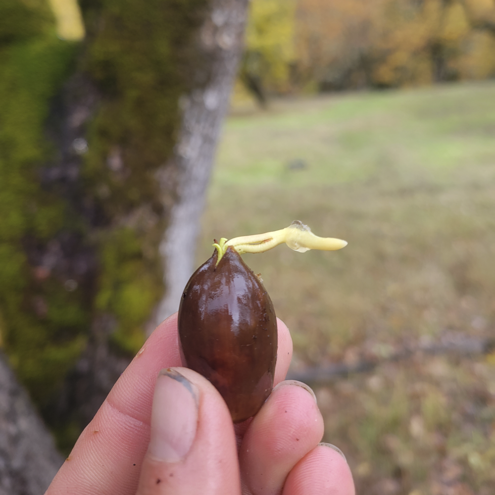
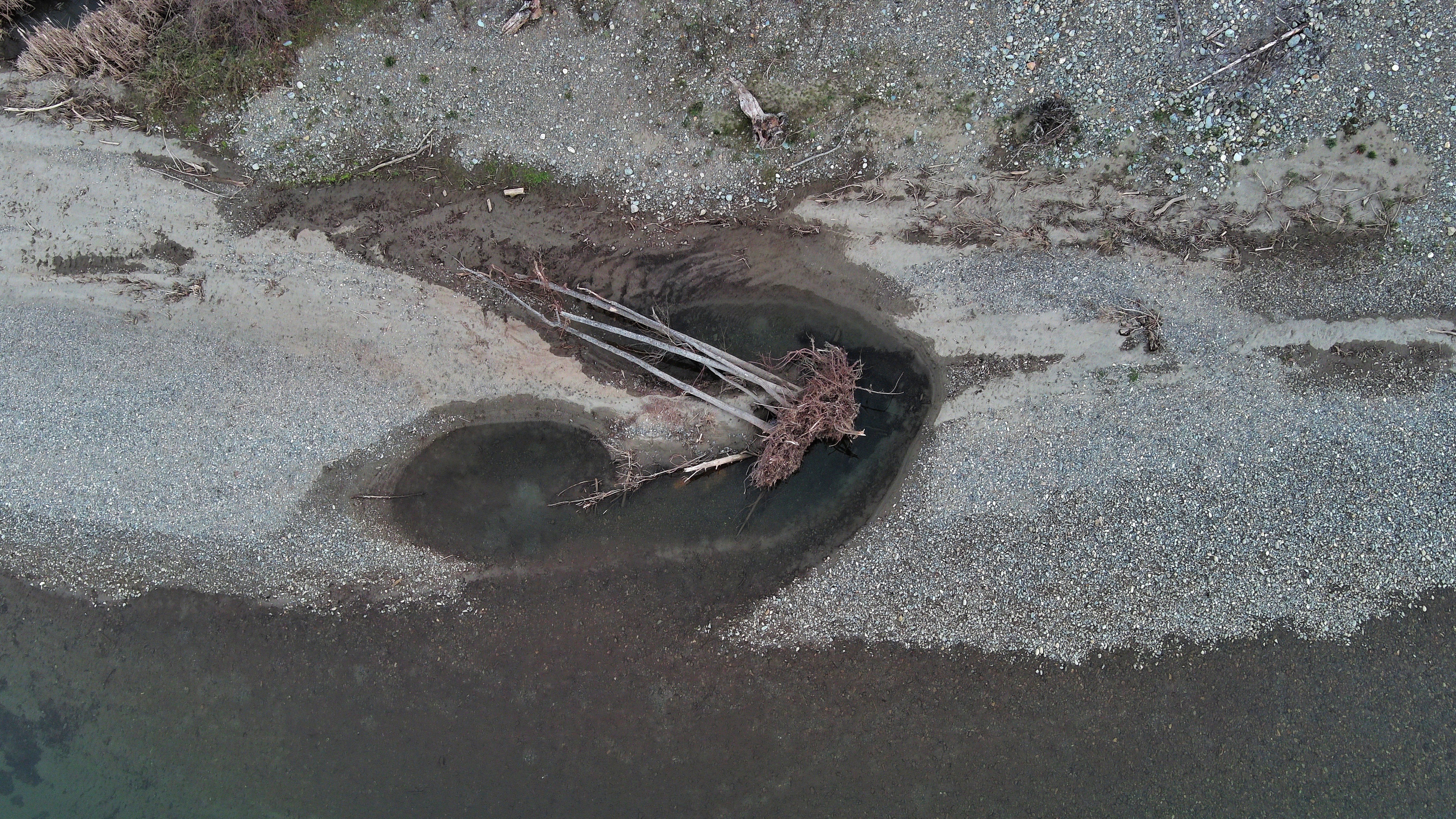
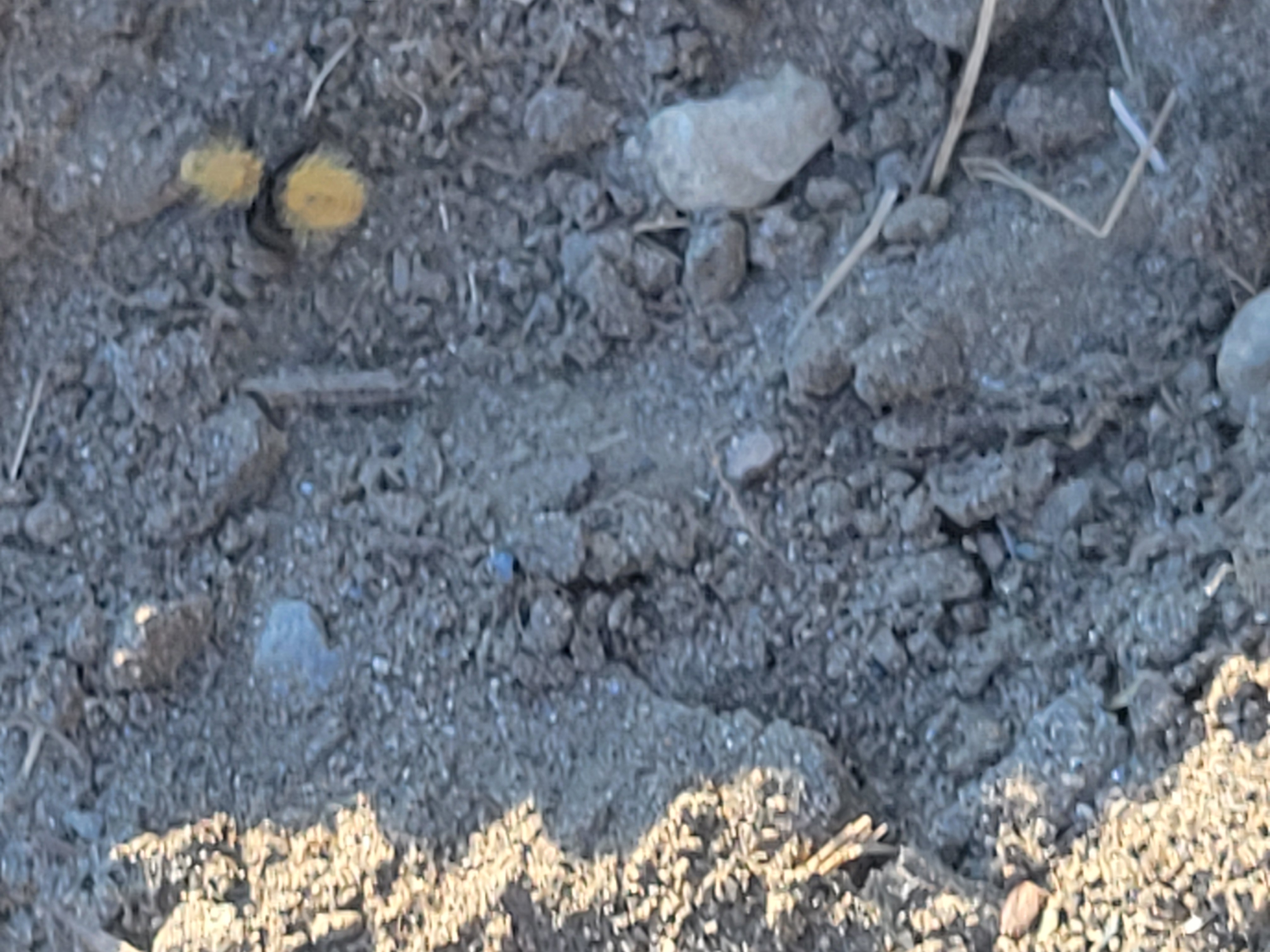
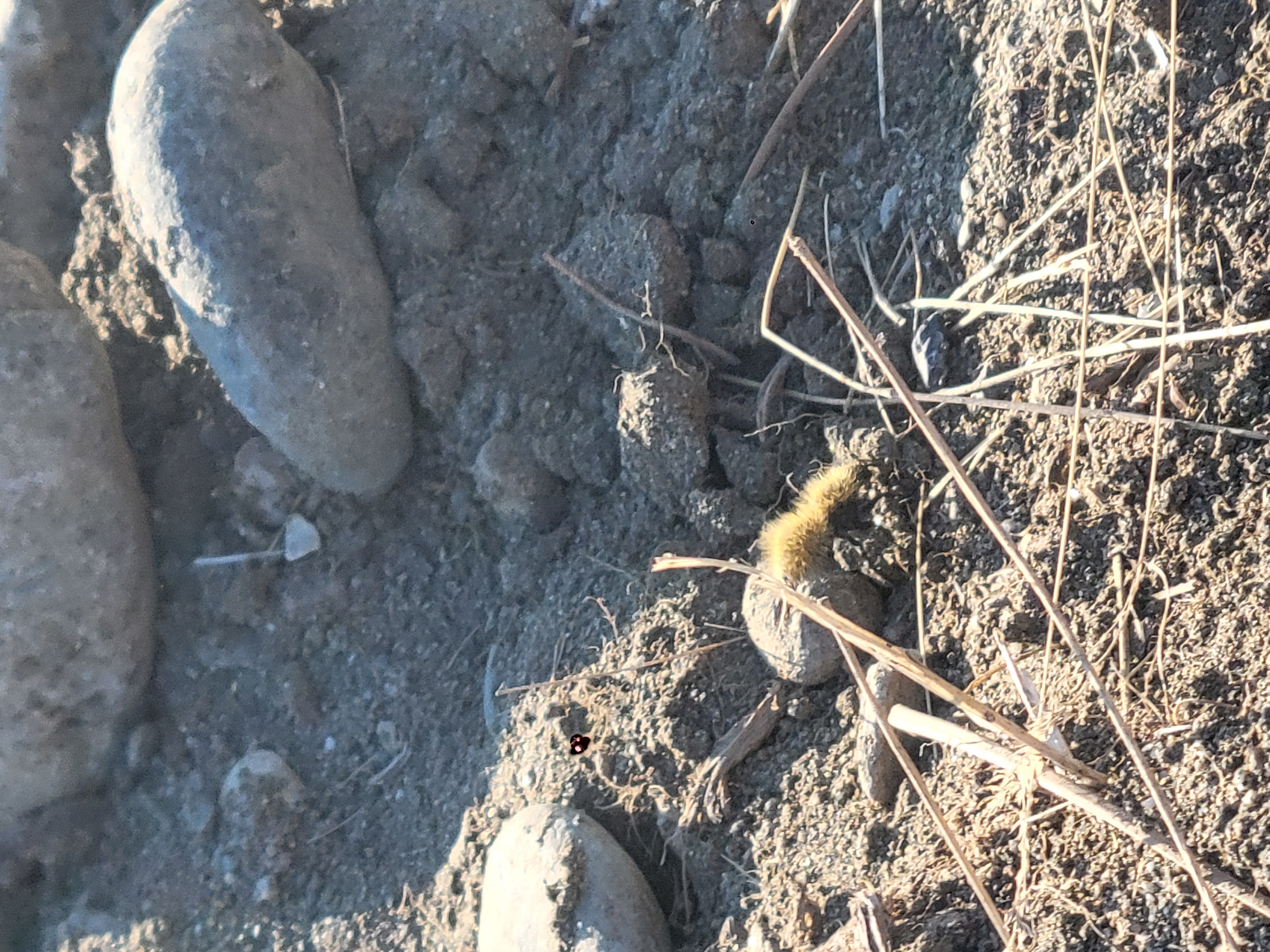
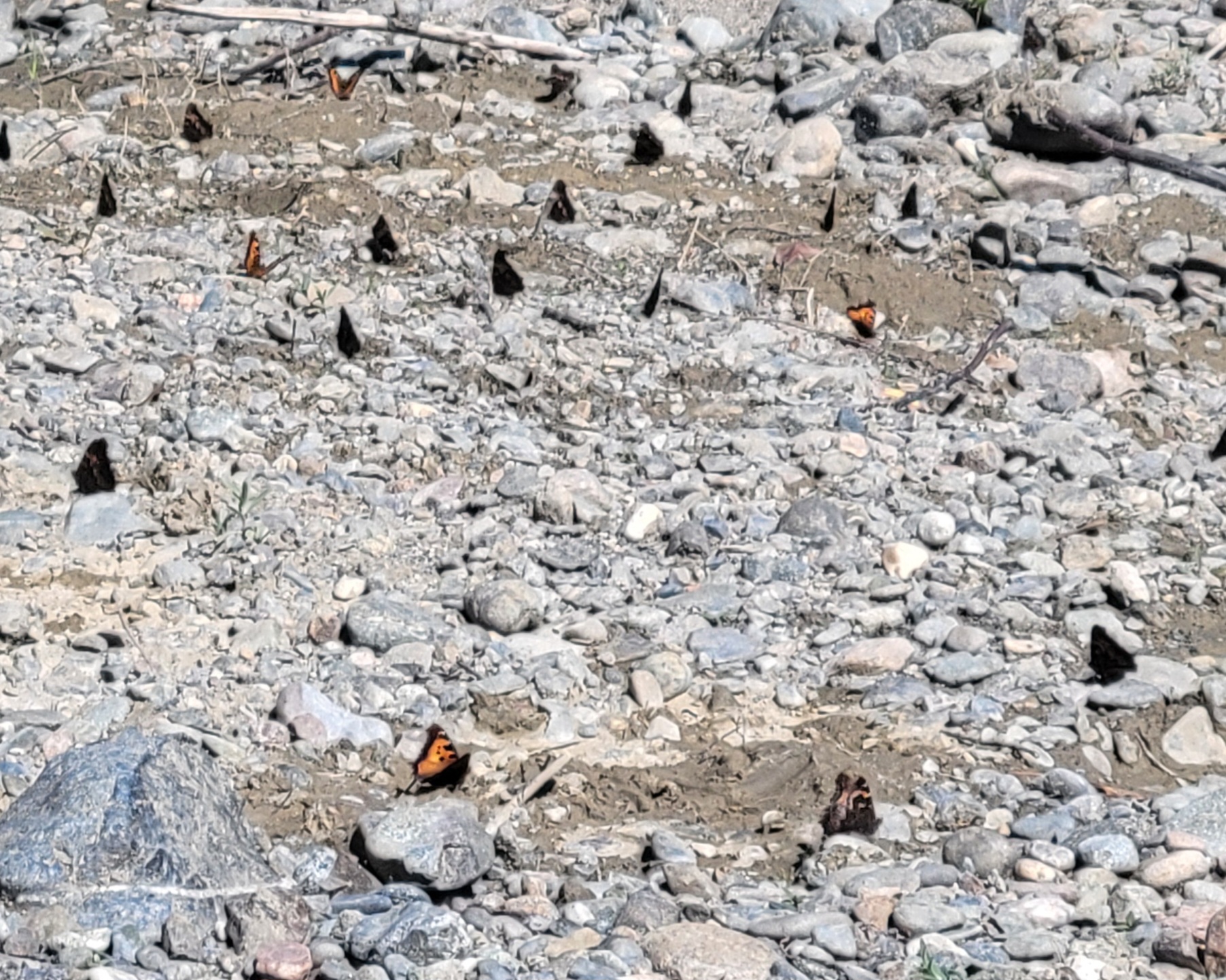
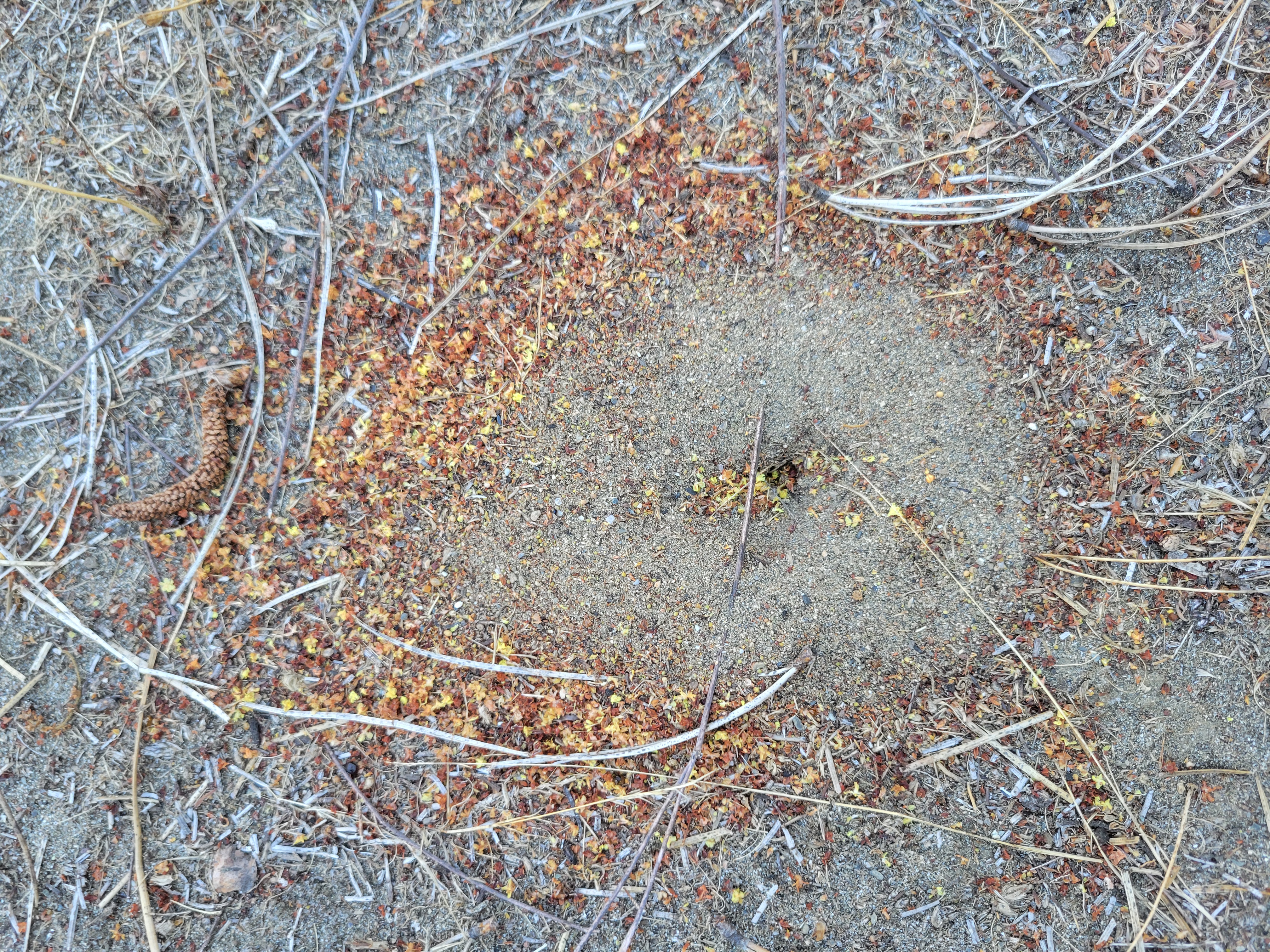
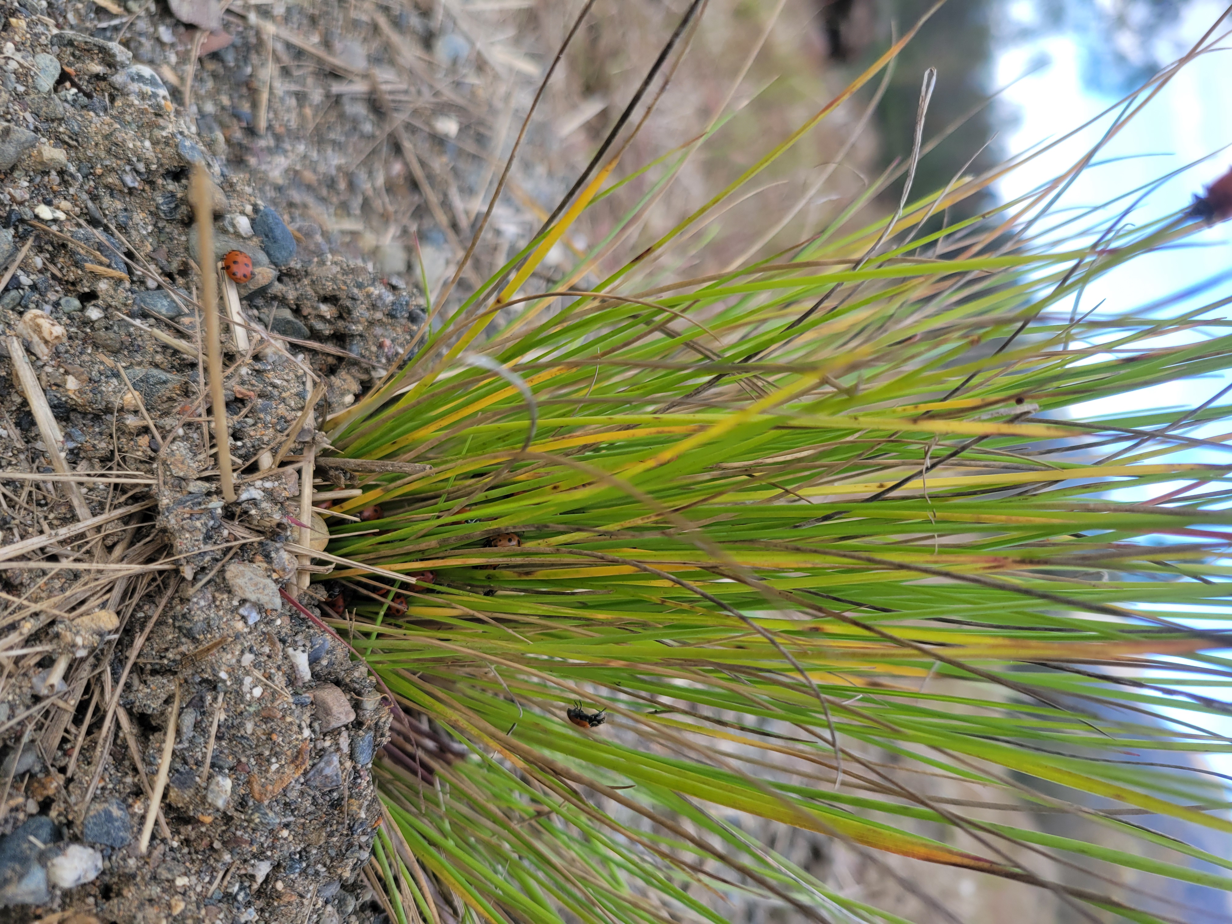
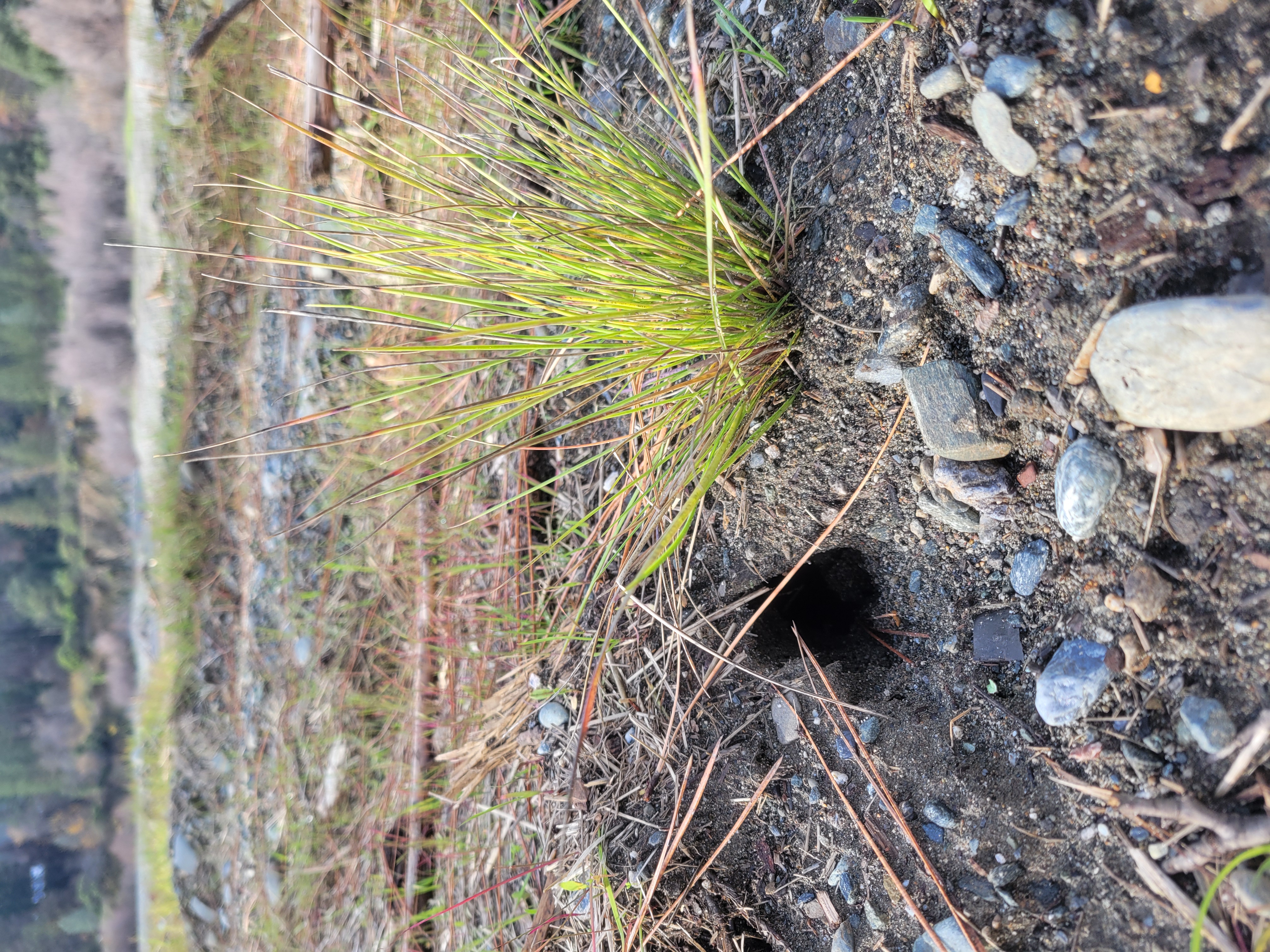
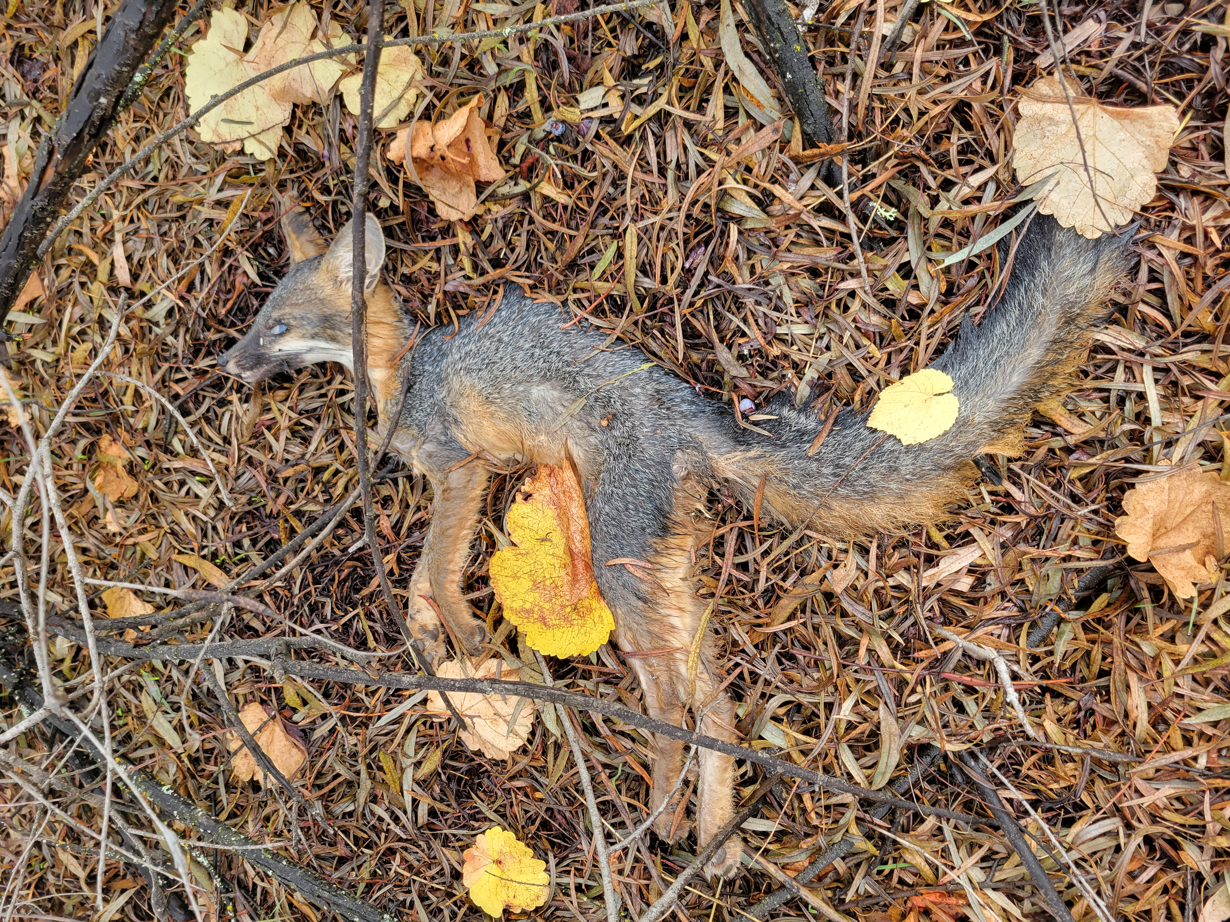
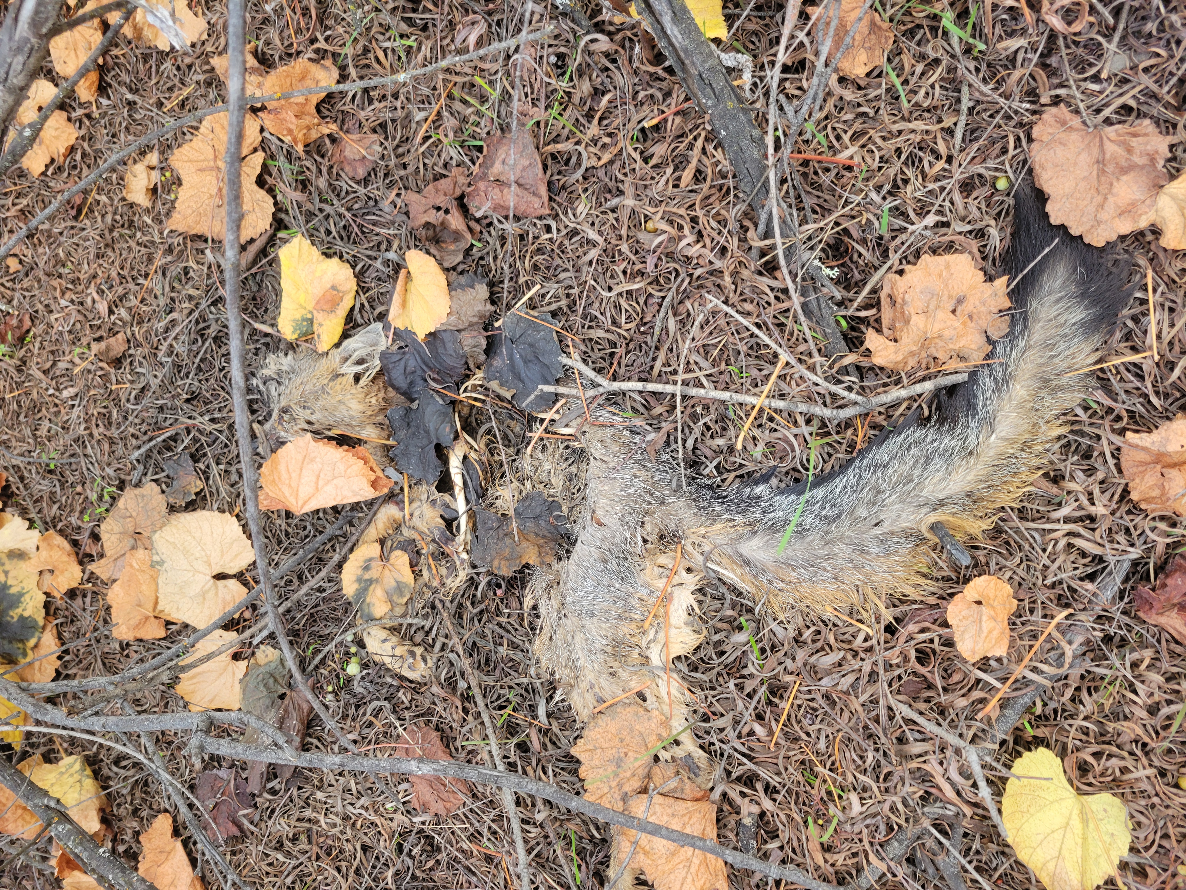
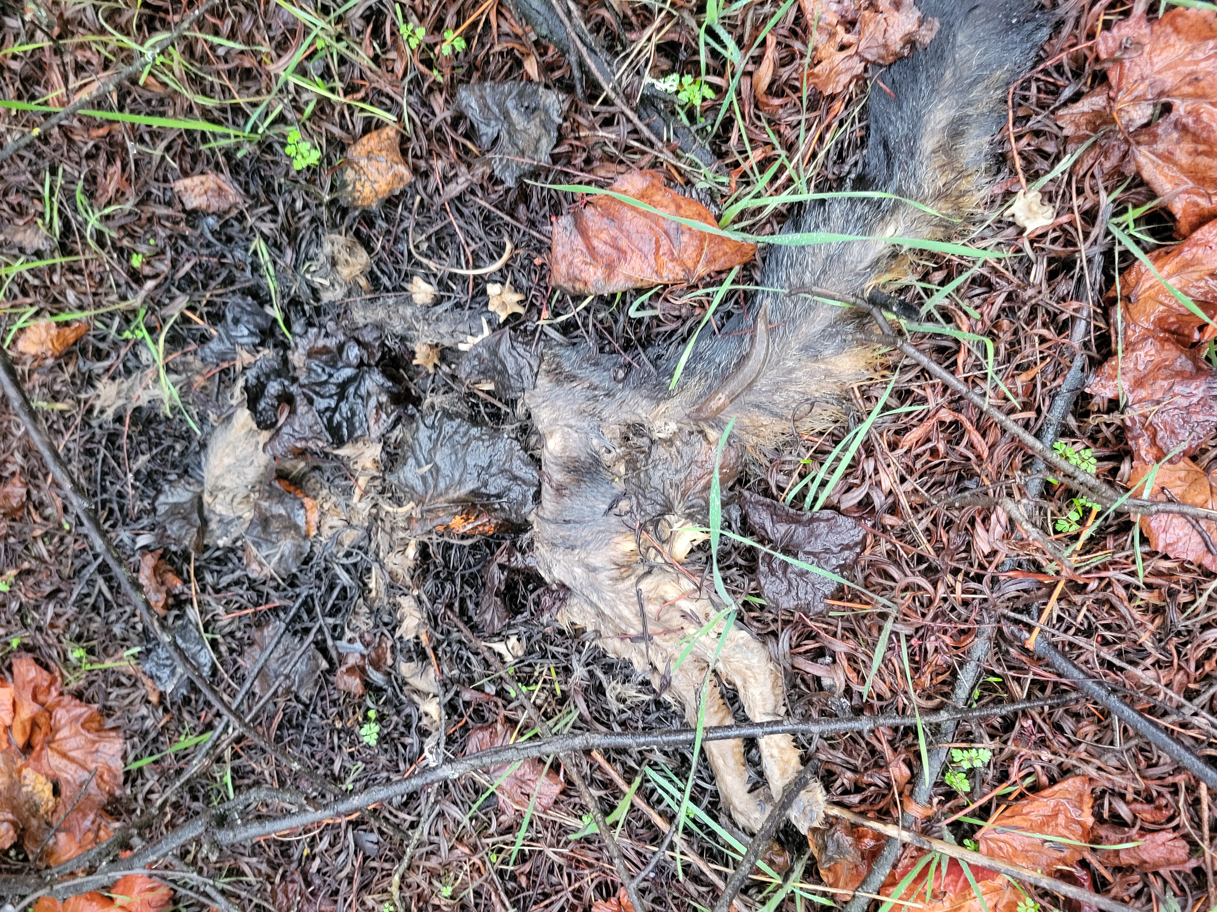
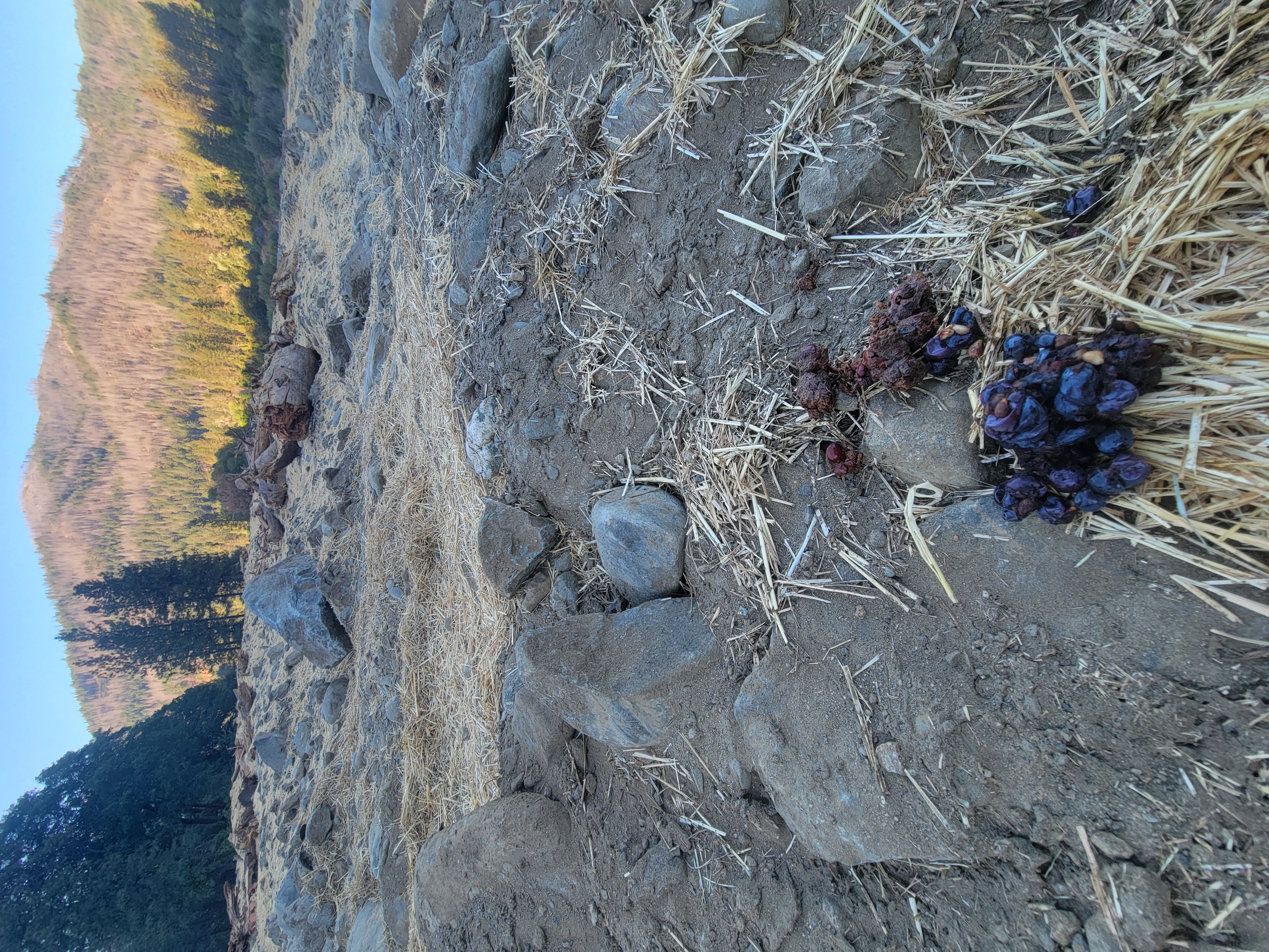
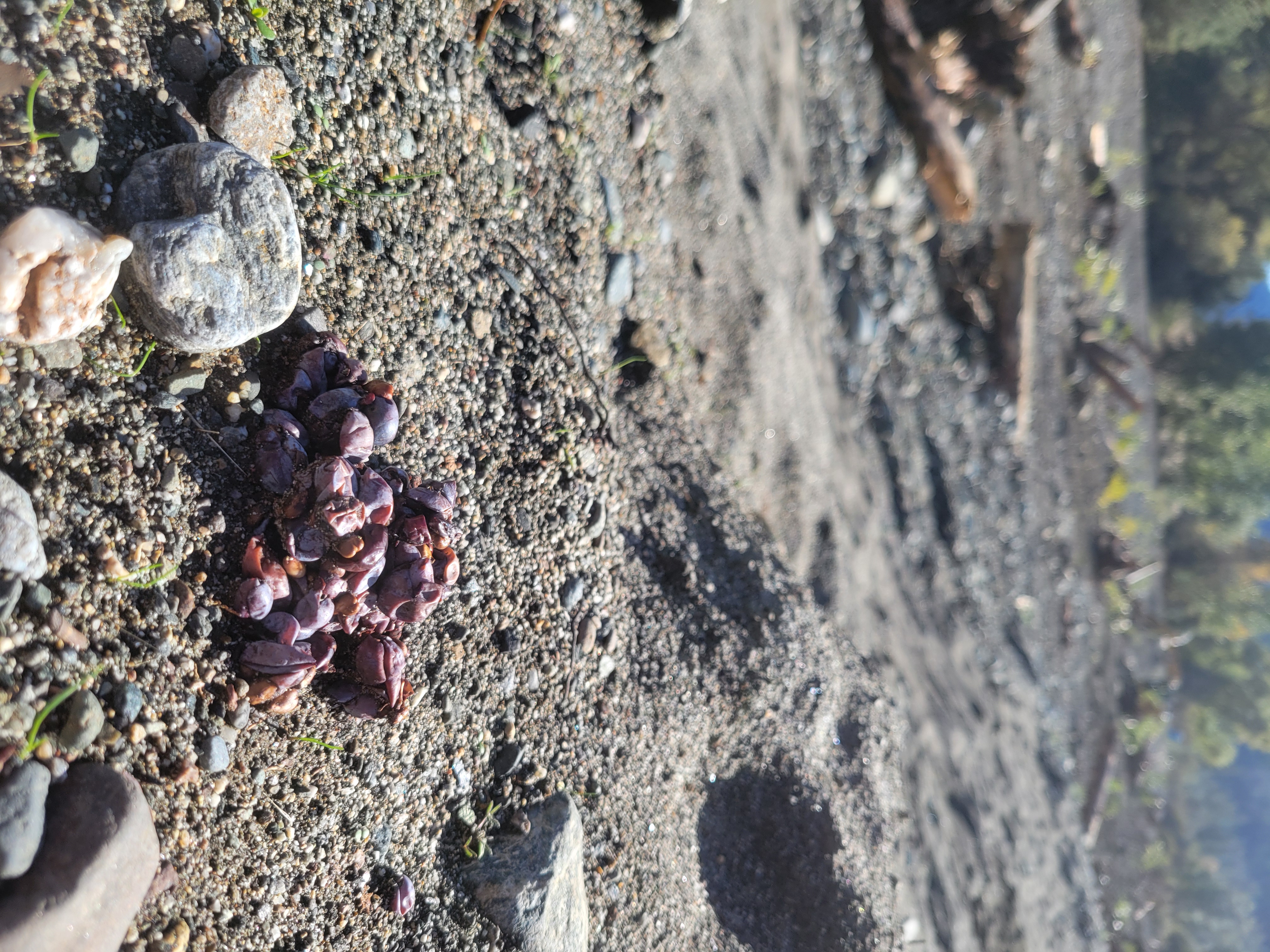
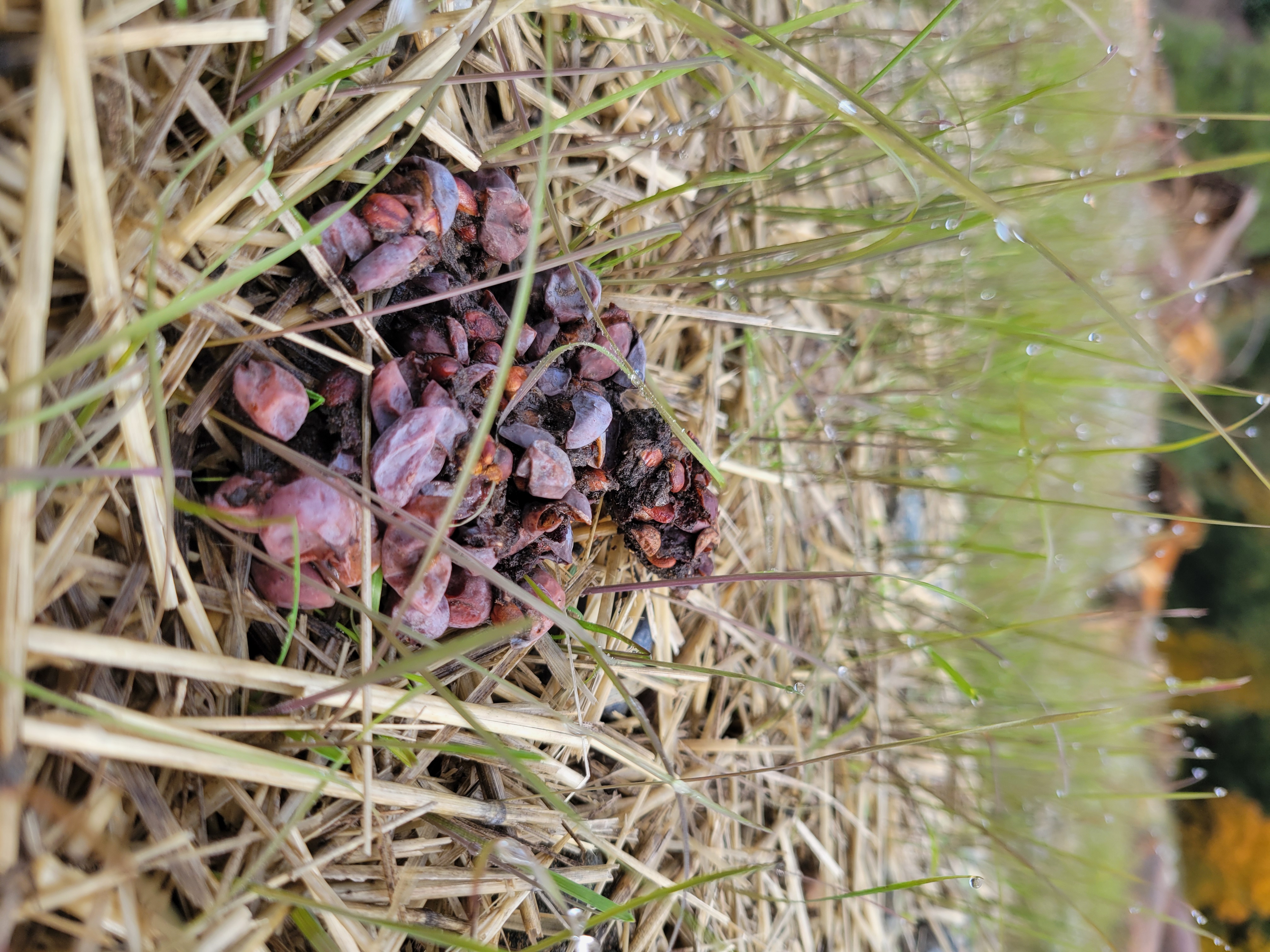
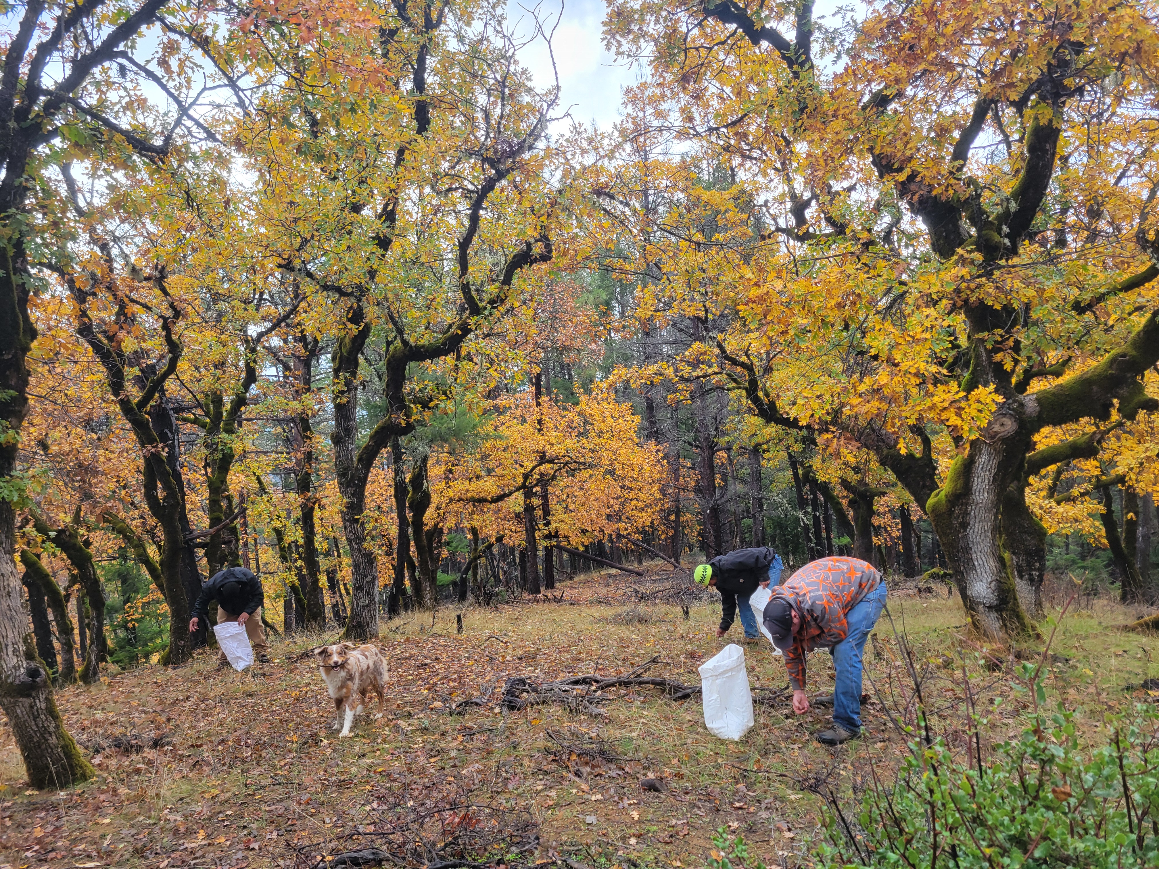

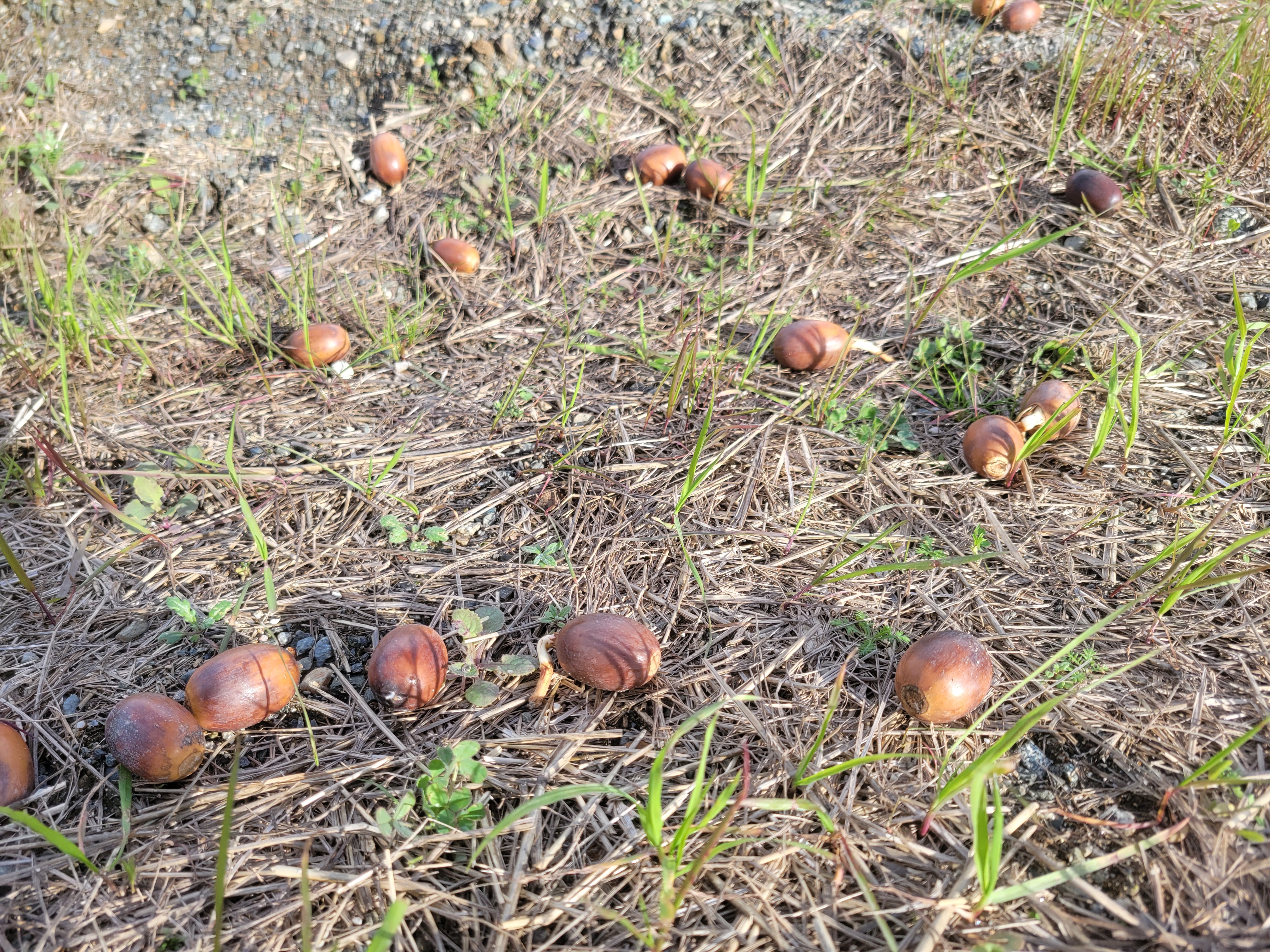
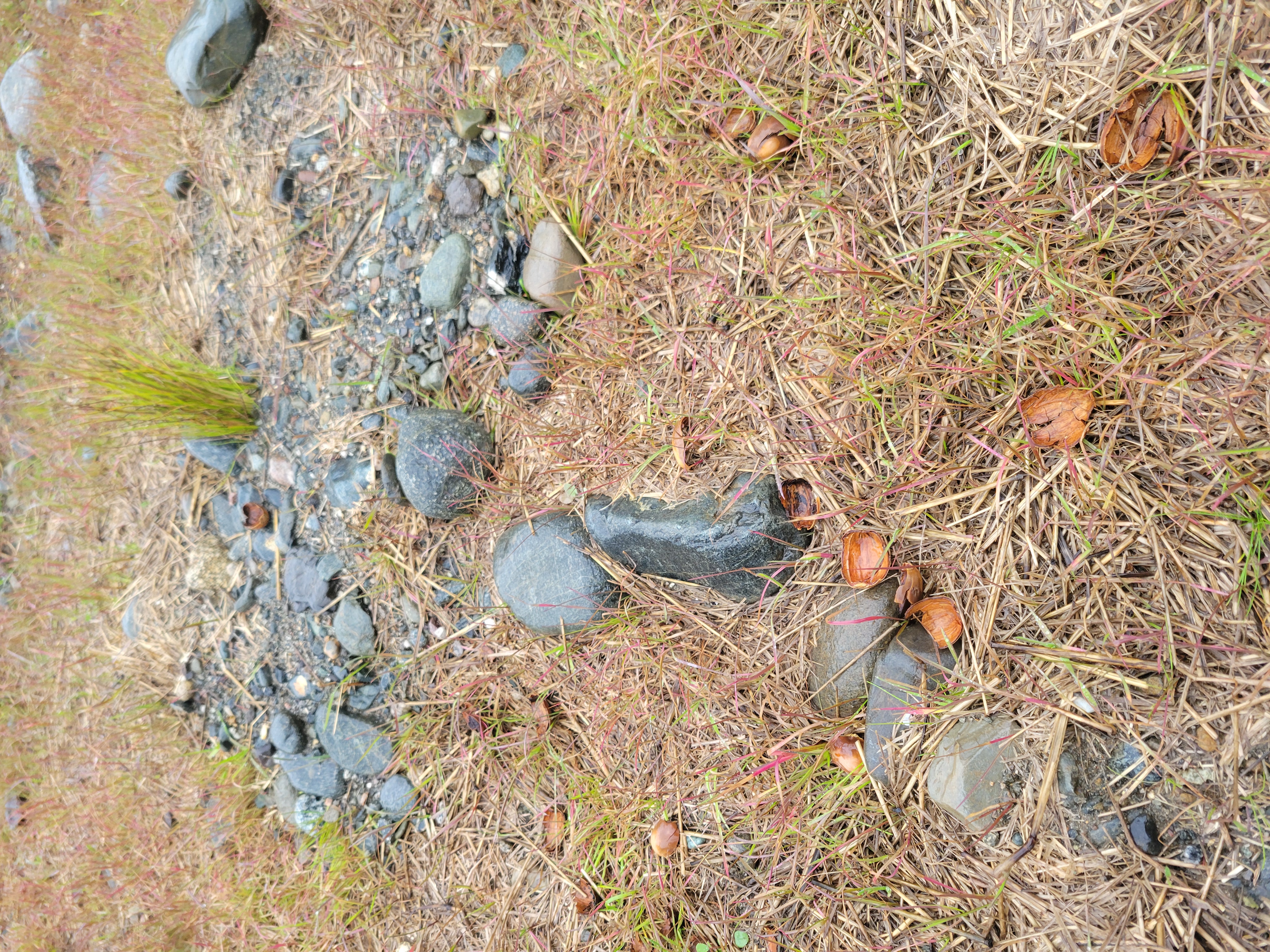
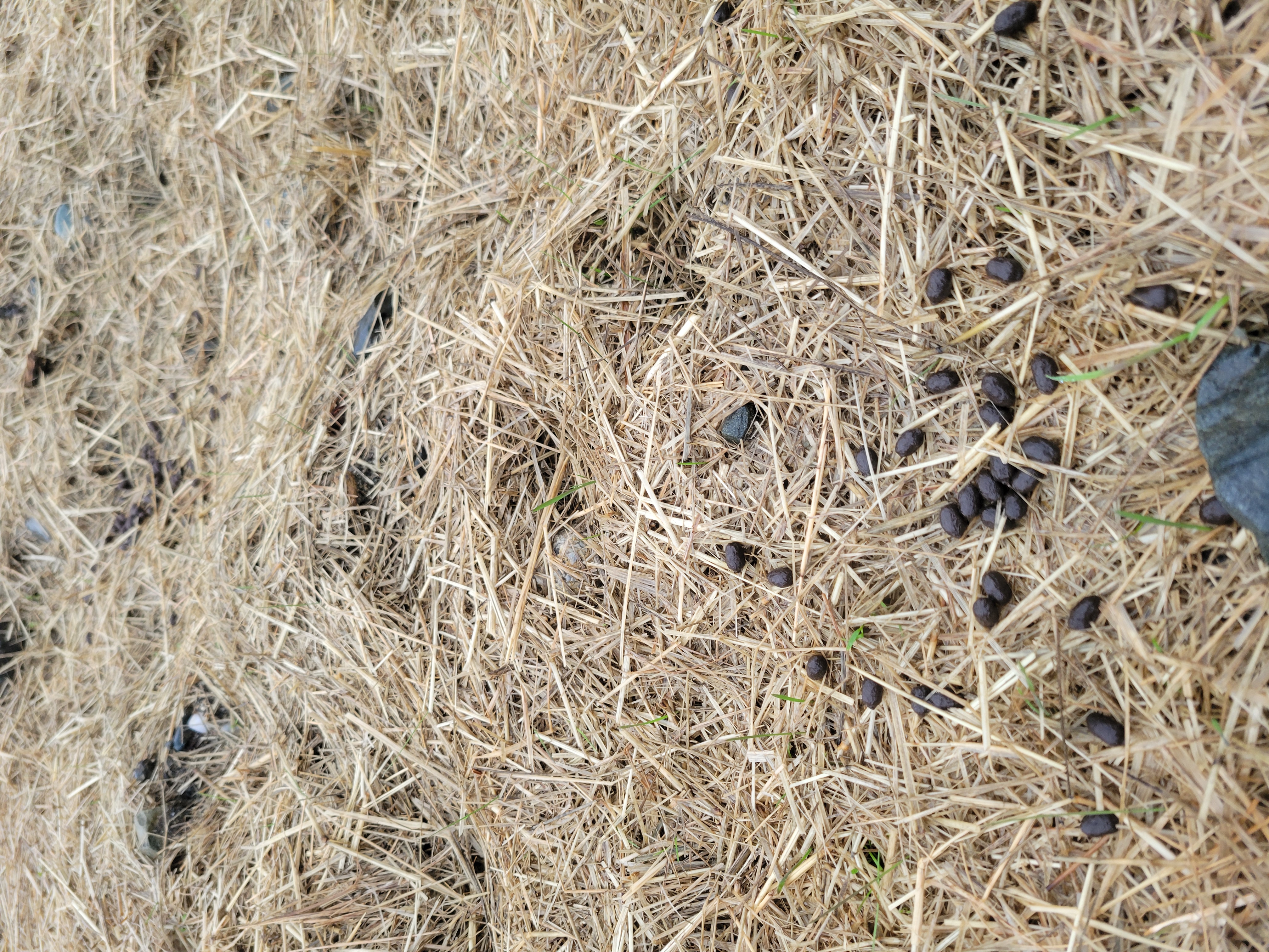
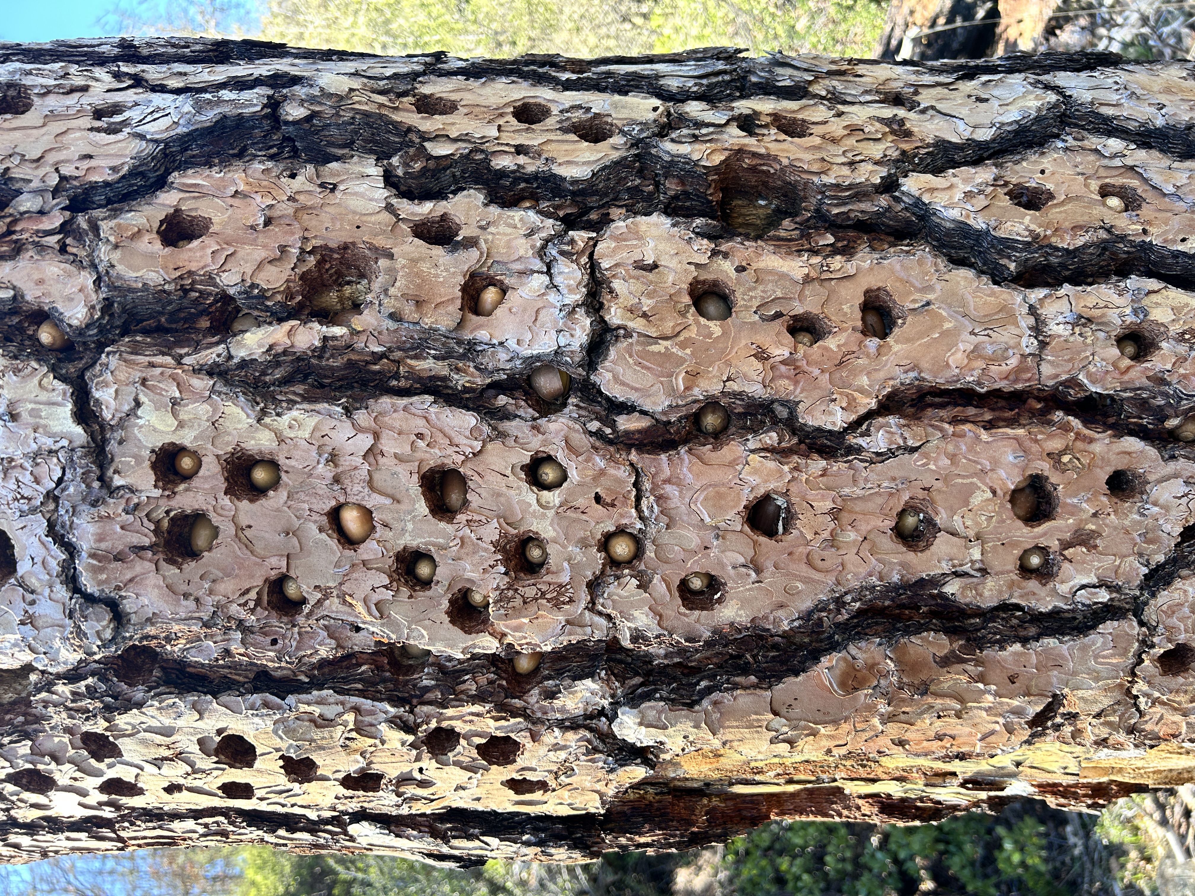
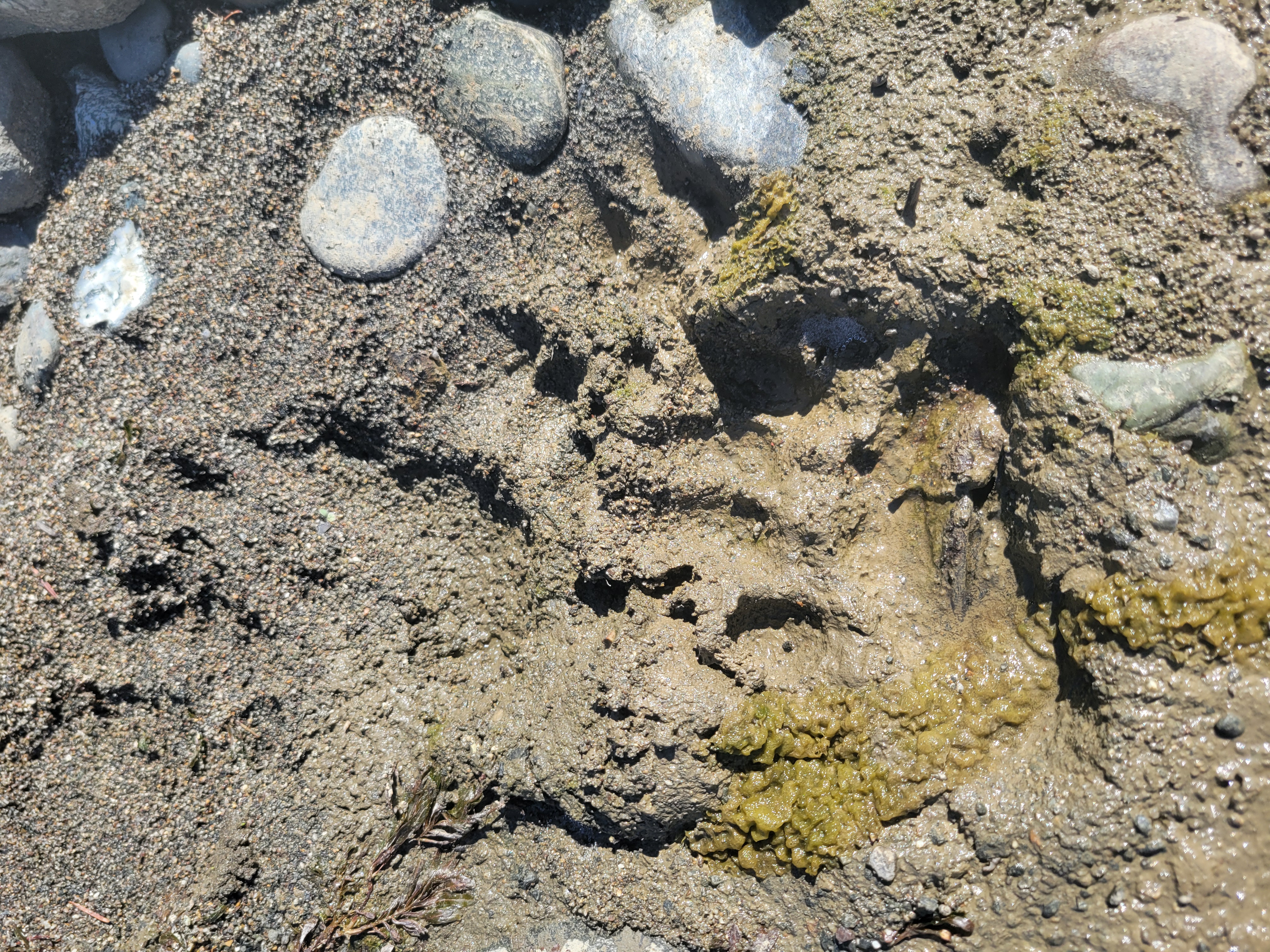
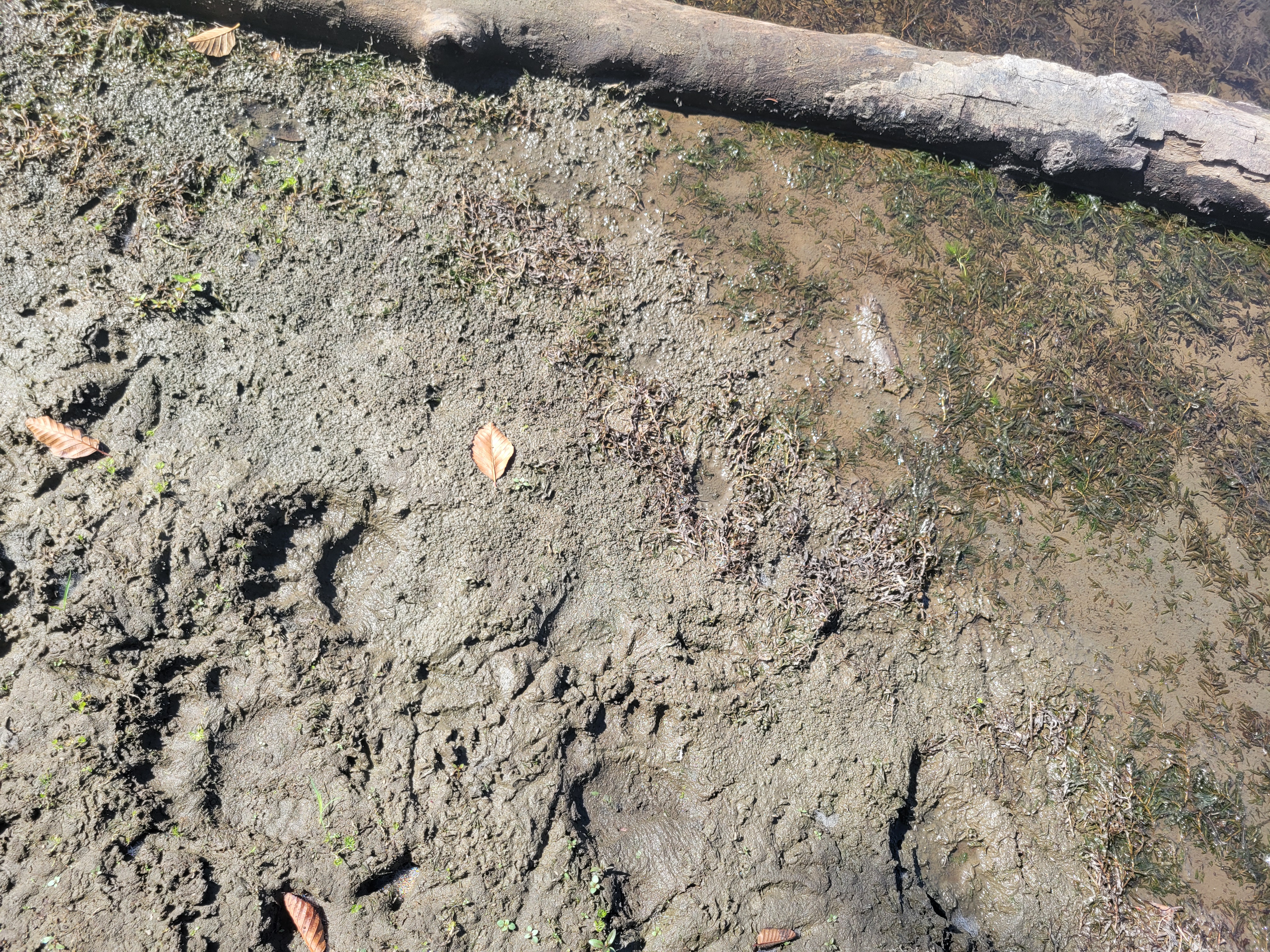
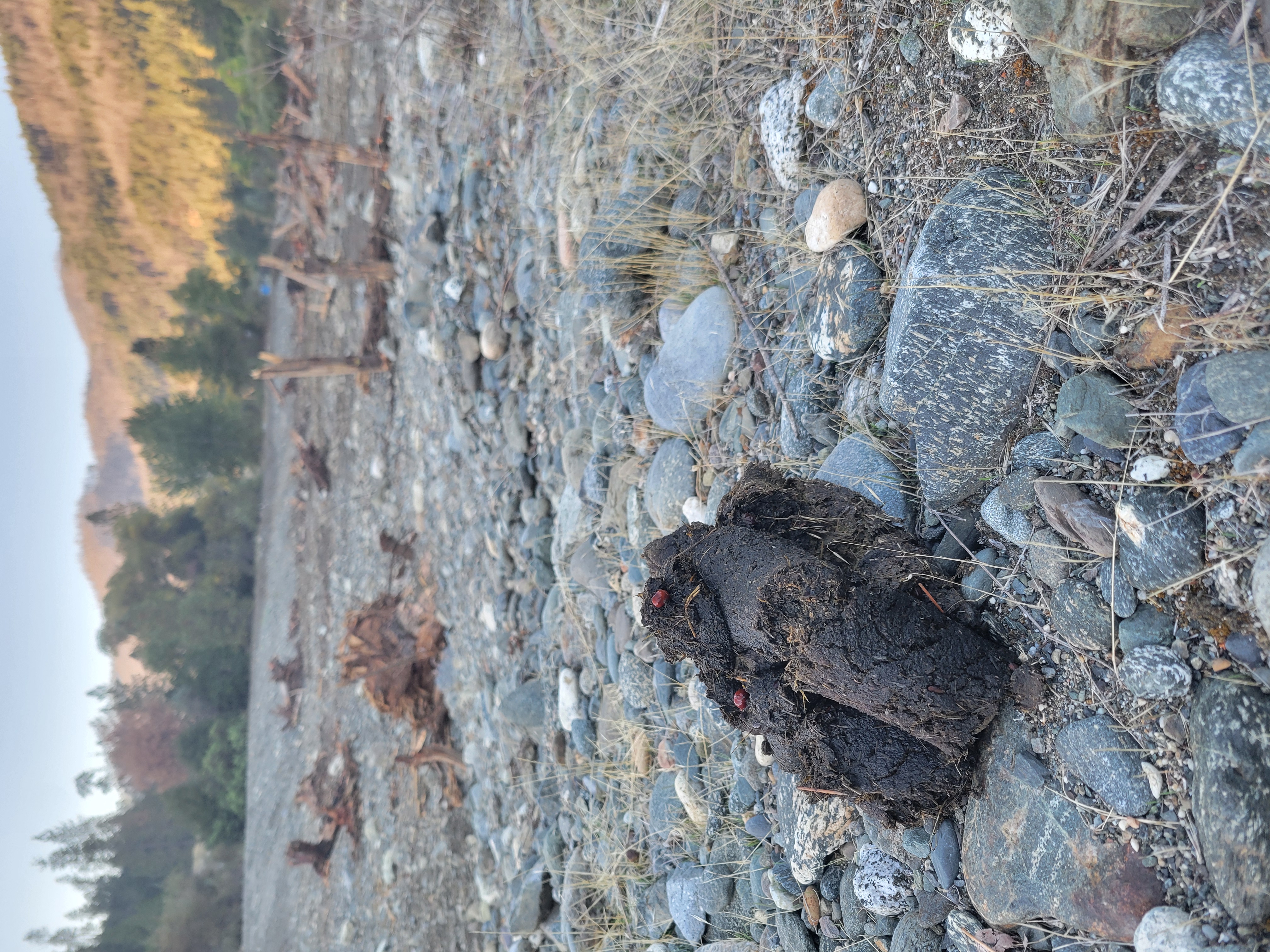
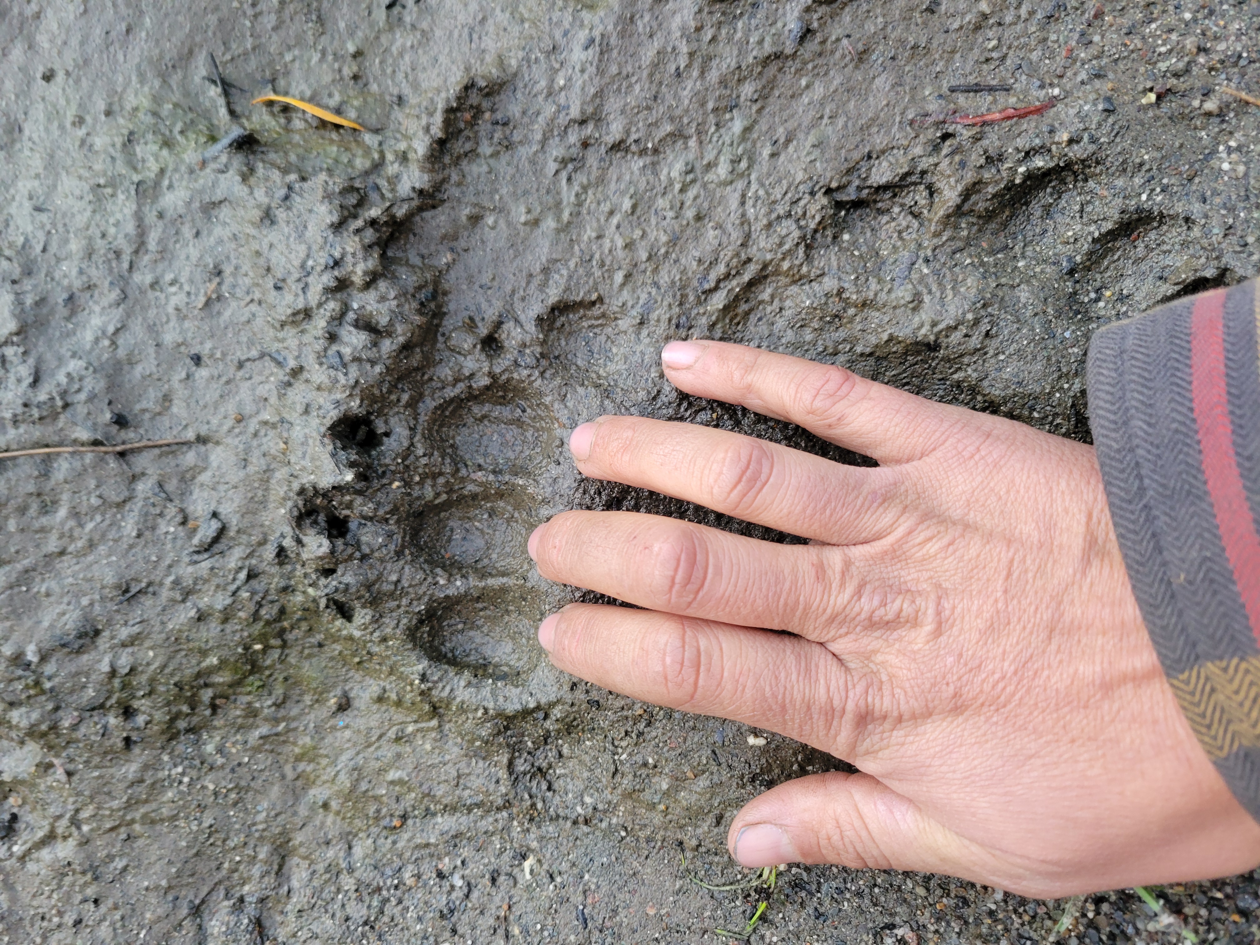
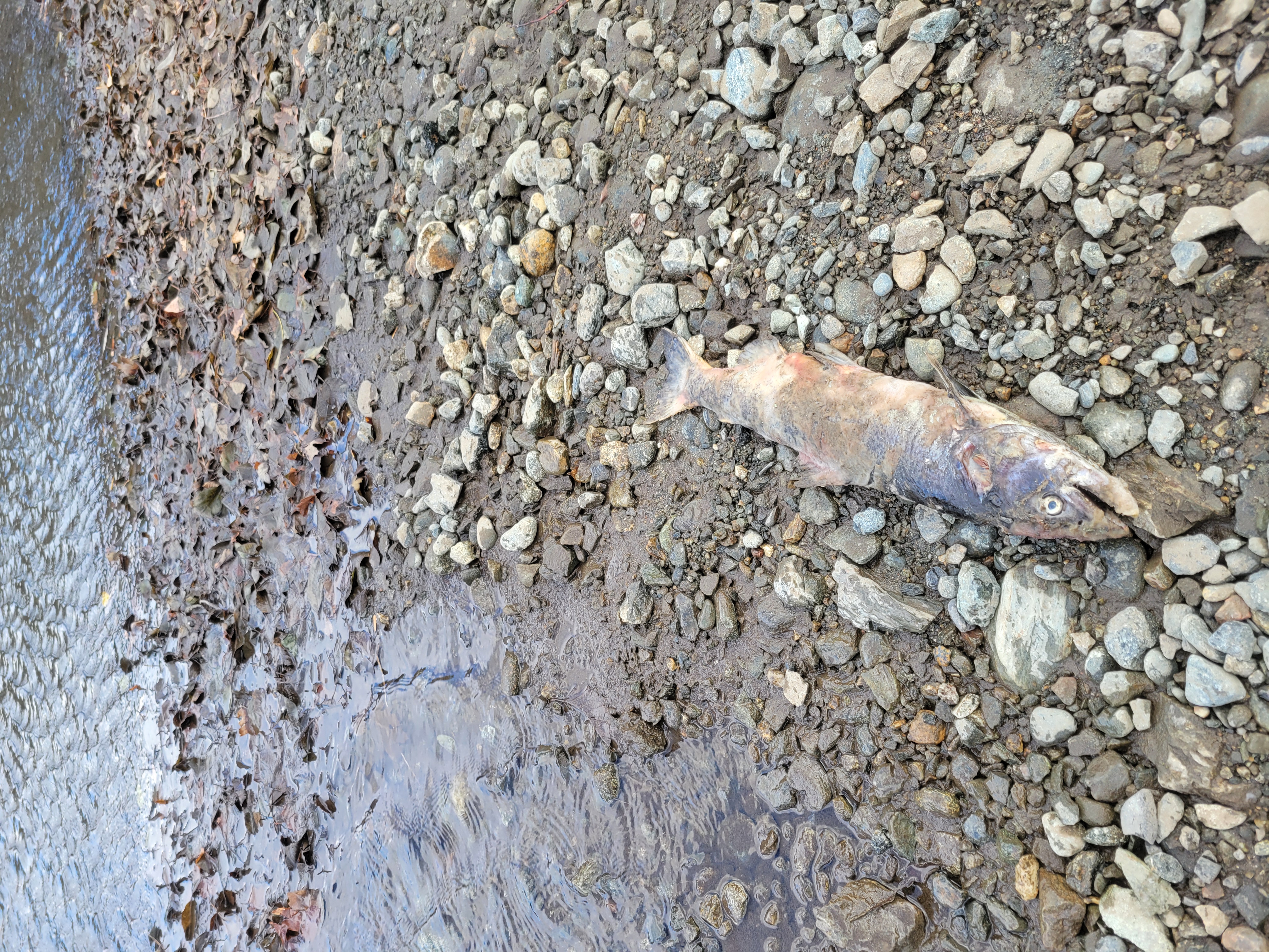
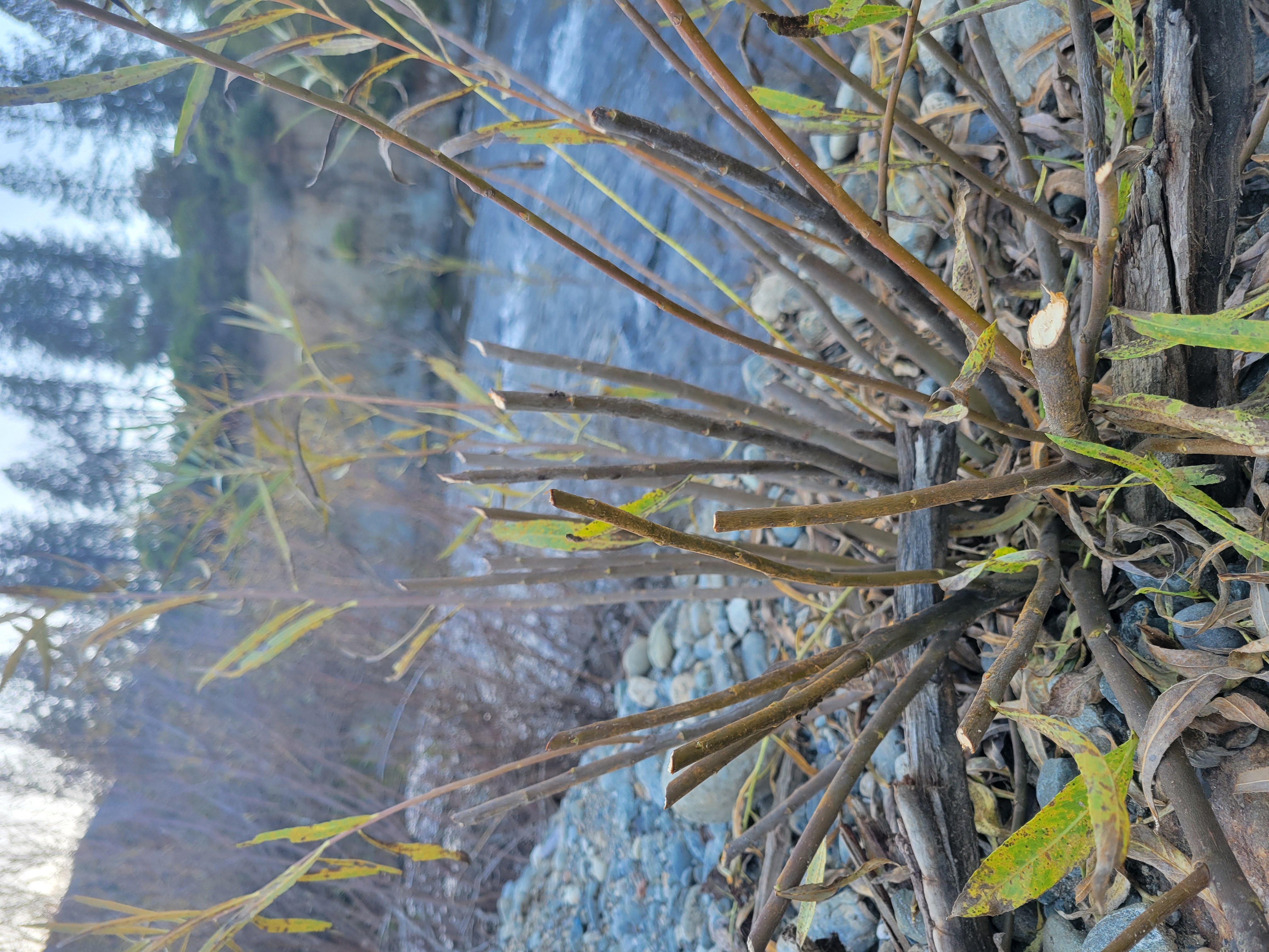
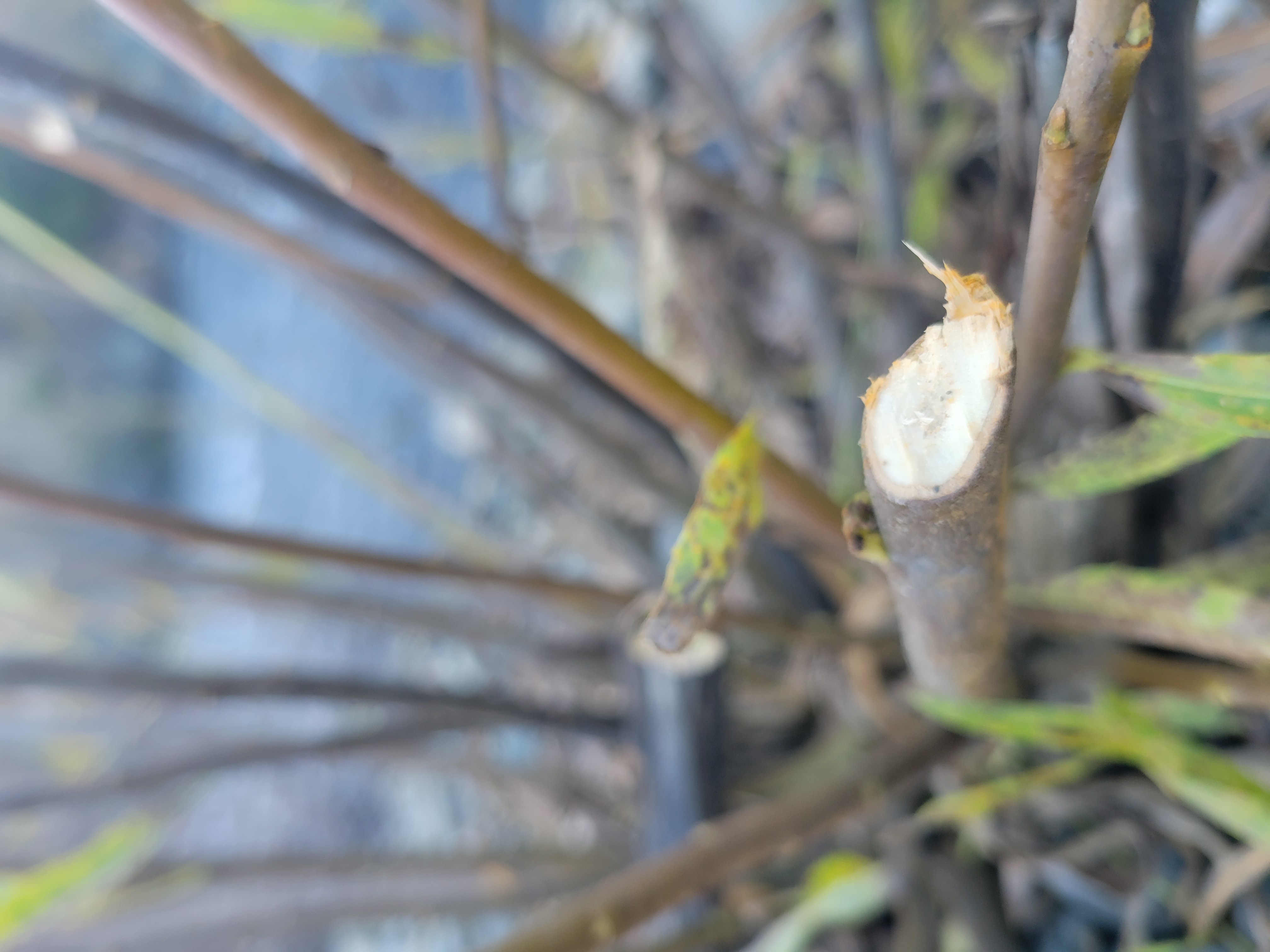
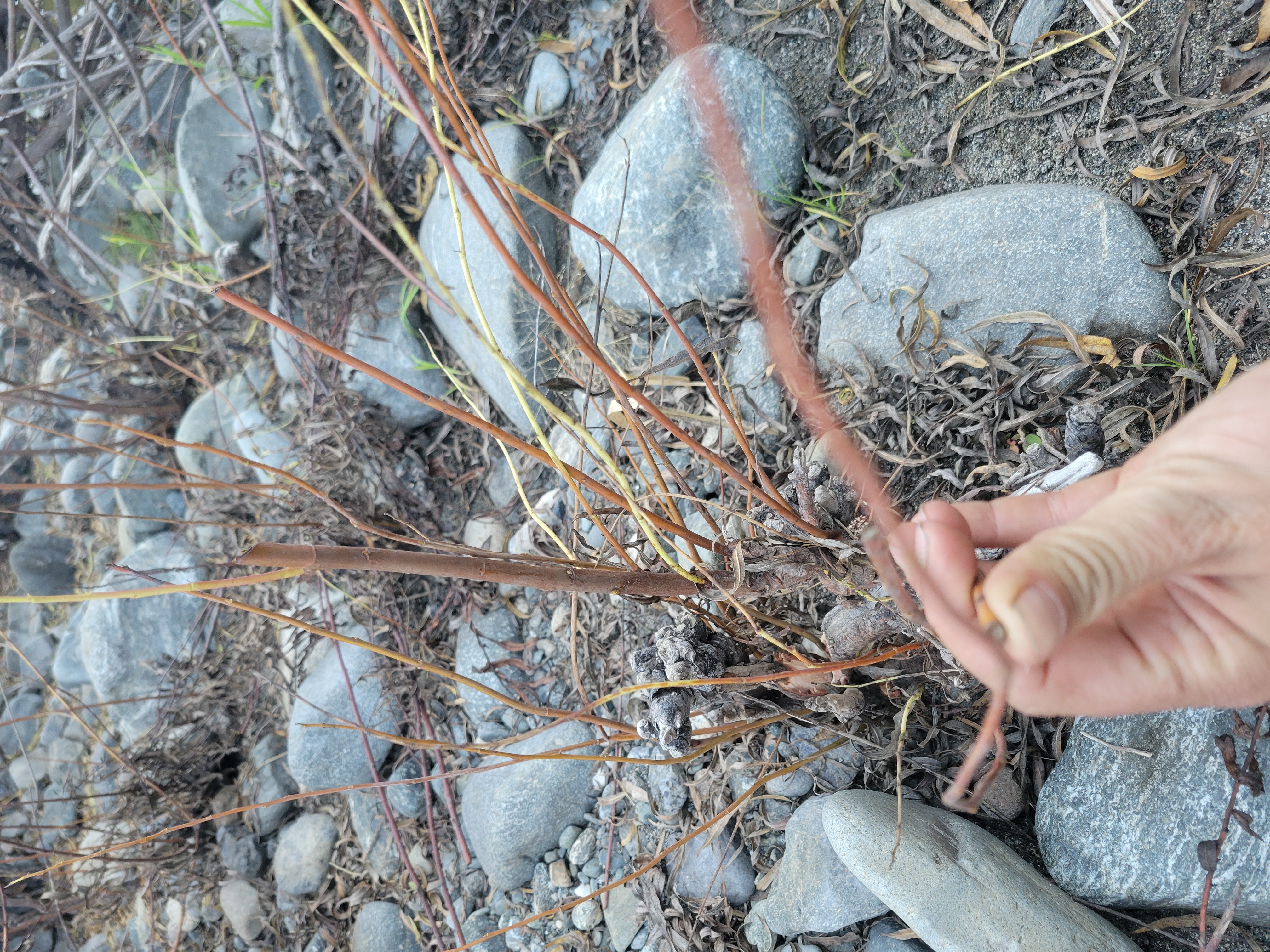
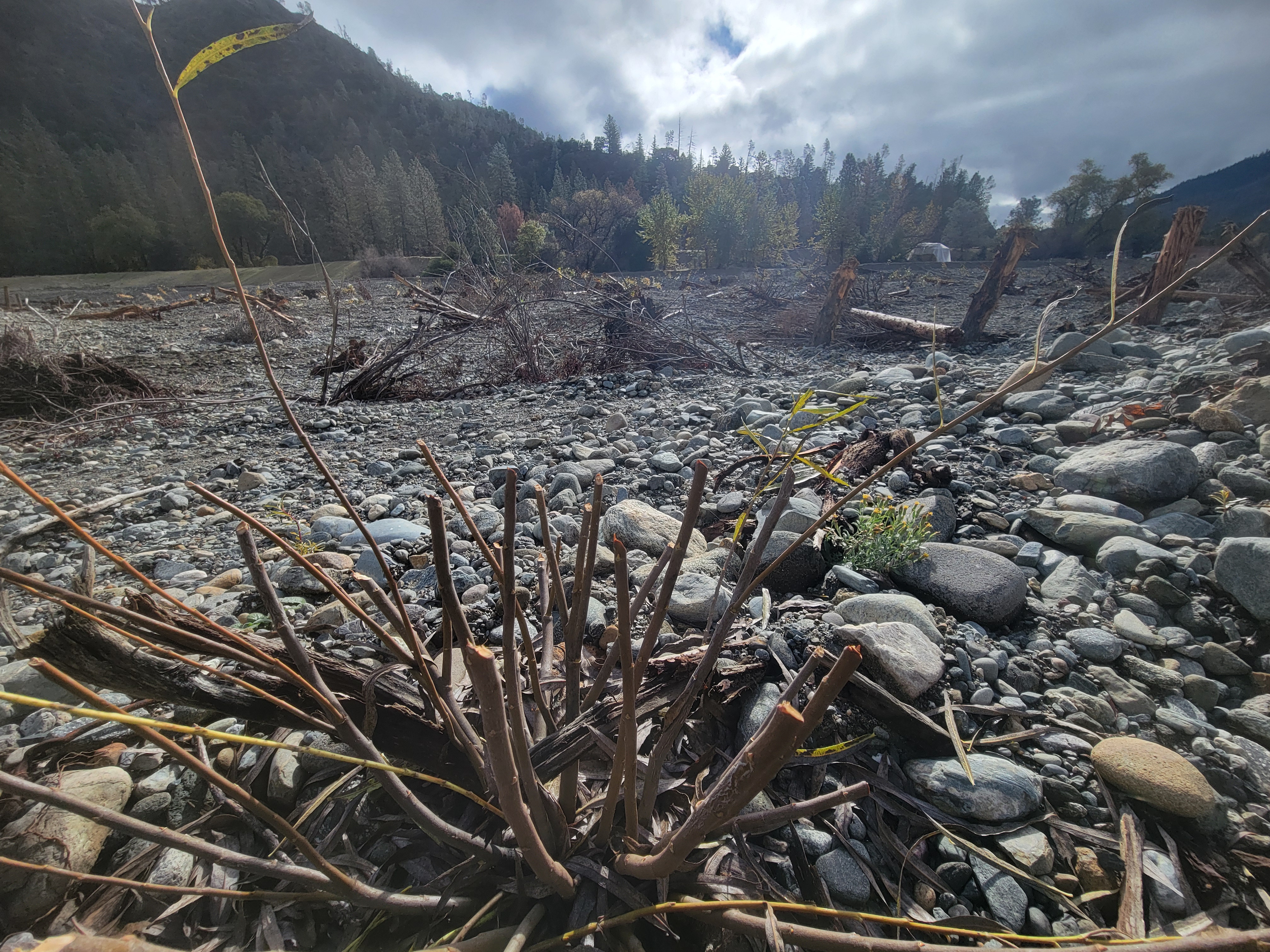
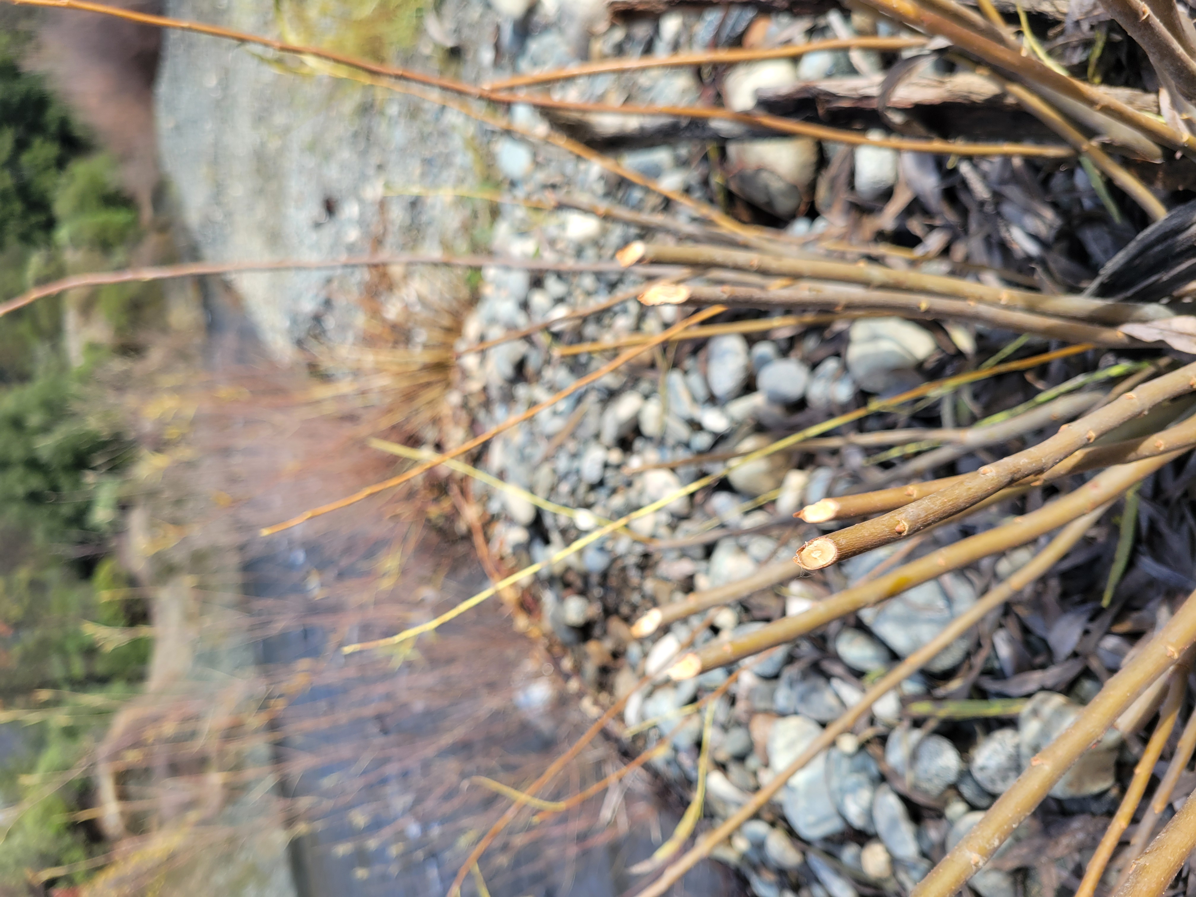
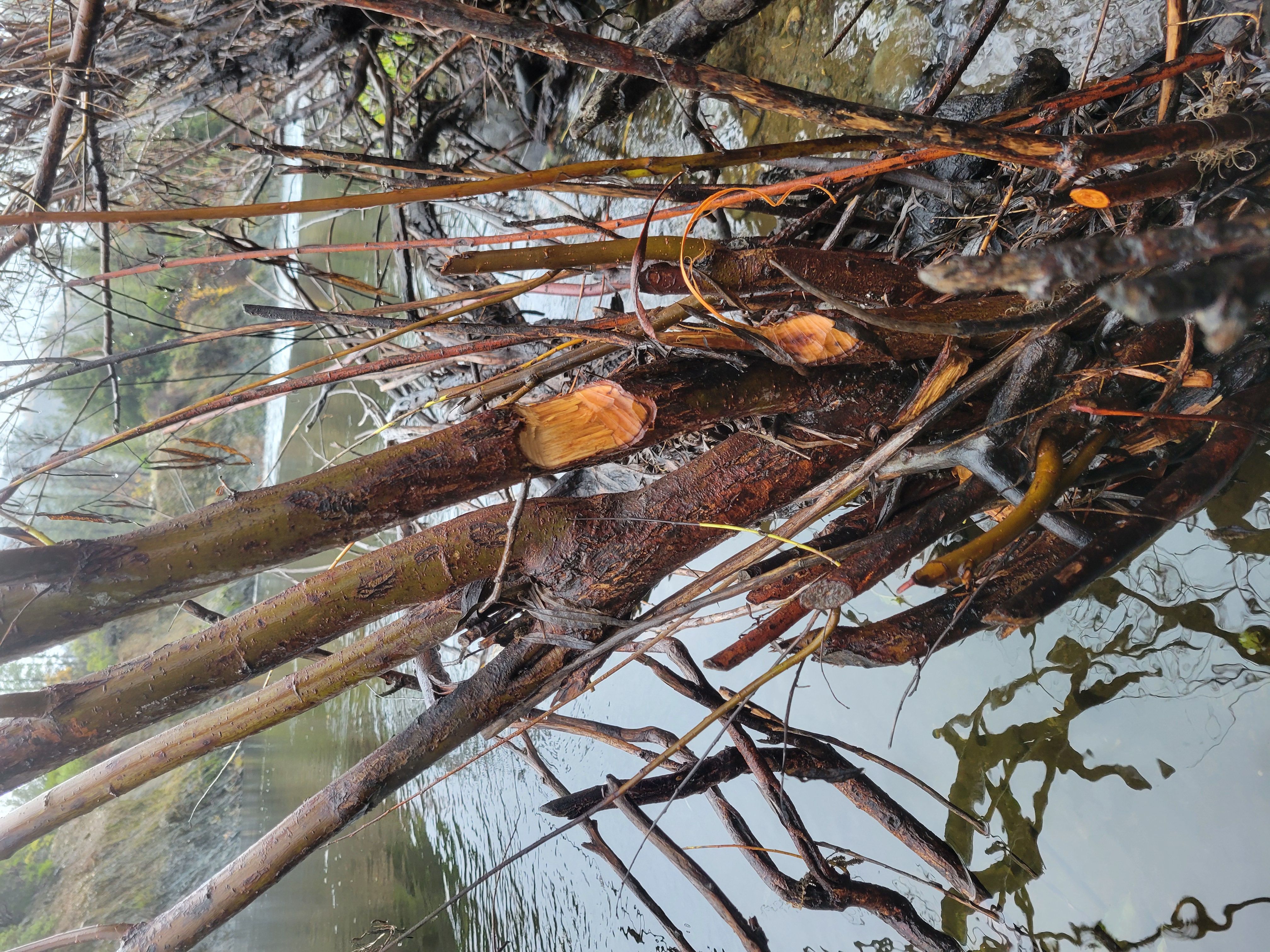
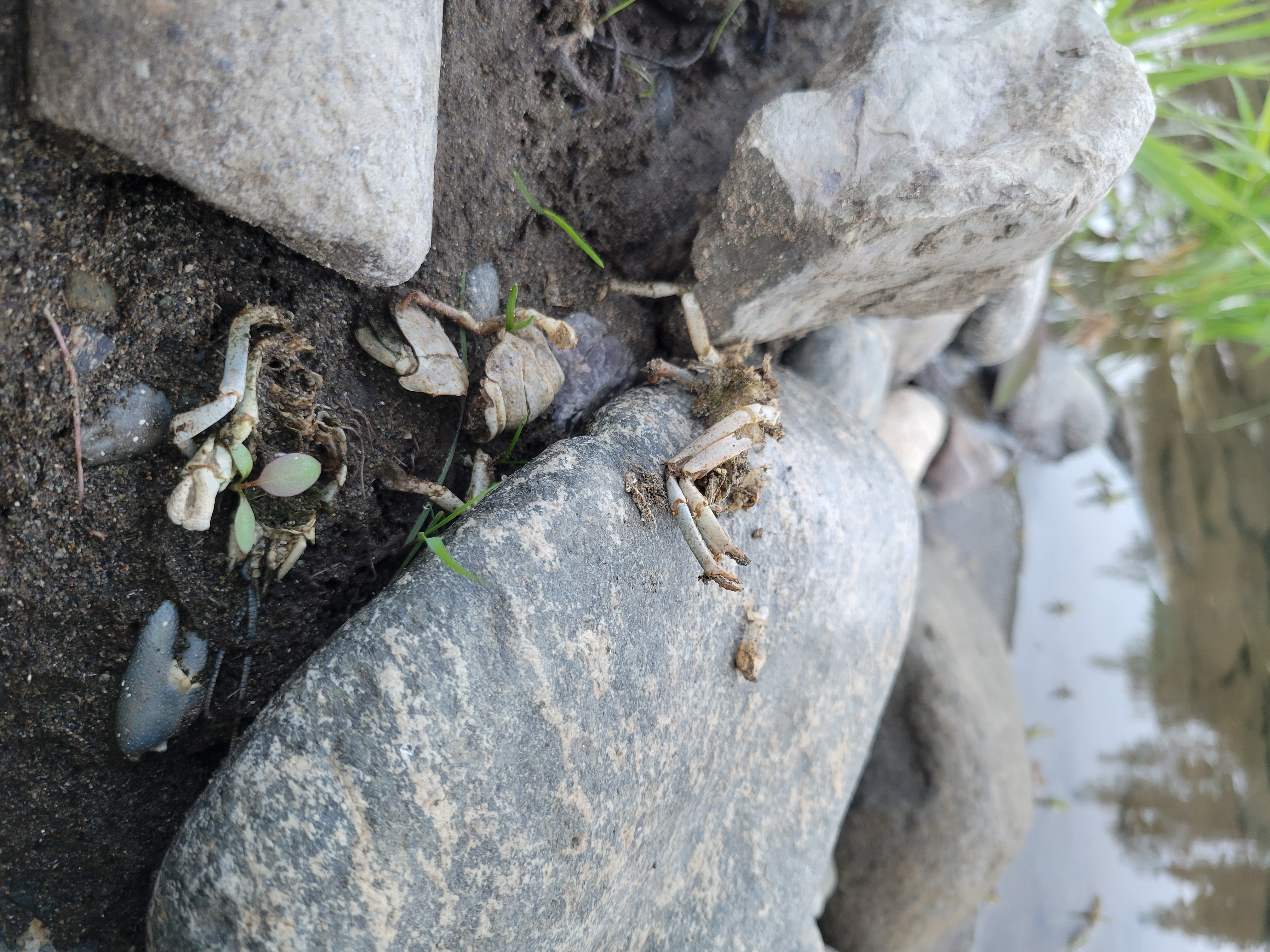
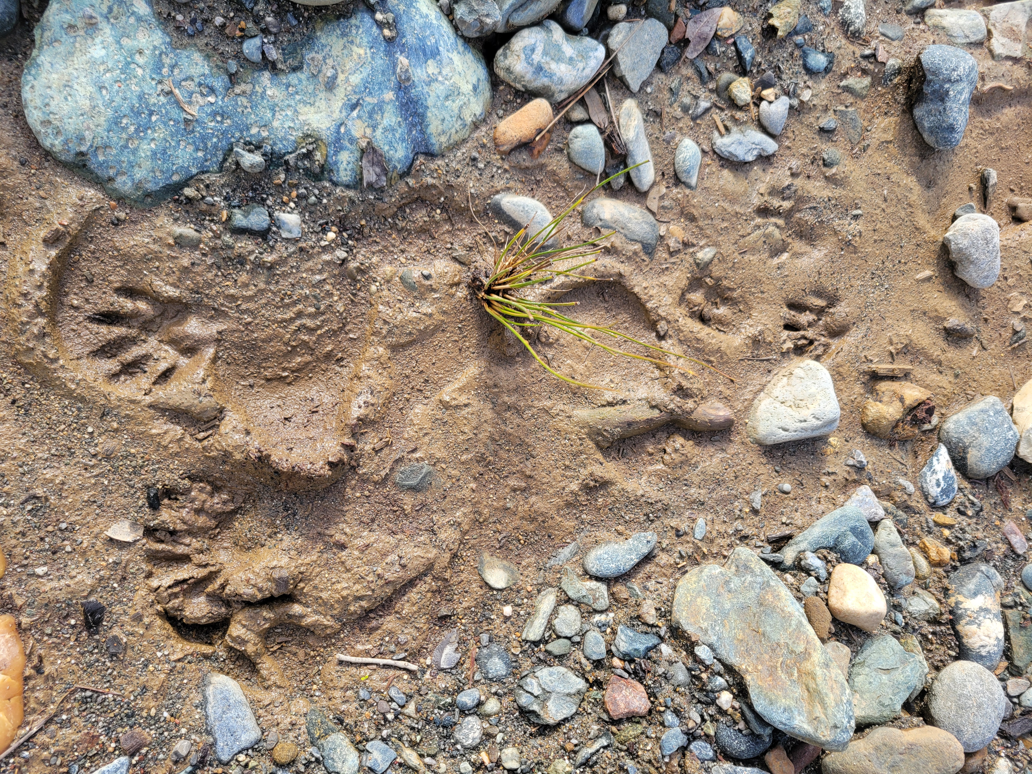
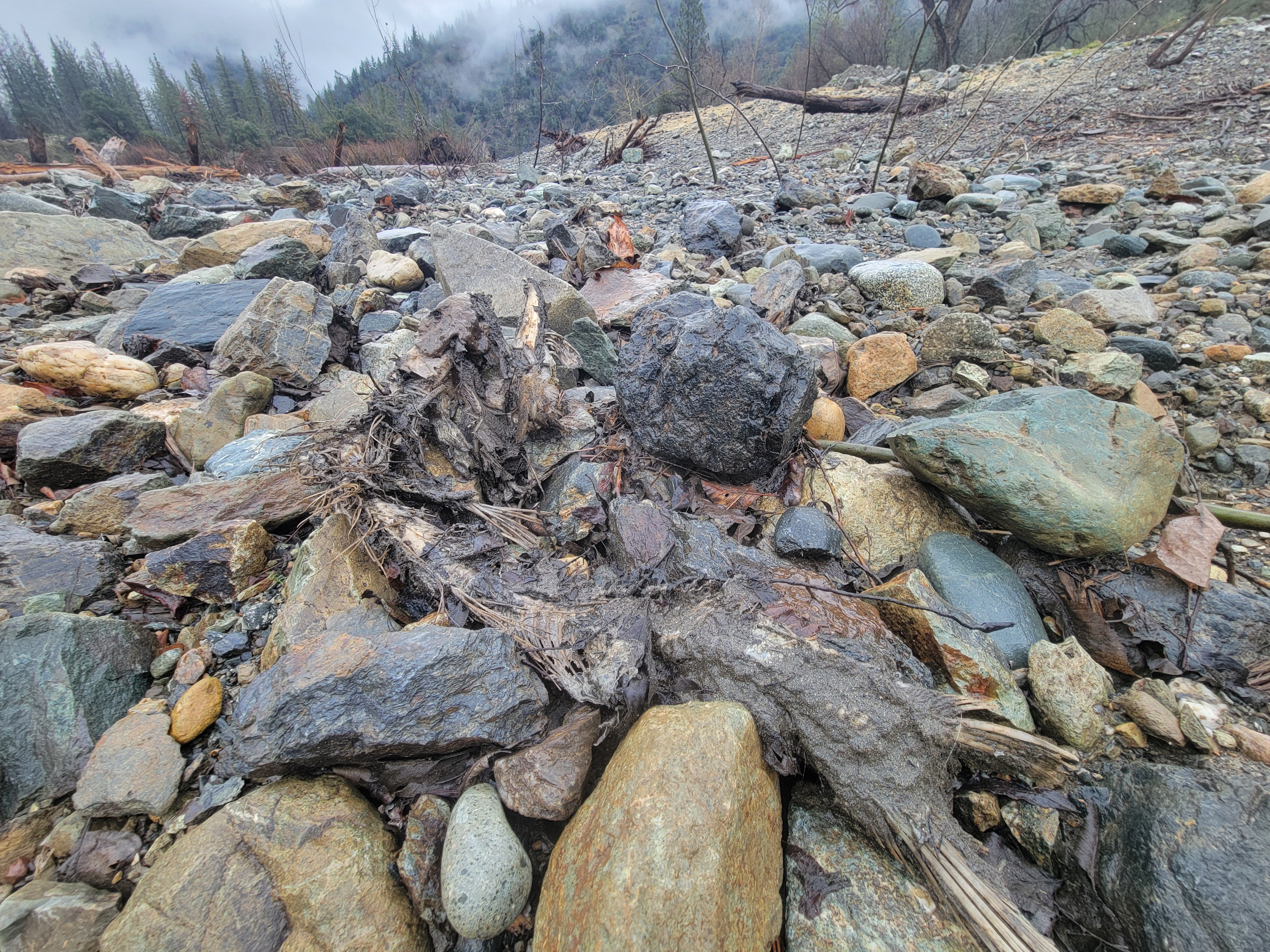
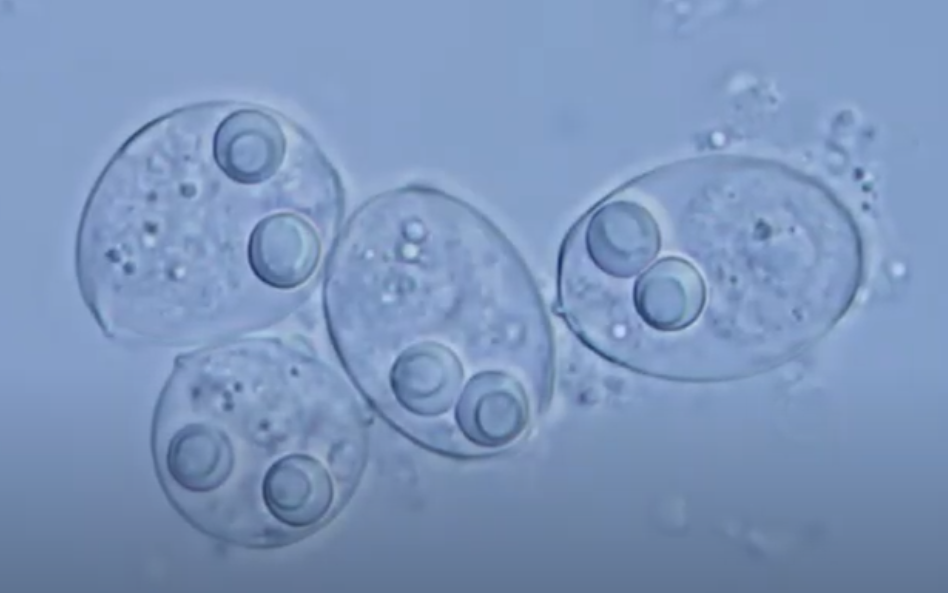
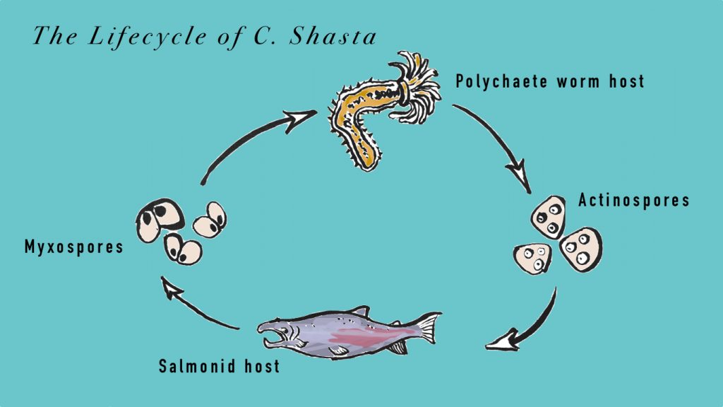
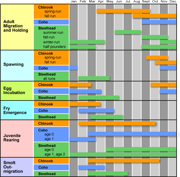
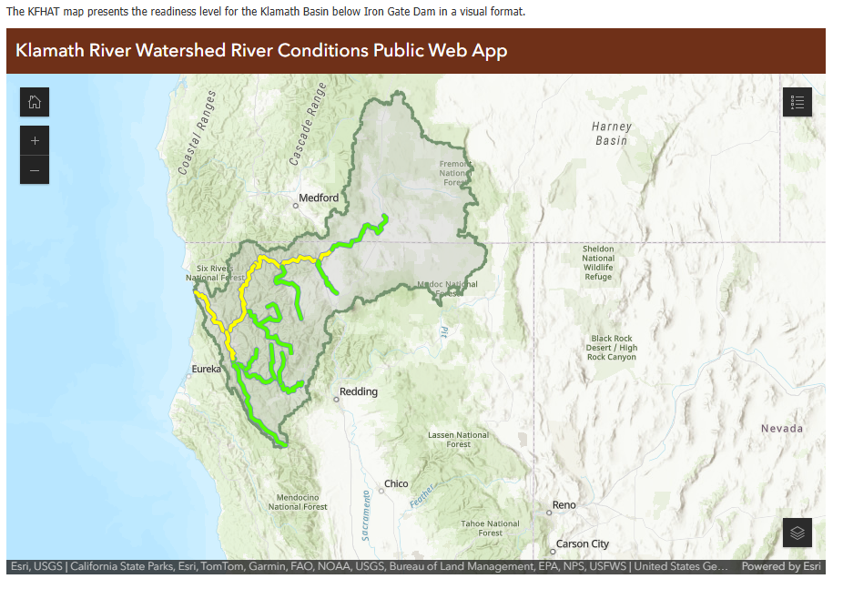

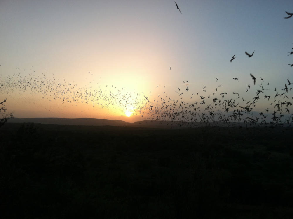
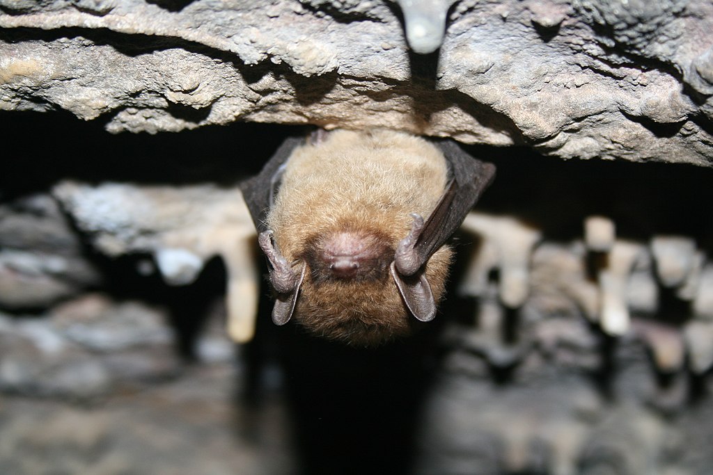
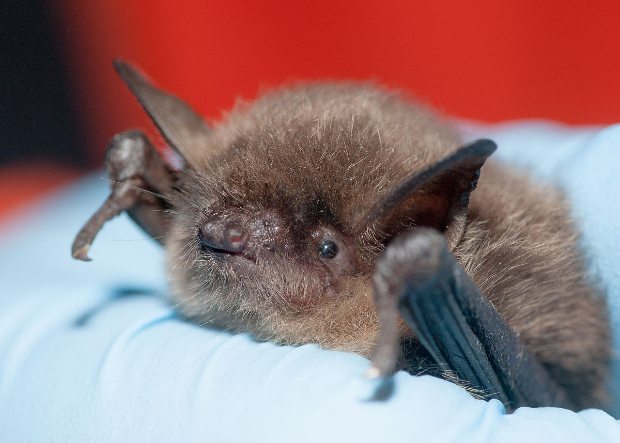
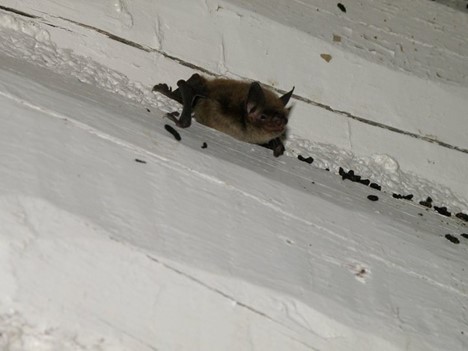
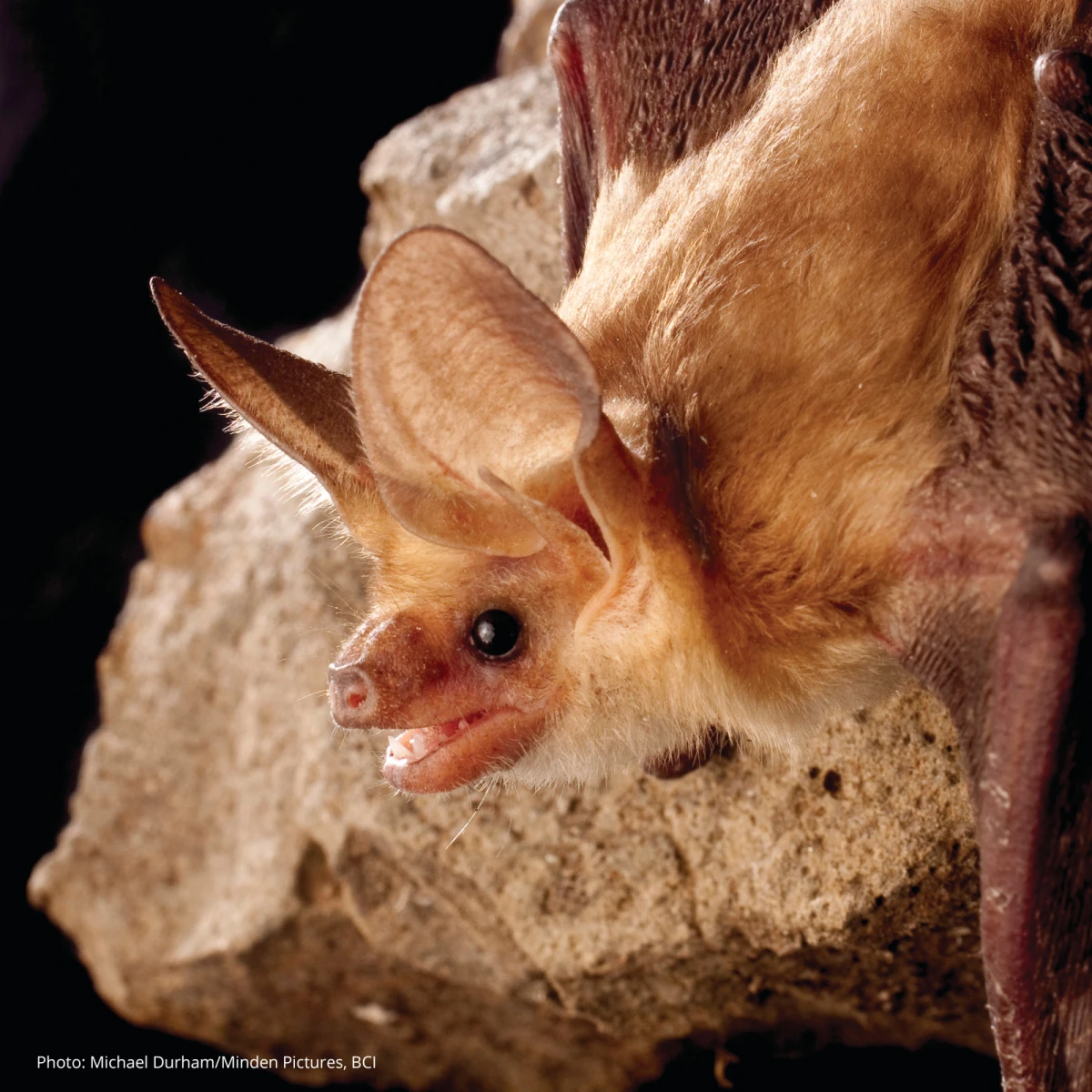
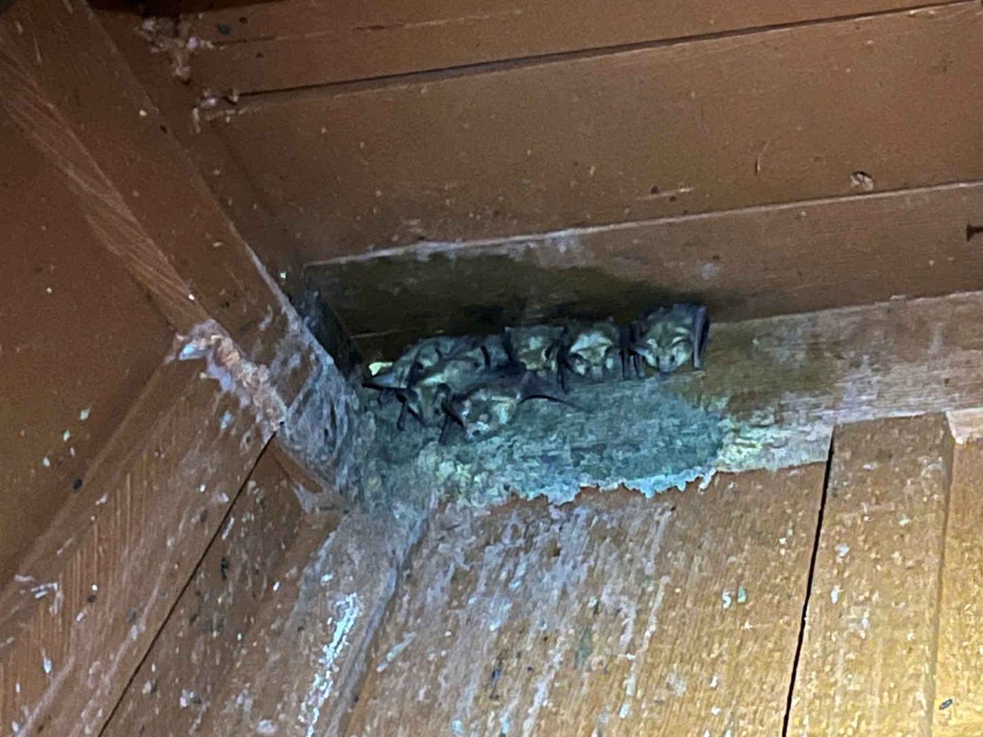
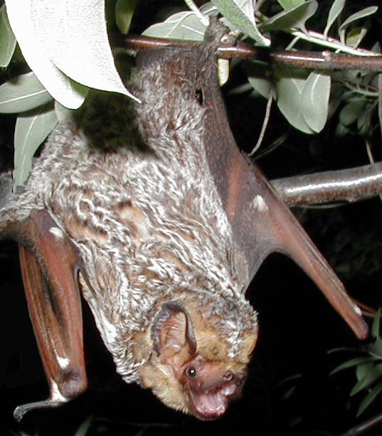
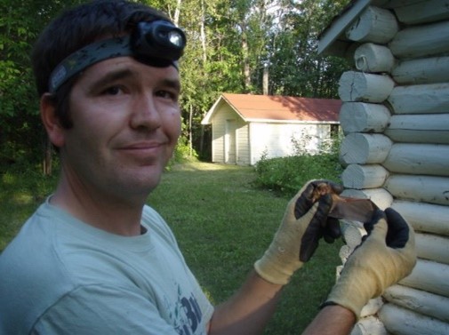
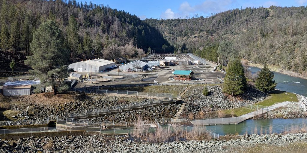
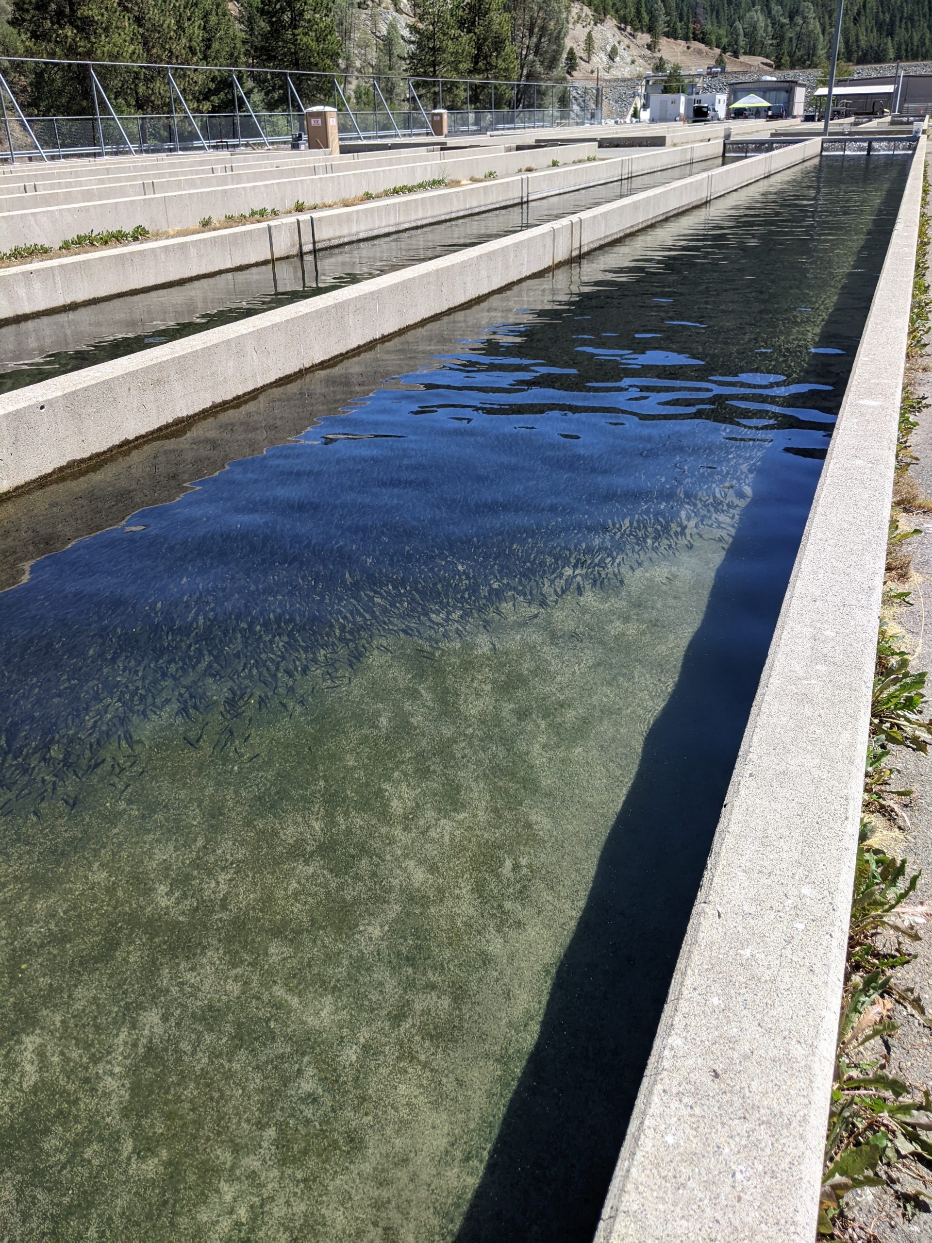
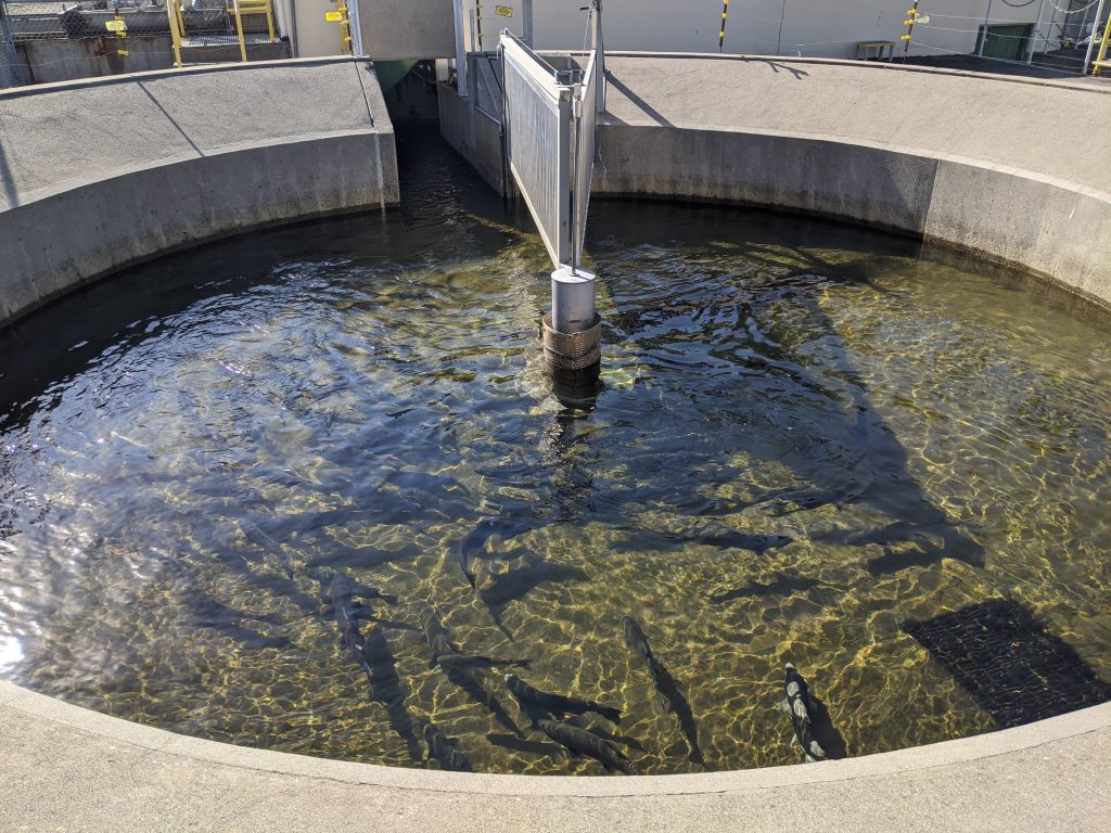
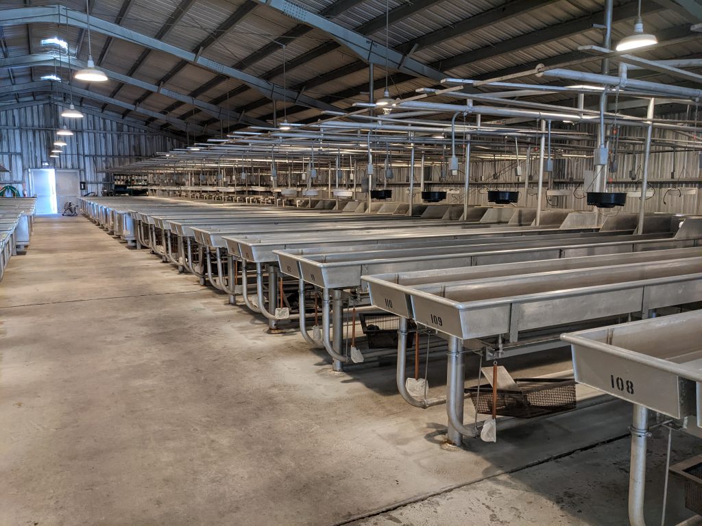
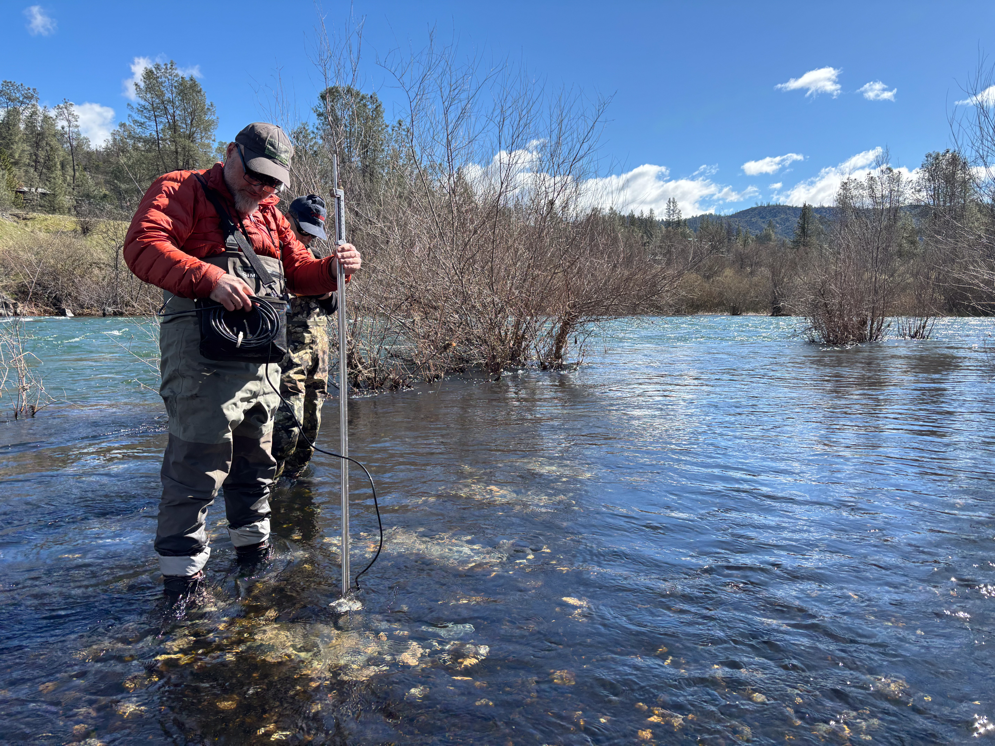
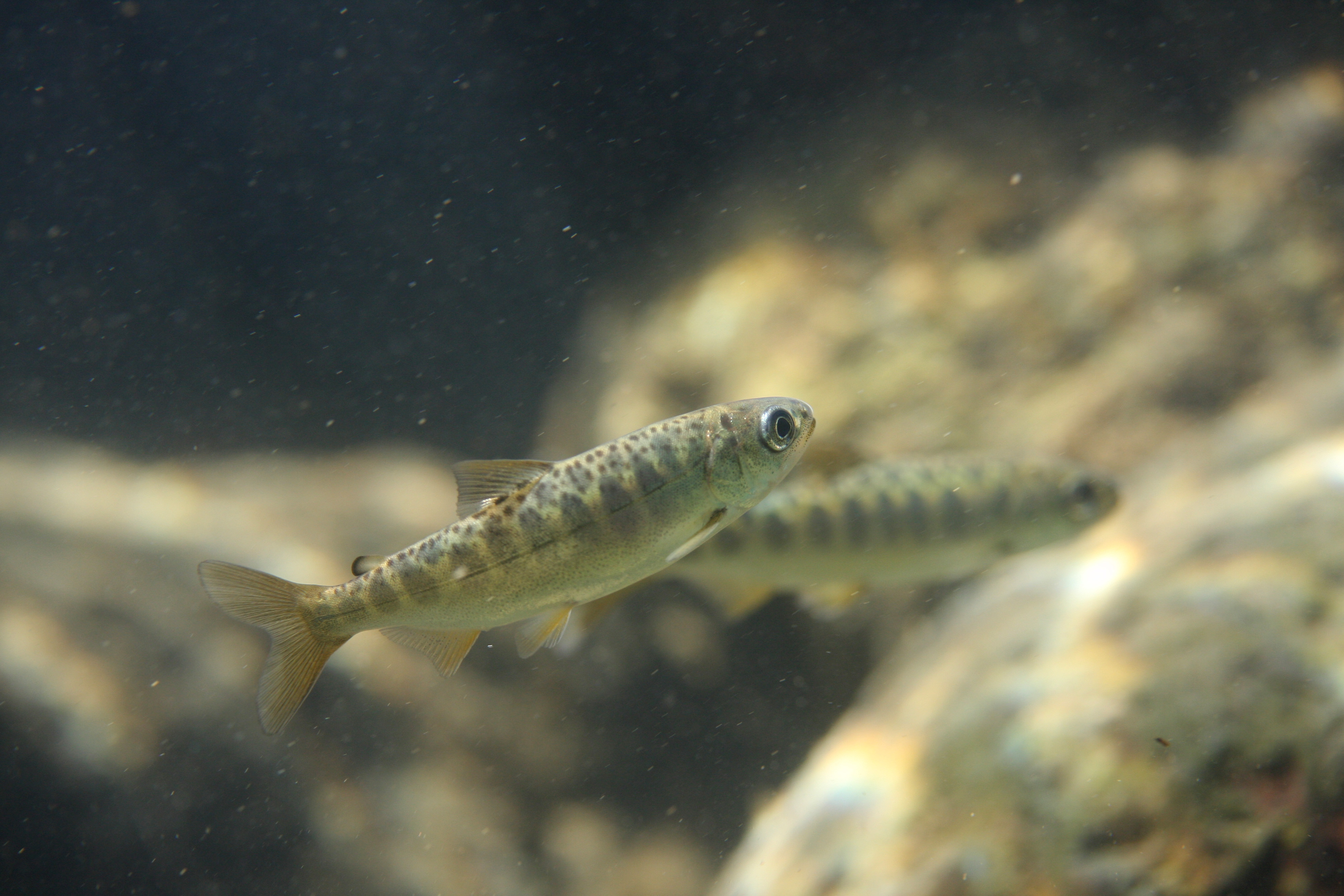
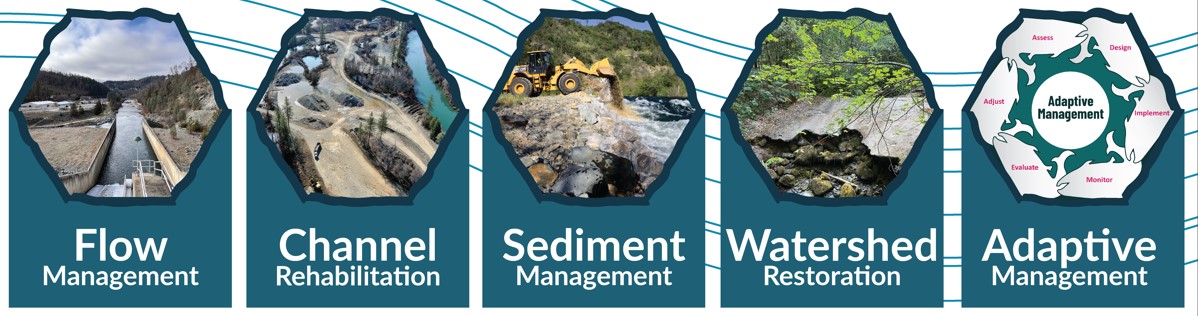
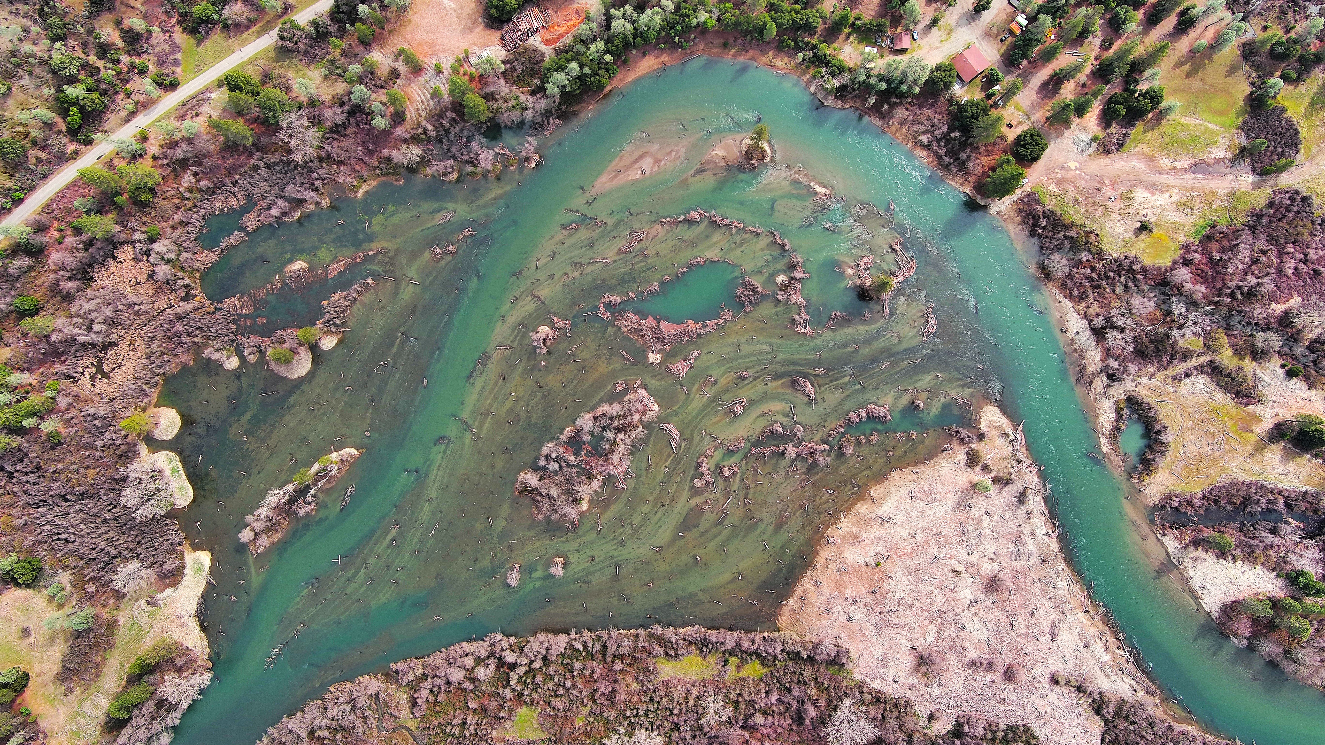
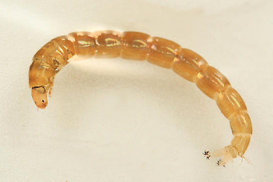
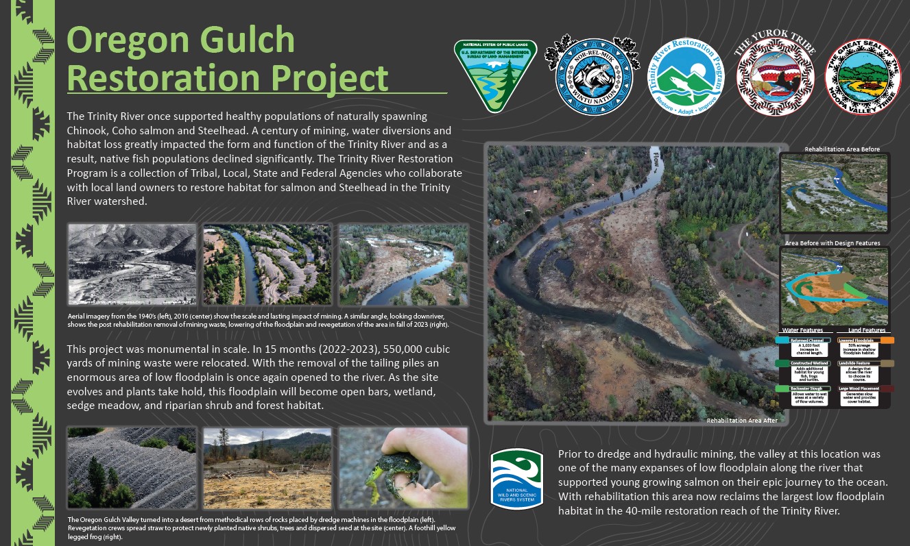
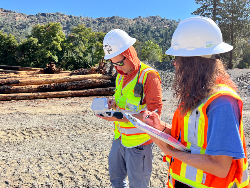
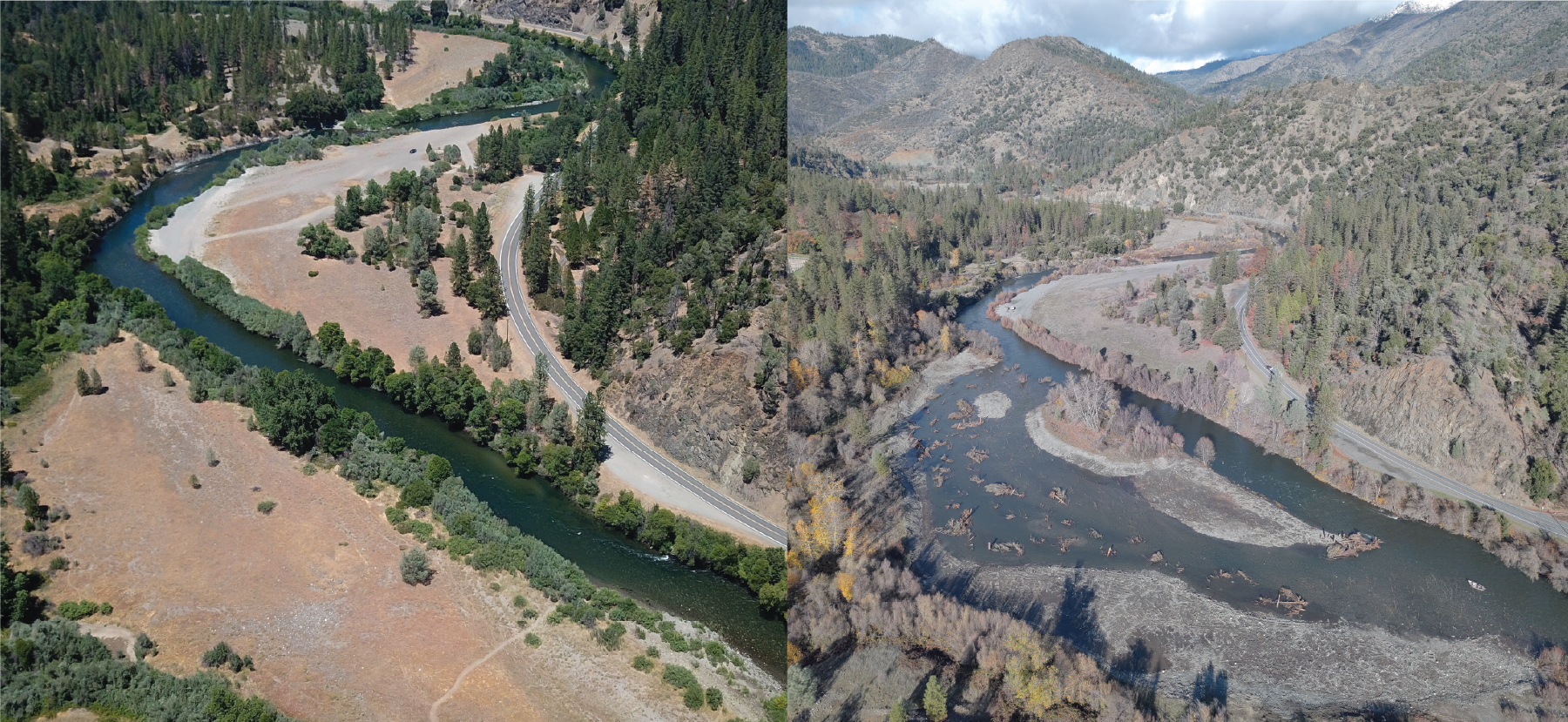
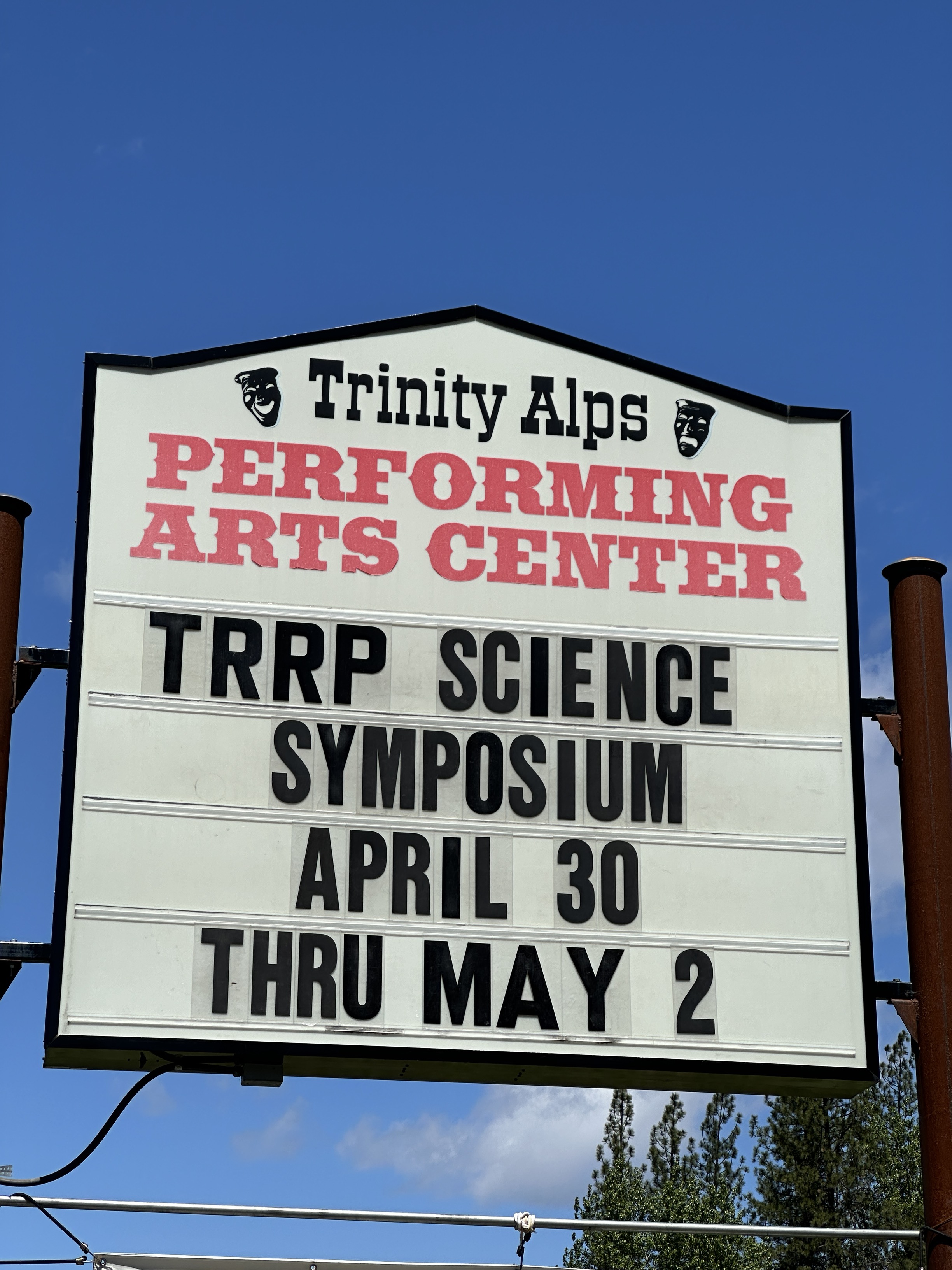
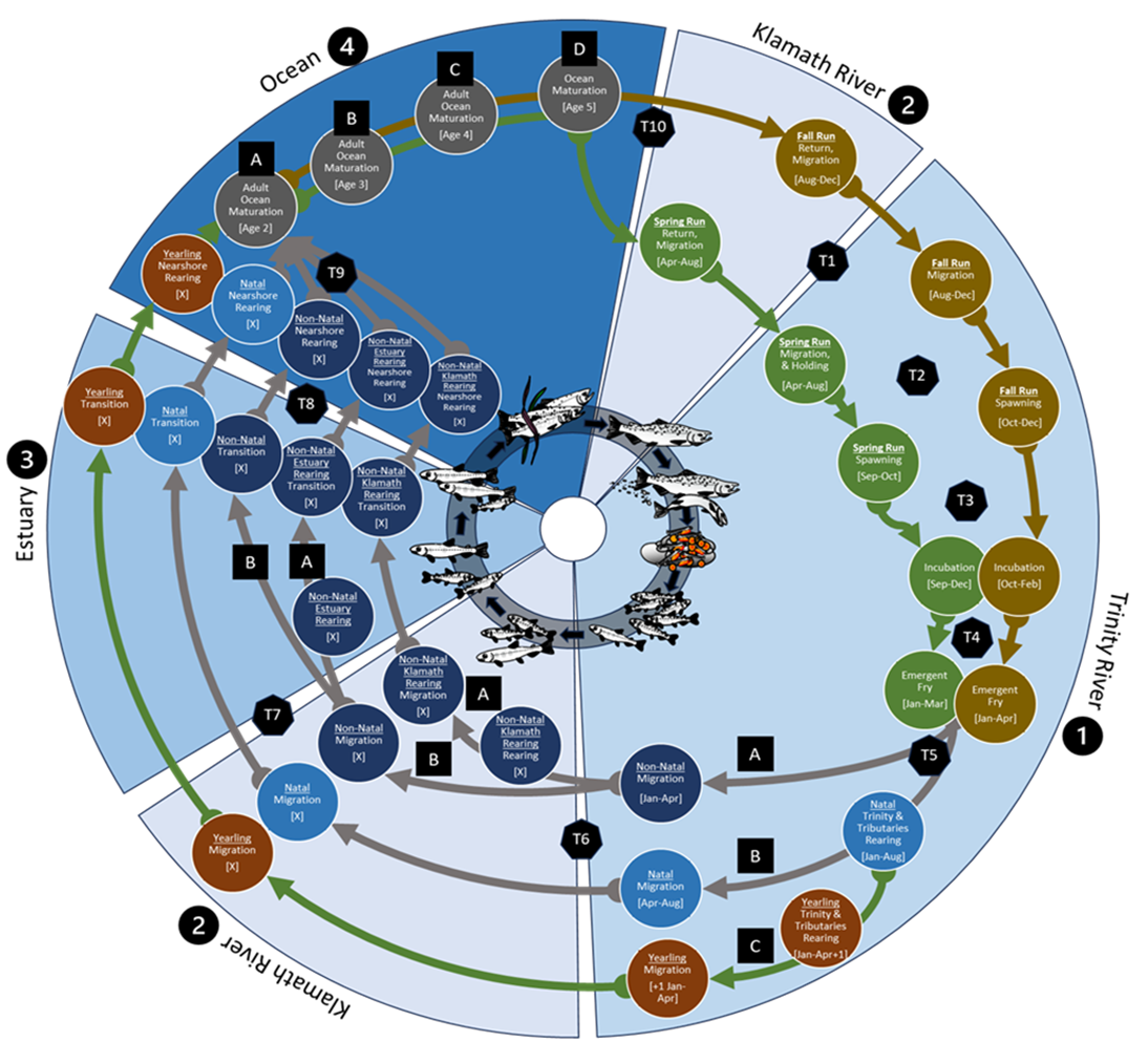
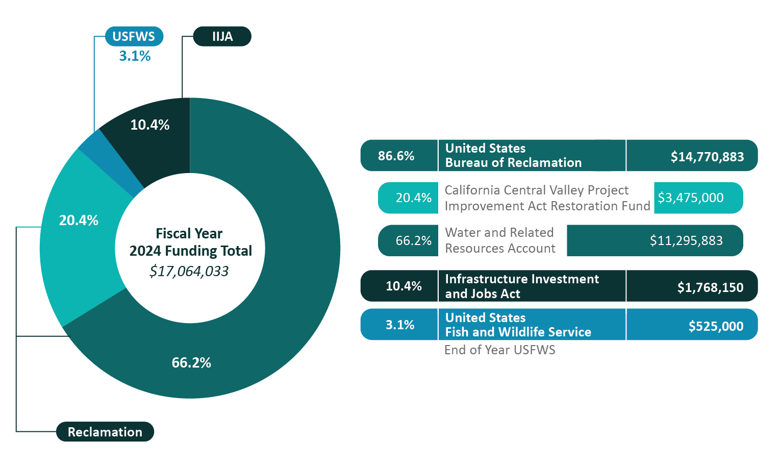
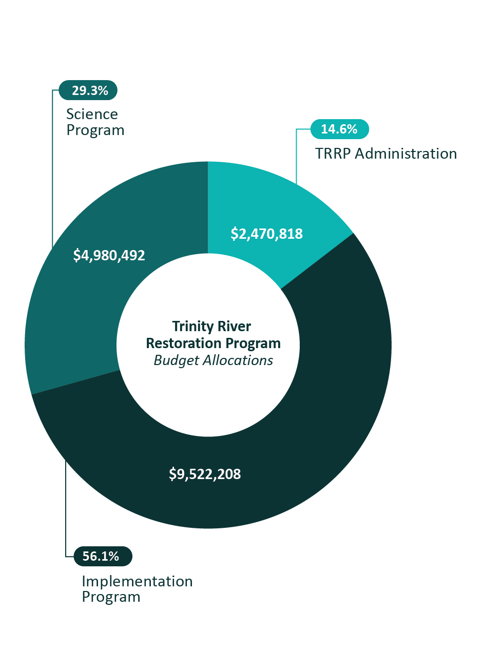

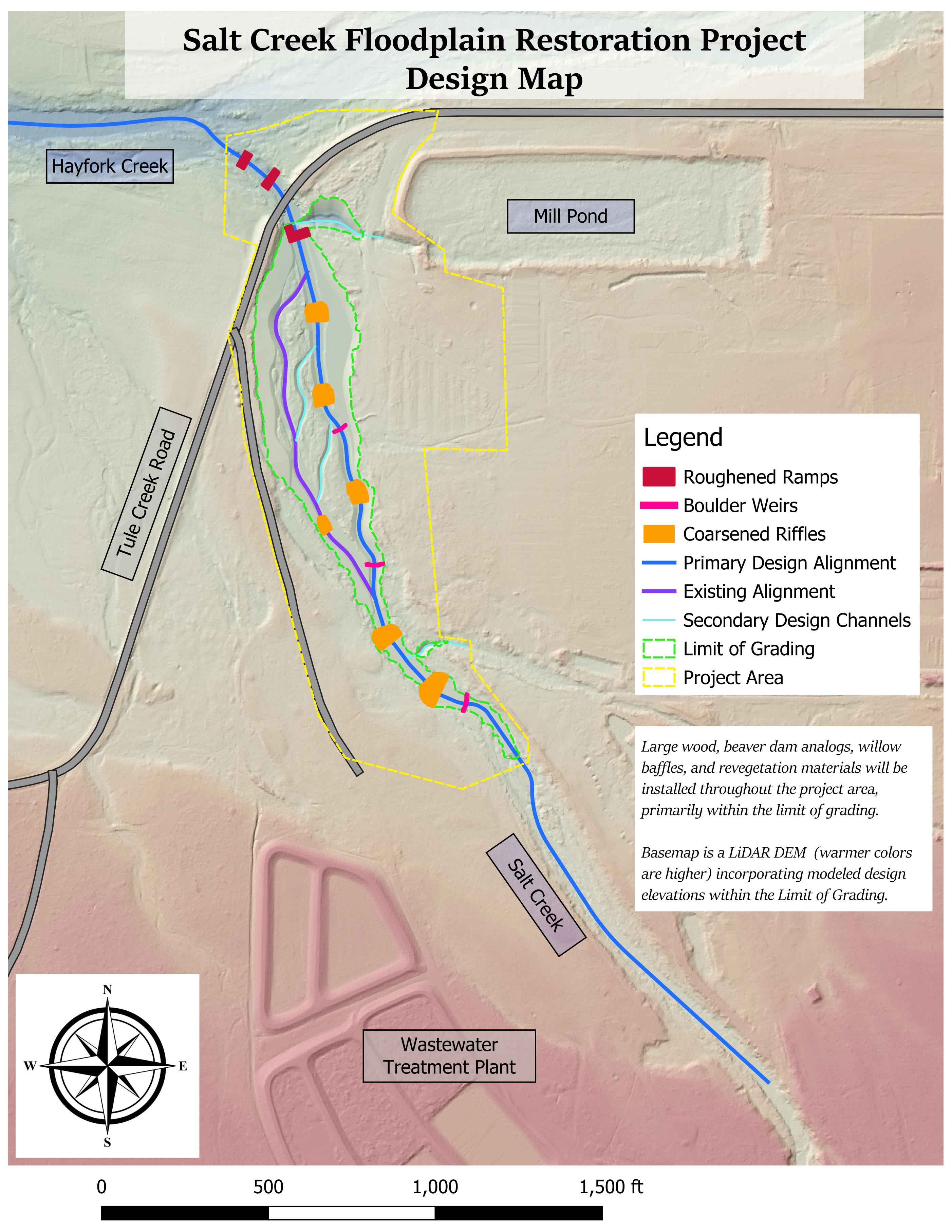
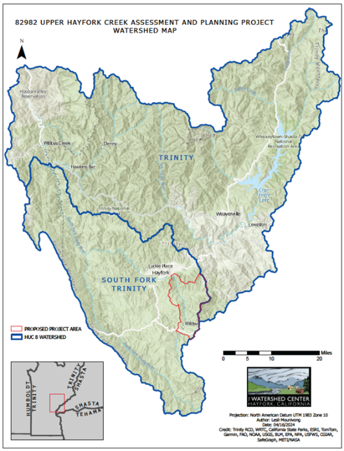
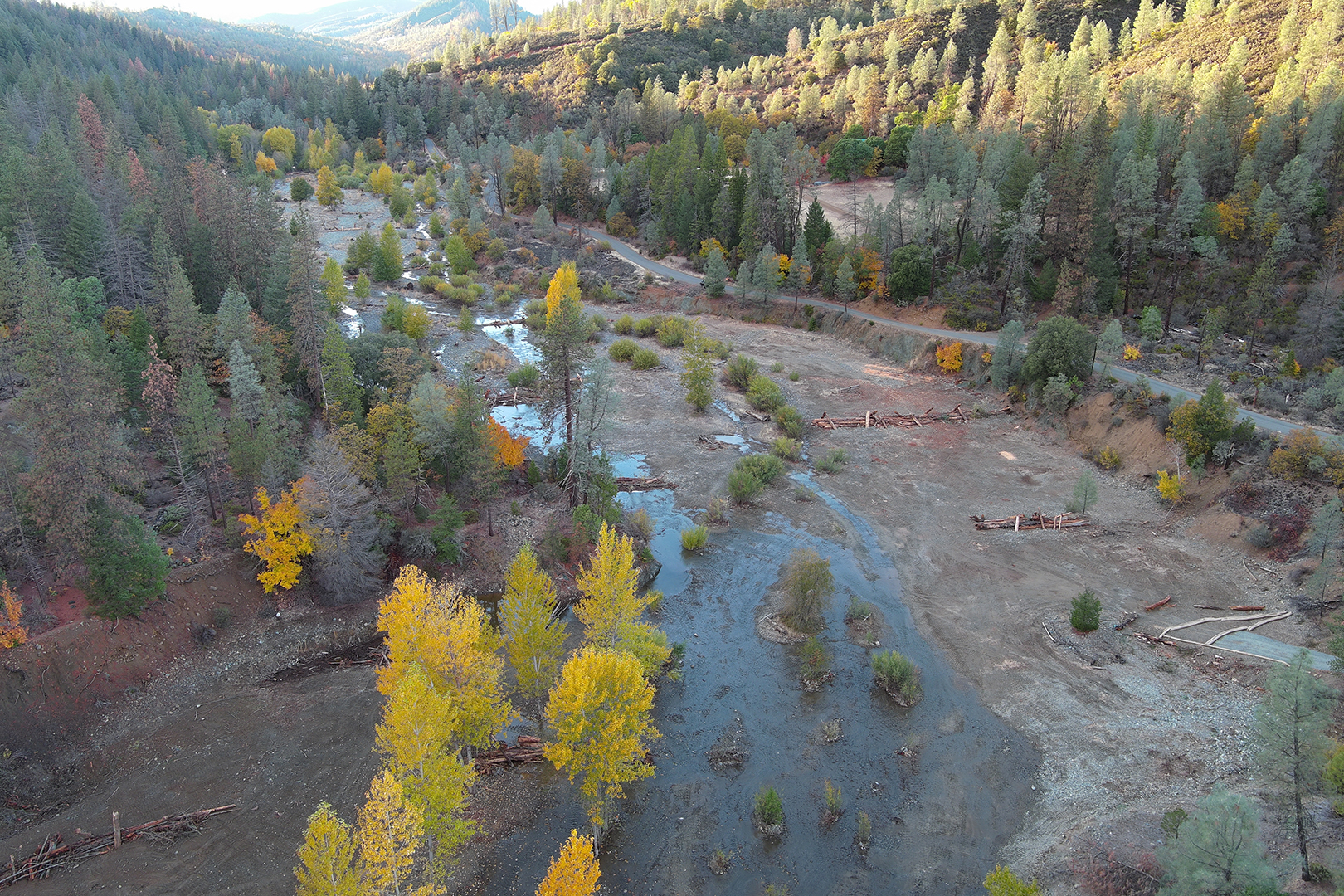
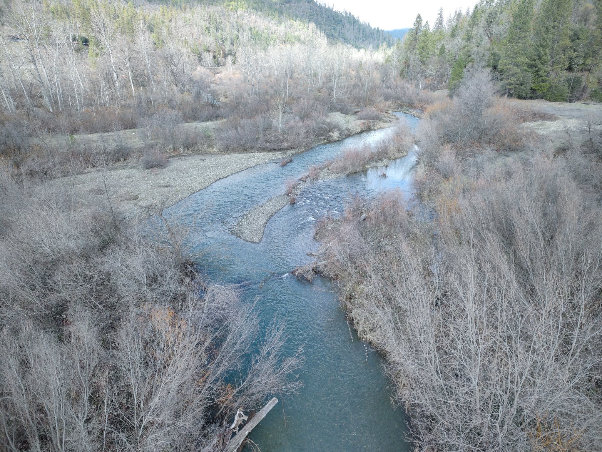

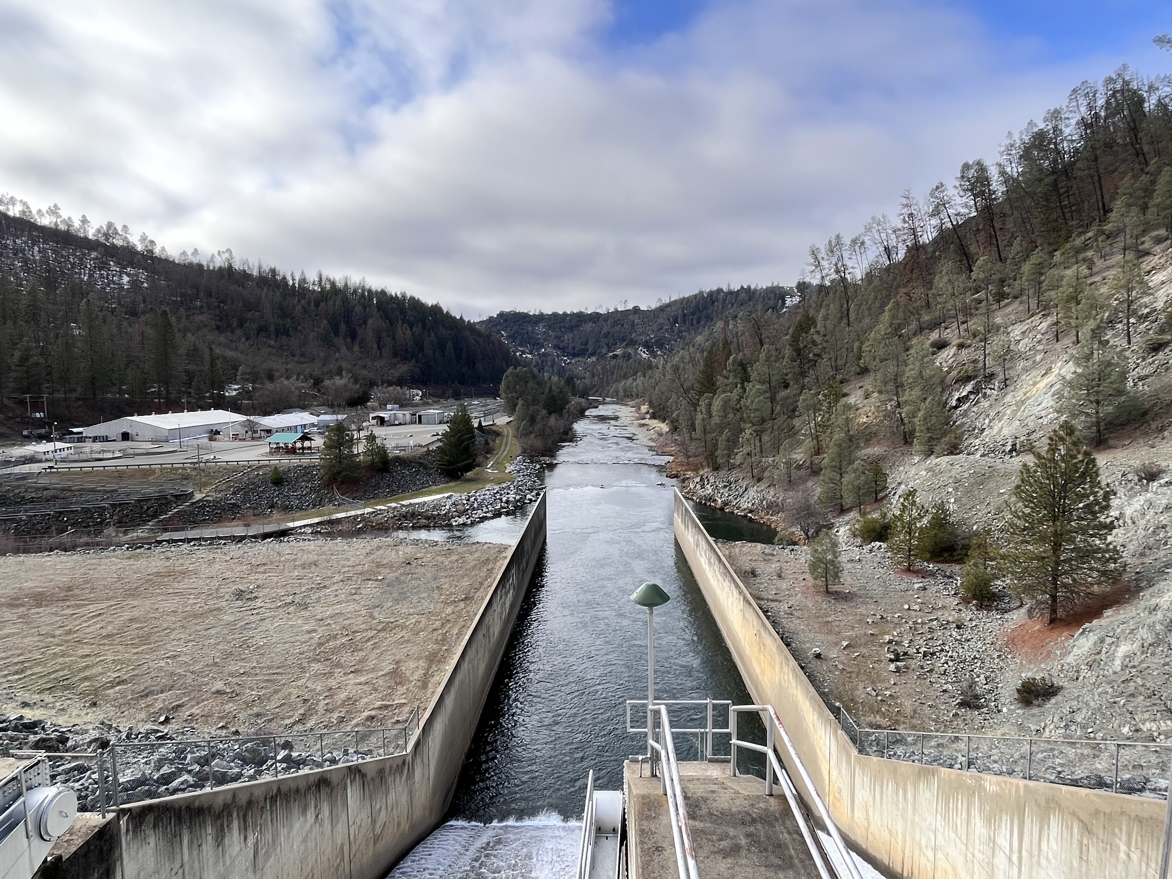
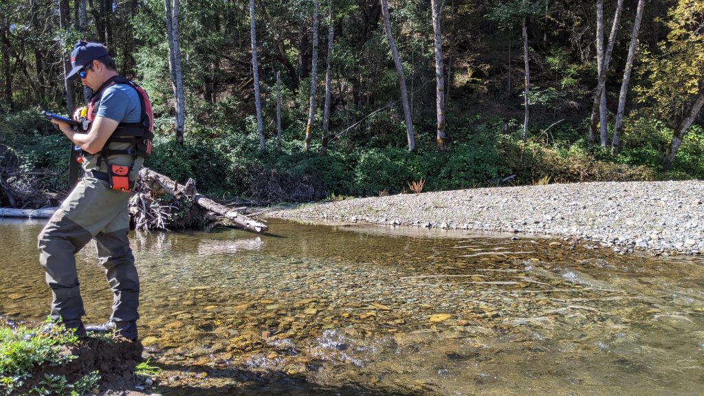
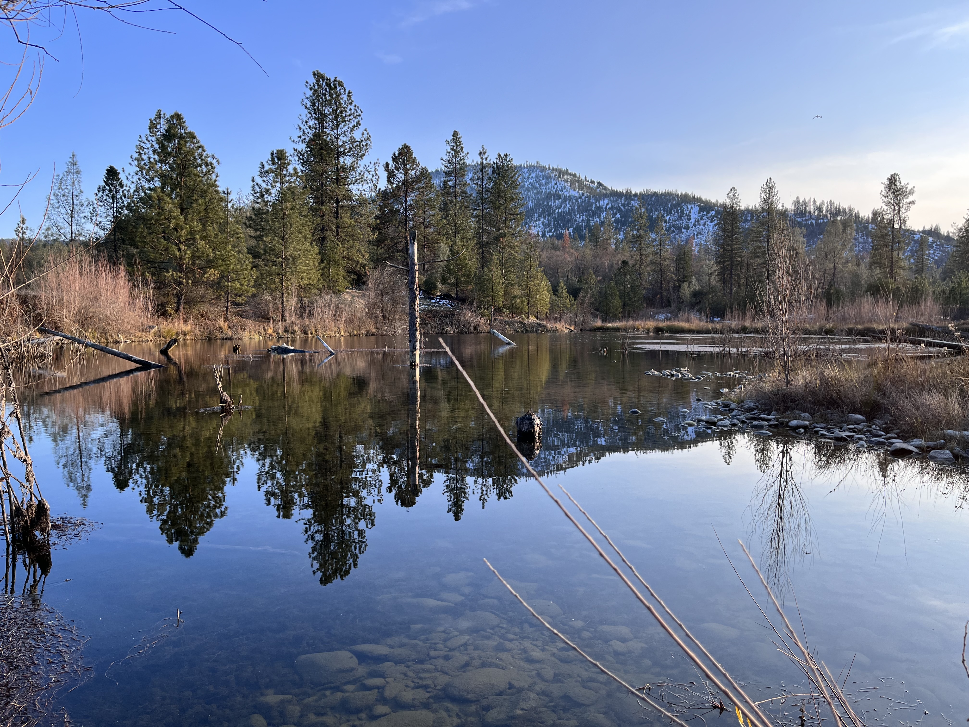
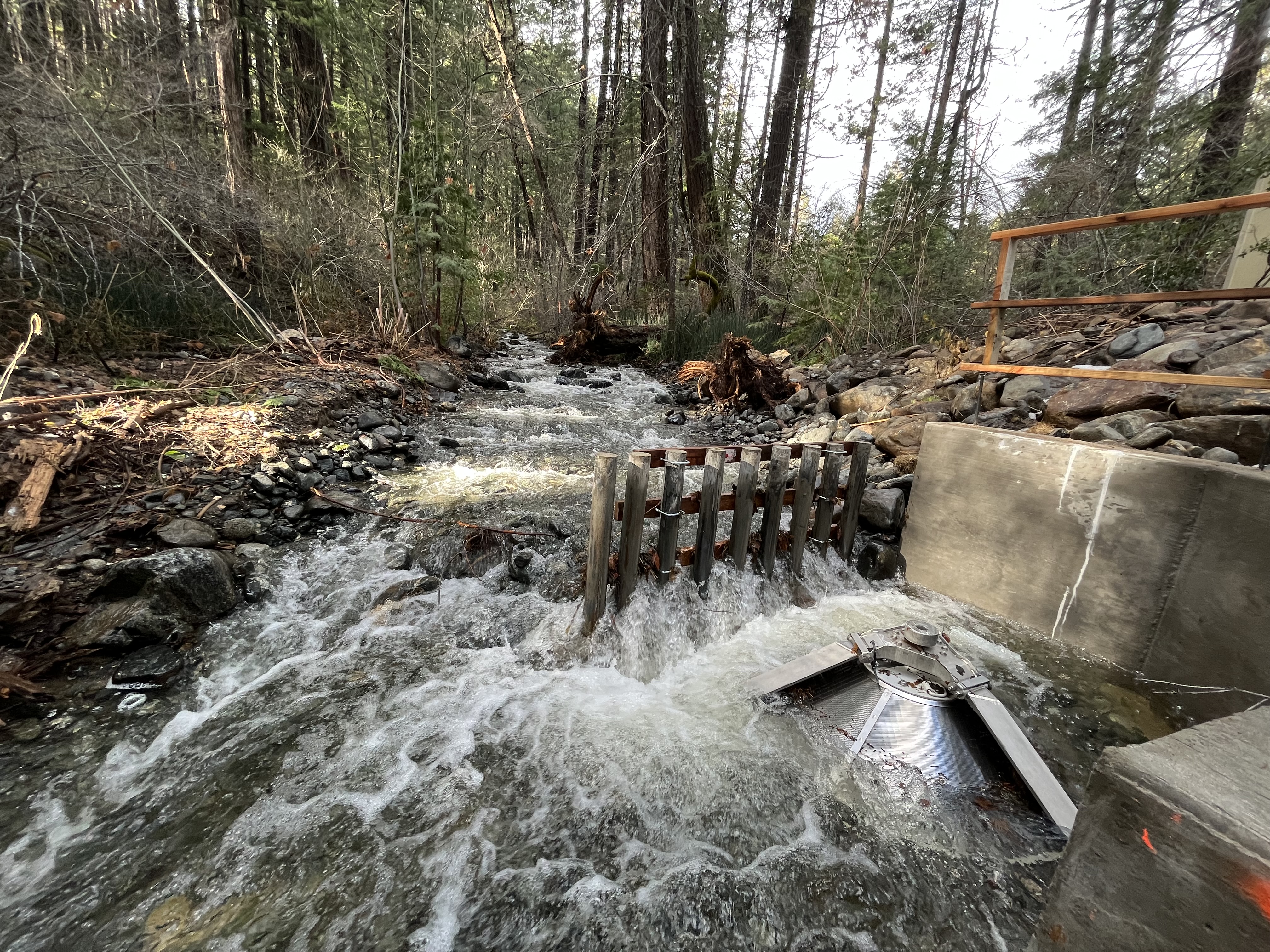
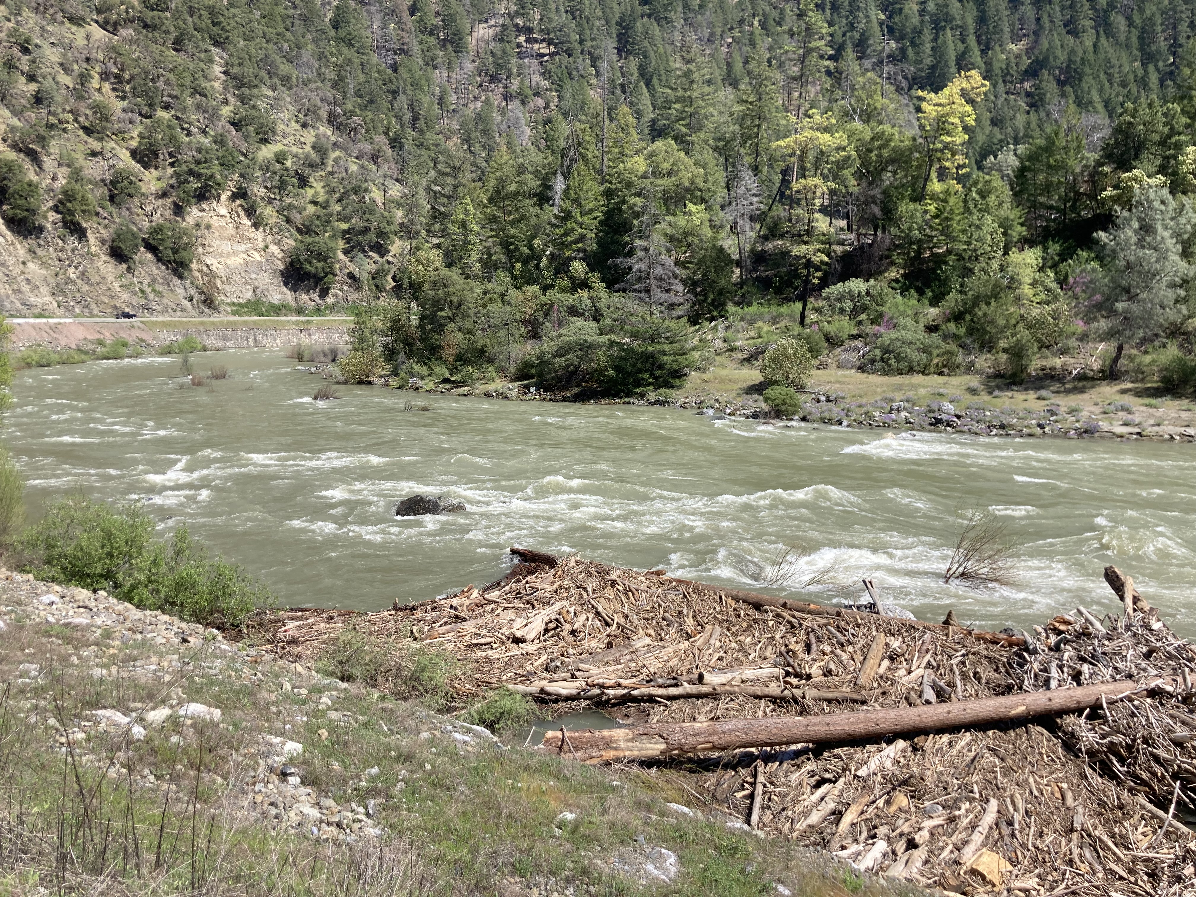
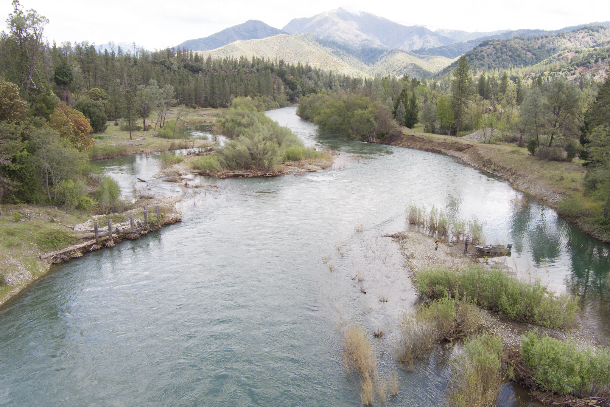
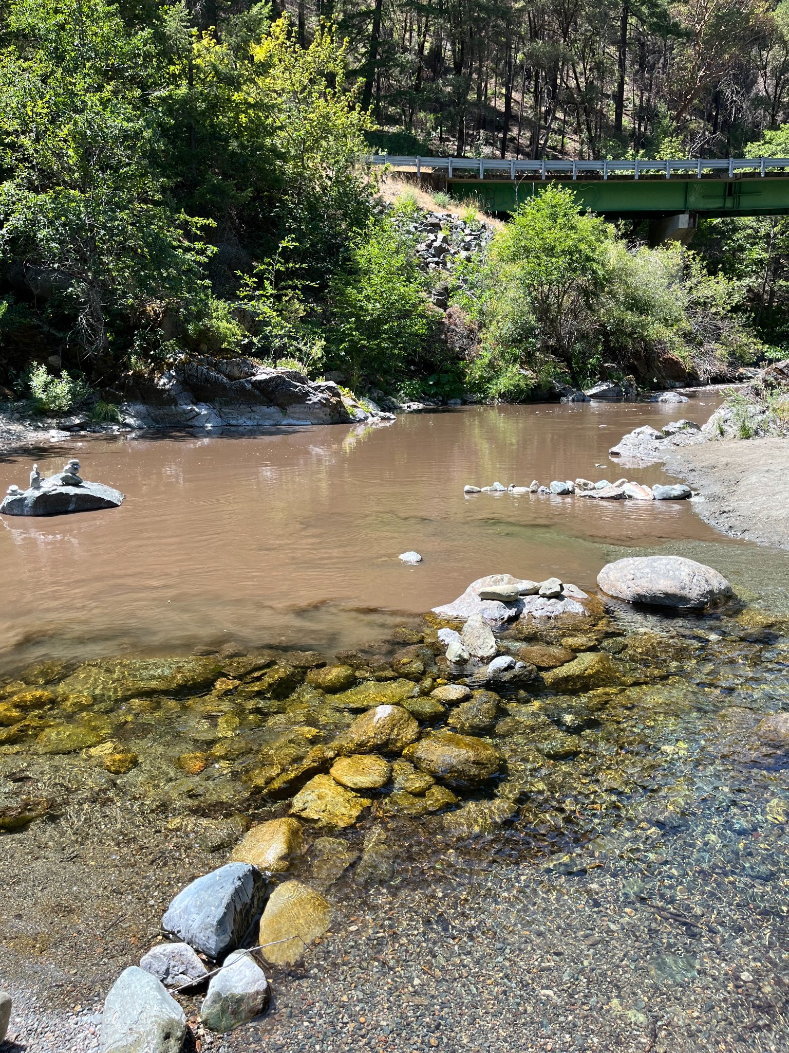
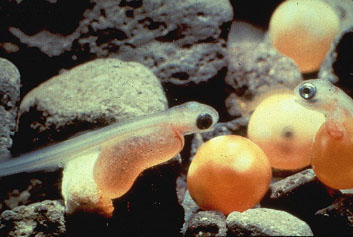
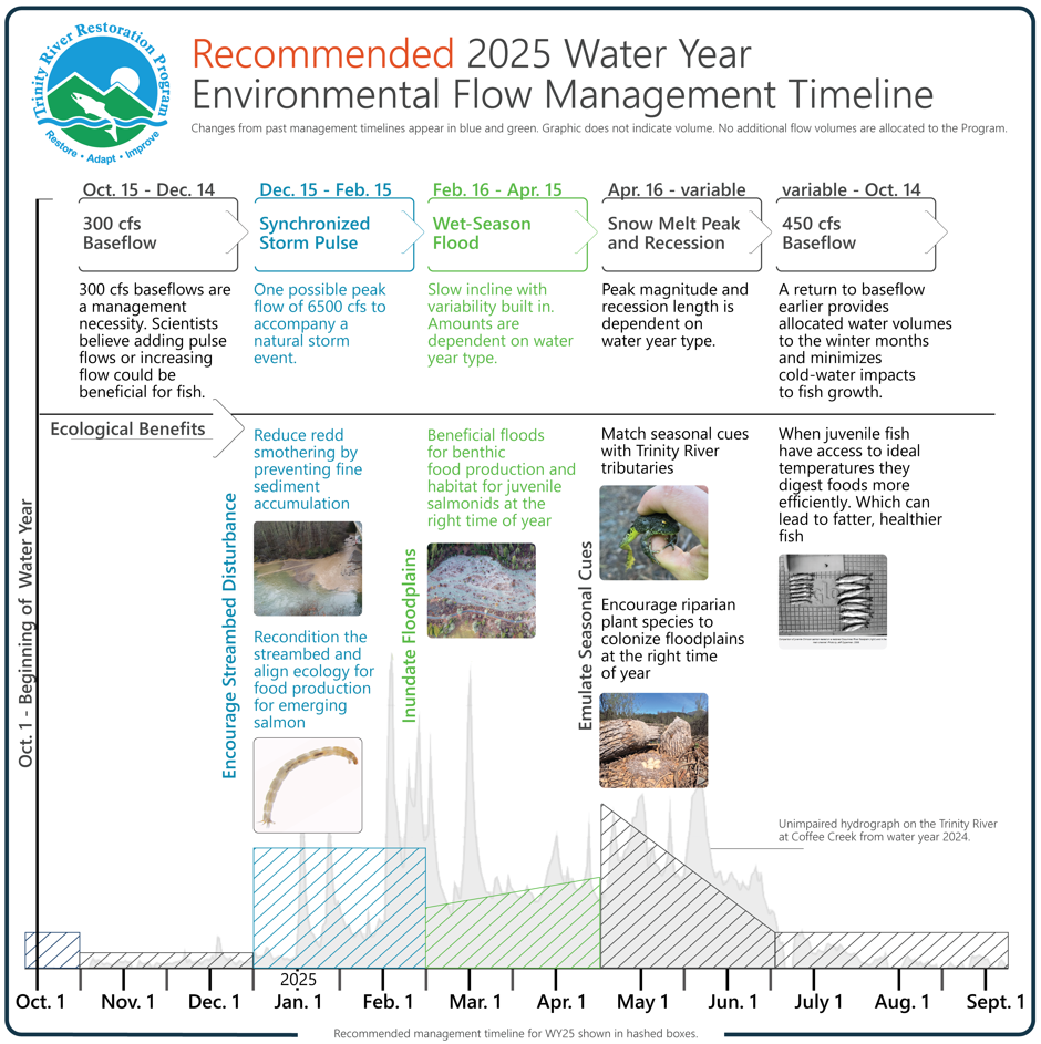
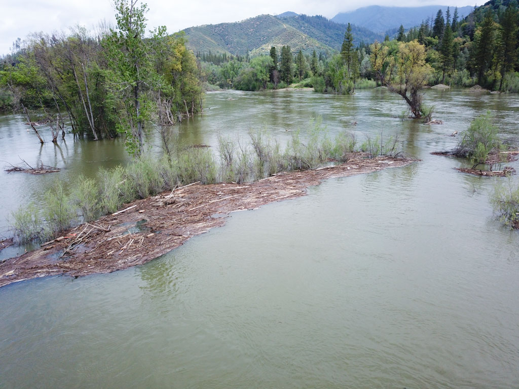
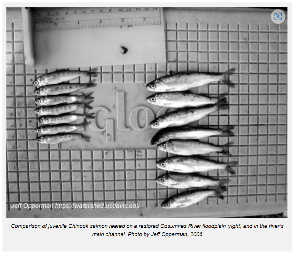
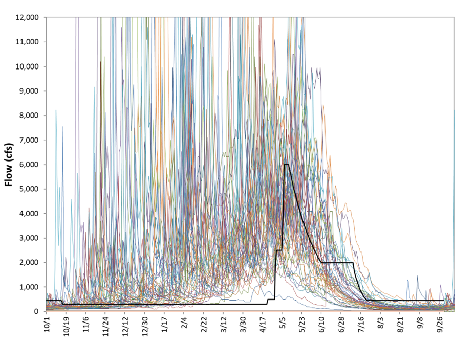
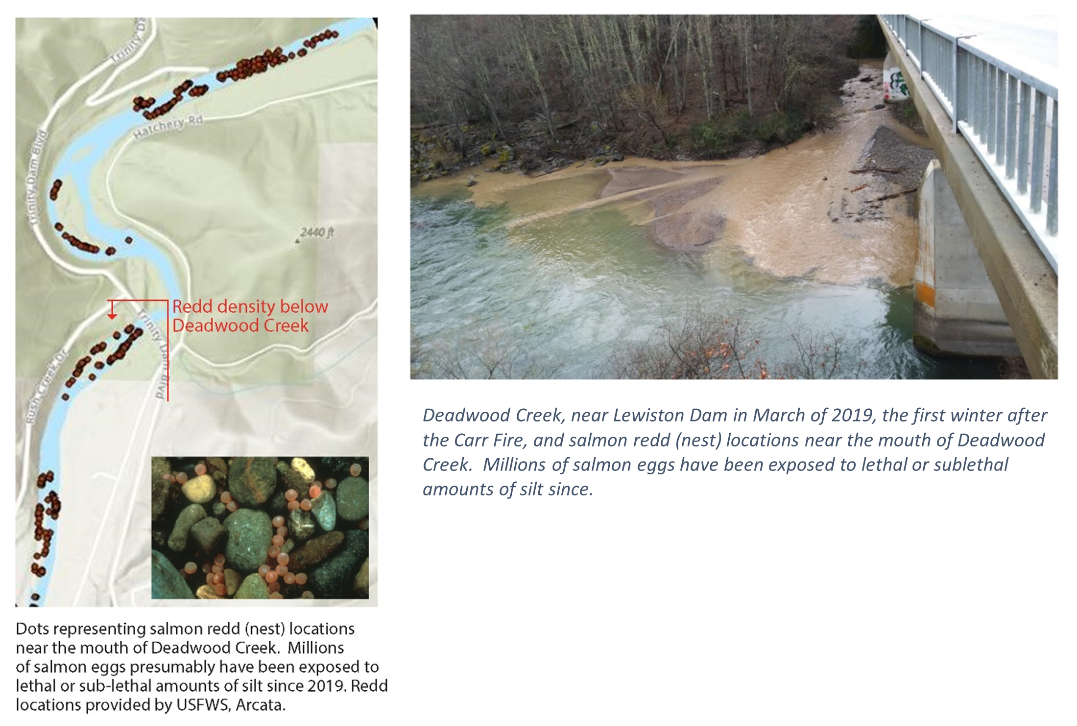
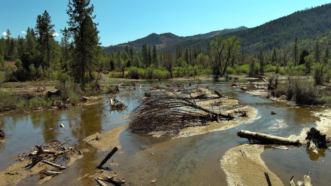
