
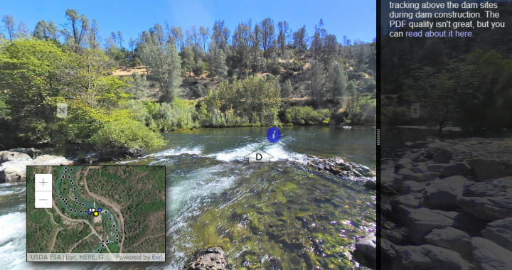
Screen shot of the RiverView feature on the TRRP website.
This page serves as your ‘put-in’ (or boat ramp) for a virtual trip down the Trinity River. Click on a link below to begin at a common starting point for floats or other significant landmarks.
Once you start your float, you can click on arrows to move to adjacent locations, use the up/down arrows (or u/d keys) to go upstream or downstream, or click a dot on the map for transportation to that location. Watch for other click-able icons on the imagery for interesting information!
RiverView also documents the river from a different point-of-view from our annual aerial photography. Although the view point is less standardized, it compliments aerial photos with the ability to see river banks and other river features that might otherwise be covered by riparian vegetation.
Notes: (1) Stretching a spherical image to fit a square, flat screen does cause some distortions – the river often appears narrower than it really is. When uncertain, look down and remember that the paddles you see coming off the raft have about a 20 ft span. (2) Compass directions and angles to nearby photos are approximate.
Put-ins: (upstream to downstream)
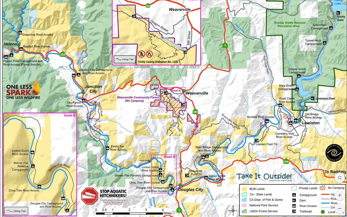
BLM map of public access points for the Trinity River from Trinity Dam to Helena. You can download the PDF from the BLM’s page on the Trinity as a Wild and Scenic River.
- Lewiston Dam
- Weir Pool public access
- Lewiston Old-Bridge
- Rush Creek public access
- Rush Creek Delta
- Bucktail public access
- Grass Valley Creek
- Poker Bar Bridges
- Steelbridge public access
- Indian Creek public access
- Douglas City Campground
- Lorenz Gulch public access
- Dutton Creek
- Browns Creek
- Dutch Creek Channel Rehabilitation site (future)
- Evans Bar public access
- Oregon Gulch
- Sky Ranch public access
- Canyon Creek
- Junction City Campground public access
- Lime Point
- Pear Tree Gulch
- Pigeon Point public access